 Portuguese
  English
  Spanish
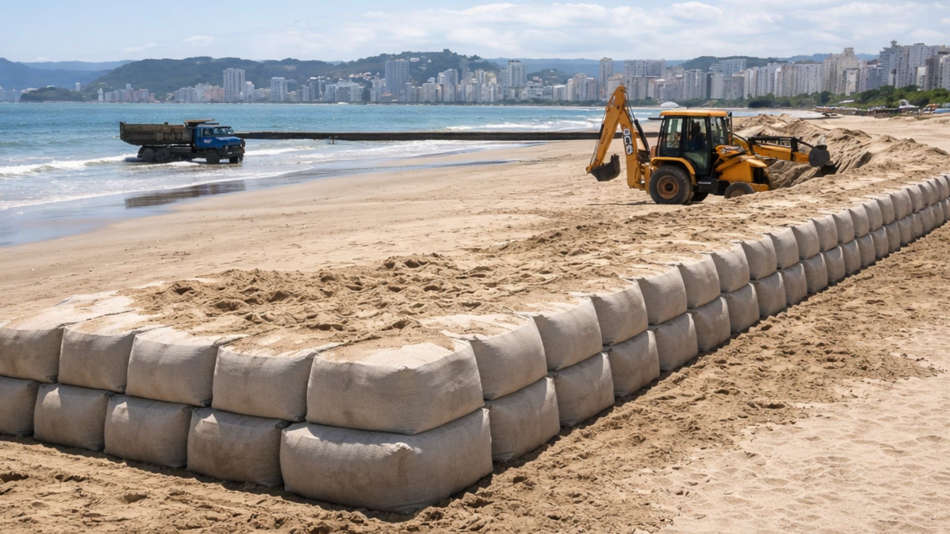


Submerged Structure Installed at Ponta da Praia Adds Up to 49 Geobags of Up to 300 Tons and Integrates Studies Funded by the Port of Santos to Analyze Dredging Impacts and Channel Deepening, Amid Debates About Coastal Erosion and Sand Retention.
The City Hall of Santos regards a submerged barrier of geotextile bags, the “geobags”, as the centerpiece of its response to erosion at Ponta da Praia, installed to reduce wave energy and promote sand retention in a stretch historically exposed to storm surges.
Although it is almost invisible to those walking along the avenue, the structure forms an “L” shape on the seabed, with 275 meters in length perpendicular to the shore and an additional 240 meters parallel to the sandy area, according to data released by the municipal administration.
According to the city hall, the set comprises 49 units filled with sand, with an approximate weight of 300 tons per bag, and was implemented as a “pilot project” to mitigate damage to the shore and create conditions for the beach to dissipate wave energy before it reaches sidewalks and walls.
-
Friends have been building a small “town” for 30 years to grow old together, with compact houses, a common area, nature surrounding it, and a collective life project designed for friendship, coexistence, and simplicity.

-
This small town in Germany created its own currency 24 years ago, today it circulates millions per year, is accepted in over 300 stores, and the German government allowed all of this to happen under one condition.

-
Curitiba is shrinking and is expected to lose 97,000 residents by 2050, while inland cities in Paraná such as Sarandi, Araucária, and Toledo are experiencing accelerated growth that is changing the entire state’s map.

-
Tourists were poisoned on Everest in a million-dollar fraud scheme involving helicopters that diverted over $19 million and shocked international authorities.


What Exists Underwater at Ponta da Praia

The technical description adopted by the municipality indicates that the geobags function as “geoforms” made of geotextile fabric supported on the seabed, forming a submerged barrier that seeks to interfere with the meeting of waves, currents, and sediments without raising a visible wall in the landscape.
In institutional communication, the city hall states that the 49 bags received about 7,000 cubic meters of sand and were positioned starting from the wall at the height of Rua Afonso Celso de Paula Lima, aiming to lessen the impact of waves and assist in sediment storage.
Additionally, according to the city hall, the perpendicular section approaches the area of the Aquarium and, continuing already in the sea, the parallel segment follows the beach, a strategy presented as a way to reduce sand loss and contribute to the recovery of the beach profile.
The installation began in 2018, according to municipal records regarding the project’s initiation, with a forecast at the time to complete the works in March of that year after the gradual placement of the bags and support elements, such as mats and stone covering in part of the segment.
Monitoring, Maintenance, and Signs of Wear
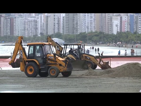
As it is a submerged structure, monitoring is considered an essential part of the model, and the city hall reports inspections with divers to check integrity, damages, and the need for restoration, in addition to measurements to observe if there has been sand accumulation in the protected area.
In a storm monitored by the municipality, the Environment Secretary of Santos stated that the protected area was less impacted on sidewalks, and Secretary Marcos Libório declared: “The area protected by the geobags had less impact on the sidewalks.”

On the same occasion, the secretary added that a verification would be made along the entire length of the system using divers, to assess the condition of the bags and identify vulnerable points, as reported by the city hall regarding the actions following the rough sea.
In an inspection released by the municipality in 2022, the administration reported finding damage in at least two geobags, attributed to human action, such as cuts and entanglement of nets, in addition to suspicion of sand loss in a third monitored point.
The municipal material also notes the need for bathymetry and cross-referencing with tide and current data, indicating that the system’s efficiency needs to be reviewed after stronger events when rapid changes in the beach profile usually occur.
Port of Santos, Dredging, and Hydrodynamic Studies
The barrier gained new public dimension by being connected to studies associated with the Port of Santos, after the city hall reported that the Port Authority of Santos, responsible for managing the port, committed to expanding coastal protection.
According to the City Hall of Santos, this commitment was incorporated into a contract signed with the State University of Campinas, outlining research and simulations to support decisions regarding coastal protection works and the deepening of the navigation channel.
In municipal disclosures, the study appears linked to the deepening of the channel to 17 meters, while reports published from the same contract describe analyses aimed at evaluating the impacts of deepening the channel from 15 meters to up to 18 meters.
The publicly cited value for the academic work is around R$ 1.1 million, and the hiring was also reported with a deadline of 18 months, combining modeling, analysis, and technical subsidies to evaluate interference between dredging, currents, and the sandy area.
In a statement from the Port Authority itself, the contract signed on December 22 was presented as a basis for the execution of studies on coastal protection works, connecting environmental agendas to navigation planning in the largest port in the country.
Coastal Erosion and Performance Metrics
By bringing coastal protection into the dredging debate, the topic has expanded beyond just the submerged work and has begun to involve questions of how the access channel and navigation interventions may relate to the dynamics of the region’s beaches.
In this discussion, the city hall argues that the geobag system should be monitored with field indicators and has already released measurements indicating a trend of sediment accumulation in the stretch, mentioning an increase of 8.9 centimeters in sand height in the bag area.
The municipality also associates the presence of the barrier with observations of marine life in the vicinity, noting the appearance of species such as octopuses, turtles, and groupers during monitoring, although the main focus of the monitoring remains on structural integrity and sand behavior.
At the same time, reports from local media show that the structure remains at the center of controversies regarding its capacity to withstand storm surges and the need for adjustments, especially after events where the sea caused damage to the shore and reignited calls for broader solutions.
Expansion of Protection to Aparecida and Embaré
The city hall claims it intends to use the experience from Ponta da Praia as a reference to seek solutions in other stretches, such as Aparecida and Embaré, where residents and visitors notice a reduction in sand and the closer proximity of waves to urban infrastructure.
In this institutional framework, “who pays” and “who executes” are presented separately: the municipality positions the system as a local pilot, while the federal agency linked to the port finances studies with a public university, and any physical expansion would depend on the results obtained.
The change of scale poses a practical challenge for public communication, as the effect of a coastal work cannot be measured by a single before-and-after photo and requires a series of measurements, comparable criteria, and transparency regarding the parameters that define success or the need for correction.
If new stretches receive submerged barriers, what metrics, with regular disclosure and clear methodology, will guide the population to understand whether coastal protection is reducing damage and helping retain sand, or merely shifting the impact along the coast?


Holanda levou 30 para resolver a erosão no litoral sudoeste. Fizerem profundas pesquisas e simulações antes de iniciar uma obra complicada como esse.
Não passa de um paliativo. Não é assim que se resolverá a questão da erosão em Santos SP
300 k/ton por saco????
Ainda que os sacos fossem cada um deles com 300 toneladas de areia não iria resolver. 300 kg não ficarão no lugar mesmo que amarrados por corrente. É estranho que basta olhar os mapas antigos para saber que a erosão é provocada pelo afundamento do calado. A rocha sob o Forte desvia o curso da maré vazante e se qualquer prático tentar fazer aquela curva na Ponta da Praia a maré é capaz de jogar o navio para o Aquário. Os interesses parecem fazer mais sentido do que a razão humana. O aumento do calado irá destruir toda a Base da Ilha de São Vicente naquele ponto do lado de Santos.