 Portuguese
  English
  Spanish
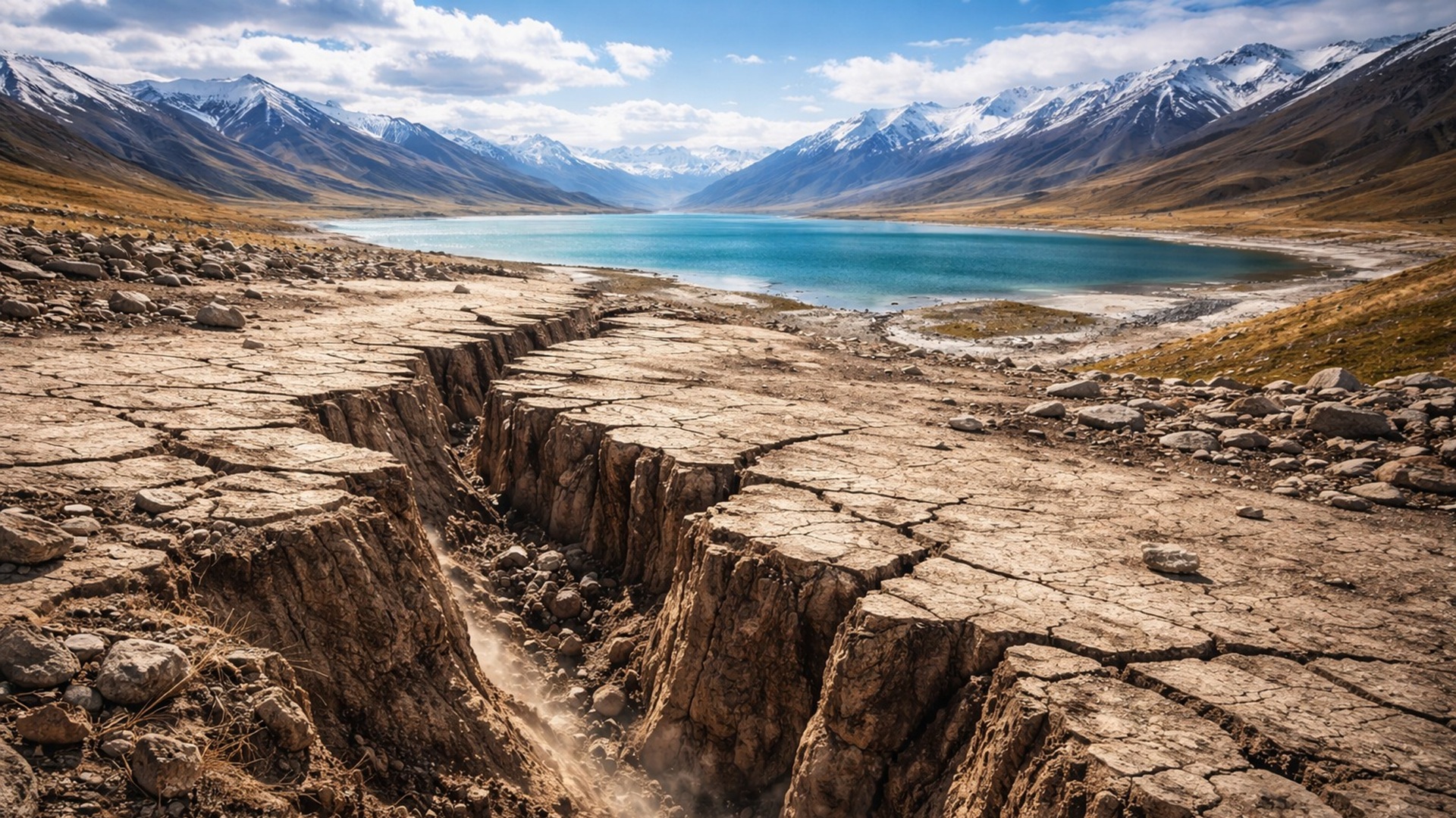
Study Published on January 17 Indicates That the Disappearance of Lakes in Tibet Between 115,000 and 30,000 Years Ago Caused Crust Elevation, Displacements of Up to 70 Meters in Faults, and Possible Direct Relationship with Earthquakes in the Region
The disappearance of lakes in Tibet may have triggered earthquakes by exposing faults in the Earth’s crust, according to a study published on January 17 in Geophysical Research Letters, which points out that water loss between 115,000 and 30,000 years ago led to displacements of up to 70 meters in nearby faults.
Researchers state that the disappearance of lakes in southern Tibet may have “awakened” dormant faults in the Earth’s crust. The discovery strengthens evidence of a strong link between the planet’s climate and geological activity in the Earth’s depths.
About 115,000 years ago, southern Tibet hosted enormous lakes, some over 200 kilometers long. Today, these lakes are much smaller. Among them is Lake Nam Co, also called Lake Namtso or Lake Nam, which is 75 kilometers long.
-
Motorola launched the Signature with a gold seal from DxOMark, tying with the iPhone 17 Pro in camera performance, Snapdragon 8 Gen 5 that surpassed 3 million in benchmarks, and a zoom that impresses even at night.

-
Satellites reveal beneath the Sahara a giant river buried for thousands of kilometers: study shows that the largest hot desert on the planet was once traversed by a river system comparable to the largest on Earth.

-
Scientists have captured something never seen in space: newly born stars are creating gigantic rings of light a thousand times larger than the distance between the Earth and the Sun, and this changes everything we knew about stellar birth.

-
Geologists find traces of a continent that disappeared 155 million years ago after separating from Australia and reveal that it did not sink, but broke into fragments scattered across Southeast Asia.

A team led by Chunrui Li from the Chinese Academy of Geological Sciences in Beijing hypothesized that the loss of water could generate indirect effects on the local geology. Large lakes exert pressure on the Earth’s crust.
When they begin to dry up, this pressure diminishes, and the crust slowly rises, akin to a loaded ship rising in water as its cargo is removed. This elevation can alter the balance of accumulated stress.
Mapping the Shores and Computational Modeling
To investigate the disappearance of lakes in Tibet, the researchers analyzed the local geology and mapped ancient lake shores. The goal was to calculate how much water had been lost over time.
They then used computational models to predict how much the Earth’s crust would have risen in response to the reduction in water load. Results indicated that this elevation should have reactivated nearby geological faults.
The study was published on January 17 in the journal Geophysical Research Letters. The authors concluded that the slow ascent of the crust, caused by the shrinking of the lakes, may have triggered ruptures and generated earthquakes.
Displacements of 15 Meters and Up to 70 Meters in Nearby Faults
The analysis suggests that the loss of water from Lake Nam Co between 115,000 and 30,000 years ago led to a total displacement of 15 meters in a nearby fault.
The lakes located 100 kilometers south of Lake Nam Co lost even more water during the same period. In these cases, a displacement of 70 meters may have occurred in nearby faults.
Calculations indicate that the faults underwent average movements between 0.2 and 1.6 millimeters per year. In comparison, the San Andreas Fault in California records about 20 millimeters per year on average.
In this case, however, the movement is primarily driven by processes at great depths. The new study demonstrates that substantial movements can also be influenced by processes occurring at the surface.
Tectonic Context of Southern Tibet
Southern Tibet is geologically active due to the ongoing collision between India and Eurasia, which began about 50 million years ago. The accumulated tension has left ancient fissures or faults ready to rupture.
Geologists assessed that the slow rise of the crust, associated with the disappearance of lakes in Tibet, may have been sufficient to reactivate these faults. The process would have altered how accumulated tension is released.
Matthew Fox, associate professor of geology at University College London, who was not involved in the study, stated that surface processes can strongly influence solid Earth.
According to him, geologists are increasingly aware that understanding the evolution of a landscape or tectonic region requires considering the interaction between surface processes and processes from deep within the Earth.
Tectonics Remains the Determinative Factor
Sean Gallen, associate professor of geology at Colorado State University, who also was not involved in the research, stated that earthquakes will not occur every time lakes are drying up.
According to him, such events will only occur where lakes are over a crust that has accumulated stress due to tectonic activity. “Tectonics is always the determining factor,” he said.
Changes in water load alter how accumulated tectonic stress is released over time. Philippe Steer from the University of Rennes stated that other surface processes can also release stress.
Severe storms can cause rapid erosion, removing heavy rocks and allowing the crust to rise. Quarries where large amounts of rock are removed from the ground produce a similar effect.
Deglaciation and Earthquakes Within the Plates
Significant decompression events in the recent geological past may be linked to the last glacial maximum, about 20,000 years ago. At that time, large parts of North America and Eurasia were covered by ice sheets several kilometers thick.
These ice sheets disappeared about 10,000 years ago. However, the crust underneath these areas is still recovering today due to the previous weight.
Some researchers associate this process with powerful earthquakes occurring within tectonic plates. In 1811 and 1812, three earthquakes of magnitude 7 or 8 occurred in the Mississippi River valley in the central United States.
One hypothesis suggests that accumulated stress in ancient faults was released when the ice melted and the crust began to rise. According to Fox, although climate change does not cause tectonics, it can modulate stress conditions in the Earth’s crust.
He stated that this should be considered in future risk assessments. The disappearance of lakes in Tibet reinforces the need to evaluate the interaction between climate, surface, and deep processes within the Earth.


-

Uma pessoa reagiu a isso.