 Portuguese
  English
  Spanish
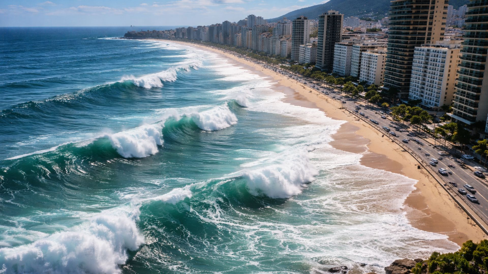
Scientific Projections Indicate Sea Level Rise and Increase Pressure on Densely Populated Brazilian Coastal Cities, with Impacts That Involve Erosion, Frequent Flooding and Increasing Structural Challenges Throughout This Century.
The rise in sea level is no longer just a long-term projection; it is already appearing as a concrete pressure on coastal areas, with beach erosion, more frequent flooding, and impacts on ecosystems, in the context of global warming and more intense extreme events.
Although it is not a “warning” directed at a specific country, NASA and other scientific institutions have been reinforcing that the average sea level is rising and is expected to continue rising throughout this century, even with significant emission cuts.
The most commonly used projections in public policies work with ranges rather than a single number because the outcome depends on the rate of warming and the response of large ice sheets, which opens scenarios that range from several centimeters to values close to 2 meters in high emission situations.
-
Friends have been building a small “town” for 30 years to grow old together, with compact houses, a common area, nature surrounding it, and a collective life project designed for friendship, coexistence, and simplicity.

-
This small town in Germany created its own currency 24 years ago, today it circulates millions per year, is accepted in over 300 stores, and the German government allowed all of this to happen under one condition.

-
Curitiba is shrinking and is expected to lose 97,000 residents by 2050, while inland cities in Paraná such as Sarandi, Araucária, and Toledo are experiencing accelerated growth that is changing the entire state’s map.

-
Tourists were poisoned on Everest in a million-dollar fraud scheme involving helicopters that diverted over $19 million and shocked international authorities.


In this context, Brazilian cities like Rio de Janeiro, Recife, and Fortaleza are on the radar of vulnerability studies because they concentrate population, infrastructure, and low areas close to the sea and estuaries, where the advance of water can combine with heavy rains and tides.
What It Means for Sea Level to Rise

The rise in sea level is the gradual increase in the average height of oceans relative to land, measured by tide gauges and satellites, and occurs mainly due to two mechanisms: the expansion of heated water and the addition of water from melting ice on continents.
Reference data indicate that the global average sea level has already risen by about 0.2 meter since the end of the 19th century, and the rate has accelerated in recent decades, which increases the risk of flooding tides and storm surges reaching areas that were previously above water.
Even when the temperature stabilizes, the ocean responds slowly to accumulated heat, and thus the rise is expected to continue for decades, even though the final magnitude depends on how much humanity will reduce emissions and how glaciers and ice sheets will react.
Direct Impacts on Coastal Cities
The rise in sea level acts as a “higher floor” for waves and tides, making it easier for water to enter streets, drainage systems, and channels, as well as accelerating the loss of sand on urban beaches, especially where the sand strip is narrow or already degraded.
In densely populated centers, the impacts are not limited to the tourist waterfront because the advance of water can reach low neighborhoods, riverbanks, and reclaimed areas, pressuring sanitation systems and increasing the risk of contamination when sewage networks overflow on high tide days.
Additionally, the so-called saltwater intrusion can push seawater into rivers, estuaries, and aquifers, affecting water quality and increasing challenges for supply and agriculture in nearby regions, especially where intense groundwater extraction already exists.
Vulnerability also increases when there is disorderly occupation, low drainage coverage, and little area for the sea to “move” naturally since walls, avenues, and buildings block coastal dynamics, transferring erosion and flooding from one stretch to another.

Projections for 2100 and Possible Scenarios
In scientific communication materials, NASA summarizes that by 2100, projections indicate an increase of at least 0.3 meter and a possibility of reaching about 2 meters in high emission scenarios, which includes the hypothesis of approximately 1 meter, but not as a single guaranteed value.
The very discussion about “how much” the sea rises involves relevant uncertainty linked to the behavior of ice in Greenland and Antarctica, and synthesis reports highlight that a stronger acceleration could occur if collapse processes intensify with warming.
Therefore, maps that simulate coastal exposure often combine sea level rise scenarios with local topography, which helps visualize where water may reach in recurring floods, although the tool does not replace detailed engineering and urban adaptation projects.
Rio de Janeiro, Recife, and Fortaleza Under Pressure
In Rio de Janeiro, the combination of storm surges and higher tides pressures structures on the waterfront and can worsen flooding in low-lying regions connected to bays and channels, where water finds pathways to advance, especially when coinciding with intense rains.
Recife frequently appears in discussions about risk due to its very flat areas, presence of rivers and estuary, as well as neighborhoods with high density near the water, a scenario in which sea level rise can reduce the efficiency of urban drainage.
Fortaleza deals with sections of coastal erosion and interventions on the waterfront, and the rise in sea level tends to elevate the level on which waves act, increasing the need for planning to protect infrastructure while also maintaining functional beaches and dunes.
Urban Adaptation and Damage Reduction
Experts point out that responses involve two fronts, as reducing emissions limits long-term rise, while adaptation organizes land use and protects exposed populations, with measures ranging from coastal works to nature-based solutions, such as mangroves.
The strategy usually starts with mapping low-lying areas and critical infrastructure, followed by drainage review, the creation of buffer zones, and alert systems, as rising seas increase the frequency of flooding during high tides even without storms.
In parallel, decisions about housing and resettlement become important in communities living on the front lines, as rising sea levels can turn currently sporadic events into recurring occurrences, requiring coordination among local government, civil defense, and essential services.


-

-

-

-

-

-

84 pessoas reagiram a isso.