 Portuguese
  English
  Spanish
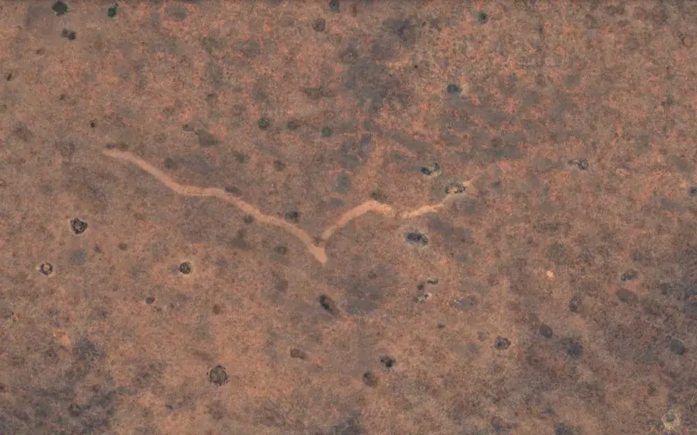
Observing an Unusual Shape on Google Earth, a Man Identified the Trail of a Tornado That Went Unnoticed by Meteorological Authorities, Revealing the Power of the Phenomenon.
In November 2022, a tornado quietly traversed the arid Nullarbor Plain in southern Australia, leaving an 11-kilometer scar on the ground. Despite its destructive power, the event went unnoticed until images from Google Earth revealed the mystery.
Tornadoes, known for their devastating strength, are typically associated with populated areas, where their impact is evident and immediate.
However, when they occur in uninhabited land, their marks can go unnoticed. This is exactly what happened in the remote Nullarbor Plain, a vast dry and treeless region that spans South Australia and Western Australia.
-
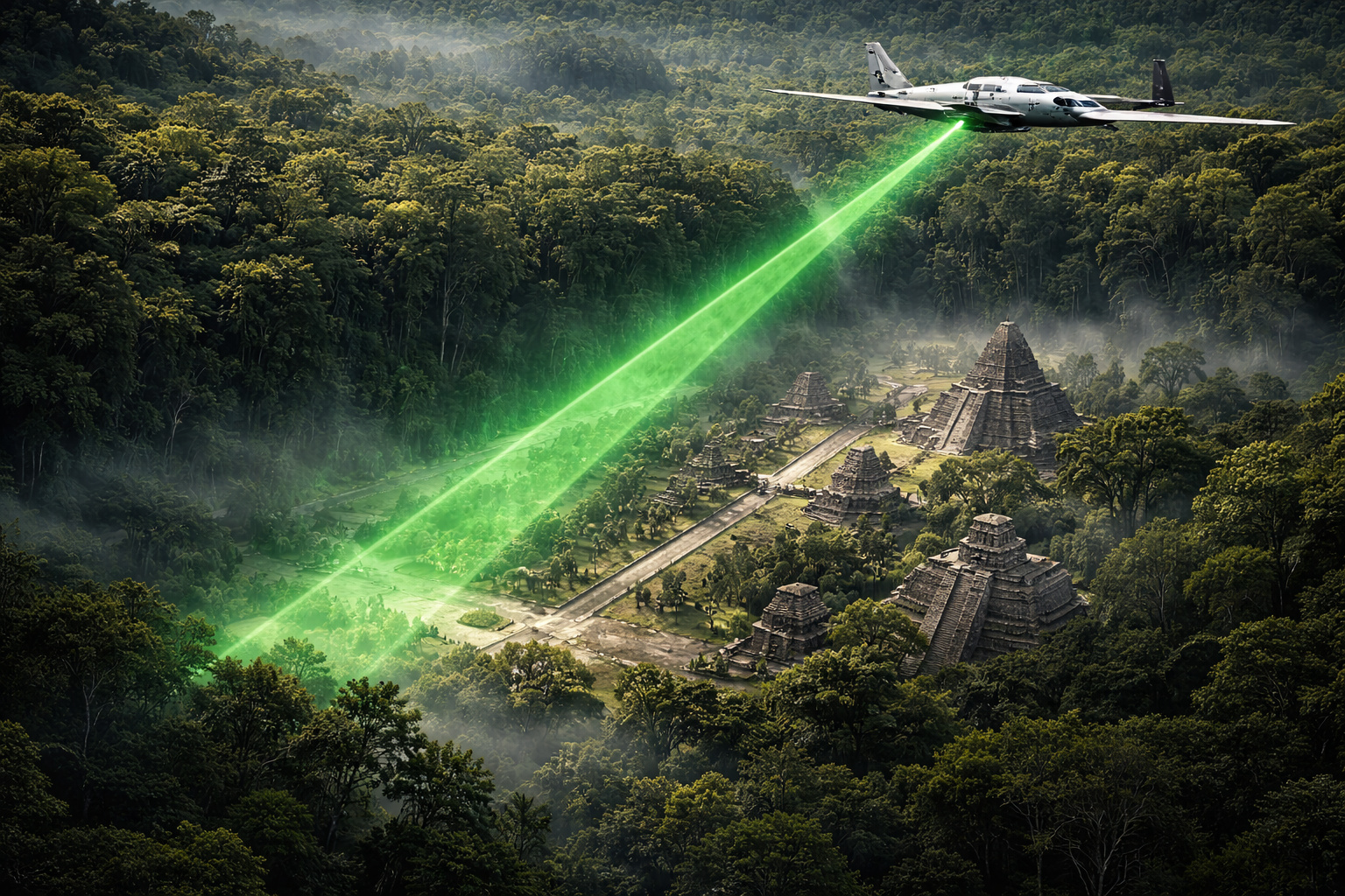
In 2016, a plane equipped with billions of laser pulses scanned 2,100 km² of jungle in Guatemala and revealed, beneath the tree canopies, a Maya megacity with 61,480 unknown structures, elevated roads spanning dozens of kilometers, industrial-scale irrigation systems, and a population of up to 15 million, three times more than any previous estimate.
-
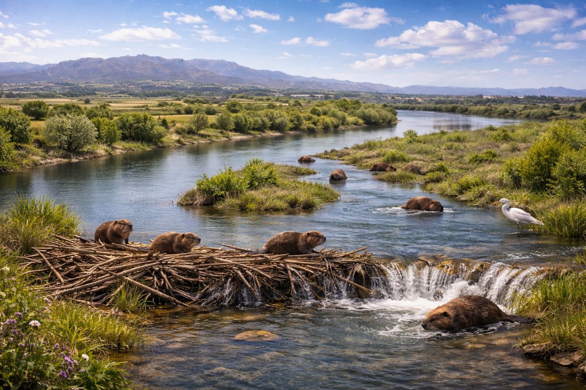
Someone released 18 beavers in the upper Ebro River; it seemed like an isolated case, but no one knows who did it or how to stop their expansion, and now they have already reached Catalonia. And there’s a detail that changes the game: they can help restore rivers and even capture carbon.
-
ZCC 11000 crane lands at the port of Vitória and heads to Ceará in a convoy with 64 trailers: Zoomlion, founded in 1992, builds a monster that lifts over 600 compact cars to 93 m.

-
The biggest drama of being born on Mars is not breathing: Rice biologist says that colonists’ children may cease to be Homo sapiens, shaped by low gravity, radiation, and isolation that divides humanity.


The discovery began unusually. An enthusiast was examining satellite images on Google Earth in search of caves but stumbled upon something unexpected: a long winding mark in the landscape.
The line, which ran east to west, formed a deep “V” in one section, reminiscent of a child’s drawing of a seagull. Intrigued, he reported the find, which quickly reached researchers at Curtin University in Perth.

Screenshot, Google Earth
Technology Reveals the Hidden Power of Nature
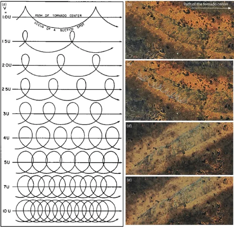
Using images and historical weather data, a research team led by Matej Lipar determined that the mark was the result of a powerful tornado. The occurrences took place between November 16 and 18, 2022, during the passage of a low-pressure system and a cold front, conditions conducive to severe storms.
In addition to satellite images, scientists visited the site. The scar remains visible even after 18 months, with a width between 160 and 250 meters. Intriguing details, such as cycloidal marks—small dark loops formed by the tornado’s suction vortices—reinforced the conclusion.
Based on the observations, the team estimated that the tornado reached speeds exceeding 200 km/h and was classified between F2 and F3 on the Fujita Scale, a significant intensity level. The event, which lasted between 7 to 13 minutes, traversed the arid landscape rotating clockwise.
Matej Lipar,
Journal of Southern Hemisphere Earth Systems Science, 2024
Scientific Debate and Estimation Challenges
Although the data is impressive, not all experts agree on the accuracy of the estimates. John Allen, a meteorologist at Central Michigan University, noted that tornadoes of this intensity are rare in Australia and typically associated with prolonged storms. Nonetheless, he emphasizes that the cycloidal marks indicate the passage of a tornado.
The absence of witnesses and material damage makes the characteristics particularly difficult to study. Still, the discovery underscores the growing utility of technologies like satellite imagery to identify and understand extreme weather events, especially in remote areas.
Unpredictable Nature and Lesson for the Future
Beyond its scientific value, the study serves as a reminder of nature’s unpredictable power. “Extreme weather can happen anywhere, anytime,” Lipar wrote in an article for The Conversation. The use of satellites not only allows for tracking isolated events but also helps meteorologists improve forecasting and preparedness for severe events.
The scar on the Nullarbor Plain, now recognized as a mark of a tornado, not only reveals the power of nature but also the importance of technology in unveiling it. Even amid the silence of an uninhabited landscape, the Earth records the stories that science can tell.


-

-

-

6 pessoas reagiram a isso.