 Portuguese
  English
  Spanish
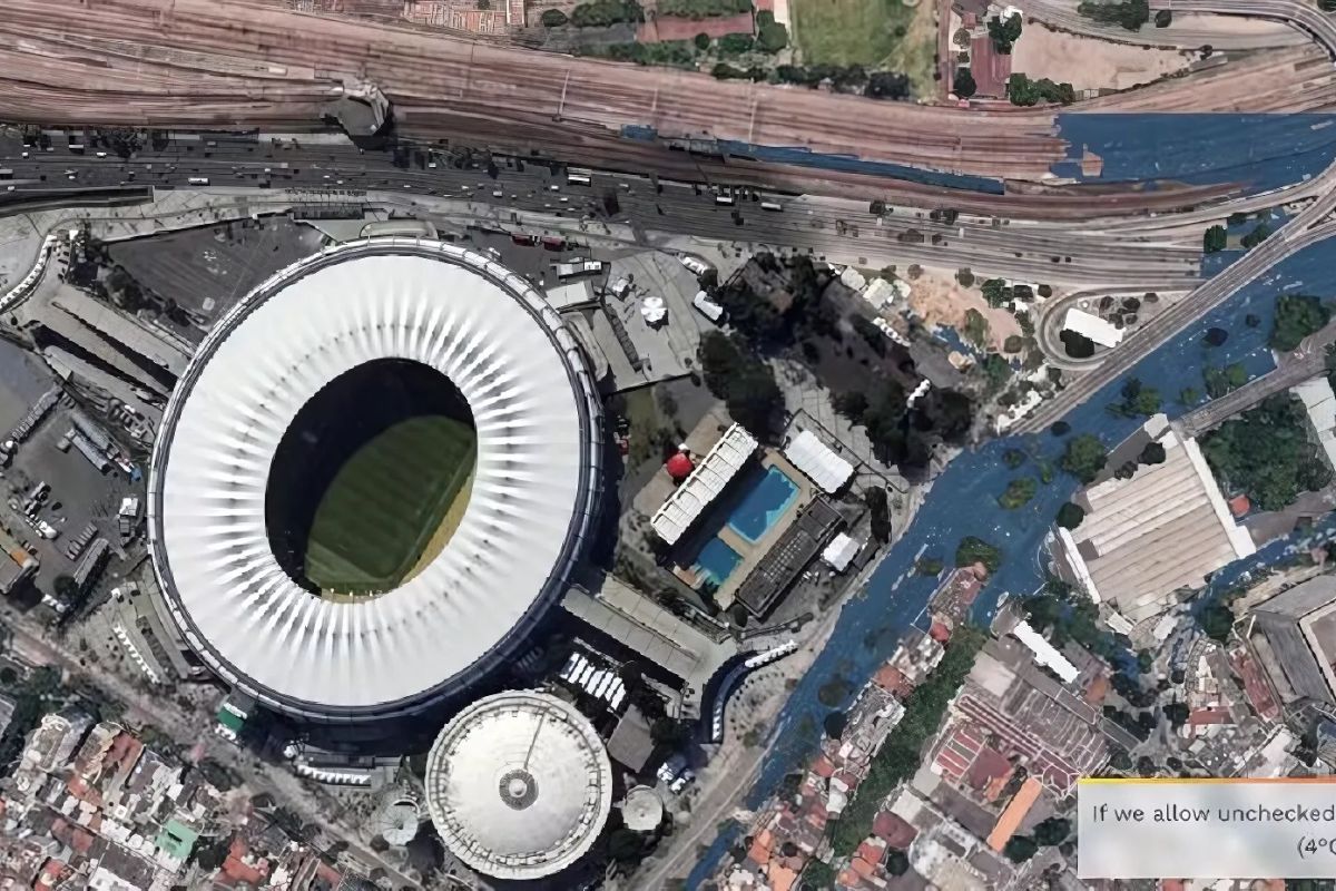


The Rise in Sea Level and Historical Flooding Challenge the Future of Rio de Janeiro, an Iconic Brazilian Metropolis, and Its Football Temple, the Maracanã, Demanding Urgent Actions.
The image of a “high tide” hitting the Maracanã symbolizes a complex and growing threat to Rio de Janeiro. This Brazilian metropolis faces combined risks from river, rain, and coastal flooding, all exacerbated by global sea level rise (SLR). The concern goes beyond a physical structure, touching on the safeguarding of cultural heritage and the resilience of the city.
This article analyzes, based on evidence, the nature and imminence of these risks. The focus is on the Maracanã region, a symbol of national identity. Understanding this threat is vital to protect not only the stadium but the entire dynamics of this vibrant Brazilian metropolis in the face of an uncertain climatic future.
The Growing Vulnerability of Rio de Janeiro to Sea Level Rise
The threat of sea level rise (SLR) to Rio de Janeiro is scientifically based and increasingly urgent. A UN report, cited by the City Hall, points to a 13-centimeter rise in sea level in the city between 1990 and 2020. Projections indicate an additional increase of 12 to 21 centimeters over the next 30 years due to global warming. This acceleration signals a continuing worsening of coastal risks.
-
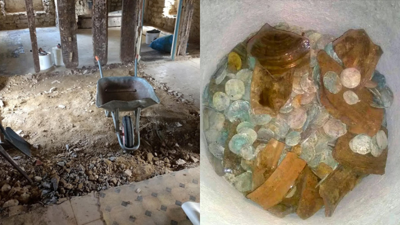
A couple buys an old chalet, breaks the kitchen floor for renovation, and finds over a thousand coins of gold and silver hidden since the English Civil War over 4 centuries ago.
-
Rigid bags with their days numbered: new trend prioritizes comfort in 2026.

-
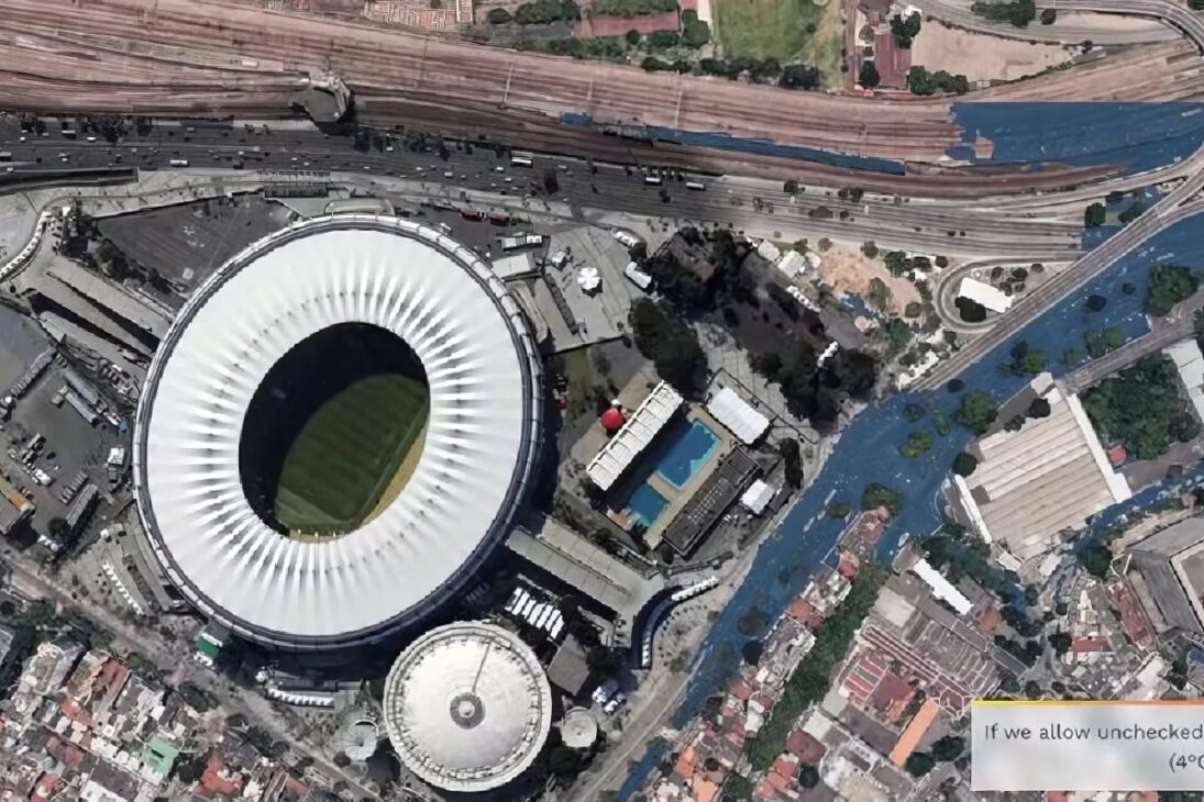
YouTuber creates an excavator equipped with a giant 4.5-meter sword to challenge his brother to a rematch, and the invention quickly goes viral on social media.
-
The U.S. Army surprises the world by presenting the UH-60MX Black Hawk helicopter capable of flying without pilots, controlled by a tablet, featuring the MATRIX system, smart sensors, and full autonomy in real combat and rescue missions.


Since 2008, studies have been conducted by the Pereira Passos Institute (IPP), the City Hall, and partners such as INPE to inform urban planning and strengthen the resilience of this Brazilian metropolis. The Guanabara Bay Basin, crucial for local hydrology, has the highest rate of population exposure to SLR risk in Brazil, reaching 78%. This extreme vulnerability has deep social implications, directly affecting millions of inhabitants. Low-lying areas, such as Baixada de Jacarepaguá, and informal settlements are particularly fragile. The loss of about 90% of the mangroves in Guanabara Bay, essential natural barriers, exacerbates the situation, leaving extensive areas more exposed.
Maracanã and Grande Tijuca: A History of Flooding in the Brazilian Metropolis
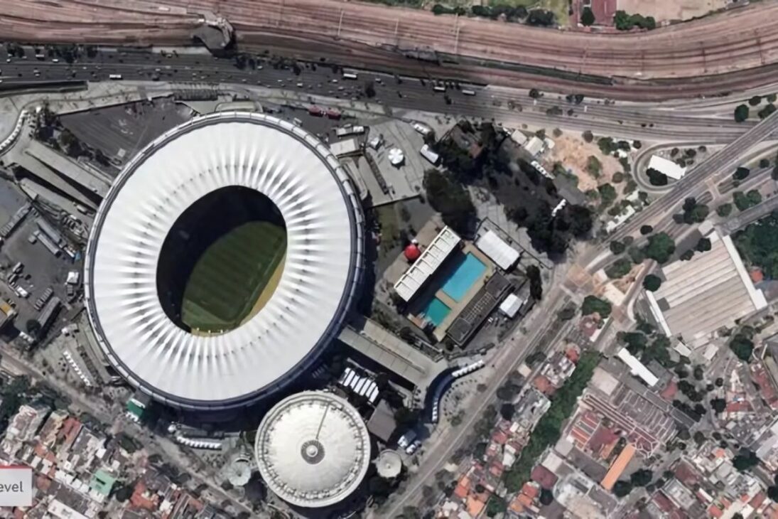
The Maracanã, Tijuca, and Praça da Bandeira region has a long history of flooding. The Great Flood of January 1966 is emblematic: the Maracanã housed 18,910 displaced persons. Tijuca and adjacent streets were submerged, compromising mobility. Praça da Bandeira, a vital traffic node for the Brazilian metropolis, has a history of disruptions since the 19th century. Although the Praça da Bandeira reservoir (operational since 2013) has provided relief, smaller floods persist.
The Maracanã Stadium itself has repeatedly suffered from intense rains. Matches were interrupted or postponed in 2019, 2015, 2010, 1998, 1989, and 1981 due to flooding on the pitch, in the locker rooms, and tunnels. The functionality of the stadium is also affected when crucial access roads, such as Praça da Bandeira and Radial Oeste, become impassable. These chronic occurrences indicate deep-rooted causes related to topography, drainage, and urbanization, now amplified by climate change.
Determinants of Increased Flood Risk
The vulnerability to flooding in the Maracanã complex and its surroundings persists due to deficiencies in the drainage system. Intense rains overload the runoff, causing significant flooding. The final stretch of the Joana River near Maracanã faces a bottleneck that restricts flow, trapping water and affecting the stadium and UERJ. The situation worsens when the Maracanã River overflows, directing more water into the already compromised Joana River system.
The Maracanã River, with springs in Tijuca Forest, was straightened and channeled in the 20th century, altering its dynamics. It flows into the Mangue Canal, which also receives water from the Joana, Trapicheiros, and other rivers before reaching Guanabara Bay. The narrowing of the Mangue Canal’s mouth for the construction of the port area drastically reduced its drainage capacity, contributing to upstream flooding. Guanabara Bay, polluted and silted, has compromised its ability to accommodate flows, especially with high tides and SLR, influencing the water levels in the rivers that flow into it, impacting even areas like Maracanã.
Global climate change accelerates risks. The “Climate Change Adaptation Strategy for the City of Rio de Janeiro” (2016) recognizes the increase in frequency and volume of heavy rains. SLR, in addition to causing coastal flooding, hinders river drainage into the bay (backwater effect). Urbanization, by filling in floodplains and sealing soil, increases surface runoff, overwhelming drainage. The geology of the coastal plain, with compressible soils, also suggests a predisposition to subsidence (land sinking), although specific data for Maracanã is limited.
Defense Strategies: Engineering, Monitoring, and the Future of Adaptation in the Brazilian Metropolis

Rio de Janeiro has been investing in structural measures, especially in Grande Tijuca. Subterranean reservoirs in Praça da Bandeira (18 million liters), Praça Varnhagen (45,000 m³), and Praça Niterói (55,000 m³) have been constructed. Diverting part of the flow from the Joana River through a tunnel to Guanabara Bay is another measure. A new tunnel is under construction to divert excess water from the Maracanã River to the Joana River system, aiming to reduce the volume of water in the main bed of the Maracanã River.
The Alerta Rio System (Geo-Rio) monitors weather conditions and issues alerts. Partnerships with NASA enhance landslide prediction models. Maps of susceptibility to landslides and floods exist. In August 2024, the “Rio Committee for Scientific Studies on Sea Level Rise” was created to deepen research on the impacts of SLR in this Brazilian metropolis. Plans like the Adaptation Strategy (2016), the State Water Resources Plan (2014), and the Municipal Basic Sanitation Plan (2021-2041) guide actions.
Nature-Based Adaptation (NbA) is gaining recognition. Guanabara Bay has lost 90% of its mangroves, crucial natural defenses. The protection and restoration of these ecosystems are recommended, offering regenerative and more cost-effective long-term solutions.


“O Rio vai sumir!” Tão deixando a gente sonhar.
Agora imagine o risco a cidade de Maricá, que está apenas 68 cm acima do nível do mar?