 Português
  Inglês
  Espanhol
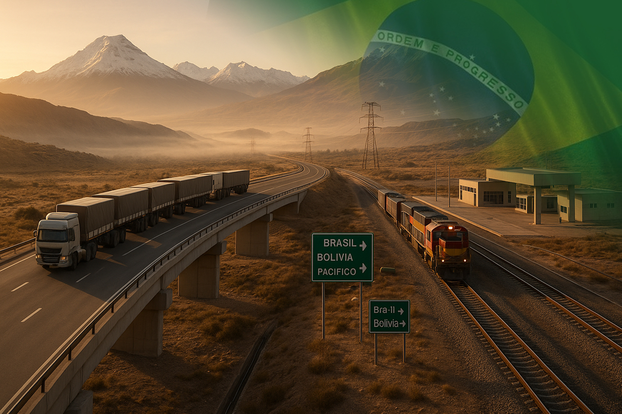


Brazil Expands Integration Routes to Involve All States and Shorten the Path to Pacific Ports. Corridors Such as the Bioceanic Route and the Rondon Quadrant Can Cut Up to Three Weeks and 10 Thousand Kilometers in Certain Flows.
The government has expanded the scope of the South American Integration Routes and incorporated all Brazilian states into the planning, connecting internal productive chains to outputs via the Pacific. In practice, the agenda is no longer limited to the border and now integrates the interior of the country into trade with neighbors and Asia. This information was detailed by the Ministry of Planning and Budget in the announcement of the 2025 Report.
With the inclusion of the 16 non-border units, the project enters a new phase of internalization and bioceanity, aligned with the strategy of diversifying routes and reducing dependence on the Atlantic. The focus is on shortening distances, reducing costs, and gaining predictability in agro-industrial and manufacturing chains.
The expansion also reinforces the geopolitical character of the plan: by connecting the Atlantic to the Pacific, Brazil brings its production closer to key markets while offering neighboring countries competitive access to Brazilian ports. The Planning Department indicates that governance will be supported by a Situation Room and a public data platform to provide transparency on progress.
-
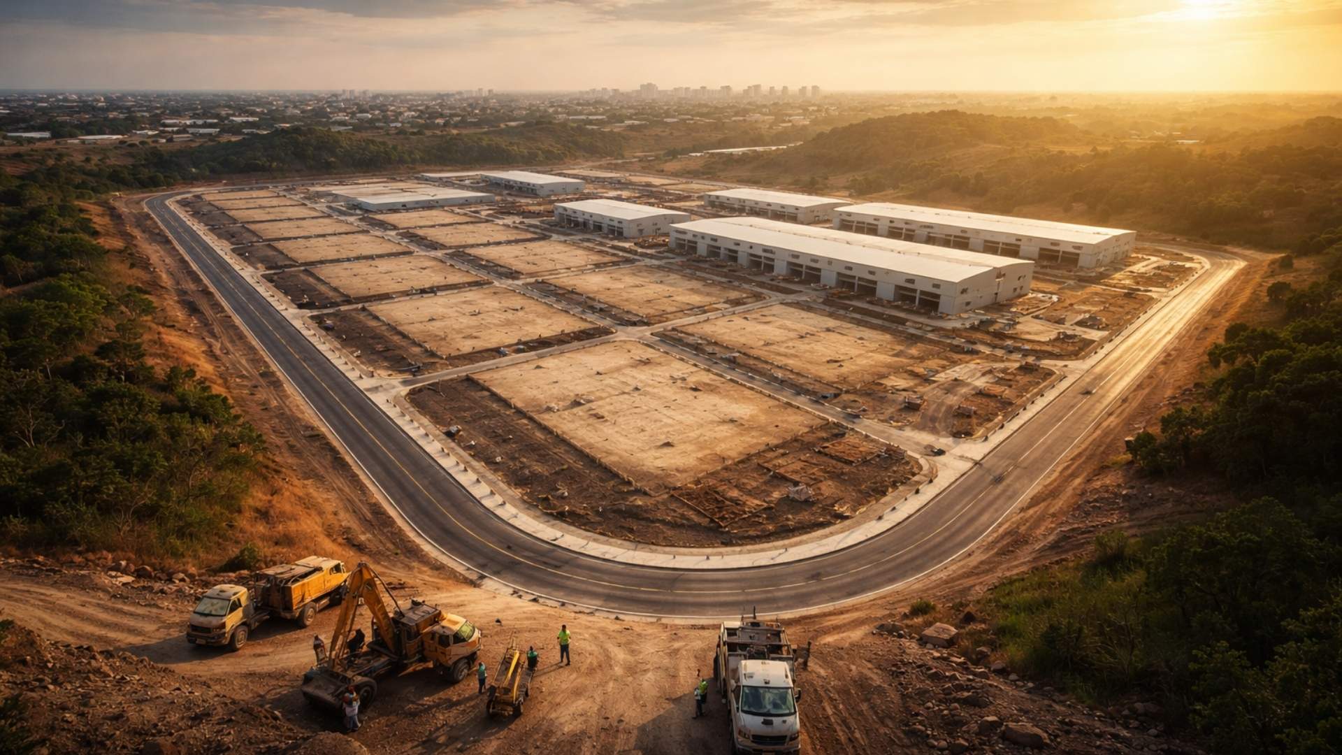
Brazilian city gains industrial hub for 85 companies that is equivalent to 55 football fields.

-
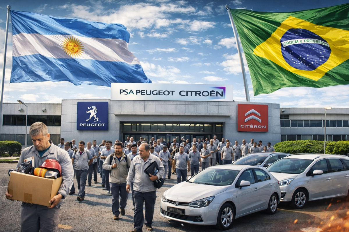
Peugeot and Citroën factory in Argentina cuts production by half and opens a layoff program for more than 2,000 employees after Brazil drastically reduced purchases of Argentine vehicles.
-
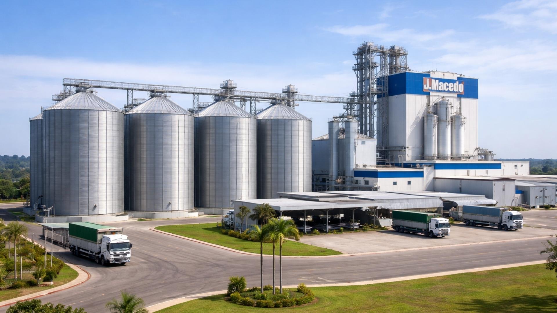
A Brazilian city gains a factory worth R$ 300 million with the capacity to process 200 thousand tons of wheat per year, a mill of 660 tons/day, silos for 42 thousand tons, and an industrial area of 276 thousand m².
-
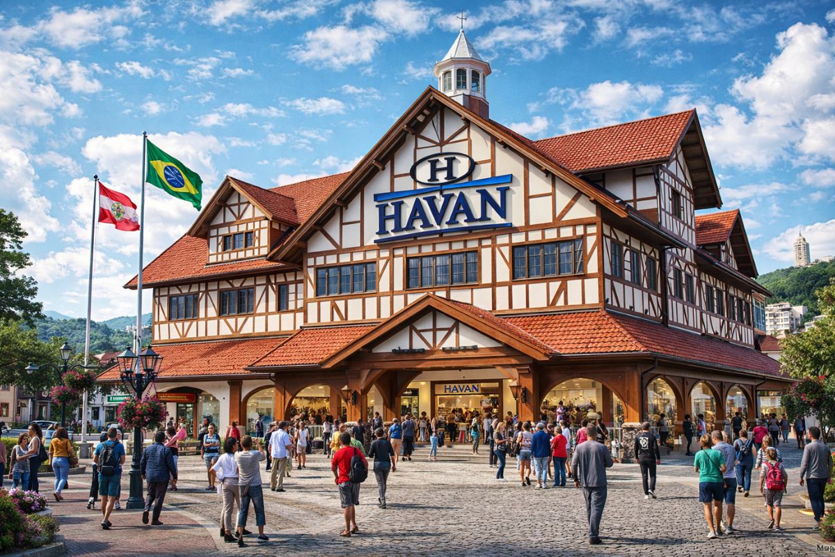
Havan will leave the shopping mall in Blumenau to inaugurate something that the chain has never done before: a megastore in half-timbered style in the Historic Center of the city, which is expected to be completed in May and change the landscape of local retail.

Strategic Corridors: Bioceanic Route and Rondon Quadrant on the Frontline
Among the prioritized axes, the Route 5 – Southern Bioceanic and Route 3 – Rondon Quadrant concentrate immediate benefits for agribusiness, mining, and industry in the Midwest, South, and North. The goal is to link production centers in Brazil to ports in Chile and Peru, shortening the path to the Asian market and better distributing cargo flows.
The agenda also engages with infrastructure under construction in the surrounding area, such as the port of Chancay (Peru), which is expected to become a pivot for connection with Asia. In a hearing at the Chamber of Deputies, the government estimated that in certain flows, the connection via the Pacific could reduce the route by up to three weeks and up to 10 thousand kilometers, a signal that helps to explain private and multilateral interest.
This means lower freight costs, less downtime, and more resilient routes. A well-planned corridor shortens the journey from grain to ship, improves the quality of logistical service, and increases the competitiveness margin of Brazilian products in international disputes.
Works and Financing: 190 Works Mapped and US$ 10 Billion Already in Sight
The government has mapped 190 projects with direct potential for regional integration, involving highways, railways, waterways, ports, airports, infoways, and transmission lines. This is not a closed list, but a living portfolio that focuses on projects capable of unlocking bottlenecks in the connection between production poles and strategic borders.
On the financial side, Planning indicates that there are US$ 10 billion in financing lines already available: US$ 3 billion from BNDES and US$ 7 billion from regional banks such as BID, CAF, and Fonplata. This combination allows for lower risk and accelerates projects with clearer licensing maturity and logistical return, also attracting private capital for concessions and PPPs.
In addition to credit, governance has been strengthened by an agreement Planning + Infra S.A. to map existing infrastructure, identify priority interventions, and create the South American Infrastructure Regional Observatory, a public data platform that should guide decisions and support social oversight of schedules.
Bottlenecks and Next Steps: Licensing, Borders, and Integrated Data
The obstacles are mapped, including environmental licensing, expropriations, customs standardization, and infrastructure of border posts. The official strategy is to anticipate studies, standardize procedures with regulatory agencies, and integrate customs systems with neighboring countries to reduce inspection time, always with socio-environmental safeguards.
Another crucial step is to publish maps, priorities, and schedules by corridor, allowing states and the private sector to calibrate logistical and industrial investments. With public data, the market can better price risks, and projects with high impact on cost and time are likely to be prioritized.
Shorter and more predictable routes increase Brazil’s competitiveness now, while multilateral governance ensures continuity in agendas that cross mandates. It is the combination of diplomacy and work on the ground that can reposition the country in regional and global supply chains.


Como o peru tem formato de cone e o acre fica próximo do norte do perú, a rota mais curta e mais barata é a do antigo projeto iirsa, indo diretamente de cruzeiro do sul ate Bayovar/Piura – via tarapoto e Jaen -e que fica 870 km mais perto do Brasil e cruza os andes por boa rodovia a apenas 2.450 m de altura e sem tuneis de Jaen a Piura. Ja o trajeto por pucallpa e cusco é bem mais longo, exige 30 túneis caríssimos e passa pelos andes a 3.550 metros
Ter que fazer uma estrada naquela floresta é muito gasto e muito tempo, vários anos de obras, mas vendo no mapa é o caminho mais curto mesmo.
Os caminhões que vão com carga pra Lima por Assis Brasil-AC nenhum vai por Cuzco. Todos vão por Macusani (4,600 metros de altitude e ficando até 4,800 metros de altura sentido Juliaca) Arequipa, Camaná e vai beirando o pacífico até Lima.