 English
  Francês
  Alemão
  Italiano
  Japonês
  Norueguês
  Portuguese
  Spanish
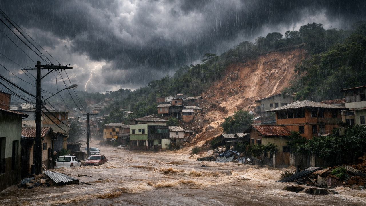
Extreme Rains Hit the Zona da Mata After Cold Front, Supercell, and Atmospheric Trough. Understand What Caused the Tragedy in Minas Gerais.
The extreme rains that affected the Zona da Mata of Minas Gerais at the beginning of this week caused at least 30 deaths, dozens of missing persons, and a trail of destruction in cities like Juiz de Fora and Ubá.
The tragedy was caused by the combination of a cold front, the formation of a supercell, and the presence of an atmospheric trough, which intensified the volume of water in just a few hours.
The phenomenon occurred between Monday and Tuesday, mainly affecting hillside areas, where there were landslides, burials, and flooding.
-
What Changed at Florianópolis Beaches? New Rule Surprises Pet Owners and Restricts Dogs on the Sand at Specific Times

-
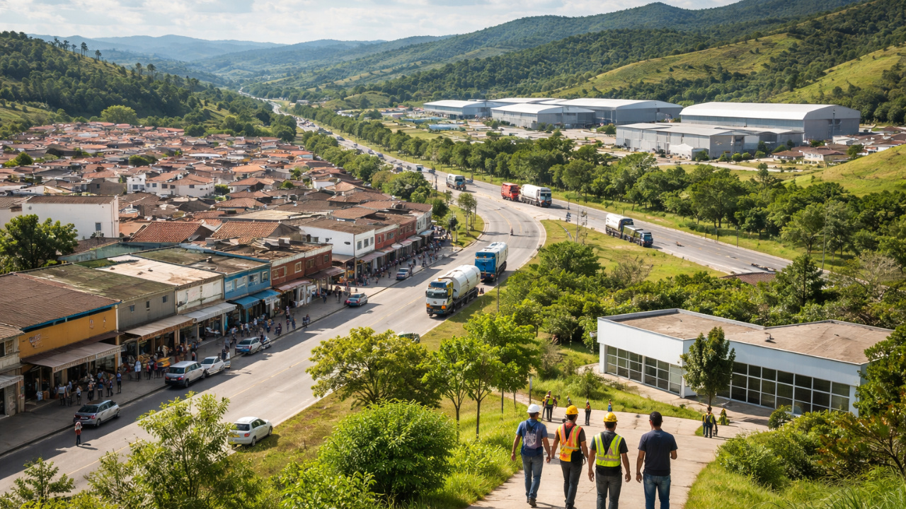
Economic Diversification Accelerates in Itatiaiuçu to Reduce Mining Dependence
-
Minas Gerais Municipalities Press Congress Against Bombshell Bills and Warn of Risks to Public Finances

-
First Firefighter School in Brazil to Be Inaugurated in Indaial, SC With Full-Time Education


In Juiz de Fora, 24 deaths were confirmed in the last 24 hours, along with 37 missing persons.
In Ubá, located about 100 kilometers away, six fatalities and two missing persons were recorded.
In addition, hundreds of residents were left homeless after the waters advanced.
How the Cold Front Triggered Extreme Rains
According to Maria Clara Sassaki, spokesperson for Tempo OK Meteorology, the starting point was the passage of a cold front through the Southeast.
The system advanced from the São Paulo coast, passed through Rio de Janeiro, and reached the Zona da Mata with force.
“We had the passage of a cold front through the southeast of Brazil, which ended up bringing a lot of instability from the coast of São Paulo, passing through Rio de Janeiro and also accumulating significant rainfall yesterday and today in the Zona da Mata Mineira area,” says Sassaki.
According to the specialist, the intense heat and high humidity created the ideal environment for the formation of heavy clouds.
Thus, the combination of these factors favored the extreme rains in a short period of time.
In Juiz de Fora, for example, 100 millimeters of rain were recorded in less than 12 hours.
For comparison, the historical average for February is 170 millimeters for the entire month.
Supercell: The Giant Cloud Behind the Storm
The intensification of the situation occurred with the formation of a supercell, considered one of the most severe types of storm.
This system is characterized by an upward and rotating air current, called a mesocyclone.
According to the National Civil Aviation Agency (Anac), among the four types of storms — supercell, multicell, single cell, and instability line — the supercell is the least common and the most intense.
It can cause strong winds, hail, tornadoes, electrical discharges, and flooding.
“It is an extensive and large territorial cloud,” says Sassaki.
“It reaches a very large area and is very laden with water, which causes extremely intense rainfall in a short time because it is such a heavy cloud that the air currents cannot sustain all that water inside the cloud, which ends up pouring it down all at once in isolated spots.”
Thus, the formation of the supercell was crucial for the extreme rains to gain destructive power in just a few hours.
The Role of the Atmospheric Trough in the Intensification of Extreme Rains
Another essential element was the atmospheric trough, an elongated area of low pressure at mid-levels of the atmosphere.
In practice, this system facilitates the rise of warm and humid air, feeding the formation of clouds.
It is as if the air at altitude were lighter, creating a suction effect that pulls moisture from the surface upward. This further strengthens the storms.
“Imagine that the trough is a wind that will push humid air from the surface into the atmosphere. This movement will carry moisture to the cloud, feeding that cloud and bringing more conditions for that cloud to grow in the atmosphere,” says Sassaki.
“The more moisture, the more ingredients it has to grow.
A supercell is nothing more than an extensively large and intense cumulonimbus cloud that covers a vast area.”
Thus, the atmospheric trough functioned as fuel for the supercell, amplifying the impact of the extreme rains in the Zona da Mata.
Is There a Relationship with Climate Change?
When asked about the connection to global warming, the meteorologist states that the phenomenon is typical of the Brazilian summer.
“These phenomena are common during the summer months.
It is not possible to affirm that an isolated event is directly related to climate change; more in-depth studies on the subject are needed.”
Yet, experts stress that intense events require constant monitoring, especially in urban areas with irregular occupation on slopes.
What to Expect in the Next Few Days in the Zona da Mata
Although the peak of the extreme rains has already passed, the forecast still indicates precipitation in the Zona da Mata until Friday (February 27).
The volume, according to meteorologists, should not repeat the intensity of the historical storm.
“These extreme events, these rains well above the average, happen once and take a certain time to happen again,” says the spokesperson for Tempo OK.
“In general, two extreme events do not happen immediately in the same week or one day after another, but there is still a forecast for rain [in the region] until next Friday [February 27].”
Even with lesser intensity, the risk remains.
The soil is already saturated, which increases the possibility of new landslides, river overflows, and flooding, including in areas like Vale do Jequitinhonha, Vale do Rio Doce, and the Muriaé basin.
“Starting Thursday, this rain should be a little more intense and still maintain the potential for disruptions in areas that have already been affected and in these other regions that are expected to receive more intense rain until the end of the week,” says the specialist.
Meanwhile, states in the Southeast, such as Espírito Santo, Rio de Janeiro, and the northern coast of São Paulo, also remain on alert for elevated rainfall volumes.
In light of the situation, authorities emphasize the importance of heightened attention, especially in risk areas, to prevent new extreme rains from further amplifying the impacts already felt in the Zona da Mata of Minas Gerais.
See more at: Juiz de Fora: What’s Behind the Rains and the Weather Forecast for the Coming Days – BBC News Brasil


Seja o primeiro a reagir!