 Portuguese
  English
  Spanish
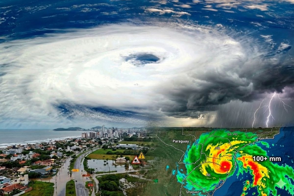


A new cyclone is expected to gain strength in the coming days, bringing persistent heat until Wednesday (28) with highs above 36°C and a sultry feeling from early on, and then organizing instabilities along the Western border, spreading thunderstorms in the South, with accumulations of 50mm to 80mm and peaks above 100mm in Paraná.
The cyclone predicted for the coming days starts with a typical script of extreme weather: first, unusual heat and a sultry feeling from the early hours of the day, then a shift with rain, irregular storms, and rapid increases in areas of instability in the South and Southeast.
Until Wednesday (28), the trend is for above-average temperatures, with highs near 40°C, plus several days exceeding 36°C, especially focusing on Rio Grande do Sul and the western half of the South Region. Subsequently, the scenario changes with the advance of thunderstorms and rainfall volumes that may exceed 100mm in areas of Paraná.
Heat Before The Turn: Morning Already Above 30°C and Highs Near 40°C
Between January 26 and February 3, the South Region enters a period of strong sultry feeling from early on.
-
China accelerates global science and may surpass the United States in 2 years with increased public investment, continuous growth, and direct impact on the global technological competition.

-
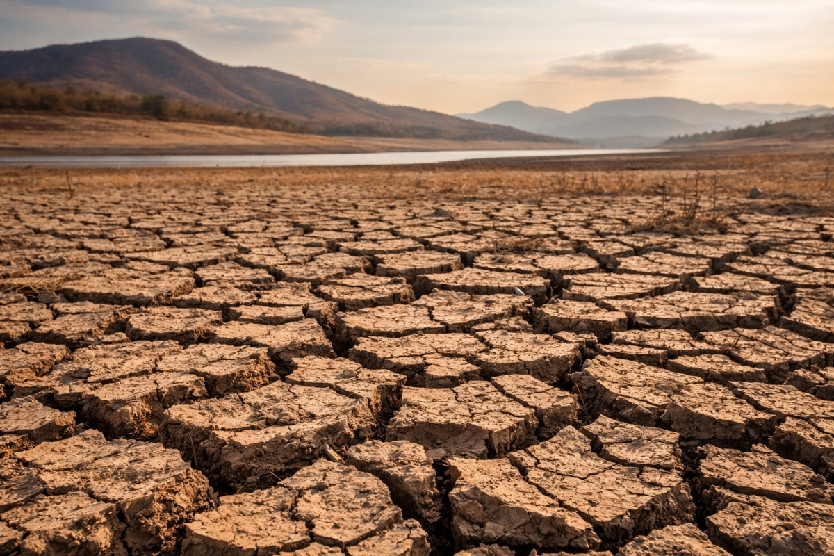
Scientific studies indicate that drought may be strengthening a much greater silent threat: more resistant superbugs.
-
Man builds functional 5-meter submarine in his garage using gas cylinders, PVC pipes, and a refrigerator motor, and navigates with the vessel on a lake in Colombia.

-
Millions of people have been eating yam for centuries without knowing that this humble tuber contains a compound called diosgenin, which scientists have now discovered can improve memory and help control blood sugar levels.

The forecast indicates thermometers exceeding 30°C in the morning, especially in Rio Grande do Sul, where the heat appears in the early hours of the day and persists throughout the afternoon.
Until Wednesday (28), highs are expected to remain elevated, staying above 36°C daily, with a focus on Rio Grande do Sul and the western half of the South Region.
This pattern maintains the feeling of prolonged heat and prepares the ground for rapid changes when instability organizes.
Where The Alert Tightens: West and Campaign of Rio Grande do Sul and Central Areas
Some areas mentioned as under alert repeat in the instability projection, forming a corridor of attention. They are on this list:
- West and Campaign of Rio Grande do Sul
- Central West of Santa Catarina
- Paraná
The combination of persistent heat and the entry of instabilities tends to increase the risk of intense downpours and localized thunderstorms, especially when the warm, humid air meets more organized systems advancing through the western border.
First Signs Of Instability: Isolated Thunderstorms In Paraná Already On Tuesday (27)
Before the broader period of thunderstorms, the forecast already points to an initial change: on Tuesday (27), isolated thunderstorms may occur in Paraná.
This type of occurrence tends to be irregular, with areas receiving heavy rain in a short time while others remain with little or no precipitation.
Starting Wednesday (28), the trend is for expansion of instability areas, indicating that rain ceases to be an isolated event and begins to gain more geographic coverage, preparing for the phase when thunderstorms spread across much of the South.
Thursday (29): Thunderstorms Spread And Organization Begins Along The Western Border
On Thursday (29), the pattern changes dramatically. Thunderstorms are expected to spread across much of the South, and systems begin to organize along the western border.
There is an emphasis on the possibility of intense episodes still in the morning in the region of Uruguaiana, signaling an important starting point for the advance of instabilities.
After this start, areas of rain and thunderstorms advance towards Santa Catarina and Paraná, expanding the reach and raising the risk of stronger downpours as the system gains strength and moves.
Friday (30) And Saturday (31): Stronger Rain In The Eastern Half And Cyclone Forming Offshore
On Friday (30), the forecast indicates that intense rains and thunderstorms tend to concentrate in the eastern half of the southern states, with a possibility of also affecting the northeast of Rio Grande do Sul.
This detail points to a redistribution of instability: after organizing along the western border, the focus shifts and intensifies in other areas.
Between Friday and Saturday (31), the formation of the cyclone off the Brazilian coast is expected, between the South and Southeast.
This is the key point of the “sudden turn” described: heat and sultriness first, followed by a scenario of thunderstorms and heavier rain in specific parts.
Irregular Rain, But With Expressive Volumes: 50mm To 80mm And Peaks Above 100mm
Even with instability, rain is expected to occur irregularly in the South Region, especially in Rio Grande do Sul. This means that the volume can vary significantly from one municipality to another, with clusters of heavy rain concentrated and intervals with little precipitation.
Still, accumulations until Saturday are expected to range between 50mm and 80mm.
The most critical highlight goes to Paraná: in the central and northeast of Paraná, volumes may exceed 100mm, raising the alert for episodes of severe weather and more violent downpours during the period.
What To Expect In Practice: Days Of Extreme Weather And Sudden Changes
The overall design of the event combines three elements that tend to increase the feeling of instability for the population:
- Persistent heat until Wednesday (28), with highs above 36°C and near 40°C
- Entry of rain and storms irregularly, with the expansion of instabilities starting Wednesday
- Stronger organization between Thursday (29) and Saturday (31), with cyclone formation offshore and volumes above 100mm in areas of Paraná
With this scenario, the feeling is of “back and forth” weather: heat and sultriness, then downpours and thunderstorms, with a chance of intense episodes at specific times, such as the emphasis on Uruguaiana early on Thursday (29).
In your city, would you prefer to face the heat of nearly 40°C or the turn with thunderstorms and over 100mm of rain coming all at once?


Virada do tempo para refrescar.
Detesto os dois, mas entre calorão e temporais, com certeza escolho o calorão.
Calorão