 Portuguese
  English
  Spanish
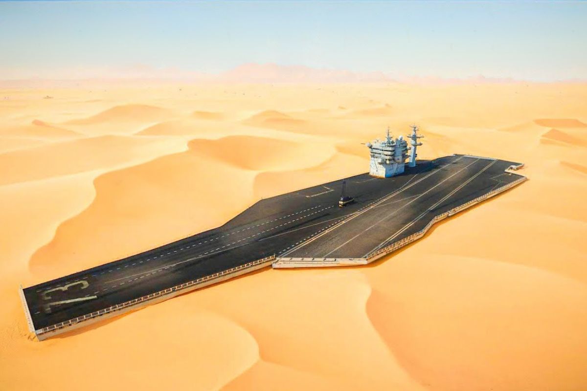
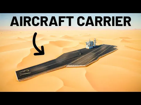
In The Desert Of China, Satellite Images Indicate Replicas Of An Aircraft Carrier And A Destroyer, Positioned Near Tracks That Curve Without Natural Obstacles, Suggesting Radar Tests And Missile Training Against Naval Targets In A Context Associated With Tensions Over Taiwan And The South China Sea.
In 2020, historic satellite images began to record, in the desert of China, structures with outlines resembling an aircraft carrier and a destroyer, positioned in the Taklamakan, in the northwest of the country, alongside tracks cutting across the sand. The dominant interpretation of the material is that these are models for training and measurement, and not operational ships.
In 2014, another episode cited as a parallel gained attention when Iran built a navigable replica of a U.S. aircraft carrier and used it in missile tests. In the case of the desert of China, the sensitive point is the context of Taiwan and the South China Sea, where the presence of American aircraft carriers and destroyers is part of the military balance and the dispute for access and control of maritime space.
What Appears In The Images In The Desert Of China

The record describes a wide and seemingly empty landscape in the Taklamakan, until, in the center of the scene, an elongated shape resembling an aircraft carrier emerges, with an area resembling a runway and markings suggesting aircraft and armaments.
-
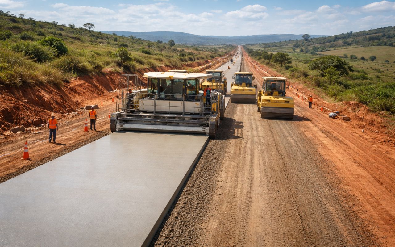
New CCR concrete paving technology promises roads up to 3x more durable, less maintenance, and cost reduction in Brazil.
-
Made from recycled plastic, plastic wood is gaining space in the construction industry because it does not rot, resists moisture, and reduces maintenance costs over the years.

-
Florianópolis will receive a million-dollar BRT that will begin construction in 2026 with nearly 400 million in funding from the federal government and the Inter-American Development Bank, and the map already shows the routes for the exclusive bus corridors.

-
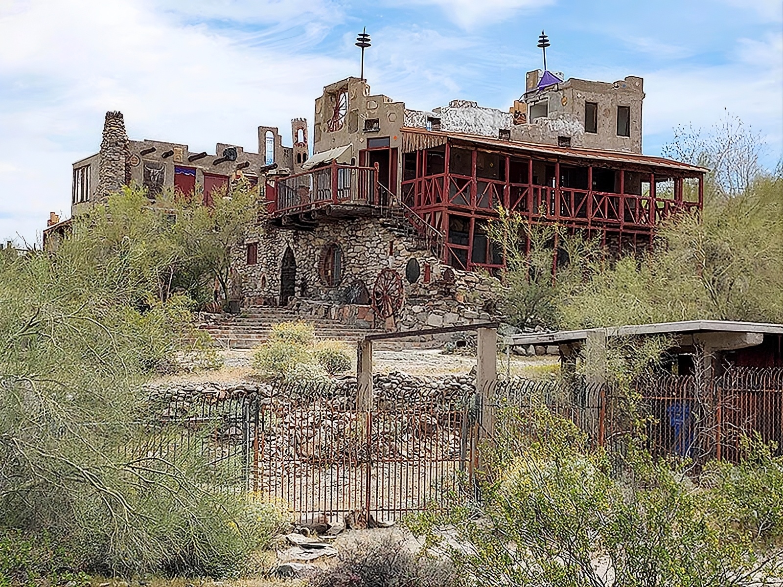
Without a blueprint, without an engineer, and using scrap from the dump, a father spends 15 years building an 18-room castle for his daughter, featuring tram tracks, 13 fireplaces, and over 700 m², which may now be demolished.

The interpretation of the material itself is that the object is not in the ocean, but in the desert of China, which shifts the interpretation towards the idea of a target and simulation.
The text also highlights a point of identification: the shape of the alleged aircraft carrier would not correspond to Chinese designs, but would resemble the American design, similar to the characteristic shape of the Gerald R. Ford class.
Expanding the surroundings, the analysis points to a line of tracks crossing the area.
On the other side of these tracks, a second structure appears resembling a destroyer, with contours close to the profile of an Arleigh Burke, including the bridge, smokestacks, and the vertical launch system area.
The base text emphasizes, however, that the shape appears flat, closer to a model than to a real hull.
Taklamakan, Sand, And Why A Desert Can Become A Military Laboratory
The Taklamakan is described as a sand desert, distinct from rocky deserts around, and cited as the second largest sand desert in the world.
This condition matters because loose sand, wind, and large spatial scale help create an environment where it is possible to install voluminous structures without immediate urban interference.
The material itself questions why to choose the desert of China to place models of aircraft carriers and destroyers.
The presented answer is pragmatic: in remote areas, large targets can be observed by satellites, tested with sensors, and adjusted without the maritime traffic and typical security restrictions of real naval exercises.
A Technical Detail Draws Attention: Tracks That Don’t Follow A Straight Line
The most unusual point is not just the presence of a fake aircraft carrier, but the design of the tracks.
Instead of running straight across flat terrain, the tracks curve, twist, and make a sharp turn to the right, with the text pointing to no natural obstacle justifying the layout.
Following the tracks north, the record states that they reach a base, with a large hangar, support buildings, and trucks in the vicinity.
Following the tracks south, the description is of an abrupt end in the desert of China, with no indication of ongoing work and no explicit function in the final stretch.
Why Tracks Matter In A Naval Combat Simulation
The central hypothesis of the base text is that tracks can transform a fixed target into a controllable moving target.
A real aircraft carrier doesn’t stay still, and part of the challenge of modern weapons is tracking and hitting a moving ship.
Tracks would allow, on land, to repeat maneuvers, measure responses, and compare data accurately.
Experts cited in the material suggest that the curves of the route were designed to simulate evasive maneuvers, such as two sharp direction changes and variations in speed.
In simple terms, the desert of China would become a scenario where it is tested whether sensors, radars, and missiles can maintain tracking of a target that changes trajectory.
Models, Metal Poles, And Two Technical Readings: Sensors Or Radar Reflectors
The text describes that, in historical images, the site would have appeared for the first time in 2020 as a grid of cubes with several tall structures, possibly masts or antennas, arranged in the shape of an American warship.
Only later would the outline of the destroyer have been marked more clearly.
Two interpretations appear as main.
The first is that the vertical metal poles function as sensors to study the impact of missile attacks on these targets.
The second is that they are radar reflectors, positioned to simulate the complex metal signature of a real vessel, allowing tests of radar-guided attacks on an aircraft carrier or a destroyer without putting them at sea.
A Third Target In The Desert Of China And The Connection With An Armaments Company
Following the trajectory described by the marks on the ground, the material points to another model of an aircraft carrier, considered the most elaborate: a three-dimensional model, with many poles projecting from the structure.
A photograph at an arms convention is cited as evidence that there would be a scale model of the same system.
At this point, the text mentions that the prototype is said to have been developed by CASIC, a Chinese armaments company.
This connection reinforces the interpretation that the objective is not just propaganda, but development and validation of capabilities, with the desert of China serving as a testing ground for detection, tracking, and guidance systems.
The Background: U.S. Aircraft Carriers Near China, Taiwan, And The South China Sea
The material places the models in the context of disputes in the South China Sea and the tensions between China and Taiwan.
At sea, several nations claim overlapping areas, and China is described as claiming virtually the whole South China Sea, treating it as national territory, not as international waters.
To support this movement, the text cites the expansion of islands and reefs with sand, transforming them into military posts.
In response, the United States sends warships and conducts freedom of navigation operations, in which aircraft carriers and destroyers cross contested routes to signal that they do not recognize unilateral restrictions.
On the Taiwan axis, the narrative points out that Beijing considers the island a rebellious province and that the possibility of control by force is treated as real.
This scenario explains why the American naval presence, including aircraft carriers, appears as a deterrent factor and why the desert of China would be used to train against such platforms.
What Is Being Tested: From A Fixed Target To A Moving Target
From the hypotheses of the text, the reasoning is that China seeks to verify whether missiles can accurately hit warships similar to those of the United States.
The material highlights that hitting a fixed target is one thing, and hitting a moving target is another, which is why the set of tracks and curves would be a central part of the simulation.
In technical terms, the described sequence is: create a target with a signature similar to that of an aircraft carrier, add elements that imitate radar and metal, record data with sensors or reflectors, and then repeat scenarios until obtaining patterns of hits, misses, and tracking.
The desert of China favors this repetition, without the variables of rough seas, commercial traffic, and navigation security.
The Most Sensitive Point: The Mention Of A Missile Designed To Hit Moving Ships
The base text states that U.S. intelligence presumes the existence of a variant of the Dongfeng 21D missile specifically designed to target and destroy moving ships, such as aircraft carriers.
The description includes a ballistic trajectory, ascent to the atmosphere, and return at extreme speed, followed by the separation of a maneuverable reentry vehicle.
The highlighted difference is that, unlike a traditional ballistic warhead, this maneuverable reentry could adjust its trajectory in the air to hit smaller and more precise targets, and even track moving ships.
Here, the desert of China appears as part of the laboratory: it does not prove the missile’s use, but supports the idea that sensors, radar, and tracking necessary to find a moving aircraft carrier are being trained.
Satellites, Real-Time Tracking, And The Defense Challenge
To support this type of weapon, the text says that China would have expanded its network of satellites, increasing the capacity to track moving targets in real time.
Without persistent tracking, the detection and engagement chain fails, especially when the target is an aircraft carrier altering speed and direction.
The material also emphasizes the defense side: intercepting a ballistic missile during the mid-flight phase can be difficult, and the final phase can be even more complex if the reentry vehicle executes maneuvers.
The journalistic point here is that the mere possibility alters the strategic calculation, forcing aircraft carriers to operate farther from the Chinese coast, which reduces the effective range of onboard aircraft.
Why Building Targets Visible To Satellites May Be Intentional
A question raised in the text is why conduct tests in the middle of the desert of China, completely visible to satellites.
The suggested answer is that this visibility may serve as a message: if capabilities are known, they produce a deterrent effect, even without combat employment.
In this framing, models of aircraft carriers and destroyers in the Taklamakan would serve two simultaneous roles.
The first is technical, as a test target. The second is communicational, as a signal that China is prepared to contest the presence of aircraft carriers near Taiwan and in the South China Sea.
Precedents: Iran In 2014 And The Common Practice Of Training With Replicas
The text recalls that China is not the only country to build replicas of American ships.
In 2014, Iran built a replica of an aircraft carrier, used it in missile tests, and bombed it repeatedly until it sank, in an exercise that attracted international attention.
In parallel, the material asserts that the United States also trains with simulated targets, including fake cities in deserts, replicas of aircraft, and the use of foreign equipment for training.
The message is that, in isolation, building a model is not proof of imminent aggression, but an indicator of preparation and doctrine.
What Can Be Asserted With Certainty And What Remains Hypothesis
The material describes that the structures resemble an aircraft carrier and a destroyer, which are located in the Taklamakan and appear associated with tracks that make unusual curves on flat terrain.
It also describes the evolution of the site in historical images, with emergence in 2020 and progressive detailing of the outlines of the models.
What remains hypothesis is the exact nature of the poles, whether they are sensors or radar reflectors, and what ammunition was used, if any, in the tests.
It is also a hypothesis the precise function of the curves of the tracks, although the explanation of simulating evasive maneuvers is coherent with the goal of transforming a fixed target into a moving target.
Without independent data, the desert of China offers signs, not closed conclusions.
If you follow defense and geopolitics, it is worth observing how satellite images, target engineering, and tracking doctrine begin to influence political decisions, budgets, and naval posture, even without open combat.
The public discussion improves when it separates what is evidence from what is hypothesis and when it demands transparency about risks and escalation.
Do you see the desert of China as a training ground to pressure Taiwan or as a technical test of radar and missiles without immediate intention?


-

-

-

-

-

-

16 pessoas reagiram a isso.