 Portuguese
  English
  Spanish

Research Led By The University Of Liverpool Identifies Two Structures The Size Of The Titanic, Located 2,900 Kilometers Deep, As Responsible For Altering The Flow Of Liquid Iron In The Core And Influencing The Shape And Stability Of The Earth’s Magnetic Field Over 265 Million Years
Two structures the size of the Titanic, hidden 2,900 kilometers beneath the Earth’s surface, have been influencing the Earth’s magnetic field for at least 265 million years, according to a study led by geologists who analyzed mantle data, computational simulations, and global magnetic records.
Deep Structures The Size Of The Titanic Inside The Planet
The two structures the size of the Titanic are known as large low-shear-velocity provinces, or LLSVPs. Each of them is comparable in size to the African continent and is located at the base of the Earth’s mantle, near the core, about 2,900 kilometers deep.
These regions are not well-defined solid blocks. They consist of irregular areas of the mantle where the material is hotter, denser, and chemically distinct from the surroundings.
-
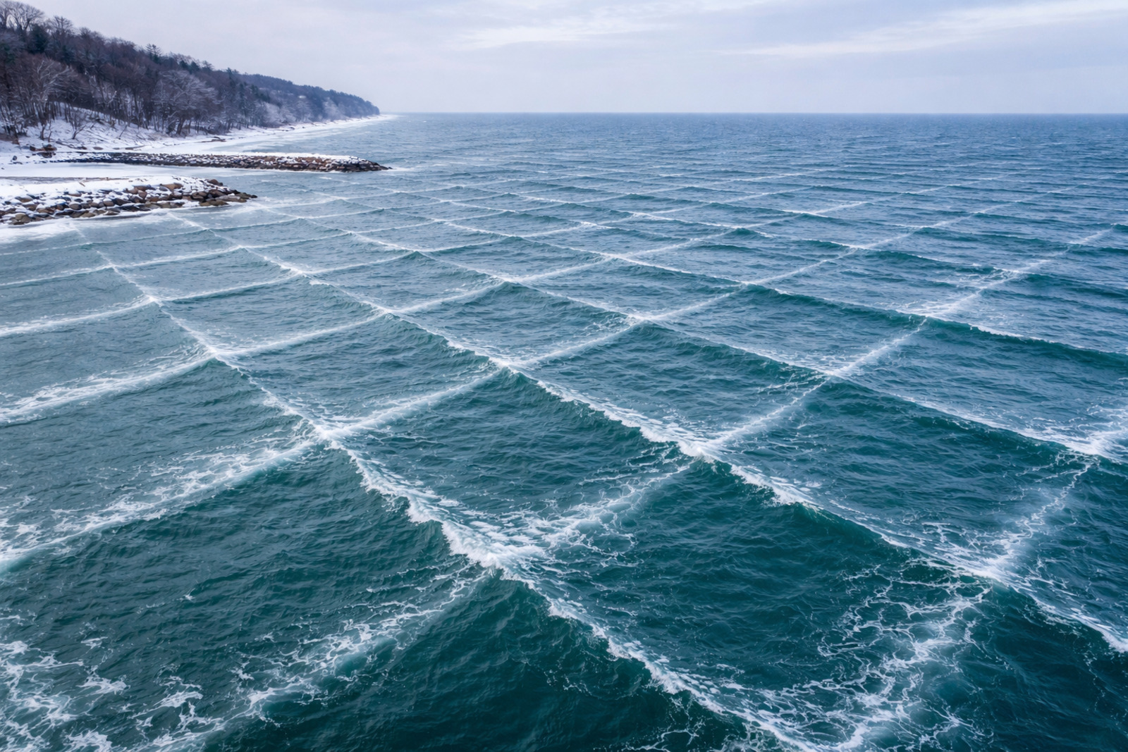
Rare phenomenon intrigues science: video captures extremely rare square waves on Lake Michigan and geometric pattern near Indiana impresses.
-
A nutritionist reveals that the real villain of your breakfast is not butter or eggs, but rather the excess of white bread, cookies, and refined sugar that you consume every day without realizing the damage it causes.

-
The Android as we know it has its days numbered after a new rule from Google that could end free APKs and completely transform the system by 2027.

-
Archaeologists use satellite technology and find a mysterious structure of 500 m² buried up to 6 meters beneath an ancient city in Egypt.


Surrounding these zones is a ring of cooler material, where seismic waves propagate more quickly.
Evidence Accumulated Since The 1970s
Geologists have suspected the existence of these structures since the late 1970s. Confirmation came about two decades later, with advances in global seismology. After another ten years of further analysis, LLSVPs began to be identified as elements capable of directly influencing the planet’s magnetic field.
The new study presents, for the first time, evidence linking these deep structures the size of the Titanic to the behavior of the Earth’s magnetic field over hundreds of millions of years, based on observational data and numerical modeling.
How The Structures The Size Of The Titanic Affect The Core
According to research published in the journal Nature Geoscience, temperature differences between the LLSVPs and the rest of the mantle alter the flow of liquid iron in the outer core. This movement of iron is the mechanism responsible for generating the Earth’s magnetic field.
The combination of cold and ultra-hot zones in the mantle can accelerate or decelerate the flow of liquid iron, depending on the region.
This process creates an asymmetry in the geodynamo, contributing to the irregular shape currently observed in the global magnetic field.
Simulations Reproduce Irregularities In The Magnetic Field
Researchers analyzed evidence from the mantle and ran simulations on supercomputers.
They compared a scenario with a homogeneous mantle to another that included structures the size of the Titanic. The results were compared with real data from the Earth’s magnetic field.
Only the model that incorporated the LLSVPs was able to reproduce the inclinations, patterns, and irregularities observed.
The simulations also indicated that some regions of the field remained stable for hundreds of millions of years, while others changed significantly.
The authors highlight that these results have implications for understanding ancient continental configurations, such as the formation and fragmentation of Pangea, as well as issues related to ancient climate, paleobiology, and natural resources.
This article was based on a study published in Nature Geoscience, in a statement from the University of Liverpool and in a report originally published by WIRED en Español, translated from Spanish.


O autor desse texto cometeu um erro de escala absolutamente astronômico (ou melhor, geológico).
Comparar algo ao Titanic e, na frase seguinte, dizer que tem as dimensões da África é como dizer que uma formiga tem o tamanho de um elefante. A diferença de escala é de ordens de magnitude.
O Tamanho Real do Problema
Para colocar as coisas em perspectiva, veja a comparação de escala que o autor ignorou:
Titanic: Aproximadamente 269 metros de comprimento.
África: Aproximadamente 8.000 quilômetros de extensão de norte a sul.
LLSVPs: Elas possuem milhares de quilômetros de largura e centenas de quilômetros de altura.
Essas estruturas, carinhosamente chamadas de “bolhas” (blobs), são de fato colossais. Elas representam cerca de 6% do volume de toda a Terra.
Localização: Estão na fronteira manto-núcleo. Uma fica sob a África (conhecida como “Tuzo”) e a outra sob o Oceano Pacífico (“Jason”).
Massa: Se estivessem na superfície, seriam 100 vezes mais altas que o Monte Everest.
Origem: Uma das teorias mais fascinantes (e recentes) é que elas podem ser restos de Theia, o protoplaneta que colidiu com a Terra há bilhões de anos, resultando na formação da Lua.
É provável que o autor tenha tentado usar o Titanic para evocar uma imagem de “algo gigante”, mas esqueceu que, perto do manto terrestre, o Titanic é praticamente um grão de poeira. A comparação com a África é a única que chega perto da realidade científica.