 Portuguese
  English
  Spanish
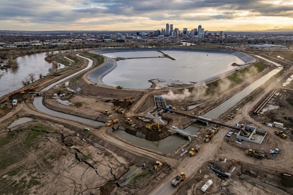
With Permanent and Temporary Infiltration Mega Basins, Flood-MAR Channels, and Prepared Agricultural Areas, the U.S. Captures Stormwater and Melted Snow to Push Volumes Underground. California Gained 2.2 Million Acre-Feet in 2024, While Virginia Plans to Inject 60,000 m³/Day into the Potomac Aquifer in 2026 to Curb Saline Intrusion
The infiltration mega basins have become the most visible symbol of emergency engineering in the United States in 2026, with works concentrated mainly in the West and Southeast, where decades of pumping have reduced groundwater levels, pressured agriculture, and accelerated land subsidence in critical areas.
On the map, the operation spreads across California, Arizona, and Virginia, along with initiatives in regions like Idaho, with a common goal: to convert excess water from floods and wet periods into groundwater recharge, treating aquifers as the “invisible vault” that needs to be replenished to avoid collapse.
Where It Is Happening and Why 2026 Became the Year for Pushing Water Underground

In the United States, the described actions are focused on two geographic blocks.
-
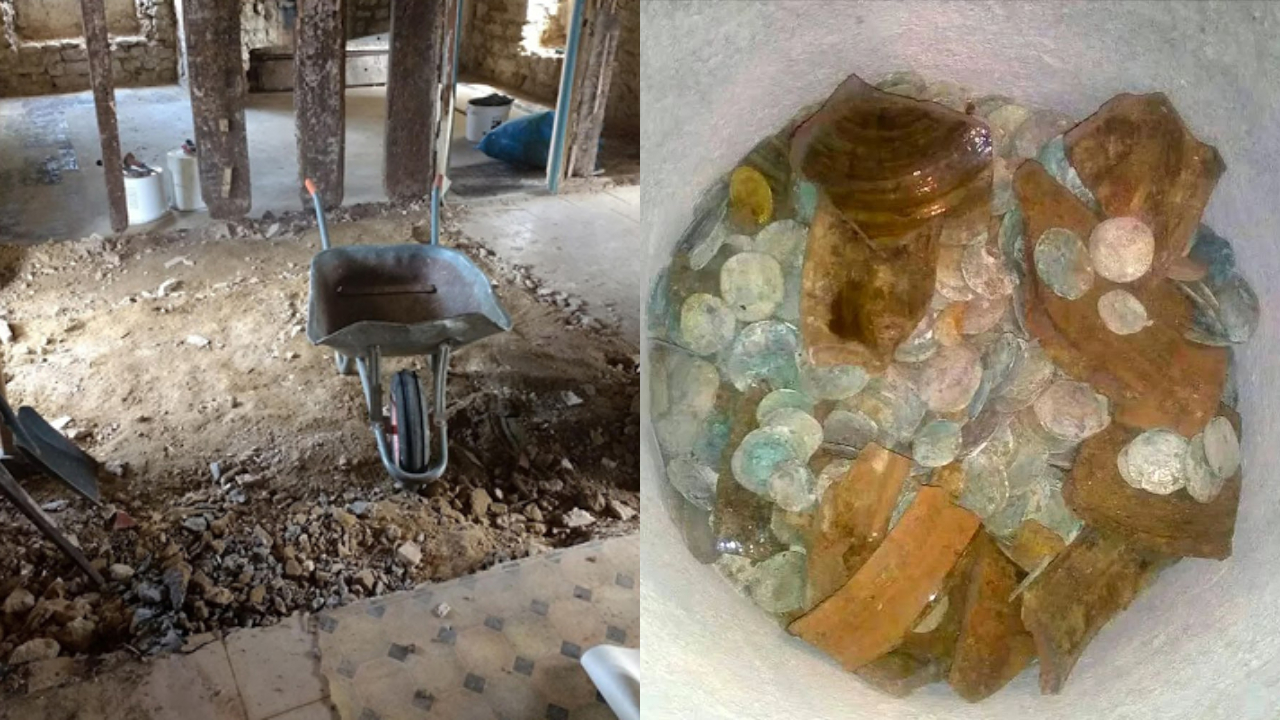
A forgotten cord on the floor of a basement in Vienna leads a plumber to a box containing 30 kilograms of gold with Mozart’s face, hidden before World War II. The treasure, worth 2.3 million euros, was just centimeters away from a worker who ignored the sign a day earlier.

-
A couple buys an old chalet, breaks the kitchen floor for renovation, and finds over a thousand coins of gold and silver hidden since the English Civil War over 4 centuries ago.
-
Rigid bags with their days numbered: new trend prioritizes comfort in 2026.

-
YouTuber creates an excavator equipped with a giant 4.5-meter sword to challenge his brother to a rematch, and the invention quickly goes viral on social media.


In the West, California is highlighted as the epicenter due to the volume of active projects and for operating under management requirements that aim for long-term sustainability.
In the Southeast, Virginia appears as a strategic front for facing saline intrusion and land subsidence in coastal areas.
In California, the focus is on capturing stormwater and melted snow and directing that pulse into the soil.
In Arizona, the priority is to curb the critical decline in groundwater levels through areas with strict regulations.
In Virginia, the focus is on building a pressure barrier with treated water to push seawater back and stabilize the underground.
What Are Infiltration Mega Basins and How Do They Work in Practice

The infiltration mega basins are shallow and extensive ponds installed in highly permeable soils, such as sand and gravel, so that water can descend by gravity and reach the aquifer.
Instead of channeling everything quickly to rivers and oceans, the system spreads water over prepared areas for infiltration, filtering sediments along the way.
The logic is simple and harsh: if pumping empties, excess rain needs to fill. The game-changing detail is the scale.
They are permanent and temporary basins, operated as infrastructure, that come into operation when there is water available, mainly during storm events and flow peaks.
California and the Jump of 2.2 Million Acre-Feet in 98 Basins in the 2024 Hydrological Year
In California, the Department of Water Resources expanded permanent and temporary recharge basins to capture storm flows and melted snow, directing them underground.
The number that defines the scale of the effort is concrete: in the 2024 hydrological year, the actions helped increase storage by 2.2 million acre-feet spread across 98 basins.
This data indicates two things at once.
First, the operation is modular, with dozens of recharge points functioning as a network.
Second, the storage gain does not depend on a single monumental project, but on multiple areas working together, which reduces operational risk and allows capturing water across different events and watersheds.
Flood-MAR and the Temporary Channels That Divert Floods to Become Recharge
A central component of the strategy in 2026 is the Flood-MAR initiative, which uses temporary channels and controlled diversion of floodwaters to infiltration areas.
The idea is to swap the logic of disaster for the logic of storage: turn floods into recharge.
The mechanism includes the use of prepared agricultural areas, described as clean and ready to receive water when there is excess, as well as channels and permeable ditches that allow water to leak intentionally into the soil while being transported.
The technical point is that recharge does not happen just “in the basin,” but also along the way, where unlined channels allow continuous infiltration.
“Rip & Chip”: Cleaning Agricultural Areas to Become Emergency Sponge
To increase immediate absorption capacity, soil preparation practices known as “Rip & Chip” are introduced, cleaning agricultural land and preparing it to receive pulses of water during flood events.
This step is crucial because the bottleneck of mass recharge is rarely “lack of water,” but rather lack of ready and safe areas to receive volumes without destroying crops, infrastructure, and rural roads.
By preparing the soil, engineering tries to reduce the time between the rainfall event and the effective entry of water into the aquifer.
SWIFT in Virginia: 60,000 m³/Day into the Potomac Aquifer to Curb Saline Intrusion and Subsidence
In Virginia, the SWIFT project is described as a turnaround for using treated water on a large scale.
With operations planned for 2026, the plan is to inject about 60,000 m³/day into the Potomac Aquifer to combat saline intrusion and land subsidence.
This type of recharge does not depend on permeable soil at the surface.
It is direct injection, via wells, useful when impermeable layers, such as clay, limit infiltration.
The goal is to create sufficient fresh water pressure to act as a barrier and stabilize the underground structure, reducing the vulnerability of coastal areas.
Arizona Tightens Rules: Ranegras Plain Becomes the 8th Active Management Area in January 2026
In Arizona, the highlight is regulatory and territorial. In January 2026, the Ranegras Plain basin was designated as the 8th Active Management Area (AMA) in the state, imposing strict regulations to contain extraction that was pushing groundwater levels into a critical decline.
The measure appears as part of the same logic of the infiltration mega basins: it is pointless to recharge without reducing withdrawal pressure.
By delimiting an area with its own governance, the state tries to control pumping and organize usage, especially in regions with agricultural weight and high dependence on groundwater.
Roseville, Kern Fan and Coachella Valley: Urban and Agricultural Pieces in the Recharge Puzzle
The mass recharge described is not restricted to isolated rural areas.
In Roseville, there is an expansion of Aquifer Storage and Recovery wells between 2022 and 2026 to strengthen urban water supply, signaling that cities are also entering the competition for underground stability.
In the Kern Fan Basin, the expansion involves acquiring hundreds of acres for recharge basins and recovery wells, with a capacity to store about 28,000 acre-feet of water.
In the Coachella Valley, there are four active facilities, including the Whitewater River, infiltrating billion gallons of imported water from the Colorado River underground.
The operational detail here is clear: part of the recharge depends on transferred water, not just local rainfall.
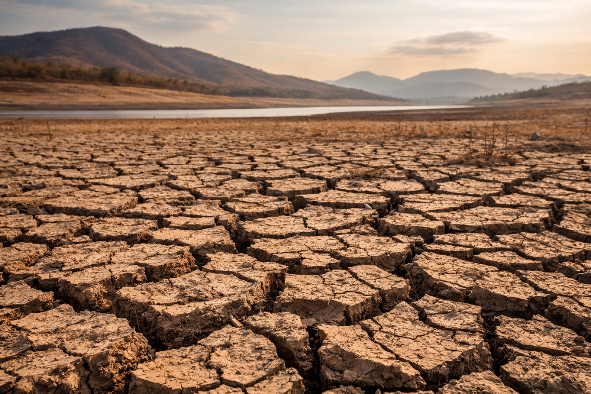
Why This Is Being Done: Subsidence, Broken Infrastructure, and an Aquifer at Its Limit
The most physical and immediate reason is subsidence, the sinking of the soil when pumping empties pores and compacts the ground.
The described impact is structural: irrigation channels, highways, and foundations can suffer damage from deformation and settlement.
The motivation is also economic and agricultural.
California is presented as a centerpiece of domestic supply, with a strong reliance on irrigation, and the associated risk is destabilizing agricultural production if the underground is not replenished.
In parallel, there is the climatic logic: rarer and more intense rains push managers to capture water peaks, instead of losing everything as rapid runoff.
The Role of Management and Monitoring: Daily Data and Faster Decisions in 2026
The text brings a component of digital management as a novelty: starting in early 2026, California’s groundwater elevation monitoring system, CASGEM, will be integrated with the SGMA Portal for management decisions based on daily data.
Moreover, the operational control of diverting floods for recharge is described as being connected to panels and integration of meteorological data, river levels, and soil moisture sensors in real-time.
The idea behind this is to reduce improvisation: opening gates and directing floods requires precision, because the same volume that recharges can cause damage if it arrives in the wrong area or at the wrong time.
Penalties and Rules to Curb Extraction: The Other Side of the “Invisible Vault”
The recharge strategy appears accompanied by a reinforcement of compliance.
In California, laws applicable from 2026 adjust fines for illegal water use for inflation, aiming to increase adherence to sustainability targets.
The underlying goal is to balance “water budgets” by 2040 to 2042, a window that serves as a correction deadline to avoid severe sanctions and harsher restrictions, such as a total cut of new wells in certain areas.
In other words, the infiltration mega basins enter as a tool, but the system depends on controlling withdrawal to avoid becoming an endless race.
What Can Happen Next: Mass Artificial Recharge as a Test of Water Survival
In 2026, the test is not just technical, but of scale and persistence.
The infiltration mega basins need to operate repeatedly over the years, capturing wet events and converting these pulses into underground storage, while extraction rules attempt to prevent the gain from being immediately sucked back.
The described scenario combines permanent and temporary basins, temporary channels, prepared agricultural areas, injection wells, and coastal pressure barriers.
Each piece solves a type of problem: gravity infiltration where the soil allows, direct injection where the soil impedes, and reinforced governance where pumping disorganizes the system.
Do you think that the infiltration mega basins will be able to recharge aquifers quickly enough to curb subsidence and support agriculture, or will pumping still win this underground race?


-

-

-

-

4 pessoas reagiram a isso.