 Portuguese
  English
  Spanish
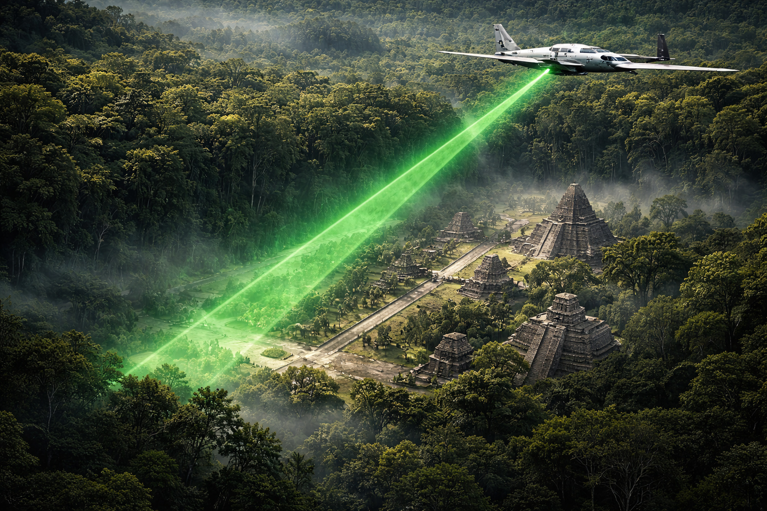
LiDAR technology revealed 61,480 hidden Mayan structures in the Guatemalan jungle and completely changed what was known about the civilization.
In February 2018, National Geographic exclusively published the results of the first phase of the PACUNAM LiDAR Initiative, an aerial survey that covered about 2,100 square kilometers of the Maya Biosphere Reserve in northern Guatemala. According to the special report from the magazine itself, the mapping revealed a pre-Columbian civilization much more extensive, dense, and interconnected than the academic consensus had maintained for decades, with evidence of urbanization, infrastructure, and territorial organization on a scale far greater than previously imagined.
The magnitude of the discovery was so great that archaeologist Stephen Houston from Brown University classified it, in a statement that resonated internationally, as “one of the greatest advances in over 150 years of Maya archaeology”.
The tool responsible for this transformation was LiDAR — Light Detection and Ranging. In the Guatemalan survey, the aircraft used operated with the ALTM Titan system, capable of firing up to 900,000 laser pulses per second, according to a technical analysis published by Lidar Magazine. Although most returns recorded vegetation, a small fraction of the pulses that managed to penetrate the canopy openings was already sufficient to digitally reconstruct the surface of the land, allowing researchers to digitally remove the forest and visualize structures, elevated roads, agricultural terraces, and fortifications that were previously invisible to the naked eye.
-
Someone released 18 beavers in the upper Ebro River; it seemed like an isolated case, but no one knows who did it or how to stop their expansion, and now they have already reached Catalonia. And there’s a detail that changes the game: they can help restore rivers and even capture carbon.

-
ZCC 11000 crane lands at the port of Vitória and heads to Ceará in a convoy with 64 trailers: Zoomlion, founded in 1992, builds a monster that lifts over 600 compact cars to 93 m.

-
The biggest drama of being born on Mars is not breathing: Rice biologist says that colonists’ children may cease to be Homo sapiens, shaped by low gravity, radiation, and isolation that divides humanity.

-
With no separate outdoor unit and designed to fit in the window, monoblock air conditioners used in Japan emerge as an alternative for those who cannot install a split system in a rented apartment.

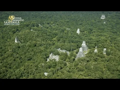
Instead of relying on decades of manually clearing trails through dense jungle, the system began to produce three-dimensional models of the terrain capable of revealing, on a regional scale, what was hidden beneath the vegetation cover. According to National Geographic itself and subsequent analyses of the same dataset to interpret Maya occupation, it showed that centers like Tikal were part of a much broader and more sophisticated network of settlements, defensive works, and territorial connections.
The largest LiDAR survey in Mesoamerican history identified more than 61,000 invisible Mayan structures
The project was orchestrated by the PACUNAM Foundation (Maya Cultural and Natural Heritage) and involved a consortium of 18 researchers from universities in the United States, Europe, and Guatemala. Funding was approved in 2016, and the initial survey covered 2,144 square kilometers of the Maya Biosphere Reserve located in the Petén department in northern Guatemala.
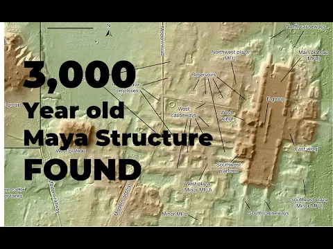
The data were published in the journal Science in September 2018 and revealed impressive numbers: 61,480 structures identified in a single mapping campaign. Among them were houses, palaces, ceremonial centers, pyramids, elevated roads, agricultural systems, reservoirs, and defensive structures, many completely invisible to traditional archaeological prospecting methods.
According to archaeologist Thomas Garrison, one of the project leaders, the data showed that the entire region functioned as a highly integrated settlement system, whose scale and density had been drastically underestimated.
How LiDAR works and why the technology can “remove” the forest digitally
For decades, Maya archaeology was conducted using traditional methods based on land exploration, often manually clearing paths through dense vegetation. This process allowed for detailed studies of small areas but made it impossible to understand the regional scale.
LiDAR completely changed this scenario by operating based on a simple yet extremely efficient physical principle. The laser pulses penetrate the vegetation and record the time it takes to return to the sensor, allowing for the reconstruction of the ground’s topography with an accuracy of up to one meter.
The result is known as a “bare-earth model,” a model of “bare earth” that digitally removes the forest and reveals the original topography of the land — as if the jungle were completely removed from the map.
This capability allowed archaeologists to see, for the first time, the landscape as it was over 1,000 years ago.
Archaeological discoveries reveal hidden pyramids, elevated roads, and advanced Maya engineering
The discoveries made by the LiDAR survey rewrote multiple aspects of Maya history simultaneously.
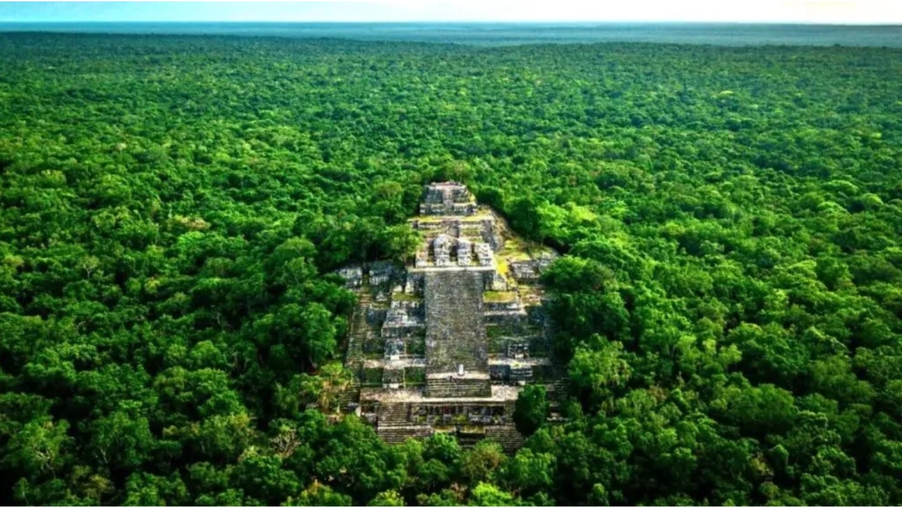
The city of Tikal, one of the most studied, turned out to be three to four times larger than previously believed. A seven-story pyramid, completely covered by vegetation, was identified without ever having been recorded before.
Even more surprising was the identification of an extensive network of elevated roads, known as causeways, that connected cities over dozens of kilometers. These structures were designed to allow movement even during periods of heavy rain when the ground became impassable.
Additionally, the survey revealed a massive transformation of the natural landscape, with agricultural terraces, drainage systems, reservoirs, and irrigation channels distributed on a large scale. In total, the following were identified:
- 362 km² of areas with terraces and terrain modifications
- 952 km² of intensively worked agricultural areas
These data highlight a level of territorial planning and environmental engineering much more advanced than previously thought.
Maya population may have reached 15 million people according to new archaeological data
The demographic implications were immediate. Previous estimates pointed to a population of about 5 million people in the region during the classic period.
Based on the density of structures revealed by LiDAR, this estimate was revised to between 10 and 15 million inhabitants, making the region comparable, in population density, to some of the most populous civilizations of the ancient world.
This revision profoundly alters the understanding of the organizational and productive capacity of the Maya civilization.
New model reveals Maya civilization as a continuous and highly integrated urban system
For over a century, the dominant model described the Maya as isolated cities surrounded by jungle. LiDAR demonstrated the opposite: a continuous network of interconnected settlements, with little distinction between urban and rural areas. This pattern, known as “low-density tropical urbanism,” indicates a much more complex and organized territorial occupation.
The so-called “uninhabitable areas” turned out to be productive agricultural zones, while flooded regions functioned as sophisticated water infrastructure.
Another critical point revealed by the data was the massive presence of defensive structures, including walls, fortifications, and strategic positions.
These evidences indicate that conflicts were not isolated events at the end of the civilization, but rather a recurring part of social organization over centuries. This directly alters the historical interpretation of the Maya collapse and its causes.
New discoveries between 2024 and 2025 further expand the map of the Maya civilization
The 2018 survey was just the beginning. Subsequent research expanded the mapping to over 95,000 km², including regions of Mexico and Belize.
In 2024, a study identified 6,764 structures of an unknown city called Valeriana, with an estimated population between 30,000 and 50,000 inhabitants.
By 2025, archaeologists announced the discovery of three interconnected cities — Los Abuelos, Petnal, and Cambrayal — dated back to 800 B.C., with pyramids, murals, and complex hydraulic systems.
These discoveries reinforce the idea that the Maya civilization is still far from being fully understood.
LiDAR revolutionizes archaeology in the same way that the Hubble telescope transformed astronomy
Experts compare the impact of LiDAR on archaeology to the role of the Hubble telescope in astronomy. The technology did not create new structures, it only revealed what has always been hidden beneath the vegetation.
According to researchers, this tool allows for the visualization of entire civilizations from a perspective that was never possible with traditional methods, paving the way for a new era of large-scale archaeological discoveries.

Now we want to know: do you believe there are still entire cities hidden under forests that have never been discovered?
The number of structures already identified suggests that a significant part of human history remains invisible beneath the surface of the planet.
With technologies like LiDAR advancing rapidly, the trend is for new discoveries to continue emerging in the coming years, further expanding the understanding of ancient civilizations.
And you, do you believe that there are still large ancient cities completely unknown waiting to be revealed?


Seja o primeiro a reagir!