 Portuguese
  English
  Spanish
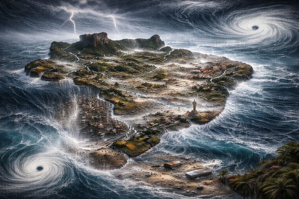
A Western Wind Burst of notable intensity described by meteorologists in the United States is pushing warm waters to the center of the Pacific and may accelerate the arrival of a Super El Niño between late autumn and early winter of 2026, with risk of severe impacts on the climate of Brazil and the world
Numerical models project the occurrence of an exceptionally intense Western Wind Burst in the Central Pacific in the coming days. Meteorologists in the United States specialized in El Niño describe the event as remarkable and one of the strongest ever seen. The phenomenon acts as an atmospheric trigger that may accelerate the arrival of a Super El Niño as early as 2026, displacing large volumes of warm water to the center and east of the ocean and creating the initial conditions for an episode that, if confirmed, could have severe consequences for the global climate.
According to MetSul, the last Super El Niño occurred between 2023 and 2024 and had a direct impact on Brazil, contributing to the major floods that devastated Rio Grande do Sul. Now, with the sea surface temperature anomaly off the coast of Peru already at +1.6°C and a western wind burst that may intensify the warming of the Pacific, the scenario points to the establishment of a new El Niño between late autumn and early winter. The question that concerns scientists is not whether El Niño will arrive, but whether it will arrive in the form of a Super El Niño.
What is the Western Wind Burst that can trigger a Super El Niño
The Western Wind Burst, known by the acronym WWB (Westerly Wind Burst), is one of the most important atmospheric phenomena in the dynamics of the equatorial Pacific. Under normal conditions, trade winds blow from east to west across the ocean, pushing warm waters towards Asia and keeping cold waters along the South American coast.
-
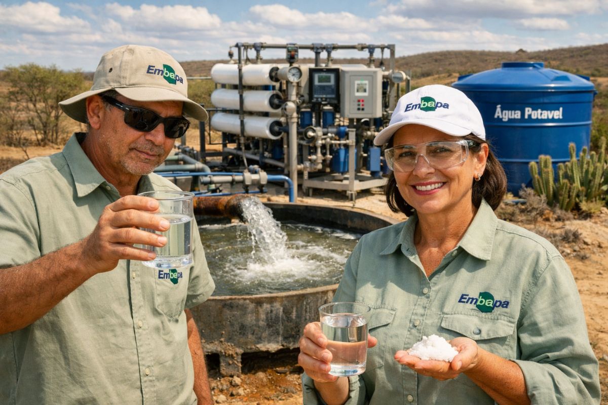
Researchers from Embrapa have discovered how to transform the saline water found in 140,000 wells in the Brazilian Semi-Arid region into a tool for producing food in an area where agriculture has always relied solely on rainfall.
-
China inaugurates a ghost factory that operates in the dark 24 hours a day without any human workers and produces 10 million smartphones a year using 97% of equipment developed by the company itself.

-
Scientists create a semiconductor that mimics the human brain using hydrogen and boost a new generation of smart chips with learning capabilities and the potential to revolutionize artificial intelligence applications.

-
Scientists discover that humanity has exchanged one environmental disaster for another: the same chemicals that saved the ozone layer are now contaminating rivers, aquifers, and human blood with an eternal pollutant that is impossible to remove.


When a WWB occurs, this pattern weakens or temporarily reverses, and large volumes of warm water are displaced to the center and east of the Pacific.
The impact goes beyond the ocean surface. The wind burst generates ocean waves called Kelvin waves, which rapidly propagate towards South America and deepen the thermocline, the layer that separates warm surface waters from colder deeper waters.
With a deeper thermocline, the upwelling of cold waters decreases and the warming of the sea surface intensifies, creating the initial conditions for a Super El Niño. When several episodes of WWB occur in succession, the effect is cumulative and can transform a moderate El Niño into an extreme event.
Why experts say this event is one of the strongest in history
American meteorologists specialized in monitoring the equatorial Pacific have classified the Western Wind Burst projected for the coming days as remarkable and one of the most intense ever recorded.
The magnitude of the event is measured by wind speed, the extent of the affected area, and the duration of the gusts, and in all these criteria, the predicted episode stands out.
Major historical El Niño episodes have been directly related to successive western wind bursts. The events of 1982 to 1983, 1997 to 1998, and 2023 to 2024 were preceded and intensified by multiple WWBs throughout their evolution.
If the 2026 event confirms the projected intensity and is followed by additional episodes, the risk of a Super El Niño significantly increases, according to the analysis of numerical models.
What is already happening in the Pacific even before the Super El Niño begins
At this moment, a Coastal El Niño is already affecting the coast of South America, a more localized phenomenon that warms the waters along the coasts of Peru and Ecuador.
According to the latest bulletin from NOAA, the U.S. government’s climate agency, the sea surface temperature anomaly in the Niño 1+2 region is +1.6°C, a significant jump compared to previous weeks. However, this coastal warming has not yet extended to the central Pacific.
The Niño 3.4 region, which is used to designate the occurrence of El Niño or La Niña in its classic form, has an anomaly of 0.0°C, indicating absolute neutrality.
In the coming weeks, the trend is for substantial warming of this part of the Pacific, driven by the western wind burst, which may lead to the establishment of the classic El Niño between late autumn and early winter of 2026. If the warming is intense enough, the episode may evolve into a Super El Niño.
The difference between classic El Niño, Coastal El Niño, and Super El Niño
Classic El Niño occurs when there is persistent and large-scale warming of the waters in the central and eastern Pacific. This warming alters tropical atmospheric circulation, weakens trade winds, and shifts rainfall areas to regions where the weather would normally be drier.
It is a global phenomenon that can last several months and influence the climate in different continents. In Brazil, the most common pattern during a classic El Niño is increased rainfall in the South and drier periods in parts of the North and Northeast.
Coastal El Niño is more geographically restricted: the warming is concentrated along the coasts of Peru and Ecuador, with more regional effects. Super El Niño, on the other hand, is the extreme form of the classic phenomenon, with sea temperature anomalies far above normal and amplified impacts on a planetary scale.
The Super El Niños of 1982 to 1983, 1997 to 1998, and 2023 to 2024 caused devastating droughts, record floods, and heatwaves across multiple continents. It is this extreme scenario that scientists fear may repeat in 2026.
What a Super El Niño in 2026 could mean for Brazil
The most recent precedent is alarming. The Super El Niño of 2023 to 2024 directly contributed to catastrophic floods in Rio Grande do Sul, one of the worst climate disasters in Brazil’s history.
If a new Super El Niño establishes itself in 2026, the South of the country will face a high risk of above-average rainfall, flooding, and landslides, while parts of the North and Northeast may suffer from prolonged droughts.
In addition to the direct impacts on the climate, Super El Niño affects agriculture, water reservoirs, hydropower generation, and food prices.
The repetition of an extreme event just two years after the previous one raises concerns about the response capacity of infrastructures that have already been damaged and have not yet been fully rebuilt. The South of Brazil, which is still recovering from the floods of 2024, may be the most vulnerable.
The trigger has already been pulled in the Pacific
The Western Wind Burst detected in the Pacific is a signal that science cannot ignore.
If the event confirms the projected intensity and is followed by additional episodes, 2026 could have a Super El Niño capable of reshaping the global climate and repeating the devastating impacts that marked 2023 and 2024.
The ocean is warming, the winds are changing direction, and the atmospheric trigger has been pulled. Now, it remains to be seen if the Pacific will respond with the force that the models suggest.
Do you remember the effects of the last Super El Niño in Brazil? Do you think the country is prepared to face another extreme event in such a short time? Leave your comments and share this article with those who need to stay alert to what is happening in the Pacific.


Seja o primeiro a reagir!