 Portuguese
  English
  Spanish
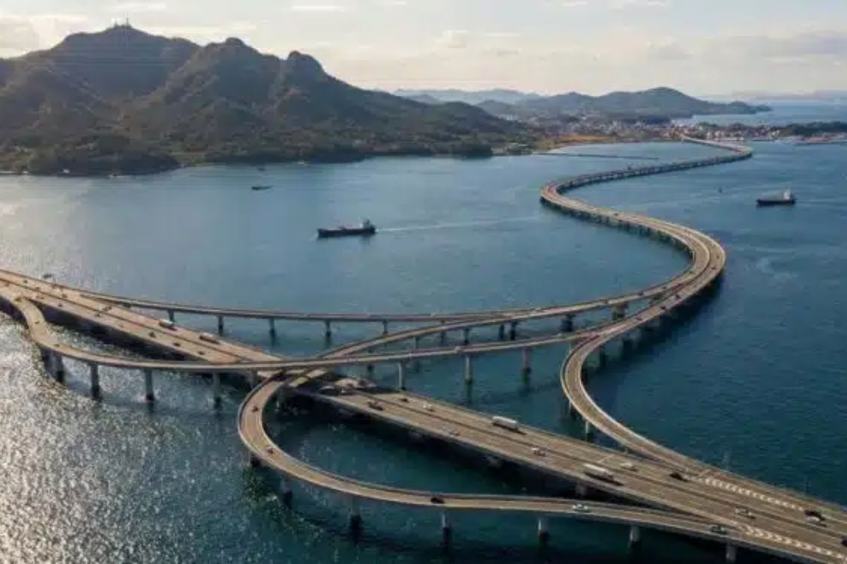
In Shandong Province, the 42.5 km Qingdao Bridge over Jiaozhou Bay has reorganized coastal transport and logistics since 2011, with six lanes, 5,000 pillars, 450 thousand tons of steel, and 2.3 million m³ of concrete, prepared for typhoons, giant ships, and earthquakes of magnitude 8.
The 42.5 km bridge crossing saltwater in Jiaozhou Bay has been recognized since 2011 as one of the engineering symbols in Qingdao, connecting the city to Huangdao District and shortening travel time by about 30 minutes compared to the bay’s detour.
Between 2007 and 2011, the construction focused on a volume of materials and structural elements that helps explain its size, with over 5,000 pillars, about 450 thousand tons of steel, and 2.3 million cubic meters of concrete, in addition to a design scaled for typhoons, giant ships, and earthquakes of magnitude 8.
Location and Function: Why Qingdao and Huangdao Needed This Connection

The 42.5 km bridge, known as the Qingdao Haiwan Bridge and also as the Jiaozhou Bay Bridge, was built in Shandong Province to connect Qingdao to Huangdao by crossing Jiaozhou Bay.
-
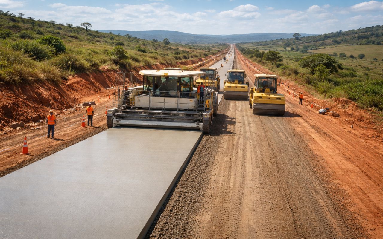
New CCR concrete paving technology promises roads up to 3x more durable, less maintenance, and cost reduction in Brazil.
-
Made from recycled plastic, plastic wood is gaining space in the construction industry because it does not rot, resists moisture, and reduces maintenance costs over the years.

-
Florianópolis will receive a million-dollar BRT that will begin construction in 2026 with nearly 400 million in funding from the federal government and the Inter-American Development Bank, and the map already shows the routes for the exclusive bus corridors.

-
Without a blueprint, without an engineer, and using scrap from the dump, a father spends 15 years building an 18-room castle for his daughter, featuring tram tracks, 13 fireplaces, and over 700 m², which may now be demolished.


The choice of the route aimed for the most direct path over the sea, reducing dependence on longer land routes.
In practice, the 42.5 km bridge reorganized transport flows because it connects highways, ports, and industrial zones along the same coastal axis.
For Qingdao, the benefit lies in the logistical integration with the bay area; for Huangdao, the effect is a faster connection to the road network and the port infrastructure associated with the region.
Length of 42.5 km and the Reduction of About 30 Minutes in the Journey
The measurement of 42.5 km is not just a numerical mark.
The length reflects the decision to cross Jiaozhou Bay with a more direct alignment, shortening the route compared to the course that goes around the bay.
With the 42.5 km bridge, the travel time between Qingdao and Huangdao has decreased by about 30 minutes, relevant information for both daily worker commutes and cargo transport.
In coastal systems, saved minutes lead to predictability, reducing pressure on road bottlenecks.
Six Lanes and Capacity: Design for High Volume of Vehicles
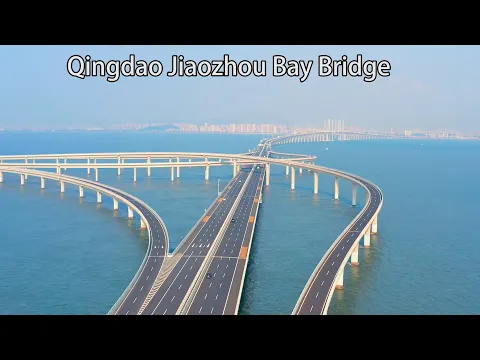
The deck was designed with six lanes, a parameter that indicates an intention to absorb high traffic volume.
By concentrating traffic flow on a direct link, the 42.5 km bridge serves as an alternative to reduce congestion and travel time in a corridor where the circulation of people and goods is continuous.
From an operational perspective, six lanes expand drainage capacity and reduce sensitivity to peak demand, an important aspect for connections between city, industrial district, and port area.
The functionality, in this case, is measured by the regularity of traffic flow between Qingdao, Huangdao, and Jiaozhou Bay.
More Than 5,000 Pillars: Load Distribution on the Seabed
The number of pillars is an objective indicator of the structural challenge.
The 42.5 km bridge is supported by more than 5,000 pillars, distributing loads along the seabed and ensuring continuous support for the deck over saltwater.
In constructions over the sea, pillars and foundations need to deal with conditions that vary over time, including currents, tide fluctuations, and the action of the saline environment.
By multiplying support points, the design reduces stress concentrations, which helps explain the logic behind so many pillars in a 42.5 km bridge.
450 Thousand Tons of Steel and 2.3 Million Cubic Meters of Concrete
Between 2007 and 2011, the execution incorporated about 450 thousand tons of steel and 2.3 million cubic meters of concrete.
In extensive structures, steel and concrete are not just materials, but part of a strategy for durability and resistance to maintain stability, rigidity, and safety over time.
The steel figure appears as one of the project milestones because it signals industrial scale.
In a 42.5 km bridge, steel and concrete need to work together with pillars, joints, and reinforcements to withstand traffic, wind, and environmental variations.
The volume of steel, combined with the number of pillars, defines the challenge.
Engineering in Maritime Environment: Saltwater, Winds, Tides, and Ship Traffic
The 42.5 km bridge was built in an area subjected to strong winds, tide fluctuations, and intense maritime traffic.
This required detailed studies of currents, depths, and ship routes to align the road connection with the dynamics of Jiaozhou Bay.
The maritime environment imposes restrictions that go beyond length.
The presence of saltwater influences technical choices and requires continuous attention to durability.
At the same time, maritime traffic in Jiaozhou Bay requires maintaining safe navigation conditions, even for large vessels transiting the area.
Design for Typhoons: Wind as a Variable for Structural Safety
The sizing for typhoons appears as an explicit requirement of the project.
In regions with extreme wind events, the 42.5 km bridge must consider aerodynamic forces capable of generating vibration and fatigue in structural components.
The indicated technical response includes deep foundations, expansion joints, and reinforcements in exposed areas.
The goal is to maintain predictable structural behavior in response to loading variations caused by wind and waves, reducing risks and increasing safety margins throughout operation.
Giant Ships and Impacts of Up to 300 Thousand Tons
The project was designed for impacts from ships of up to 300 thousand tons, a requirement that makes the topic of collision protection a central part of the design.
In busy maritime corridors, pillars and elements near shipping routes need to be considered in risk analysis.
This specification reinforces that the 42.5 km bridge was not conceived merely as a land connection but as infrastructure that coexists with heavy navigation.
The compatibility between roadway and maritime traffic in Jiaozhou Bay is one of the reasons that this work is regarded as an engineering reference in Qingdao.
Earthquakes of Magnitude 8: Resilience in Seismic Scenario
Another explicit requirement is the capacity to withstand earthquakes of magnitude 8.
For a 42.5 km bridge, the challenge is not only to resist point loads but to maintain global integrity in an event that can simultaneously affect different sections.
The described solution relies on deep foundations, expansion joints, and reinforcements, allowing for accommodations to movements and distribution of efforts.
The goal is to preserve stability and safety for traffic, even in the face of a severe event.
Timeline Between 2007 and 2011 and the Character of Symbol Since 2011
Construction took place between 2007 and 2011, with a short timeline for the size of the project.
Since its inauguration in 2011, the 42.5 km bridge has been treated as a symbol of contemporary Chinese engineering and a reference point for marine constructions.
The fact that the 42.5 km bridge has solidified as a milestone since 2011 is also related to the practical effect on mobility in Jiaozhou Bay.
In projects of this scale, reputation depends on consistent operation, connecting Qingdao and Huangdao on a predictable route.
Economic and Logistical Impact: Goods, Ports, and Industrial Zones
The bridge connects Qingdao to Huangdao, a region described with industrial, port, and residential zones.
By shortening the route that used to go around Jiaozhou Bay, the 42.5 km bridge improves the flow of goods and people, favoring port movement and the establishment of companies.
In logistics, the reduction in distance and time tends to lower transportation costs and increase route predictability.
In terms of infrastructure, the 42.5 km bridge integrates highways, ports, and industrial zones, reinforcing the bay as a strategic corridor within Shandong Province.
Tourism and Urban Image: The Bridge as Attraction and Postcard
Besides logistics, the 42.5 km bridge has become an attraction and postcard for Qingdao.
The presence of a structure over saltwater with a visible scale on the horizon influences the urban image and creates an element of identity, especially when associated with a remarkable inauguration such as that of 2011.
In urban planning, the integration with Huangdao is linked to real estate expansion and new public services.
The 42.5 km bridge, in this context, is seen not only as an engineering work but as infrastructure that reorganizes the spatial relationship between the city, district, and the surrounding area of Jiaozhou Bay.
Bridge and Submarine Tunnel: Redundancy with 7.8 km Under the Bay
The crossing of Jiaozhou Bay does not depend solely on the 42.5 km bridge.
The region also features the Qingdao Jiaozhou Bay Undersea Tunnel, a submarine tunnel of about 7.8 kilometers, planned to complement the bridge.
The combination of bridge and tunnel enhances transportation capacity and creates alternative routes for crossing the bay under different weather conditions.
This redundancy reduces dependence on a single access and reinforces the role of Qingdao and Huangdao in a coastal network that needs to maintain operation even under wind, tide, and severe events.
Why the Structure Became a Reference: Numbers, Function, and Design Requirements
Three layers explain the status of reference. The first is the size, with a 42.5 km bridge, over 5,000 pillars, and 450 thousand tons of steel.
The second is the function, with a reduction of about 30 minutes and logistical integration between Qingdao, Huangdao, and Jiaozhou Bay.
The third is the set of requirements, with designs for typhoons, giant ships, and earthquakes of magnitude 8.
This set of parameters describes infrastructure that needs to operate in a complex maritime environment, reconciling intense road traffic with large-scale navigation.
By combining pillars, steel, concrete, six lanes, and resistance criteria, the 42.5 km bridge positions itself as a symbol due to specifications and expected performance.
The 42.5 km bridge over saltwater in Qingdao has been established since 2011 as a strategic link in Jiaozhou Bay, connecting Qingdao to Huangdao, reducing travel time by about 30 minutes for a previously longer route, and reorganizing a coastal axis with ports and industrial zones.
What sustains its symbolic character is the combination of scale and technical demand, with over 5,000 pillars, 450 thousand tons of steel, and a design prepared for typhoons, giant ships, and earthquakes of magnitude 8, in addition to complementarity with the 7.8 km submarine tunnel to enhance crossing redundancy.
Do you think the 42.5 km bridge in Qingdao has become a reference more for the number of pillars and steel, or for its practical impact of connecting Huangdao and shortening the route in Jiaozhou Bay?


-

Uma pessoa reagiu a isso.