 Portuguese
  English
  Spanish
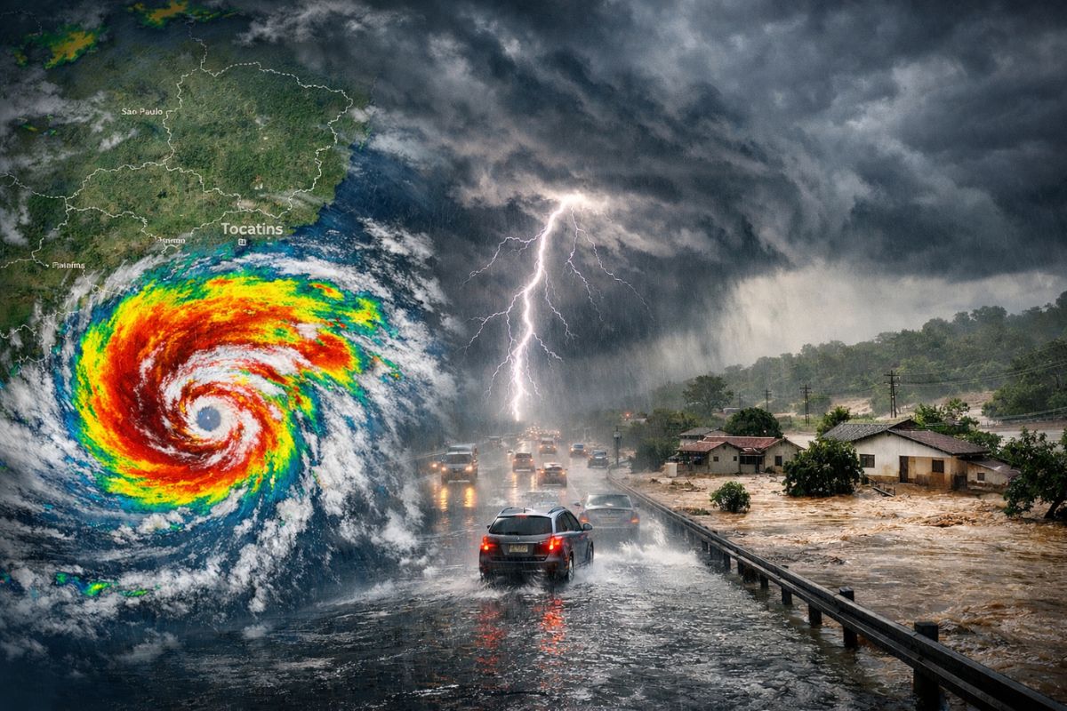
Meteorological Models Indicate That a Low Pressure in the South Atlantic Is Likely to Acquire Hybrid Characteristics and Form a New Subtropical Cyclone, Increasing Instability Between February 26 and March 3, With Accumulations Near or Above 200 mm and Gusts Above 70 km/h in Five Brazilian States
The emergence of a new subtropical cyclone in the South Atlantic, near the Southeast coast, puts on the radar a sequence of at least six days of heavy and persistent rain, with volumes that may approach or even exceed 200 mm in some areas of the country. When rain stops being an “episode” and becomes a “sequence,” the risk shifts to a higher level.
The trend is for broader and more lasting instability, with an increased potential for flooding, heavy rains, and landslides, especially in the eastern part of the country. The highlighted window runs from February 26 to March 3, and the highest accumulations are expected to be concentrated in areas of São Paulo, Minas Gerais, Bahia, Goiás, and Tocantins.
What Is Behind the “New Cyclone” and Why It Alters the Weather Pattern
Cyclones are systems organized around low atmospheric pressure, capable of intensifying moisture convergence and sustaining heavy clouds for longer periods. In the case of the new cyclone mentioned in the projections, the central point is the possibility of the low pressure taking on a “hybrid” behavior, with a structure that favors persistent instability.
-
Dozens of Chinese research ships are discreetly mapping the ocean floor in three oceans – and naval analysts see a military pattern.

-
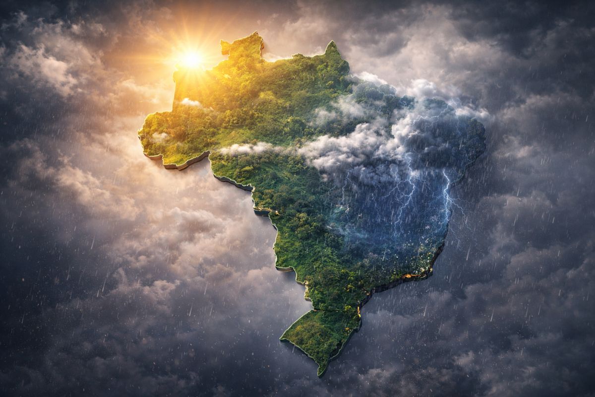
The winter of 2026 in Brazil will not be what you expect: meteorologists warn that the season will be warm and rainy at the same time due to the advance of El Niño, which is already warming the Pacific and changing the climate of the entire country.
-
For the first time, humanoid robots will compete in a full half-marathon without any human assistance in Beijing, with over 100 teams from China registering machines that need to complete the course with autonomous navigation on two legs.

-
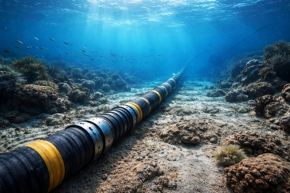
Submarine cables installed to transmit the internet now also help scientists detect earthquakes.

This type of system falls into the category of subtropical cyclones, which are often described as intermediates between tropical and extratropical systems. In straightforward terms: they combine traits from two worlds, forming over warmer waters with a warm core, but can maintain colder air at higher levels of the atmosphere. And, contrary to what many people automatically associate with cyclones, they do not need to have a classic cold front attached to cause severe weather.
Why “Six Days” Matters: Accumulated Rain Is Heavier Than an Isolated Peak
The idea of six days of instability draws attention not only due to the discomfort of overcast weather but also because of the cumulative effect. When rain repeats day after day, the soil tends to saturate, urban drainage loses efficiency, and slopes become more vulnerable. The real danger often appears when the rain “does not give a break,” even without extremes every hour.
That is why the projected accumulations near 200 mm (or above) gain practical importance: it is not just the final number, but how it can be distributed in short intervals during this period.
In such scenarios, episodes of heavy showers can combine with continuous rain, increasing the risk of flooding and flash floods in urban areas and landslides in regions with more sensitive topography.
When and Where the System Is Expected to Act With Greater Force, According to the Projection Described
The presented projection indicates that the low pressure in the South Atlantic is likely to acquire hybrid characteristics in the coming days, shaping the new subtropical cyclone.
The detail that catches attention is the possible advance of the system’s core over the continent between Friday (27) and Saturday (28), which could limit further intensification before the system shifts back to the ocean.
This “back and forth” between ocean and continent is relevant because it alters the positioning of the most unstable areas and the persistence of rainfall bands.
It is not a point event with clear start and end, but rather a sequence in which the center and influence of the system can reorganize rainfall at different moments, keeping the alert elevated over several days.
States Most Exposed to High Volumes and What “200 mm” Means on the Risk Map
Among the states highlighted on the route of highest risk of heavy rain are São Paulo, Minas Gerais, Bahia, Goiás, and Tocantins.
The indication is that these areas may concentrate the highest projected accumulations within the timeframe from February 26 to March 3, with marks close to or exceeding 200 mm in just a few days.
In practice, “200 mm” tends to be a number that confuses those who do not follow meteorology daily because it does not describe how the rain falls; it describes how much it adds up.
And a high sum can come from different combinations: very intense showers, persistent moderate rain, or alternation between strong and weaker periods. What defines the impact is the combination of volume, duration, and local vulnerability, such as drainage, occupation of risk areas, and soil condition.
Besides the Rain: Hail, Winds Above 70 km/h, and Chain Reactions in Cities
The described scenario is not limited to accumulated water. There are indications of storms with hail and wind gusts above 70 km/h, with expectations of stronger winds especially between Friday and Saturday in states of the Southeast and Midwest.
In episodes with this profile, disruptions tend to appear in sequence: falling trees, localized damage to structures, power outages, and difficulties in moving through exposed areas.
Strong winds can also worsen the sense of risk in already soaked regions because they increase the chance of branches breaking and reduce the stability of trees in saturated soil.
When heavy rain and wind overlap, the urban impact tends to be quicker and more widespread, even in neighborhoods that usually do not flood.
How to Read This Type of Forecast Without Falling Into Alarmism and Without Underestimating the Risk
There is an important balance: forecasts by models and risk maps indicate trends and preferred areas, but extreme rain can concentrate in relatively narrow bands within the same state.
Therefore, the central message is not “it will rain the same everywhere,” but that the new cyclone can sustain instability for several days and increase the potential for severe episodes, especially in parts of the highlighted states.
The most useful point for the public is to understand the logic of risk: the more persistent the instability, the greater the chance that the accumulated will reach levels that pressure drainage, rivers, and slopes. It’s not just about the peak of the day; it’s about the accumulation of the week.
And when there are indications of hail and gusts above 70 km/h, attention must also include indirect effects, such as power outages and obstacles on roads.
With the new subtropical cyclone gaining strength in the South Atlantic and instability expected to last at least six days, the period between February 26 and March 3 represents a critical window for heavy rainfall near 200 mm (or more) and episodes of severe weather, especially in São Paulo, Minas Gerais, Bahia, Goiás, and Tocantins.
In situations like this, what defines the size of the problem is the persistence and the fragility of each city to deal with it.
In your city, when the rain intensifies for several consecutive days, is the problem usually more flooding, flash floods, or landslides? And what has been the highest rainfall accumulation you have ever seen “in practice” turn into a real hassle in your neighborhood?


-

-

-

-

-

-

15 pessoas reagiram a isso.