 Portuguese
  English
  Spanish
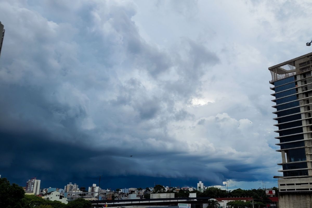
Between Saturday Afternoon and Sunday Morning, the Civil Defense Forecasts Storms in Santa Catarina with Heavy Rain, Orange Alert and High Risk of Flooding, Flash Floods, Roof Damage and Falling Trees. The Weather Forecast Indicates the Influence of an Extratropical Cyclone and Areas of Low Pressure in the Atmosphere.
The Civil Defense keeps Santa Catarina on alert because the weather forecast indicates storms and heavy rain between Saturday afternoon (10) and Sunday morning (11), under the influence of an extratropical cyclone and with high risk of flooding and flash floods throughout the state.
The scenario occurs after a week marked by storms, including a thunderstorm with strong electrical activity that resulted in the death of 26 cattle on a farm in Urupema, in the Serra Catarinense, on Thursday (8), which reinforces the need to follow official warnings and avoid exposed areas during heavy rain.
What Makes Sunday Morning So Dangerous
The weather forecast for Santa Catarina points to a critical interval between the end of Saturday afternoon and Sunday morning.
-
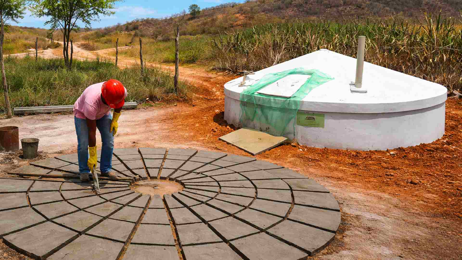
How to build a 35,000-liter cistern with 60 by 50 cm panels and rainwater for drinking and cooking without relying on water trucks or the city hall.
-
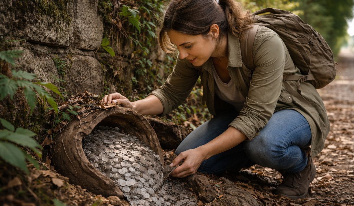
A woman went out for a regular walk and ended up finding a treasure buried for over 900 years, with more than 2,000 medieval silver coins compared by archaeologists to a lottery prize and considered one of the most significant finds in recent years in the country.
-
Scientists revealed 11 signs that very intelligent people exhibit in their daily lives, and most people have no idea that some of these common behaviors are directly linked to an above-average brain.

-
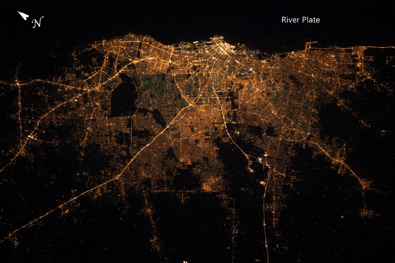
From space, Buenos Aires appears as a colossal spot of light surrounded by kilometers of darkness, revealing at a single glance the exact boundary between the metropolis and the countryside, seen from 400 km altitude.

During this period, the storms tend to reorganize with the increase in heat throughout the day and the maintenance of instability.
The Civil Defense describes a rain pattern that may alternate sunbreaks and strong showers, which usually raises the risk of flash flooding and flash floods in urban and rural areas.
Risks Mapped by the Civil Defense in All Regions
According to the Civil Defense, the risk is high in all regions of Santa Catarina for flooding and flash floods between Saturday afternoon and Sunday morning.
In addition, there is a moderate to high risk for roof damage, electrical network damage and falling branches and trees, with orange alert.
In episodes of storms, the combination of wind, heavy rain and electrical discharges usually causes sequential disruptions, so the recommendation is to reduce travel and not cross flooded streets.
How Sunday Will Be and Where Risk Decreases
On Sunday, the weather forecast indicates that Santa Catarina will continue with unstable weather.
The day starts with clouds and rain in some areas, but the sun returns at times during the day and storms gain strength from the afternoon, especially between the Meio-Oeste and the Coast.
In these areas of the state, the risk remains moderate to high for occurrences related to bad weather. In the western part of Santa Catarina, however, the weather forecast classifies the risk as low on Sunday, although instability still requires attention.
Extraterrestrial Cyclone and Low Pressure Intensify the Rain
The Civil Defense attributes the conditions to areas of low pressure in the atmosphere and the action of an extratropical cyclone located away from Santa Catarina, positioned between Uruguay and Rio Grande do Sul.
This extratropical cyclone helps to intensify rainfall in the state and maintain instability, creating a favorable environment for the formation of storms.
Even with the extratropical cyclone outside of Santa Catarina territory, its effects help sustain the humidity and energy needed for new rain cells.
Recent Thunderstorms and the Case of 26 Cattle in Urupema
The storms have already hit Santa Catarina throughout the week and left examples of their potential impact.
At the end of Thursday afternoon (8), an intense thunderstorm with strong electrical activity killed 26 cattle in Urupema, in the Serra Catarinense, in the locality of Rio dos Touros.
According to the information gathered, an electrical discharge directly hit the herd concentrated in the same area, resulting in 14 cows and 12 calves dead, with no record of injured people. In such scenarios, the risk of remaining in the open field during storms increases.
Guidelines for Crossing Storms More Safely
The Civil Defense’s guidance is to follow official warnings and adjust routines to reduce exposure during storms and heavy rain.
Avoid flooded areas, do not approach isolated trees, and stay alert to signs of roof damage, falling branches and problems in the electrical network.
If the weather forecast indicates new windows of instability, prioritize safe locations and postpone non-essential travel.
In Santa Catarina, the difference between scare and loss often lies in simple decisions made before the peak of storms.
In your city, have you ever seen storms causing flooding or falling trees in a matter of minutes?


-

-

-

-

-

25 pessoas reagiram a isso.