 Portuguese
  English
  Spanish


Partial Inauguration Unlocks Historic Work on the North Ring Road, Marked by Delays, Contractual Changes, and a New Concession Model, with Expected Impact on Mobility, Regional Logistics, and Heavy Traffic in the Metropolitan Region of São Paulo.
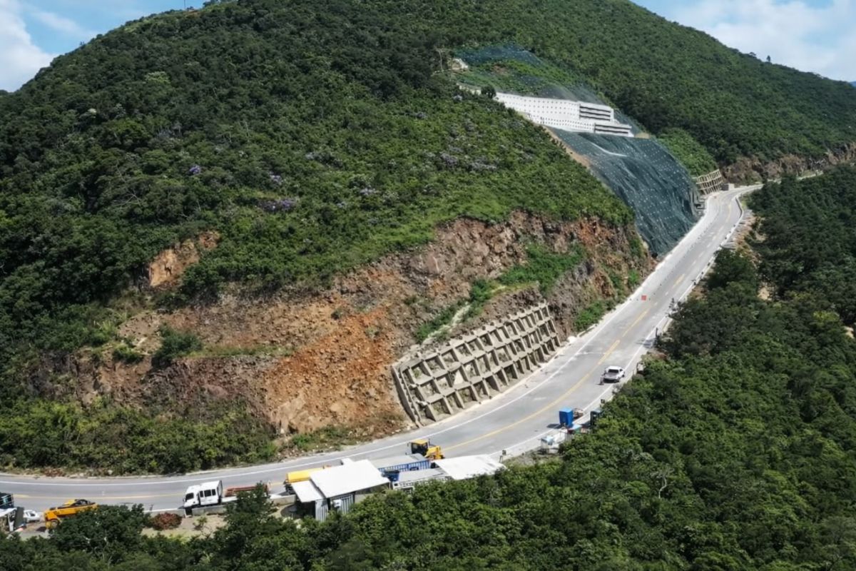
After more than a decade marked by stoppages, contractual revisions, and changes in the concession model, the Government of São Paulo is set to inaugurate the first phase of the North Section of the Mário Covas Ring Road next Monday (22).
The initial delivery will feature 24 kilometers in length and will connect the Presidente Dutra highway to Fernão Dias, creating a new roadway connection in the Metropolitan Region.
This information was confirmed by the São Paulo Executive in discussions with media outlets.
-
The section of Serra da Rocinha on BR-285 is now open in Timbé do Sul: 50 m tensioned curtains and top-down technique stabilize the slope, with a stairway duct controlling the water.
-
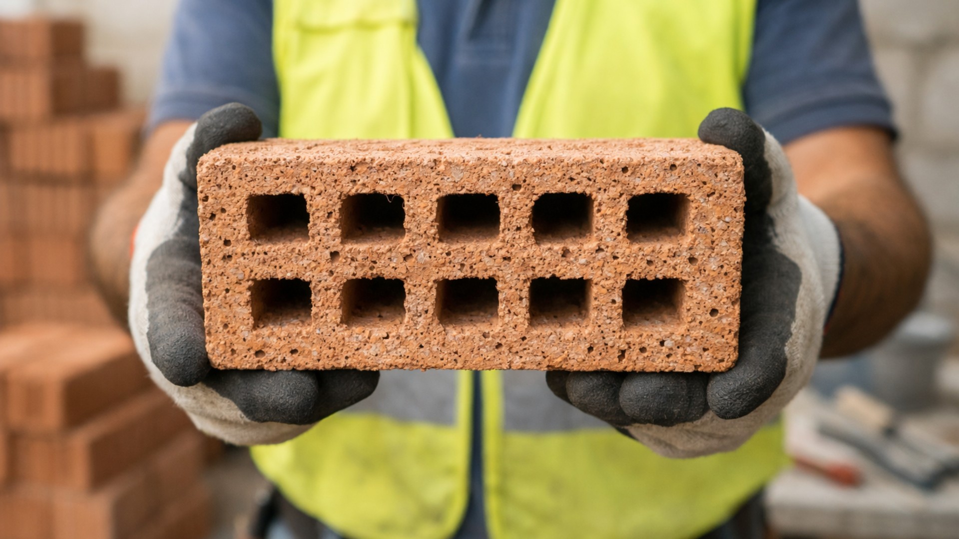
Scientists use sawdust mixed with clay to create a lighter brick, promising efficient thermal insulation and impressing by transforming waste into a solution for construction.
-
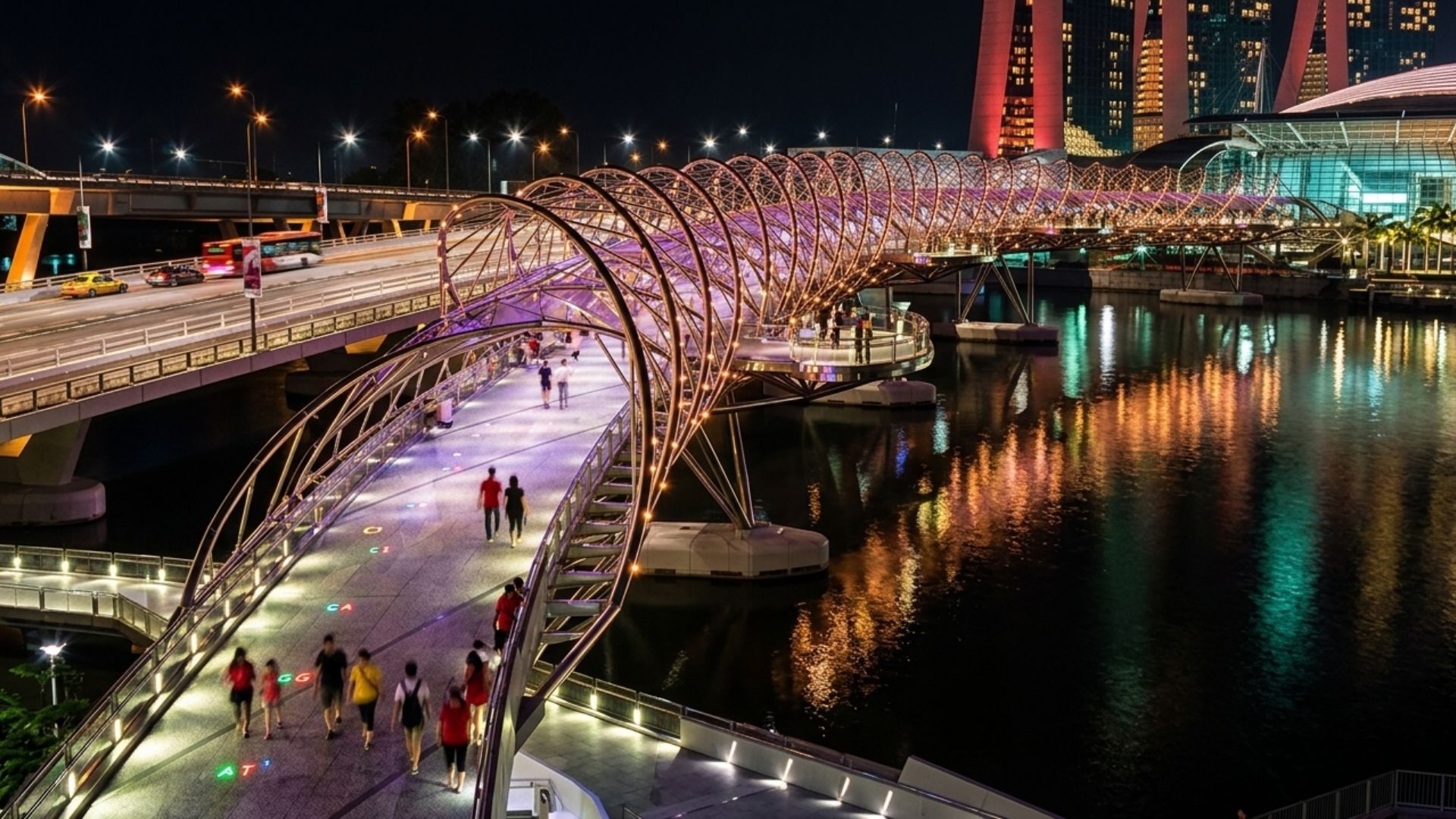
With a DNA shape, this bridge in Singapore draws attention in modern architecture and surprises tourists by transforming a simple crossing into an unforgettable visual experience in the urban heart.
-
Giant underwater pipeline begins to take shape with a R$ 134.7 million project at the Port of Santos: the 1.7 km structure uses 12-meter and 700 mm pipes to supply water to 450,000 people in Guarujá.


The segment is part of a project conceived in the 1990s, aimed at removing transit traffic, especially heavy transport, from urban roads in the capital.
So far, this goal has not been fully achieved, as the North Section remains incomplete and will only be fully integrated into the ring road system after the completion of all planned phases.
Section Between Dutra and Fernão Dias Commences Operations
The section entering into operation connects two of the main roadway corridors accessing São Paulo, in a stretch that crosses the municipalities of Guarulhos and Arujá.
In practice, the connection between the Dutra and Fernão Dias now offers an alternative for long-distance travel that currently uses the urban roadway system.

According to the executive project, the section will have dual lanes and three lanes in each direction, in addition to access devices, overpasses, and other roadway structures.
The layout also includes four tunnels, totaling approximately two kilometers, one of the elements that required specific technical solutions throughout the construction.
According to state government estimates, around 40,000 vehicles are expected to travel daily on the new segment.
Within this volume, the official projection indicates that more than half will be composed of trucks and trailers, which could reduce the circulation of such vehicles in urban areas of the capital.
Investment of R$ 3.4 Billion and Sponsored Concession
The execution of the North Section involves a total estimated investment of R$ 3.4 billion.
Of this amount, approximately R$ 1.35 billion corresponds to contributions from the Government of São Paulo, while about R$ 2 billion will be the responsibility of the concessionaire responsible for the construction and future operation of the section.
This model, classified as Sponsored Concession, was adopted after the interruption of the previous contract.
The reformulation aimed to financially enable the resumption of the project, which had been halted amid contractual disputes and difficulties with the original arrangement.
In balances disclosed throughout 2025, the São Paulo government reported that the North Section surpassed the mark of half of the physical execution.
In this scenario, the connection between the Dutra and Fernão Dias appears as the most advanced part of the project.
History of Delays and Resumption of Works
The construction of the North Section began in 2013, but was interrupted in 2018.
Since then, the project has undergone layout revisions, reassessment of environmental licenses, and a re-bidding process.
These factors contributed to extending the schedule and the need to redefine deadlines and responsibilities.
The effective resumption of construction occurred in April 2024, already under a new concession contract.
From that point, the government began to release a revised schedule, with phased deliveries and intermediate execution goals.

Even with the partial inauguration scheduled for December, the North Ring Road will continue to operate in a segmented manner.
Part of the traffic will be able to use the new stretch, while another part will still rely on urban connections until the work is fully completed.
Total Integration of the Ring Road Depends on the Final Stage
When completed, the North Section will have 44 kilometers in length and will connect the Raimundo Pereira de Magalhães Avenue in the northern zone of the capital to the Presidente Dutra highway in Arujá.
The layout crosses the municipalities of São Paulo, Guarulhos, and Arujá.
Only with this completion will it be possible to achieve full integration with the West, South, and East sections of the Ring Road, forming the roadway ring designed to circumvent the Metropolitan Region of São Paulo.
The most recent forecast disclosed by the government and the concessionaire indicates the delivery of the final phase for 2026.
Until then, the impacts on regional mobility are expected to occur gradually, as drivers and transportation companies adjust their routes to the new segment available.
Free Flow Toll and Effects on Cargo Transport
One of the main features of the North Section is the adoption of the free flow electronic toll system, charging per kilometer traveled and without physical toll plazas.
The model provides for the installation of electronic portals for license plate reading or identification via vehicle tags.
The tariff rates have not yet been officially disclosed.
According to representatives from the transport sector interviewed by industry organizations, the determination of price will be crucial for truckers’ acceptance of the new route.
Without this information, carriers are still assessing how the toll might impact operational costs.
The Ring Road was originally conceived as an alternative route to urban traffic.
With financial model changes over the decades, the introduction of tolls has become part of the project, leading to discussions about the future behavior of heavy transport.

Cantareira Mountains and Environmental Conditions
The layout of the North Section crosses areas of the Cantareira Mountains, a region with the presence of Atlantic Forest and areas of environmental preservation.
For this reason, the project is subject to environmental conditions established in the licensing.
Among the measures planned are wildlife underpasses, environmental monitoring programs, reforestation actions, and recovery of degraded areas.
These requirements have accompanied the execution of the work since the beginning and continue to be monitored by the relevant agencies.
Regional Logistics and Limits of Immediate Impact
According to the São Paulo government, the new section is expected to facilitate the connection between important roadway corridors, expanding logistical alternatives and access to routes leading to the Port of Santos.
The official expectation is for improvement in the flow of production and in the circulation of long-distance cargo.
However, mobility and infrastructure specialists emphasize that the broader effects can only be assessed after the full completion of the North Section and the determination of toll rates.
Until then, the partial inauguration represents an operational advance but does not yet allow for a complete measurement of the impacts on urban traffic and regional logistics.
With the opening of the first 24 kilometers and the final phase still ongoing, how will the transport market and drivers react when the system is complete and the tolls come into effect?


Esse trecho já contempla a entrega da ligação com o aeroporto de Guarulhos? Mas o pior desse projeto foi ter ficado de fora a ligação como uma opção de escape/desvio com a estrada de Nazaré (SP036) que liga a rodovia D. Pedro II