 Portuguese
  English
  Spanish
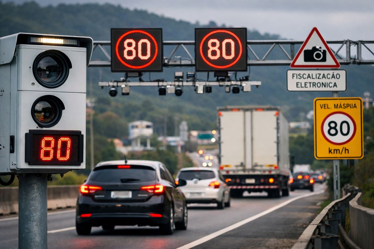


With a contract signed at the end of 2025, DNIT began the resumption of electronic enforcement and prioritized segments with higher traffic risk, high traffic volume, and speeding; by April 2026, the first radar units should issue fines after installation, signaling, calibration by Inmetro, and technical validation of the studies in the segments.
The radars have regained prominence on federal highways in Santa Catarina with an implementation that combines operational urgency and rigorous technical filtering. The first batch is already underway, and the official expectation is that the equipment will start issuing fines from April 2026, according to the completion of each mandatory stage.
The change does not occur randomly or simultaneously throughout the state. The adopted model provides for prioritization based on traffic criticality, staggered implementation, and metrological validation before any fines. In practice, the driver sees new points emerging in corridors of higher traffic pressure, while other segments are still under analysis.
Why These Segments Received Electronic Enforcement
The definition of the radar points follows DNIT’s Normative Instruction No. 43/2021, which establishes mandatory technical criteria for indicating electronic enforcement.
-
A French brand placed a car on four huge red balloons to prove that its suspension made the vehicle “float,” and the surreal scene became one of the most iconic and unusual images in automotive history.

-
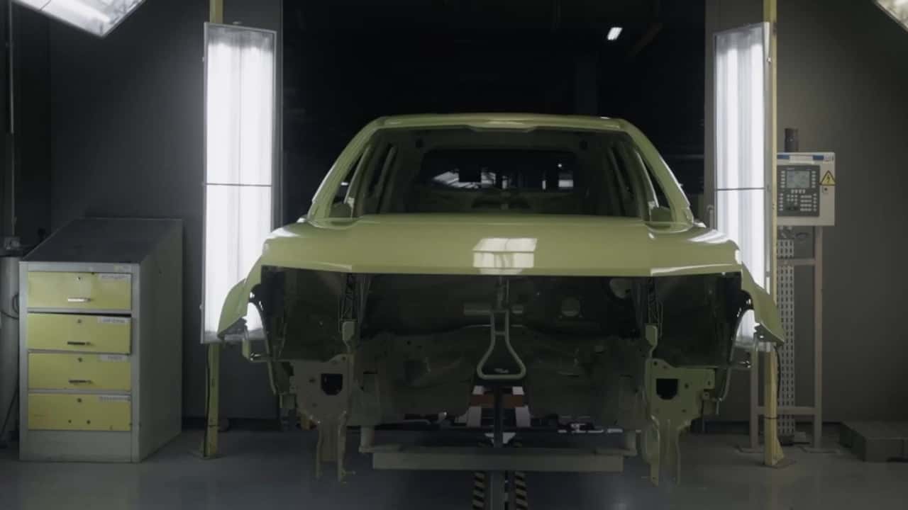
Jeep Avenger begins production in Brazil, debuting as the brand’s new entry-level SUV and inaugurating an unprecedented phase by becoming the first national Jeep manufactured outside of Goiana, as part of a R$ 3 billion plan.
-
Costing R$ 12,490, the new Shineray Urban Lite 150 “cheap one” arrives in Brazil with a CVT transmission, digital dashboard, and LED lights, making it more affordable than the Biz and targeting those who want to abandon the bus.

-
Ducati brings to Brazil the Superleggera V4 Centenario: 228 hp that become 247 with a track kit, carbon fiber and carbon-ceramic brakes, estimated price between R$ 1.5 and 2 million, deliveries only in 2027.


Among the elements evaluated are physical characteristics of the road such as curves, inclines, crossings, and accesses, as well as the volume of vehicles that circulate daily in each segment. It is not just the speed limit number that determines the installation.
Another central axis of the analysis is the actual circulation behavior, including the speeds effectively practiced and the so-called 85th Percentile Speed, used to depict how most drivers travel in the area.
This operational picture is cross-referenced with accident and incident history to identify critical segments. The stated objective is road safety, focusing on reducing risk where the combination of flow, road geometry, and speeding elevates the probability of serious occurrences.
Who Participates in the Implementation and How Much Has Been Released
The process is led by DNIT, through its regional superintendence, with technical execution by the contracted company and compliance control throughout the phases.
After a new contract signed in November 2025, Santa Catarina began to foresee 321 enforcement lanes, equivalent to 201 points on federal highways, with execution estimated to take up to 12 months. This volume shows a broad resumption, not isolated.
In the completed prioritization phase, 131 lanes corresponding to 82 points have been released and forwarded to the responsible operator.
At the same time, other locations continue in Technical Viability Studies to confirm criticality and initial implementation conditions. This means that the final map may undergo adjustments, because the points planned in the contract still depend on definitive technical validation.
Deadlines, Stages, and What Needs to Happen Before the Fine
The operational schedule separates two scenarios. In locations still undergoing study development, the contractor has up to 60 days to complete the analysis and submit it to DNIT.
For points authorized for installation, the deadline is up to 90 days to close all stages, including physical installation, signaling, and technical procedures necessary for the start of operation. Without closing this cycle, there is no valid enforcement.
In addition to the installation, there is a non-negotiable requirement: metrological calibration by Inmetro. This procedure certifies the reliability of the measurements and is a prerequisite for the application of fines.
Meanwhile, DNIT emphasizes that, even where the equipment is not yet issuing fines, the signaling of the road remains fully valid. Adhering to the speed limit remains mandatory before, during, and after the activation of the radars.
Where Radars Are Advancing in Santa Catarina
In the West, BR-153 already shows points under installation, such as kilometers 35.015 and 35.77 in Ponte Serrada, as well as kilometers 58.315 and 58.9 in Irani. This block indicates concrete progress in segments with significant flow and sensitive history. It is one of the fronts where implementation has already moved from the planning phase.
On BR-282, movement appears in two large axes. In the Greater Florianópolis and Serra region, installation is taking place in segments such as km 3.47 and 3.49 (Florianópolis), km 16.95 (Palhoça), km 27.4 and 32.06 (Santo Amaro da Imperatriz), km 44.025 (Águas Mornas), and km 111.07 (Alfredo Wagner), while other points remain under study.
In the Serra/Oeste corridor, installation is occurring in Bom Retiro (km 127.95 and 128.22), Vargem Bonita (km 436.89), Irani (km 437.49), several segments of Ponte Serrada (between km 445.6 and 462.96), and Cordilheira Alta (km 529.185 and 529.245). The distribution confirms a focus on areas of intense traffic and operational criticality.
BR-280 North: Strategic Corridor Still in Technical Stage
In the northern part of the state, BR-280 concentrates a long list of points under study by the contractor, including segments in São Francisco do Sul, Araquari, Jaraguá do Sul, Corupá, and São Bento do Sul.
Among the kilometers already mapped for this phase are, for example, 1.515; 4.73; 7.29; 10.93; 14.4; 24.3; 28.7; 33.08; 68.32; 72.835; 75.32; 75.535; 78.74; 81.77; 84.83; 93.2; 96.73; 111.3; and 111.57. It is a corridor still mostly in technical validation.
This stage is not merely a bureaucratic protocol. It is where it is confirmed whether each contracted point remains suitable for implementation, based on real risk, road operation, and consistency with federal parameters.
Therefore, although the list of locations is extensive, the start of operation depends on the completion of studies, authorization, installation, signaling, and calibration. Electronic enforcement, in this case, progresses through layers of control to reduce contestation and increase accuracy.
How the Driver Can Stay Informed and What Changes in Routine
For those wanting to know where active equipment is located and which study supported each point, DNIT indicates a public consultation on the Fines Portal.
The platform allows you to check the radars in operation and access technical information related to the implementation. This monitoring is expected to gain importance as April approaches and new points transition from “installation” to “effective enforcement”.
In practical terms, the main change is predictability with responsibility: critical segments should have more constant monitoring, and the margin for driving above the limit decreases.
The financial impact exists, but the official design prioritizes risk reduction in areas of greater roadway vulnerability. For the driver, the most economical and safe decision remains the same: speed compatible with signage and continuous attention to the segment.
The resumption of radars in Santa Catarina combines scale, technical criteria, and gradual implementation: there are already over 80 prioritized points, while the total plan anticipates 201 points and 321 lanes throughout the contractual execution.
With operation starting progressively from April 2026, the scenario is one of more present enforcement precisely where the risk is higher.
If you frequently drive on BR-153, BR-280, or BR-282, which segment has the change already altered your driving behavior? And, in your experience, does enforcement at these points tend to improve safety in daily life, or does it still need adjustments in signaling and communication to work better?


Concordo que deve ter Radares,mas com tanta tecnologia, fica difícil acreditar que os novos radares não tenham um meio de aferir velocidades diferentes para veículos pesados e veículos leves.
Veículos leves com tanta tecnologia embarcada nao tem o porquê de fazer uma curva 40Kmh, 60 kmh. Como era no tempo que so tínhamos Fusca,Brasília, kombi, corcel,chevet….