 Portuguese
  English
  Spanish
Underground Surveillance Became Part of Brazilian Defense Strategy to Face the Use of Tunnels by Criminal Organizations, Combining Sensors, Data Analysis and Coordinated Action on the Border to Reduce Blind Spots and Respond to New Illegal Routes.
The Brazilian land border, with approximately 16,900 kilometers and contact with ten countries, has faced a challenge that is no longer limited to the surface.
In addition to rivers, roads, and air routes, security agencies have identified, over the past few years, the increasing use of the subsurface by criminal organizations for smuggling and trafficking, especially in urban and rural areas of the Midwest and South of the country.
This movement forced a review of traditional surveillance strategies.
-
Oldest tree on the planet reappears after 130 years of searches: Wattieza, 385 million years old, was 10 meters tall and had no leaves or seeds; Gilboa fossils in New York solved the mystery in 2007.

-
A 48-square-meter house assembled in hours with 4,000 bricks made of recycled plastic that does not absorb moisture, has natural thermal insulation, and costs less than 90,000 reais in a complete kit.

-
Luciano Hang revealed that Havan’s air fleet has already accumulated more than 20,000 landings, 10,000 flight hours, and 6 million kilometers traveled, and he says that without the planes, the company would never have grown so quickly.

-
A historical discovery in the Andes Mountains reveals a gold deposit valued at 770 billion reais hidden over 4,000 meters above sea level on the border between Chile and Argentina, and the whole world is watching.


Ostensive patrolling, physical barriers, and aerial monitoring remain central, but have left gaps in the face of clandestine excavation.
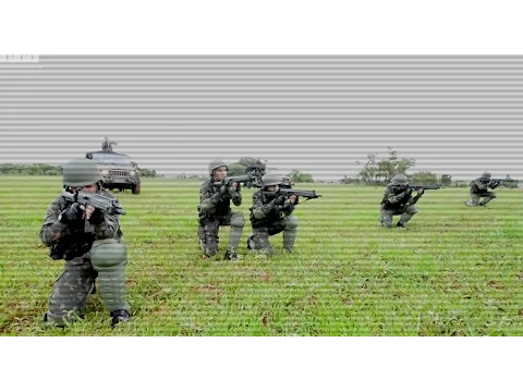
In response, Brazil has begun to invest in integrated monitoring models, particularly the Integrated Border Monitoring System (Sisfron), coordinated by the Army and based on the articulation between sensors, command centers, and joint action with other agencies.
Brazilian Border and the Advancement of Underground Routes
Historically, border control focused efforts on what is visible.
Irregular crossings on bridges, clandestine ports in rivers, trails in the forest, improvised runways, and low-altitude flights have been at the center of inspection actions.
This approach, however, showed limitations when organized crime began to explore the subsurface as an alternative route, reducing exposure to cameras, radars, and direct inspections.
In twin cities separated by just a few meters, such as Ponta Porã in Mato Grosso do Sul and Pedro Juan Caballero in Paraguay, police operations over the years have revealed tunnels connecting properties, warehouses, and logistical support points.
There are also records of excavations in rural areas and isolated warehouses, where territorial control is more complex and response times tend to be longer.
According to border security experts, the main difficulty in this type of scenario is the practical impossibility of monitoring each section continuously.
Satellites do not capture underground activities.
Thermal sensors have limited range.
Ground teams face the vastness of the area and the diversity of terrains.
Seismic Sensors and Soil Vibration Analysis
The use of sensors capable of detecting soil vibrations appears, in technical documents and public debates, as one of the alternatives to reduce blind spots in surveillance.
The logic is well-known in science.
Impacts and movements generate waves that propagate through the ground.
The challenge, in security, lies in differentiating common vibrations from patterns associated with human activity.
The Brazilian subsurface presents great geological diversity, which interferes with the propagation of these waves.
Heavy traffic, intense rain, agricultural machinery, and even root growth produce signals that can confuse readings.
Therefore, when this type of technology is mentioned in programs like Sisfron, it is often described as part of a broader system, combining data collection, digital filtering, and pattern analysis.
In practice, the sensor does not operate in isolation.

It acts as an initial indicator that can trigger other layers of verification, such as remote observation, team deployment, or aerial means.
This chain aims to reduce false alarms and concentrate resources on situations deemed more likely.
Clandestine Tunnels, Investment and Adaptation of Crime
Reports from authorities in different countries indicate that tunnels used by organized crime range from rudimentary excavations to structures with reinforcement, ventilation, lighting, and systems for cargo transport.
When this type of construction is identified, the investigation usually indicates medium or long-term planning and significant investment.
This degree of sophistication has a direct impact on operations.
On one hand, it reduces the immediate risk of surface interception.
On the other hand, it raises the costs and time needed to keep the route active.
The discovery of a tunnel usually brings about changes in gang behavior, which begin to seek alternatives, adjust depth, alter excavation techniques, or migrate to other means of transport.
Analysts consulted in studies on transnational crime indicate that this adaptation game is constant.
Whenever one route becomes riskier, another begins to be tested.
In this context, data integration gains relevance as it allows crossing information and identifying movement patterns before they become established.
What Is Public, Confirmed and Verifiable

Sisfron is an official program widely cited in public documents.
Its implementation is already consolidated in parts of the western border, with planned expansion to other stretches.
It is also proven that Brazil faces a history of clandestine excavations in border regions, especially at the border with Paraguay.
On the other hand, detailed descriptions of specific operations, accuracy percentages of algorithms, spot alerts, or actions involving alleged attempts of underground infiltration against military installations are not openly available in official records accessible to the public.
Defense experts recall that this type of information, when it exists, is usually protected by operational secrecy.
Thus, it is not possible to assert, based on public data, that there is total control of the subsurface or systems capable of predicting enemy actions with absolute precision.
What can be asserted is that there has been advancement in detection and response capabilities, reducing historical vulnerabilities and increasing integration among security agencies.
Indirect Impacts and Future Challenges of Surveillance
The strengthening of monitoring tends to produce indirect effects.
When certain routes become riskier or more costly, criminal organizations may be forced to return to traditional paths, such as roads and rivers, where inspections are more established.
In parallel, experts point out that pressure in one environment often pushes crime to another, such as the use of drones or discreet vessels.
This movement reinforces the assessment that border surveillance needs to be treated as a layered system, capable of adapting to rapid changes.
The border, in this sense, ceases to be merely a line on the map.
It begins to be seen as a three-dimensional space, requiring constant monitoring and technological integration.


-

-

-

-

-

-

27 pessoas reagiram a isso.