 Portuguese
  English
  Spanish
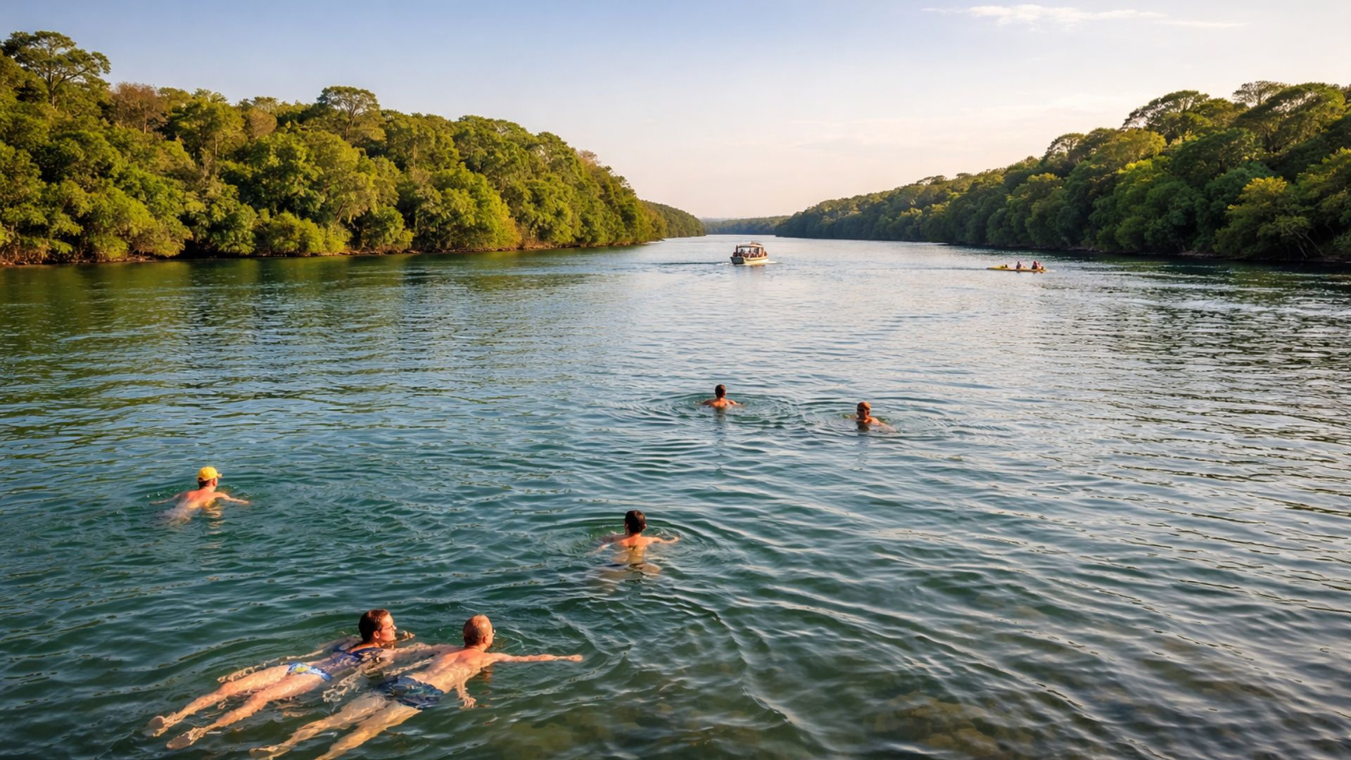


Municipality in the Extreme West of São Paulo Brings Together the Final Stretch of the Tietê River, Areas of Preserved Forest, and a Reservoir That Covered Waterfalls, Old Constructions, and Historical Structures.
Located on the border of São Paulo and Mato Grosso do Sul, Itapura concentrates characteristics that contrast with the more well-known image of the Tietê River in large urban centers.
In the final stretch of the river, the municipality brings together areas of preserved forest, nautical activities, and sites used for leisure and fishing.
Due to this set of factors, the city appears in official tourism itineraries as part of the so-called Pantanal Paulista and is also mentioned in specialized guides for offering diving in submerged structures formed after the creation of a large reservoir in the region.
-
Friends have been building a small “town” for 30 years to grow old together, with compact houses, a common area, nature surrounding it, and a collective life project designed for friendship, coexistence, and simplicity.

-
This small town in Germany created its own currency 24 years ago, today it circulates millions per year, is accepted in over 300 stores, and the German government allowed all of this to happen under one condition.

-
Curitiba is shrinking and is expected to lose 97,000 residents by 2050, while inland cities in Paraná such as Sarandi, Araucária, and Toledo are experiencing accelerated growth that is changing the entire state’s map.

-
Tourists were poisoned on Everest in a million-dollar fraud scheme involving helicopters that diverted over $19 million and shocked international authorities.


Mouth of the Tietê River Marks Change of Landscape in the Interior of São Paulo
The Tietê River travels over a thousand kilometers from its source in Salesópolis to reach the extreme west of São Paulo.
As it approaches the confluence with the Paraná River in Itapura, the environment presents characteristics distinct from those observed in the urban stretches of the state.
According to tourism institutional materials, the city caters to visitors interested in rivers, lakes, and areas of native vegetation, as well as boat rides and birdwatching.

In this same stretch, sport fishing is frequently practiced, favored by the presence of different species associated with the meeting of large watercourses.
In promotional content, it is common to assert that the river is “clean and suitable for bathing” in this region.
However, a continuous public series of official bathing data for the Tietê River in Itapura has not been reliably identified to technically classify the water quality for recreation throughout the year.
The available references are based, above all, on tourist descriptions and reported recreational use in areas of the municipality, which does not equate to regular environmental monitoring.
Origin of Itapura is Linked to the Military Strategy of the Empire
The origin of Itapura is linked to a project of the Empire of Brazil aimed at occupying and defending an area considered strategic in the interior of the country.
Historical records indicate that the Military Colony of Itapura was created in 1858, in a context of strengthening Brazilian presence near the border and the river routes that connected the interior to the Paraná River.
Academic research situates the development of the settlement in the period before and during the Paraguay War, from 1864 to 1870.
The geographic position favored both surveillance and control of river traffic, a central element for the movement of troops, supplies, and information in the 19th century.
Documents and institutional reports indicate that the initial urban configuration of the region was directly associated with military structures and the dynamics of the rivers.

Since then, local history has been marked by strategic decisions of the state and by transformations imposed by the river environment.
Hydroelectric Plant Altered the Course of the River and Submerged Historical Waterfalls
For decades, the stretch of the Tietê where Itapura is located was known for its large waterfalls, such as the Itapura and Urubupungá Falls.
These natural features are described in historical records as obstacles to navigation and important geographic references for the region.
This scenario was altered with the implementation of the Urubupungá Complex, which includes the Engenheiro Souza Dias Hydroelectric Plant, known as Jupiá.
With the formation of the reservoir, extensive areas were flooded, affecting old urban centers, waterfalls, and energy generation structures predating the project.
According to information released by the municipality itself, the Itapura Falls were submerged after the filling of the lake, along with parts of the old town and facilities such as the Eloy Chaves hydroelectric plant.
These sites have become part of the submerged areas associated with local tourism.
Submerged Ruins Boost Diving Tourism in Itapura
The flooding caused by the reservoir transformed the landscape and left, under the water, vestiges of the previous occupation.
Reports and tourist guides indicate that Itapura has become one of the few municipalities in the interior of São Paulo to offer diving tours in submerged ruins.
Among the sites mentioned are remnants of buildings and structures that were part of the old urban and energy configuration of the region.
Diving activity, according to local operators, takes place according to lake conditions and follows specific safety and authorization rules.
For those who do not engage in underwater activities, the municipality is also promoted as a destination for boat rides, enjoying the river landscape, and visits to preserved vegetation areas.
These options frequently appear in official promotional tourism materials.
Shipwreck Attributed to the Tamandathay Steamship Integrates Historical Narrative
One of the most mentioned episodes in content about Itapura involves the Tamandathay steamship.
According to accounts reproduced in tourism guides and historical curiosity articles, the vessel is said to have been purchased by Dom Pedro II in 1860 for military use and sank in 1883 near the mouth of the Tietê River.
These same sources indicate that the wreckage of the ship is now at the bottom of the reservoir, at a depth that varies according to water level, and that the site is included in diving itineraries.
The information, however, is not accompanied in these publications by accessible primary documentation detailing the circumstances of the purchase, the sinking, or the exact position of the vessel.
For this reason, data on the Tamandathay are treated as part of the historical and tourist narrative associated with the city and not as fully confirmed records from widely available official sources.
Beyond the shipwreck, academic studies and historical surveys about the Military Colony of Itapura help to contextualize the importance of the municipality in the process of occupying the interior of São Paulo and in the country’s defense strategy during the Paraguay War.
With rivers, submerged structures, and historical references concentrated in one territory, Itapura today appears as a point of interest for different visitor profiles.
Upon arriving at the mouth of the Tietê, what most catches the attention of those who know the region: the contact with nature, the historical vestiges, or the possibility of exploring a river marked by contrasts throughout its course?


Franco se depender do ser humano salivar algo na terra vai ser ele mesmo!
Conheço esta região, morei na cidade vizinha, Cadtilho sp,realmente é lindo ver a natureza preservada,bem como o rio Tietê, qdo passo pela ponte que divisa sempre tirobfotos do rio Tietê, é lindo e limpo
O