 Portuguese
  English
  Spanish
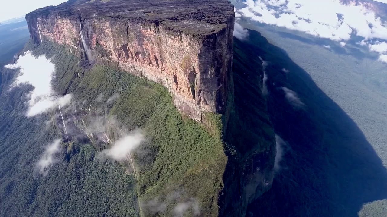
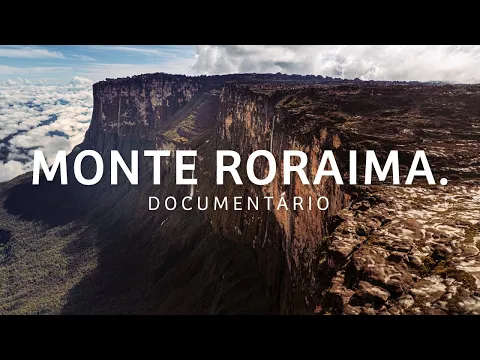
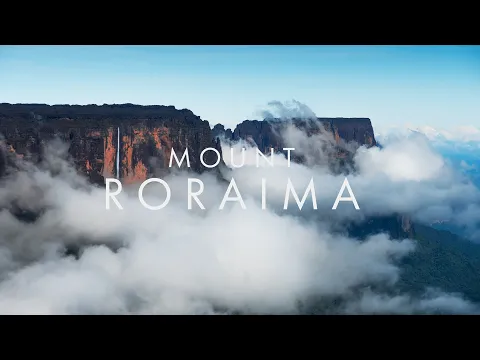
Mount Roraima, at 2,810 Meters High and Rock Formations of About 2 Billion Years, Allows Views of Brazil, Venezuela, and Guyana at the Same Time and Houses Unique Species Above the Clouds.
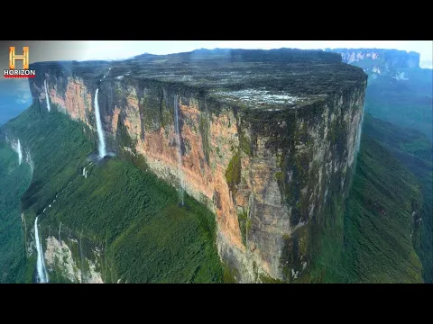
About 220 kilometers from Boa Vista, on the border between Brazil, Venezuela, and Guyana, stands one of the oldest geological formations on the planet: the Mount Roraima. With 2,810 meters of height, the tepui with vertical walls rises above the clouds and marks the tripoint between three South American countries. What makes the place unique is not only its height or the fact that it allows viewing three territories at the same time but mainly its geological age.
The rocks of Mount Roraima are part of the Guiana Shield and are approximately 2 billion years old, being considered some of the oldest sedimentary formations still exposed on the Earth’s surface.
A Mountain of Two Billion Years
Mount Roraima is predominantly formed of quartzitic sandstone. It is part of a group of tabular mountains known as tepuis, which emerged from the fragmentation of an ancient plateau.
-
Friends have been building a small “town” for 30 years to grow old together, with compact houses, a common area, nature surrounding it, and a collective life project designed for friendship, coexistence, and simplicity.

-
This small town in Germany created its own currency 24 years ago, today it circulates millions per year, is accepted in over 300 stores, and the German government allowed all of this to happen under one condition.

-
Curitiba is shrinking and is expected to lose 97,000 residents by 2050, while inland cities in Paraná such as Sarandi, Araucária, and Toledo are experiencing accelerated growth that is changing the entire state’s map.

-
Tourists were poisoned on Everest in a million-dollar fraud scheme involving helicopters that diverted over $19 million and shocked international authorities.


These structures date back to the Paleoproterozoic era, when large sedimentary deposits were compacted and subsequently uplifted by tectonic movements. Over millions of years, erosion sculpted the vertical walls that characterize the massif today.
The estimated age of the rocks — about 2 billion years — makes Roraima one of the oldest landscapes on the planet still preserved.
The Tripoint Above the Clouds
At the top of Mount Roraima is a unique geographic marker: the point where Brazil, Venezuela, and Guyana meet. The border between the three countries is marked by landmarks set in the plateau region.
On clear days, it is possible to see territories of all three countries from the mountain’s summit. The view is often described as the experience of “being above the clouds”, as the top often remains above the layer of mist that envelops the mountain’s base.
This geographical positioning contributed to the site’s international fame.
The “Lost World” of Unique Biodiversity
The geographical isolation of the plateau has created an environment with endemic species, adapted to the specific conditions of the summit. The term “lost world” became popular after the publication of the novel The Lost World by Arthur Conan Doyle, which was inspired by accounts of the tepuis.
At the top of Mount Roraima, there are plants and small animals found only there. The combination of high altitude, poor soils, and ecological isolation has favored the evolution of unique species.
Scientific research has identified amphibians, insects, and vegetation that do not occur in other regions.
Formation of the Tepuis
Mount Roraima is one of the most well-known tepuis in the Guiana Shield region. These isolated plateaus emerged from the erosion of an ancient continuous massif.
Over millions of years, water and wind wore down the more fragile areas, leaving only resistant blocks with flat tops and steep walls.
This formation results in vertical cliffs that can exceed hundreds of meters in height.
Altitude and Extreme Climate
The altitude of 2,810 meters creates a specific microclimate. Temperatures are lower than in the Amazonian lowland areas, and the constant presence of clouds generates high humidity.
The summit is frequently covered by mist, and precipitation is common throughout the year. The plateau’s surface features rock formations sculpted by water action, creating cavities and shapes that resemble natural sculptures.
Mount Roraima is the subject of geological and biological studies. Its formation helps scientists understand ancient processes of the Earth’s crust.
Moreover, the isolation of the plateau provides opportunities for research on the evolution of species in isolated environments.
The region is part of the Mount Roraima National Park, on the Brazilian side, and protected areas in Venezuela.
Access and Adventure Tourism
The climb and crossing to the summit attract adventurers from different parts of the world. The most used route starts from the Venezuelan side, where logistical access is more established.
The ascent involves days of hiking over rugged terrain until reaching the flat top of the mountain.
The crossing requires physical preparation and specialized guidance due to variable weather conditions.
One of the Natural Postcards of South America
The image of Mount Roraima emerging above the clouds has become a symbol of the northern region of Brazil. Its silhouette is often associated with the idea of unexplored territory and primordial nature.
The combination of altitude, geological age, and location at the tripoint reinforces its uniqueness.
With 2,810 meters in height, rocks of about 2 billion years, and a strategic location where Brazil, Venezuela, and Guyana meet, Mount Roraima represents one of the oldest and most emblematic formations on Earth.
Above the clouds, the plateau houses an isolated environment that is


-

-

-

-

-

-

65 pessoas reagiram a isso.