 Portuguese
  English
  Spanish
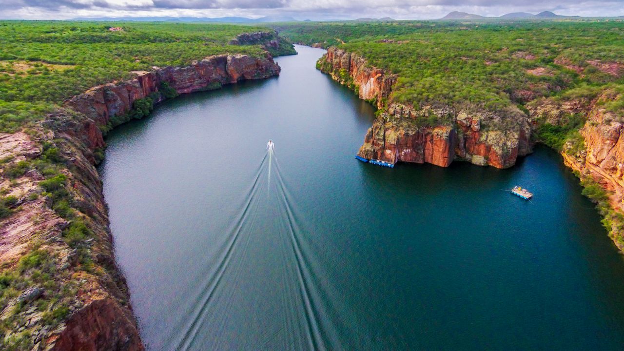


The Rio São Francisco Water Basin Covers 8% Of The National Territory, Is Essential For Supply, Energy, And Biodiversity In The Country, But Faces Serious Socio-Environmental Challenges.
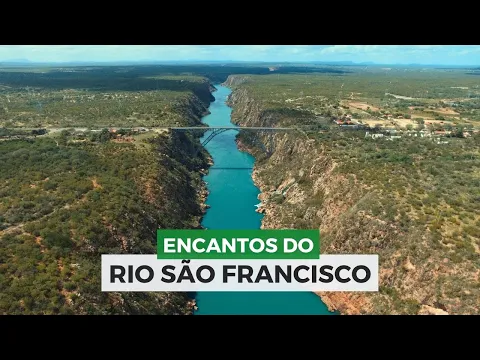
The Rio São Francisco water basin, which spans over 639,000 km² and crosses six Brazilian states, is one of the country’s most strategic regions. With springs in Minas Gerais and its mouth in the Atlantic Ocean, at the border between Alagoas and Sergipe, the river flows 2,863 km, supplying cities, driving industries, generating energy, and maintaining the biodiversity of four distinct biomes.
However, despite its vital importance, the basin faces serious challenges.
Since 2013, it has suffered from prolonged droughts and a decrease in river flow, which directly affects reservoir levels and the supply for millions of people.
-
He started running at 66 years old, broke records at 82, and is now a subject of study for having a metabolic age comparable to that of a 20-year-old, in a case that is intriguing scientists and inspiring the world.

-
Oldest tree on the planet reappears after 130 years of searches: Wattieza, 385 million years old, was 10 meters tall and had no leaves or seeds; Gilboa fossils in New York solved the mystery in 2007.
-
A 48-square-meter house assembled in hours with 4,000 bricks made of recycled plastic that does not absorb moisture, has natural thermal insulation, and costs less than 90,000 reais in a complete kit.

-
Luciano Hang revealed that Havan’s air fleet has already accumulated more than 20,000 landings, 10,000 flight hours, and 6 million kilometers traveled, and he says that without the planes, the company would never have grown so quickly.


Additionally, socioeconomic inequality and pollution are issues that exacerbate the situation.
How Many States Does The Rio São Francisco Cut Through?
The Rio São Francisco water basin is present in over 500 municipalities and crosses Minas Gerais, Goiás, Bahia, Pernambuco, Alagoas, and Sergipe, as well as the Federal District.
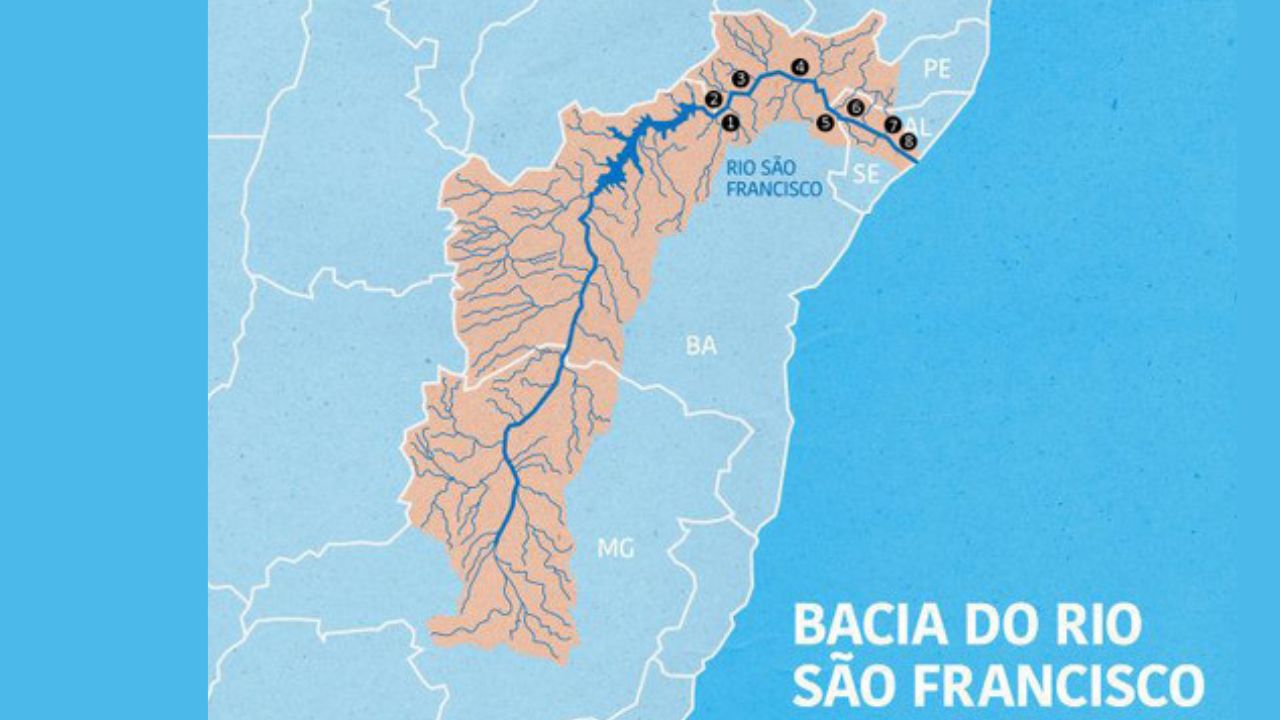
Its division into four major regions — Upper, Middle, Lower Middle, and Lower São Francisco — facilitates the planning and management of water resources.
- Upper São Francisco: Covers about 40% of the basin and is primarily located in Minas Gerais.
- Middle São Francisco: Located entirely in Bahia, represents 39% of the area.
- Lower Middle São Francisco: Concentrated between Pernambuco and Bahia.
- Lower São Francisco: With the smallest extent (5%), lies between Alagoas, Sergipe, Pernambuco, and Bahia.
Environmental Diversity Of The Rio São Francisco Basin
With four biomes along its extent, the Rio São Francisco water basin harbors:
Cerrado: Present mainly in Minas Gerais and Bahia, it covers almost half of the basin area.
Caatinga: The dominant biome in the northeastern region of Bahia and areas with a more arid climate.
Atlantic Forest: Appears in fragments in the Upper São Francisco, although considerably degraded.
Estuarine Ecosystems: At the river’s mouth, represent a unique ecological richness.
This diversity results in abundant fauna and flora but also requires specific conservation efforts, especially in the face of climate change and the advancement of human activity.
Climate And Droughts: Reality Of The Semi-Arid
More than half of the Rio São Francisco water basin is situated in the Brazilian Semi-Arid region, where the scarcity of rainfall and high evaporation make water management a constant challenge.
Average Annual Precipitation: 1,036 mm, with extremes of 1,400 mm at the springs and 350 mm between Sento Sé and Paulo Afonso (BA).
Rainiest Period: November to January.
Dryest Quarter: June to August.
Evapotranspiration: Average of 896 mm/year, potentially reaching 1,400 mm in the hottest regions.
This climatic irregularity directly impacts multiple uses of water, from domestic supply to electricity generation.
Strategic Reservoirs And Energy Generation
To control the flow of water and ensure energy production, large reservoirs and hydroelectric plants have been installed along the São Francisco.
Among the main ones are: Três Marias (MG); Sobradinho, Itaparica, and Paulo Afonso (BA); Xingó (between AL and SE).
These structures are essential for supplying the Northeast, especially during drought periods, and also contribute to the navigability of the river in specific stretches, totaling about 1,670 km.
Socioeconomic Reality: Striking Contrasts
The Rio São Francisco water basin is home to over 15 million people, with extremely contrasting realities.
- HDI: Ranges from 0.823 (Upper São Francisco) to 0.538 in poorer areas.
- Per Capita GDP: R$ 5,239 in Minas Gerais, R$ 2,275 in Alagoas.
- Infant Mortality: From 25.66% (MG) to 64.38% (AL).
While the Upper São Francisco has a strong industrial and urban presence, the Lower São Francisco still depends on traditional agriculture, although it is growing in tourism, aquaculture, and leisure.
More than 70% of the water extracted from the basin is used for agriculture, especially for irrigation in public and private projects.
There are about 336,000 hectares irrigated, mainly concentrated in the Middle and Lower Middle São Francisco.
However, the pressure on water resources does not come only from the fields.
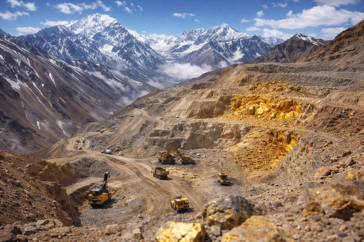
Cities and industries discharge waste into the river and its tributaries, as seen in the Metropolitan Region of Belo Horizonte — one of the most critical pollution areas, with high levels of inorganic load from mining.
Challenges And Future Of The Rio São Francisco Water Basin
Despite its fundamental role in regional and national development, the Rio São Francisco water basin faces significant challenges:
- Efficient water management amid prolonged droughts.
- Reduction of social inequalities between regions.
- Combat industrial and domestic pollution.
- Preservation of biomes and recovery of degraded areas.
The basin is both a symbol of Brazil’s natural wealth and a testament to the necessary commitment to a more just, sustainable, and integrated management.
The Rio São Francisco water basin is a true hydric heart of Brazil, pulsing between extremes of abundance and scarcity.
To ensure its future, it is necessary to unite efforts among governments, communities, and productive sectors, promoting development with environmental and social responsibility.
Source: CBH


Eu só nao entendi onde o estado de Goiás entra na bacia do São Francisco.
Júnior
Alguns rios que nascem neste maravilhoso estado são afluentes do Velho Chico.
Pelo que entendi, o rio São Francisco não cruza 6 estados.
A bacia do rio é que cruza os 6 estados citados.
Se for considerar os afluentes, Tocantins s e Piauí também deveriam entrar na bacia do Rio Sao Francisco.
A matéria fala sobre a abrangência da bacia hidrográfica, ou seja, a bacia hidrográfica do Rio São Francisco também abrange o Estado de Goiás e Distrito Federal…
Os afluentes também fazem parte da bacia de um rio.
Sim. A bacia abrange os 6 estados. Não o rio.
Se for considerar os afluentes, Tocantins s e Piauí também deveriam entrar na bacia do Rio Sao Francisco.