 Portuguese
  English
  Spanish
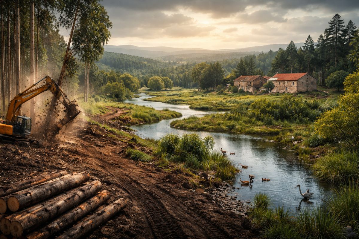
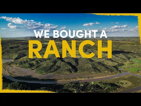
After Months Of Negotiation, The Team Purchased An Old Farm In Portugal For €1.5 Million And Began A Renaturalization Plan That Combines Fence Removal, Road Revision, Water Management And Forest Recovery, Salt Marsh And Ecological Corridors At Basin Scale, Over The Years.
In Southwestern Portugal, forest recovery has moved from an abstract idea to a land use plan with physical goals: removing extensive livestock structures, reducing the pressure of invasive species, and reconnecting freshwater, estuarine margins, and slopes within the same ecological unit, the Mira Valley.
The project stems from the purchase of an abandoned ranch and a clear diagnosis: despite the scenic beauty, the land bears signs of accumulated degradation, such as weakened waterways, roads over natural courses, altered salt marsh by old agricultural use, and imbalanced plant mosaics between scrubland, pasture, and woodland.
A Large Purchase For A Greater Mission

The acquisition was conducted after months of searching for properties in the region, with direct participation from Matt, Teresa, and Tiago, as well as a lengthy legal process with multiple parties involved.
-
Friends have been building a small “town” for 30 years to grow old together, with compact houses, a common area, nature surrounding it, and a collective life project designed for friendship, coexistence, and simplicity.

-
This small town in Germany created its own currency 24 years ago, today it circulates millions per year, is accepted in over 300 stores, and the German government allowed all of this to happen under one condition.

-
Curitiba is shrinking and is expected to lose 97,000 residents by 2050, while inland cities in Paraná such as Sarandi, Araucária, and Toledo are experiencing accelerated growth that is changing the entire state’s map.

-
Tourists were poisoned on Everest in a million-dollar fraud scheme involving helicopters that diverted over $19 million and shocked international authorities.


The closing took place in a notary’s office, with an installment purchase and a total value of €1.5 million, a significant figure for a smaller organization.
This investment represented about 25% of the total renaturalization budget for 2025, 2026, and 2027, indicating the financial weight of the decision.
Still, the logic was not about expansion by size, but about strategic positioning: the area is in the center of the Mira basin and can serve as a field base for actions that had already been planned at a regional scale.
What Will Be Removed For Nature To Function Again

Right from the first incursions, the team identified a typical feature of old grazing areas: infrastructure aimed at cattle, with fences and roads that fragment the territory.

The plan is not just to recover vegetation, but to reconfigure the physical space, removing barriers that hinder wildlife movement and interrupt habitat continuity.
In the surrounding area, non-native eucalyptus plantations were treated as a priority front due to the risk of fire, especially in the context of dry summer.

The strategy includes creating protection strips at the edges and, within the property, promoting a transition to local vegetation.
Practically, this means replacing a simplified scenery with a landscape of greater structural diversity, including native forests, functional open areas, and regeneration corridors.
In the higher fields, the history of sowing exotic grasses and overgrazing has left impoverished soil. The initial response may seem simple, but it is ecologically sound: reduce continuous interference, allow biomass to accumulate, and restore fertility.
In parallel, the management of herbivores in different ecological roles—grazers, browsers, and mixed-feeders—will speed up the return of a more stable mosaic.
Water, Marsh, And Choices That Require Fine Diagnosis

On the slopes facing the river, the team describes dominant scrubland and halted ecological succession. In several stretches, young trees struggle to establish themselves, requiring initial interventions such as cutting, controlled trampling, and opening space for woody species.
This is not about eliminating the scrubland, but reducing its excess where it hinders the formation of more complex structures.
The situation of the waterways is one of the most sensitive parts. In some places, roads pass over the course itself, compressing the natural dynamics and degrading margins.
The proposal is to correct problematic alignments and conduct the restoration of riparian forest with native riparian species, such as willows and ashes, to reactivate shade, soil stability, and ecological flow along the valleys.
In the lower area, the terrain forms freshwater waterlogged areas, rare in a more arid context. This wet nucleus coexists with a salt marsh that was modified in the past for rice cultivation, through hydraulic barriers and water diversion.
Today, a central decision remains open: to maintain the barrier or break it. The team itself acknowledges that this point should only advance after comparative studies of pros and cons, as it involves salinity, connectivity, and impact on already established habitats.
How The Ranch Connects To The Entire Mira Valley
The property was not conceived as an isolated project. It integrates into a regional package that includes the restoration of forests upstream, monitoring of streams, evaluation of seagrasses downstream, and actions related to threatened species.
One of the focuses is a critically endangered fish that depends on this river system, particularly highlighting Torgal stream as a remaining refuge.
In the salt marsh, another challenge is the invasion of blue crab, which requires a coordinated response at estuary scale.
Thus, the value of the ranch lies not only in what happens within its boundaries but in the logistical capacity to support teams, equipment, and continuous monitoring. The logic is of watershed, not a closed lot.
This territorial design also explains why the team sees the area as an “ecological and operational base” at the same time.
What seems like an abandoned farm actually becomes a connection point among different projects that share the same goal: restoring ecological processes and reducing the distance between human landscapes and wildlife.
Minimal Infrastructure, Adaptive Management, And Long-Term Horizon
The existing buildings, now degraded, should undergo repairs for functional use: to host volunteers and store equipment.
There is also discussion about a shed for machines used in reforestation and field management. The announced guideline is minimal infrastructure with low interference, prioritizing technical utility without blocking regeneration.
On a more ambitious horizon, two ideas emerge: an outdoor nursery for native plants with attention to small and threatened species, and a breeding center for vulnerable fauna.
Both depend on physical capacity, budget, and ecological validation, so they are still in the planning stage. What is already defined is the method: gradual decisions based on diagnosis and monitoring.
The team itself emphasizes that the complete survey of flora and fauna will still be conducted, and that the current information is an initial snapshot.
This care is decisive for credibility: in restoration, acting quickly without understanding the system can create new imbalances. Therefore, the adopted sequence combines immediate intervention where damage is evident and deeper research where trade-offs are more delicate.
The transformation of the ranch in the Mira Valley does not depend on a single project but on a sum of technical choices: which roads to remove first, where to prioritize freshwater, how to redesign edges with eucalyptus, when to accelerate succession, and where to let nature guide the pace.
It is a project of Forests, Rivers, And Marsh that demands time, method, and landscape reading.
Considering your reality, which measure would have the fastest and most lasting impact: recovering waterways, replacing flammable monocultures with native vegetation, or reconnecting areas fragmented by fences and roads? And, if you had to choose a single indicator to measure success in five years, what would it be?


-

-

-

-

-

-

42 pessoas reagiram a isso.