 Portuguese
  English
  Spanish
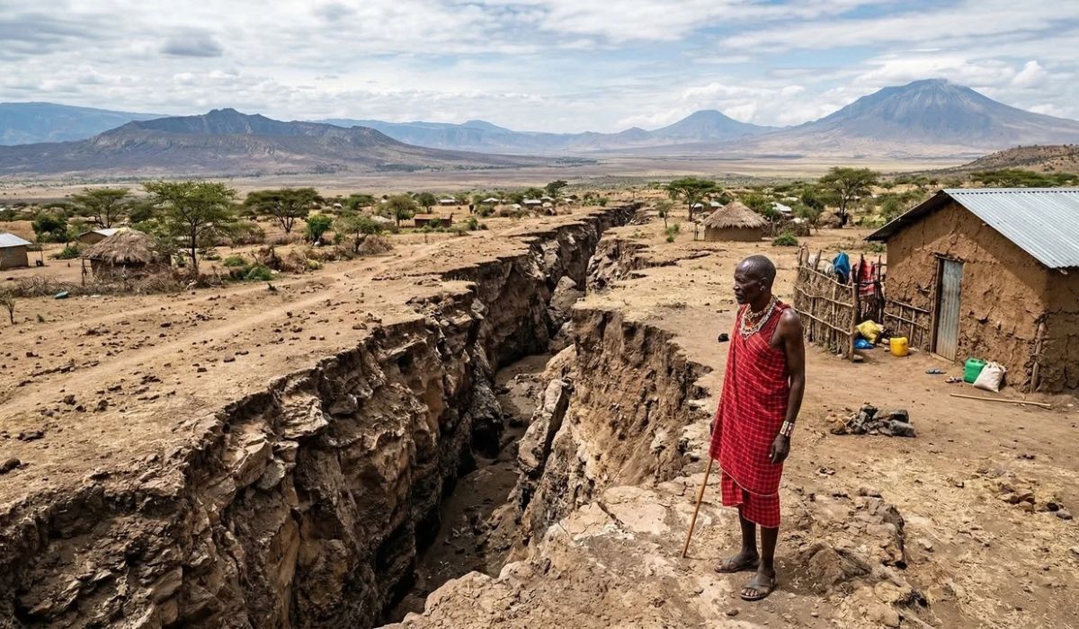
A geological process of long duration in East Africa returns to the center of public and scientific debate, while fissures, volcanoes, and large lakes help reveal how the Earth’s crust changes slowly and continuously.
The idea that Africa is splitting in two often appears in reports and publications about the eastern part of the continent.
According to experts, what geology describes is a slow and continuous process, already identified for millions of years in the region of the East African Rift System.
In this section, the Earth’s crust undergoes extension and fracturing, in a movement that gradually separates the Nubian Plate, associated with most of the continent, from the Somali Plate, linked to East Africa and the Horn of Africa.
-
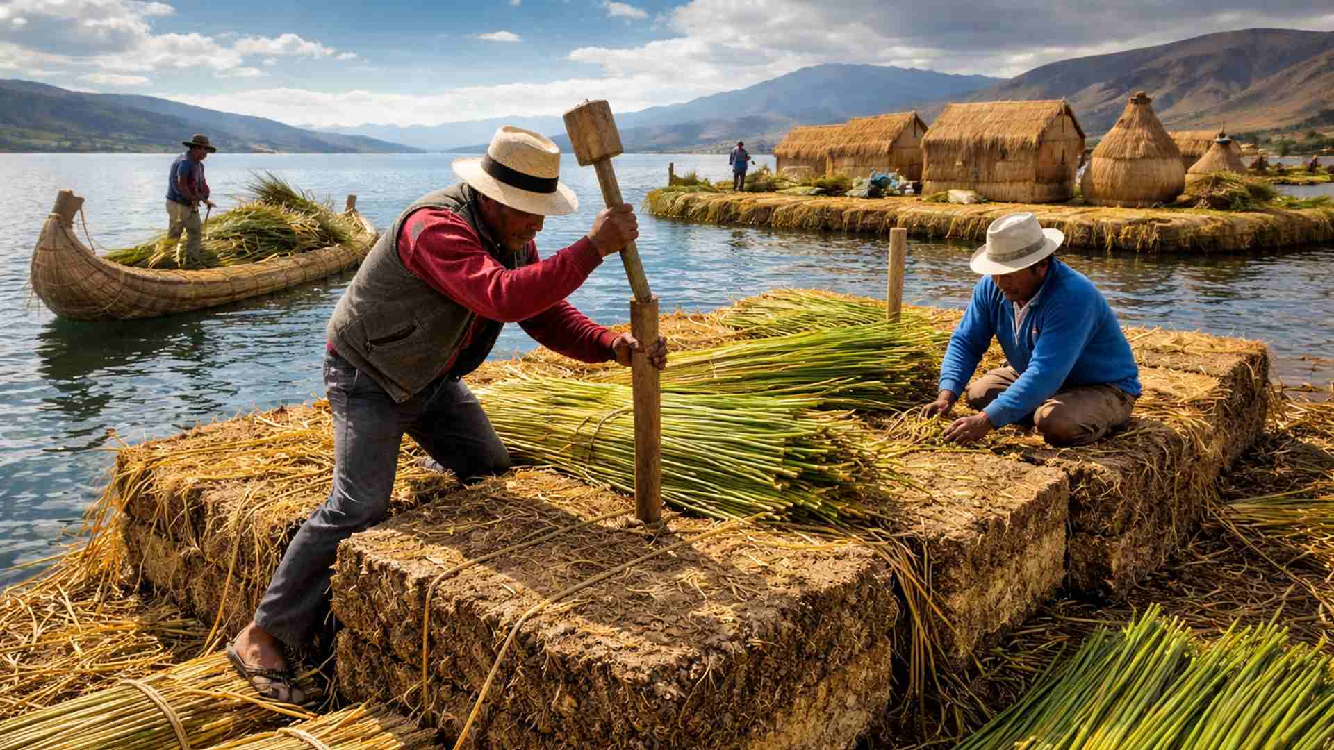
How to build a floating island from scratch with reeds, giant blocks, and stakes in the lake in a process that needs to be repeated almost every day.
-
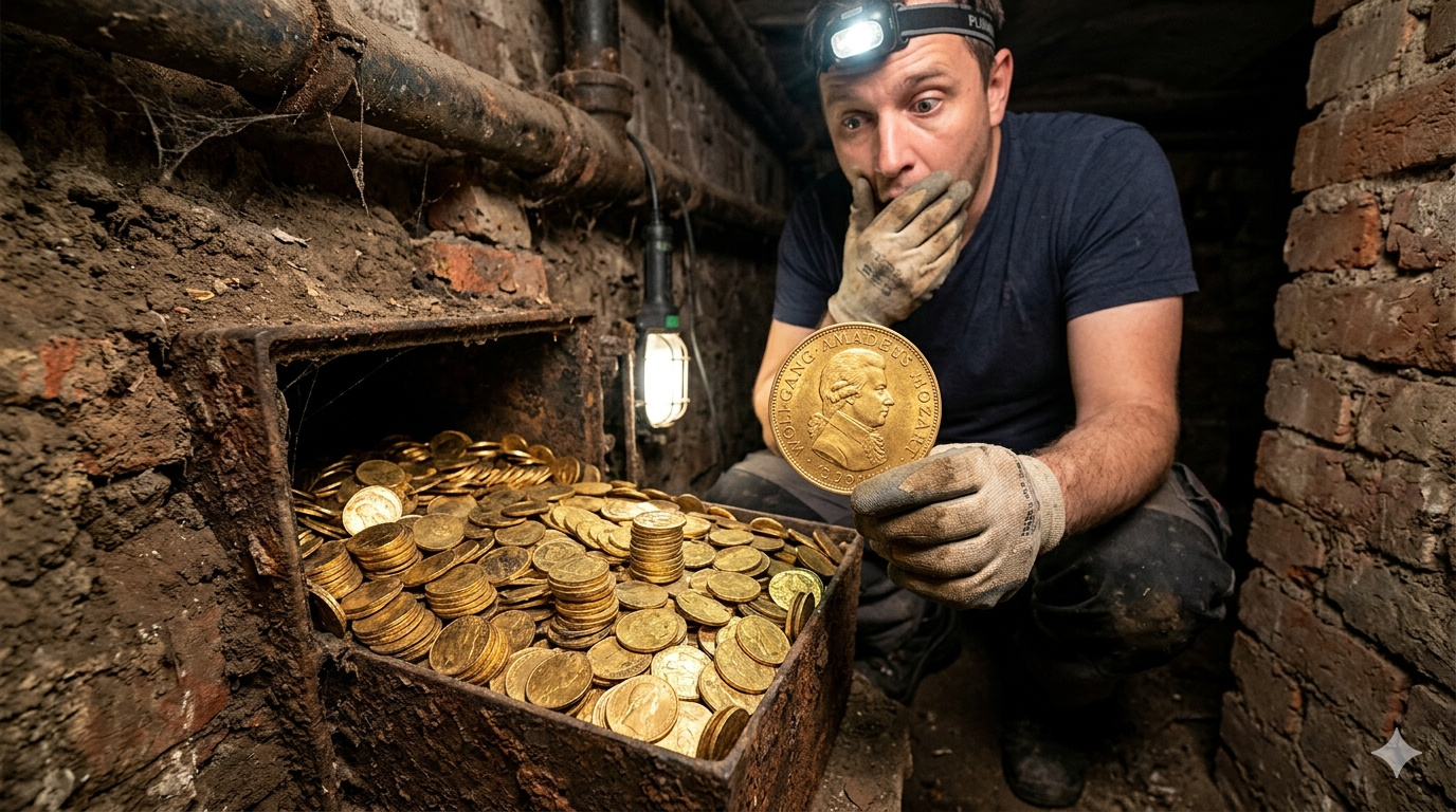
A forgotten cord on the floor of a basement in Vienna leads a plumber to a box containing 30 kilograms of gold with Mozart’s face, hidden before World War II. The treasure, worth 2.3 million euros, was just centimeters away from a worker who ignored the sign a day earlier.
-
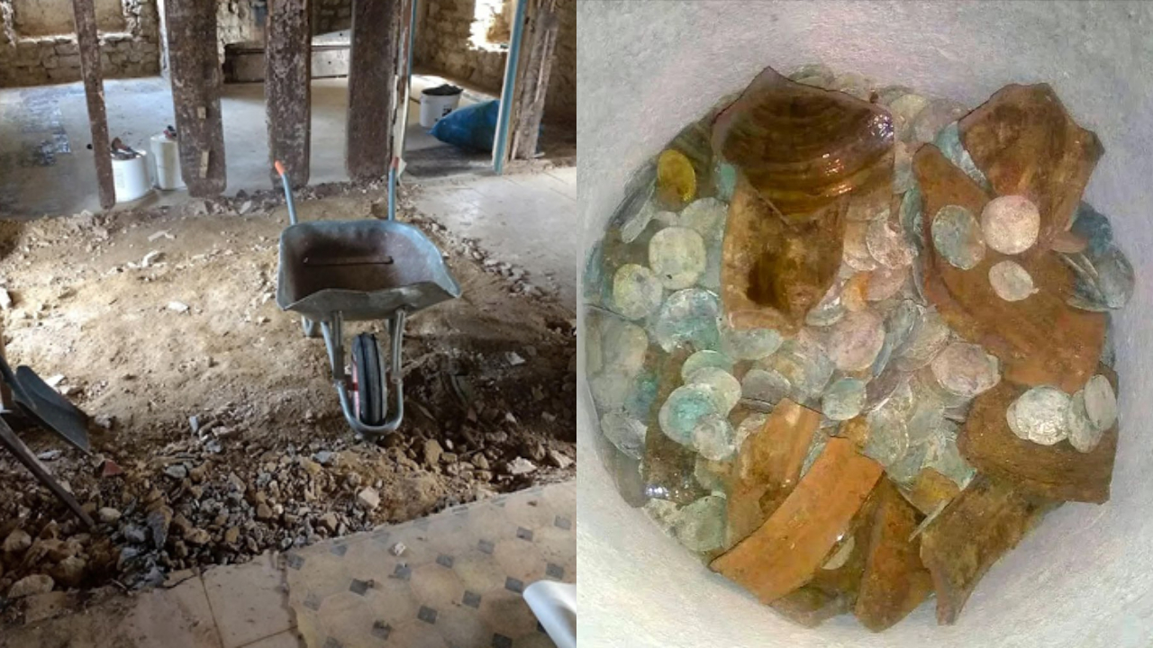
A couple buys an old chalet, breaks the kitchen floor for renovation, and finds over a thousand coins of gold and silver hidden since the English Civil War over 4 centuries ago.
-
Rigid bags with their days numbered: new trend prioritizes comfort in 2026.


The topic has been circulating strongly in international reports because the region is considered by researchers one of the most important areas for the study of tectonic dynamics.
National Geographic has already addressed the East African Rift as a zone where the continent is opening.
Nevertheless, the process is not interpreted by the scientific community as a sudden or visible rupture in the short term.
Measurements indicate a separation of a few centimeters per year, with geological effects accumulated over millions of years.
How Rifting Alters The Earth’s Crust
In practice, this movement produces typical signs of rifting.
The crust stretches, loses thickness in some areas, and begins to concentrate faults, earthquakes, volcanoes, elongated depressions, and large lakes.
In different sections of East Africa, the landscape already reflects this dynamic.
Deep valleys, steep escarpments, volcanic areas, and basins filled with water help characterize one of the most studied tectonic structures on the planet.
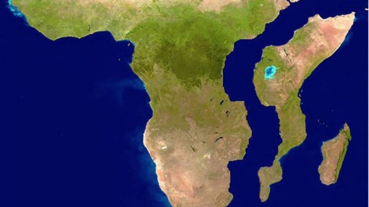
This strip extends from the Afar region in northeastern Ethiopia southward, reaching or influencing areas of countries such as Kenya, Tanzania, Uganda, Rwanda, Burundi, the Democratic Republic of the Congo, Zambia, Malawi, and Mozambique.
From a geological standpoint, it is not a single continuous fissure, but a broad system, with more active sectors and others less evident on the surface.
Even with these differences, the general pattern observed by scientists is one of progressive opening of a continental rift zone.
The Afar Region Concentrates Part of The Geological Activity
Afar receives special attention in geological studies because it brings together the meeting of three tectonic fronts: the East African Rift, the Red Sea, and the Gulf of Aden.
According to researchers, this configuration helps explain why the area is used as a reference in studies of continental separation.
Volcanic activity, the occurrence of earthquakes, and crust thinning make the region one of the most active in this system.
The mechanism associated with this transformation lies beneath the surface.
The Earth’s interior transfers heat and movement to the lithosphere, the rigid layer formed by the crust and the upper mantle.
In East Africa, tectonic forces extend this structure, opening faults and weakening the terrain.
Moreover, scientific studies indicate that the rise of hot material from the mantle in the Afar region may contribute to this weakening, stimulating volcanism and altering the crust over time.
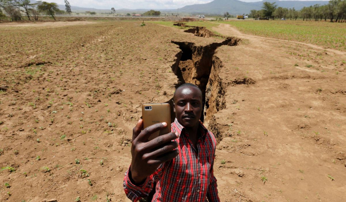
Fissures In The Soil And Impacts Already Observed In East Africa
This context helps explain why fissures and localized subsidence sometimes attract attention.
When a crack appears near roads or inhabited areas, the image is often associated with the idea that the continent is breaking apart rapidly.

According to specialists, these episodes represent superficial manifestations of an active tectonic system and, in some cases, can be aggravated by heavy rains, erosion, and soil instability.
Therefore, occurrences are treated as localized signs of a much broader geological process.
There are records, for example, of fissures and terrain deformations in Kenya and Ethiopia that affected roads and buildings.
These episodes are not presented by researchers as evidence of the immediate formation of an ocean but as signs that rifting produces concrete impacts in the present.
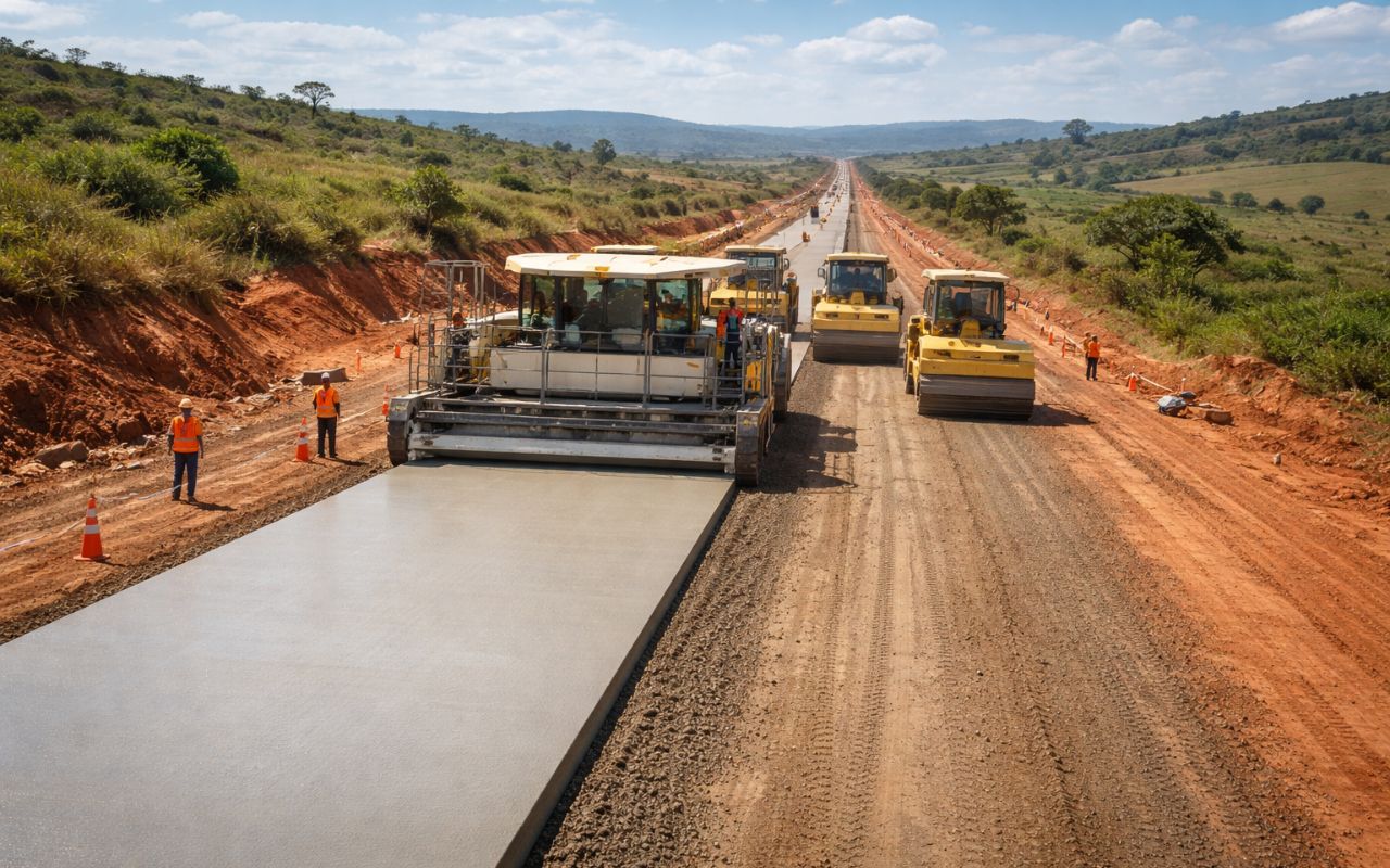
In urban and rural areas near active faults, geological monitoring is deemed relevant for construction, transportation, land planning, and damage reduction.
Geothermal Energy, Lakes, And Economic Impacts Of The Rift
In addition to effects on the soil, the Rift is also associated with economic and environmental activities.
Geothermal energy is one of the most cited examples.
Countries such as Kenya and Ethiopia already use the heat from the ground for electricity generation, precisely due to the tectonic characteristics of the region.
At the same time, large lakes connected to the system, such as Tanganyika and Malawi, play an important role in supply, fishing, tourism, and maintaining biodiversity.
A New Ocean In Africa Is A Long-Term Hypothesis
The possibility of a new ocean arising is related to the more advanced stage of this process.
According to the most accepted geological explanation, a continent subjected to prolonged extension may have its crust thinned, fractured, and lowered in some sectors.
If the opening continues for long enough, this separation can evolve into the formation of oceanic crust, with seawater entering and the development of a new basin.
In the African case, this scenario is treated by researchers as a long-term possibility, on a scale of millions of years.
It is at this point that specialists usually make a caveat about how the topic appears in the news and on social media.
The claim that Africa “will divide” may suggest an imminent event, when the central fact is different: the tectonic process is already underway, but at an extremely slow pace.
In scientific terms, the East African Rift is described as a long reorganization of the crust, accompanied by earthquakes, volcanoes, subsidence, and gradual separation between tectonic plates.
What Do Scientific Studies Say About The Division Of Africa?
Also, there is no “confirmation” in the scientific sense of an isolated announcement made by a magazine.
What exists, according to geological institutions and academic studies, is a broad set of evidence obtained from satellites, GPS measurements, seismic records, and field analyses.
Reports from National Geographic and other outlets have helped popularize the subject, but the foundation of this information lies in the scientific literature and monitoring conducted by researchers and specialized agencies.
Thus, the more precise formulation is that the eastern part of Africa is undergoing a real process of tectonic separation, already perceptible to varying degrees along the Rift.
The marks of this movement appear in the topography, volcanic activity, tremors, and soil deformations observed in several points of the region.
In a geological horizon, if the opening continues, part of this strip may be occupied by a new ocean.
Until then, the phenomenon continues to be monitored as a slow transformation of the Earth’s surface, recorded by scientific studies and observations made over decades.


-

Uma pessoa reagiu a isso.