 Portuguese
  English
  Spanish
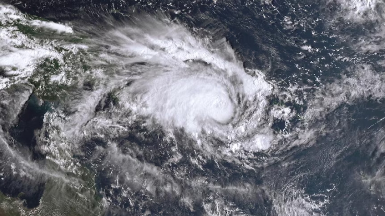
Cyclone Maila, classified as category 3, advances between Papua New Guinea and the Solomon Islands towards northern Queensland, with the risk of arriving stronger, spreading heavy rain, storm surge, destructive winds, and causing isolation in Cape York.
The Cyclone Maila is already affecting the far north of Australia and puts the Cape York region on alert. The system is moving over the sea with significant strength and may reach the coast even more intense in the coming days.
The impact is not limited to the point where the center of the cyclone touches the mainland. The combination of persistent rain, rough seas, and strong gusts increases the risk of disruptions in remote communities, affecting energy, transportation, and access.
Cape York enters the most sensitive route of advance
The area of greatest concern is in the far north of Queensland. The most likely projection indicates the approach of Cape York by the end of the week, precisely in a coastal strip more vulnerable to storm surge, heavy rain, and logistical interruptions.
-
Neither Coca-Cola nor Pepsi wins the dispute for the healthiest zero-calorie soda in Brazil, according to experts who analyzed the sodium and sweeteners of each brand.

-
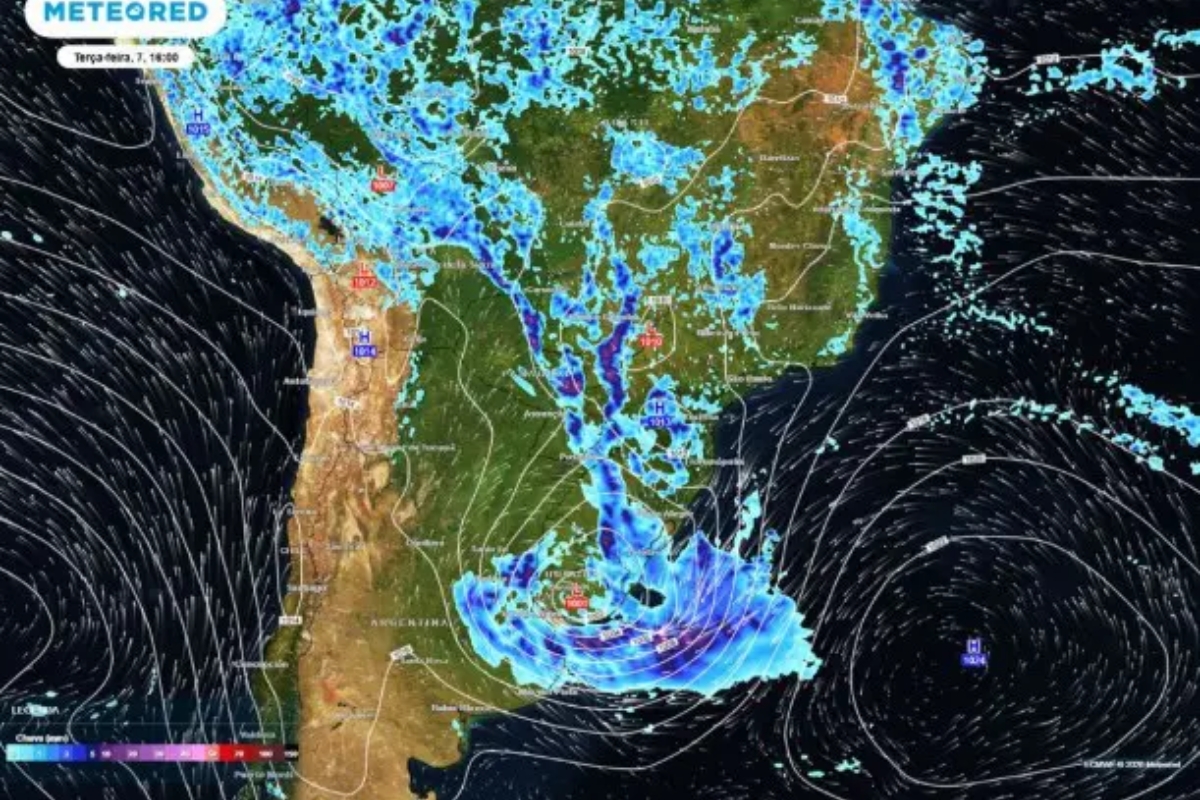
The Civil Defense issued a red alert amid the advance of the cold front in southern Brazil, where instability is increasing and the chance of problems is becoming more serious.
-
South Korea’s intelligence agency claims to have reliable information that Kim Jong-un’s teenage daughter has already been chosen as his successor and is being prepared to lead North Korea by driving tanks and shooting rifles.

-
At over 2,400 meters above sea level, Pico da Tripla Divisão is a rare mountain where a single drop of rain can take paths that lead to three different oceans.

This movement draws attention because the region includes remote sections and infrastructure more sensitive to severe events. When a system of this size slows down near the coast, the effects can last longer and affect a much larger area.

Force in the ocean increases risk before arrival
Even before any advance over the mainland, the system already shows the capacity to cause strong winds, rough seas, and heavy rainfall. This changes the reading of the scenario, as the danger begins before the possible direct contact with the coast.
Another important point is the slower movement. In such situations, severe weather can linger over the same region for several days, increasing the potential for flooding, structural damage, and temporary isolation.
Wide winds and slow loss of strength keep alert high
According to Bureau of Meteorology, the official meteorological service of the Australian government, Maila is expected to head towards the coast of Far North Queensland by the end of this week and may cross the coastline as a category 3 or 4 system.
The analyzed data also indicates a broad and persistent wind field. Even with a gradual loss of intensity along the trajectory, the cyclone remains organized enough to maintain dangerous conditions for several days over the sea and near the coast.
Category 4 poses greater damage risk in the region
If the system reaches category 4, the scenario becomes even more delicate. In this range, the risk of damage to roofs, fragile structures, and the electrical grid significantly increases, with a direct impact on residents of coastal areas and smaller communities.
Still, the category does not summarize the entire problem. Even if the winds lose strength later, the combination of heavy rain, storm surge, and saturated soil can continue to produce severe effects.
Rain, storm surge, and isolation are more concerning than the exact point of arrival
The focus now is not only on where the center of the cyclone will touch the coast. What really matters is how long the region will remain under the influence of rough seas, strong winds, and heavy precipitation, with repercussions on roads, navigation, and supply.
In remote areas, this type of evolution tends to increase the risk of temporary isolation. Minor damage to access roads and local routes is already enough to hinder response efforts and increase pressure on regional services.
The advance of Maila keeps northern Australia under a dangerous combination of wind, rain, and rough seas. With an approach expected in the coming days, the scenario demands heightened attention from those living in the most exposed areas.
If the most likely trajectory is confirmed, Cape York may feel the effects for an extended period, even with changes in intensity along the way. It is a situation that pressures the region.


Seja o primeiro a reagir!