 Português
  Inglês
  Espanhol
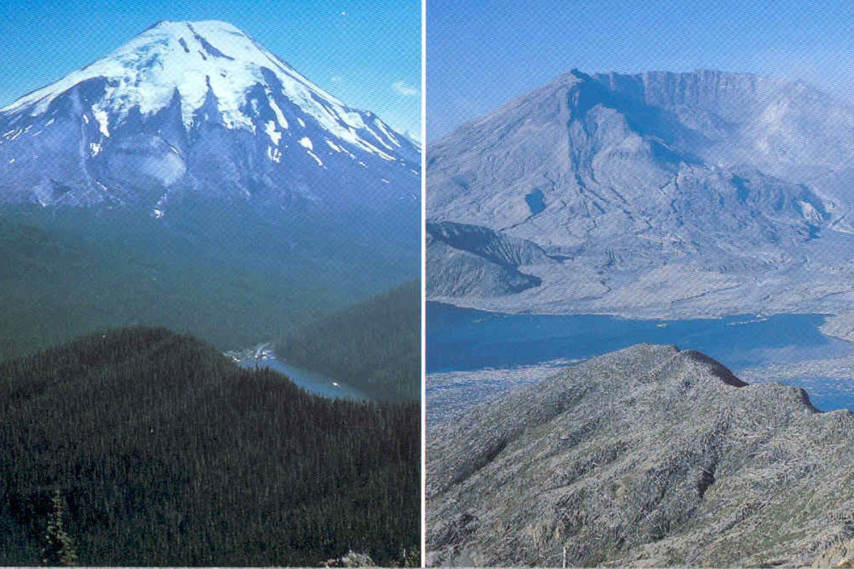
The Eruption of Mount St. Helens in 1980 Was Initiated by the Largest Landslide on Its North Face, an Event That Entered History and Redefined Science.
The eruption of St. Helens volcano on May 18, 1980, did not start with an explosion, but with the largest landslide in modern history. The eruption of St. Helens volcano in the state of Washington, USA, was preceded by the largest subaerial landslide ever recorded by humanity. The entire north face of the mountain simply collapsed, triggering a lateral explosion that traveled almost at the speed of sound.
This event, which claimed 57 lives and caused over one billion dollars in damages, was not just a tragedy. It was a unique scientific opportunity that transformed our understanding of volcanoes, geological hazards, and the incredible resilience of life, leaving a legacy that endures until 2025.
The Earthquakes and the “Bulge” That Deformed Mount St. Helens in 1980
The St. Helens eruption generated the largest subaerial landslide in recorded history
byu/sporadiclee inmegalophobiaARTIGO CONTINUA ABAIXOVeja também
The world’s first octopus farm wants to open in the Canary Islands and is already provoking an international reaction: the plan aims to produce 3,000 tons per year.

Drought may be creating stronger superbugs in the soil and helping antibiotic resistance reach hospitals, warns a study highlighting a problem that could grow alongside extreme weather.

The biggest scam in history: Napoleon’s France deceived the United States by selling them a territory that was Spanish.

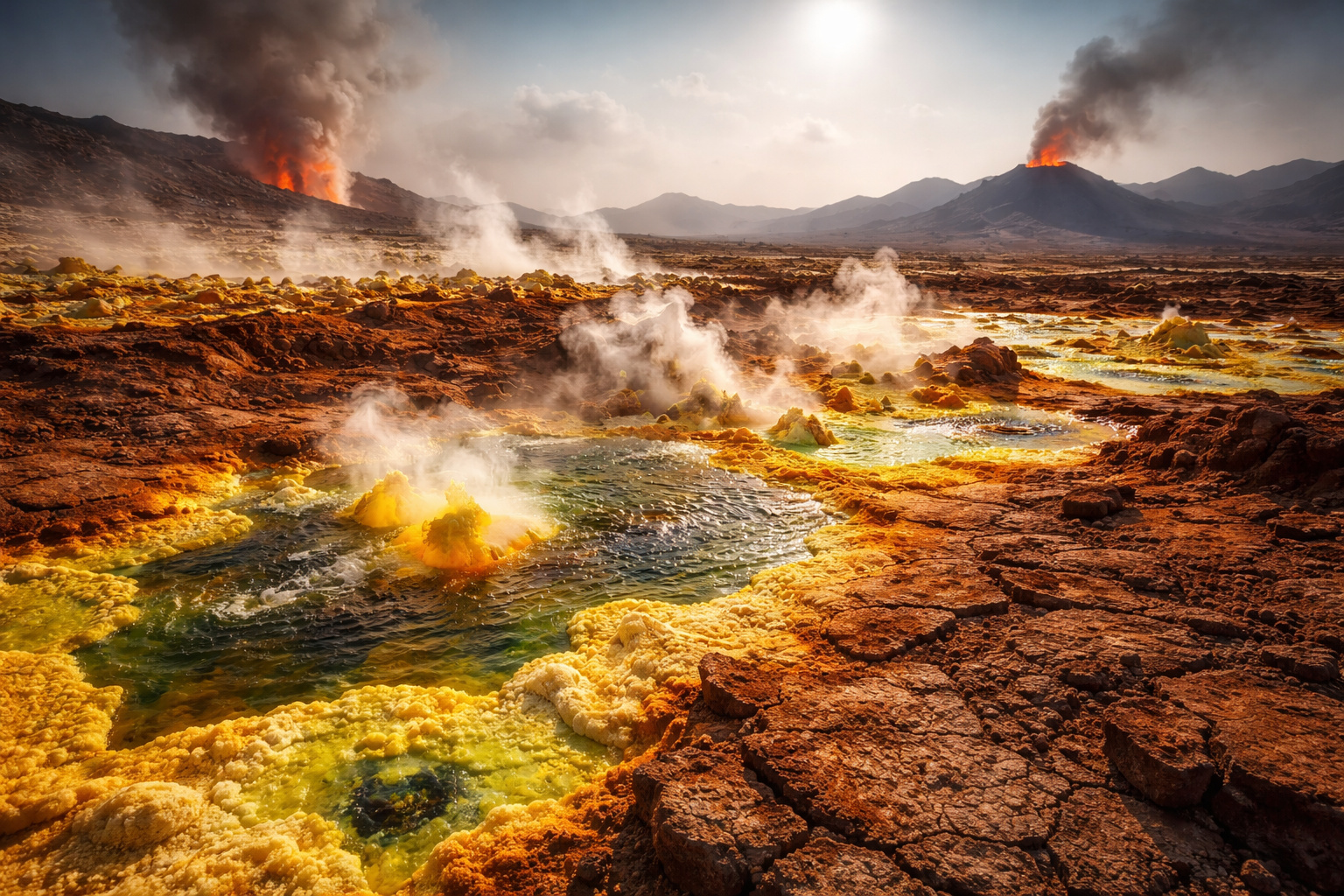
Why is the Danakil Desert so dangerous? It has unstable terrain and how extreme temperatures and toxic gases turn the region into one of the most hostile environments on Earth.
After 123 years of dormancy, Mount St. Helens began to awaken in March 1980. A series of earthquakes signaled that magma was moving beneath the volcano. Activity intensified, and on March 27, the first steam explosions occurred, opening a new crater at the summit.

The most alarming phenomenon, however, was the emergence of a gigantic “bulge” on the north face of the mountain. A viscous body of magma, called a cryptodome, rose and became trapped inside the volcano, pushing the slope outward at an impressive rate of 1.5 to 2.5 meters per day. By May 17, the day before the eruption, the visibly swollen north flank had already shifted more than 140 meters. The mountain was no longer just a volcano; it had become a geological ticking time bomb, ready to detonate.
May 18, 1980: The Timeline of the Disaster That Started with a Magnitude 5.1 Earthquake
The catastrophe began at 8:32 a.m. on a Sunday. A magnitude 5.1 earthquake, with an epicenter directly beneath the bulge, was the final trigger. In the following seconds, the entire north face of the mountain disintegrated.
What followed was a cascade of events:
The Landslide: the unstable slope collapsed in the form of a colossal avalanche of rock, ice, and soil.
The Lateral Explosion: the mountain’s collapse acted like the cork of a champagne bottle, instantly releasing the pressure of the magma. An explosion of pulverized rock, ash, and superheated gas burst sideways at a velocity reaching almost 1,100 km/h.
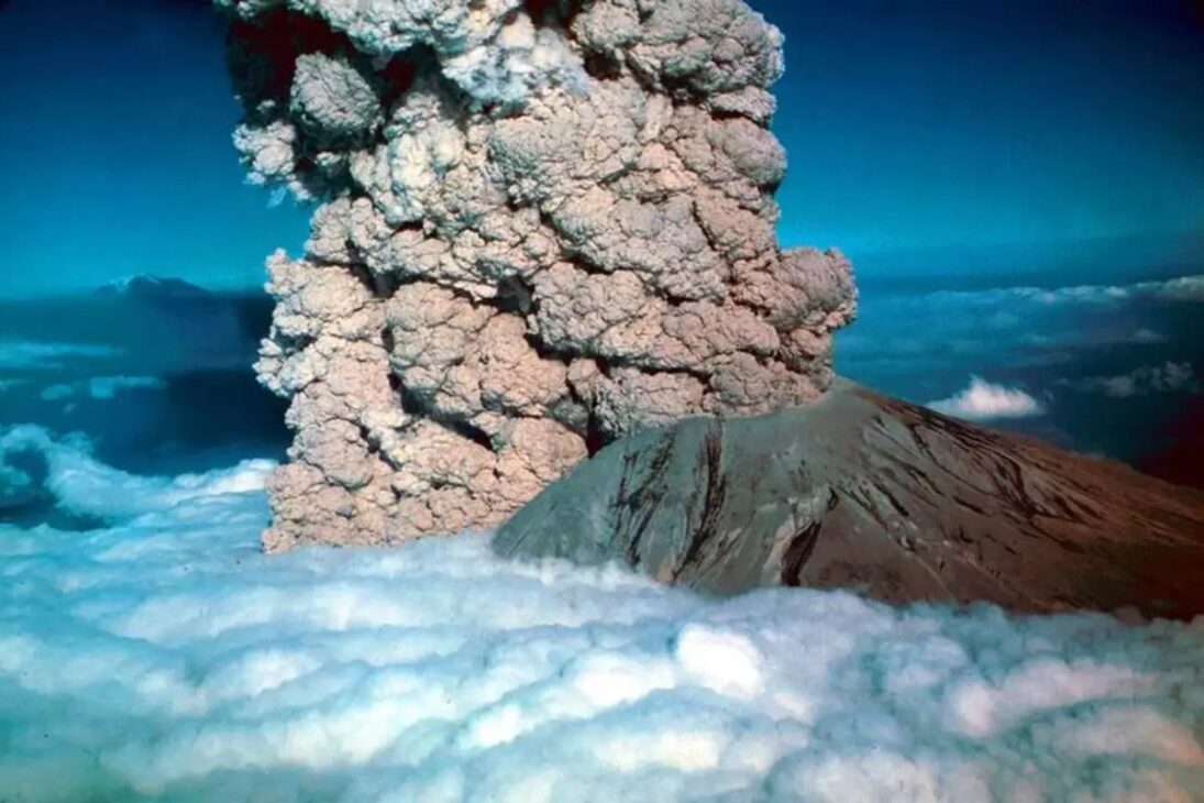
The Vertical Eruption: almost simultaneously, a column of ash and gas rose more than 24 kilometers high, plunging cities hundreds of kilometers away into darkness.
Debris Flows (Lahars): the heat from the eruption melted the snow and glaciers on the mountain, creating volcanic mudflows that surged down the rivers, destroying everything in their path.
The Scale of the Largest Subaerial Landslide in History
The claim that the St. Helens event was the largest subaerial landslide in recorded history is factually correct. It is crucial to note the distinction between “recorded history” (events observed and measured by humans) and geological history. Although there are larger prehistoric landslides, such as Heart Mountain, St. Helens is the largest ever documented.
The numbers are impressive:
Volume: the avalanche moved 2.8 cubic kilometers of rock, ice, and soil. To put this in perspective, this volume would be enough to bury the entire island of Manhattan under a layer of 40 meters of debris.
Area Covered: the avalanche covered an area of approximately 60 km².
Depth: the valley of the North Fork Toutle River was buried under a debris layer with an average depth of 46 meters.
The Aftermath of the Eruption: The Tragic Human Cost and the Destruction of the Landscape
The eruption claimed the lives of 57 people, including geologist David A. Johnston, who was at an observation post and managed to transmit the message “Vancouver! Vancouver! It’s now!” before being hit by the explosion.
The economic cost exceeded US$ 1.1 billion in values at the time. More than 200 homes, 47 bridges, and hundreds of kilometers of roads and railways were destroyed. The local timber industry was decimated. Ecologically, an area of 600 km² was transformed into a gray desert.
How the St. Helens Tragedy Revolutionized the Study of Volcanoes Worldwide
Although it was a tragedy, the eruption of St. Helens became the most well-documented event in the history of volcanology. The disaster provided the first modern and detailed look at the danger of flank collapses and lateral explosions, transforming a phenomenon that was once merely theoretical into a terrible and understandable reality.
The eruption catalyzed a revolution in monitoring volcanoes, accelerating the use of technologies such as high-precision GPS and gas monitoring, which are now standard worldwide. The knowledge gained from St. Helens helped create disaster response programs that have already saved countless lives. The devastated area was transformed into the Mount St. Helens National Volcanic Monument in 1982, a natural laboratory that, to the surprise of scientists, showed a recovery of life much faster than expected, rewriting theories of ecology.


-

Uma pessoa reagiu a isso.