 Portuguese
  English
  Spanish
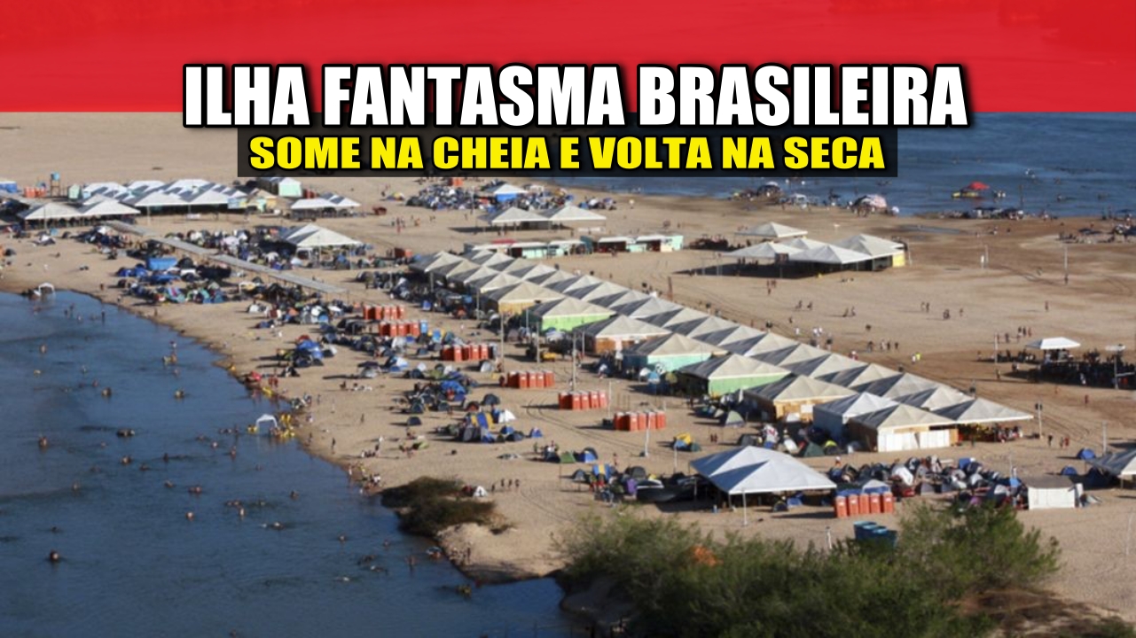
The Ghost Island in Bananal, A Thermometer of Real Brazil: Fresh Water, Cerrado, Amazon, Indigenous Peoples and the Constant Dispute Between Preserving and Destroying
The largest river island in the world is located in Brazil, and no, this is not a tourist guide exaggeration. Bananal Island is the size of a small country, formed by the embrace of two giant rivers, and it has become a real stage for a dispute over conservation, indigenous territories, and environmental pressure.
In 2025, it came back into the spotlight because the government tightened the clamp on deforestation, fires, and illegal occupations.
The result? A place that was already impressive in itself has now also become a symbol of what the country wants (or doesn’t want) for its green future.
-
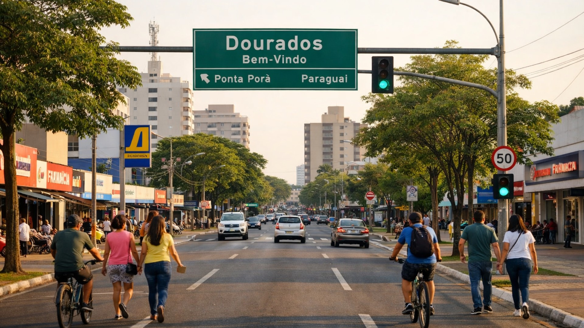
Brazilian city neighboring Paraguay becomes a ‘magnet’ for people seeking quality of life and high standards with exceptional growth and commutes of up to 15 minutes.
-
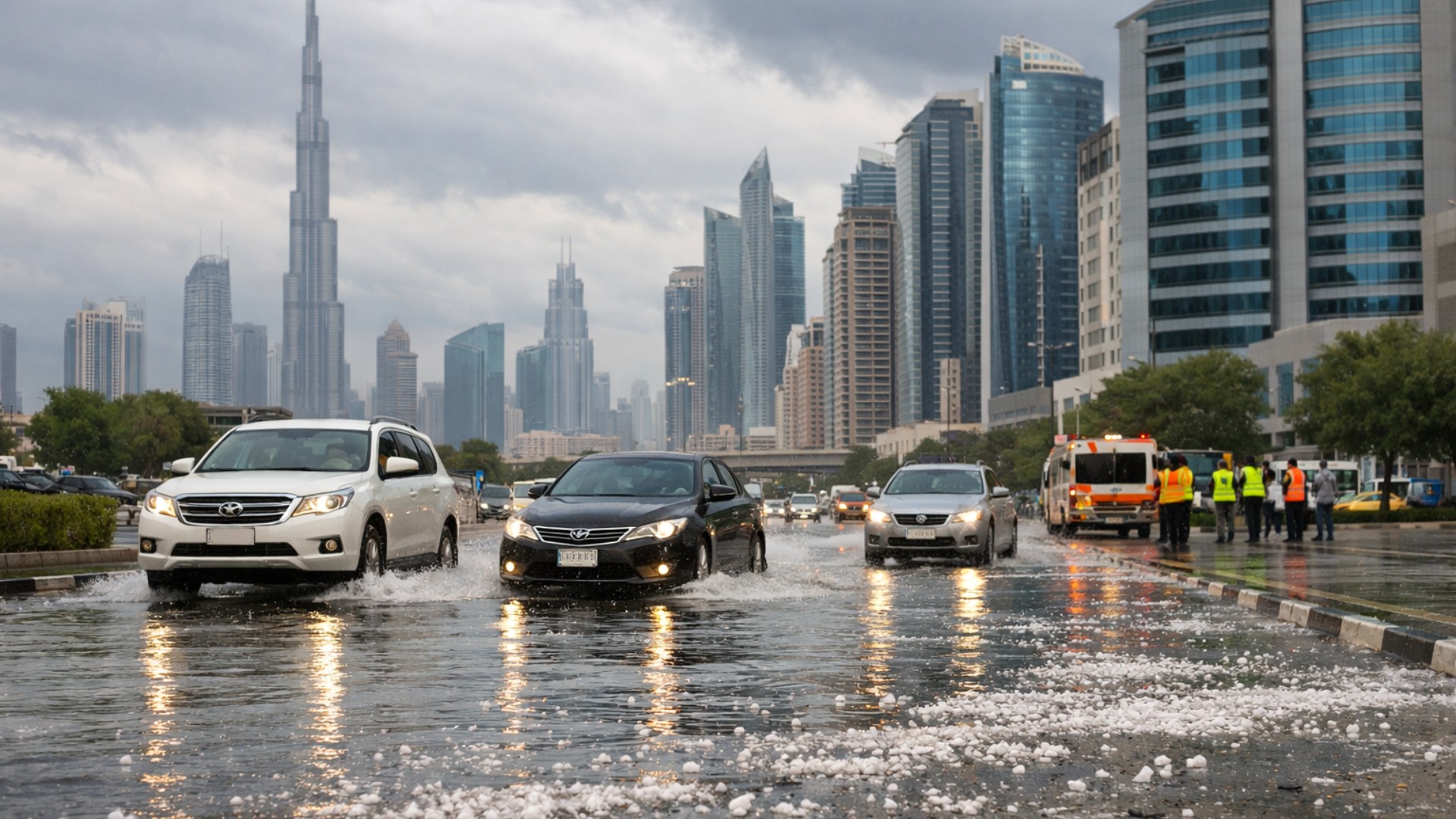
A rare storm transformed part of the Gulf into an unlikely scene of hail, extreme rain, and tornado risk in the middle of the desert, with volumes that exceeded the annual average in a single day.
-
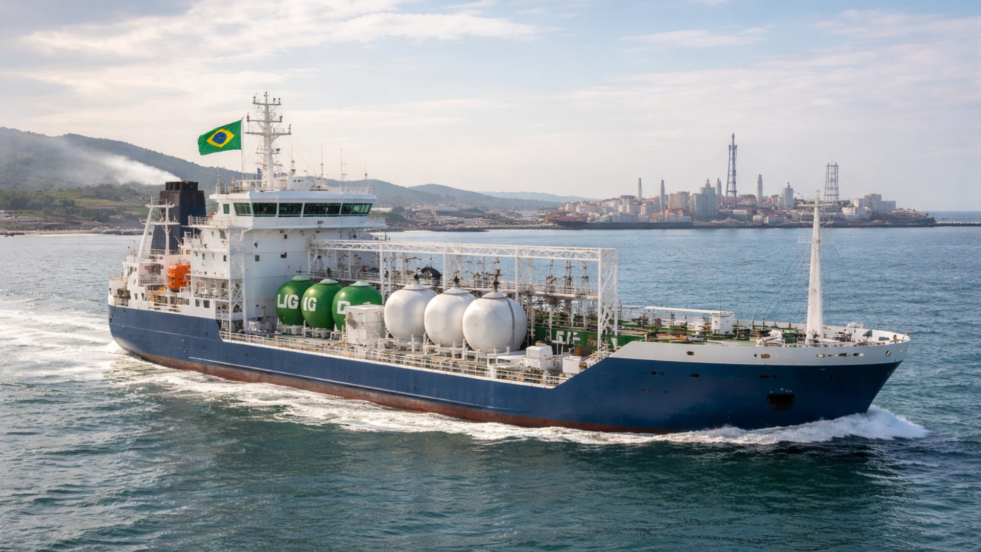
Brazil catches the world’s attention with ships powered by ethanol and biodiesel that have lower emissions, an unprecedented certification with advantages in chartering, and a revolution in cabotage.
-
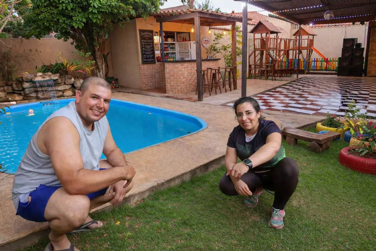
A couple who only has Sundays free has built a hand-dug pool, a hamburger joint, a dance hall, and a playground in their own home without hiring a mason, and even with breaks due to accidents and the pandemic, the work has never truly stopped.

Where Bananal Island Is Located and How It “Appears” on the Map
Bananal Island is in the southwest of Tocantins, but many people say it is “between Tocantins and Mato Grosso.” It makes sense: although the island is 100% Tocantinense, its western side borders Mato Grosso via the Araguaia River, and the south/east is close to Goiás via the Javaés River.
The coolest detail is how it forms. The Araguaia River arrives huge and divides into two branches:
- the west branch continues being the Araguaia;
- the east branch becomes the Javaés.
Up ahead, they meet again. This “double diversion” closes the outline and creates an island surrounded by fresh water on all sides. This is what defines a river island.
To better visualize this geography, it’s worth checking out the official tourism material from the state about the Bananal Island.
Why It Is the Largest River Island in the World
Bananal is recognized by institutions and geography materials as the largest river island in the world.
The size is astonishing:
- many current sources use around 20,000 km²;
- others, more traditional, point to approximately 25,000 km².
This difference is not an error. The island is flat and goes through a strong cycle of flooding and drought. Between January and March, the Araguaia rises and floods huge areas; during the dry season, everything reappears. Depending on the time and the method of measurement, the area changes.
And to have an idea of its size without needing a ruler: recent reports remind us that Bananal is more than three times larger than the Federal District.
An Island That Disappears in the Flood and Returns in the Drought
The dynamics of Bananal are almost a magic trick of nature. In the rainy season, large parts become submerged and turn into flooded fields, temporary lagoons, and wetlands.
In the dry period, the land emerges again and the scenario completely changes. This cycle maintains soil fertility and supports entire ecological chains.
Not by chance, the island was included in the international list of priority wetlands of the Ramsar Convention. This status is given to places that help regulate water, climate, and wildlife on a global scale.
Biodiversity at the Meeting Point of Biomes
The word biodiversity here is no embellishment. The island is in a transition zone between theCerrado and the Amazon—and this creates a rare mosaic of habitats. It’s as if two different ecological Brazils share the same backyard, with typical species from both biomes coexisting side by side.
Recent studies continue to point out Bananal as a key area for conservation precisely because it acts as a “natural corridor” between biomes, with highly varied fauna and flora.
Heavy Protection: National Park, UNESCO, and Brazilian Reserves
Bananal has a long history of protection. Since 1959, it has been considered a Brazilian environmental reserve. On the northern part of the island lies the National Park of Araguaia, created in the same year and currently managed by ICMBio.
In 1993, the international stamp came: the region became part of the UNESCO Biosphere Reserve, a title that recognizes strategic areas for maintaining life and testing sustainable conservation models. UNESCO itself defines Biosphere Reserves as territories that combine environmental protection and traditional human presence.
To contextualize this seal, the page of UNESCO on Biosphere Reserves explains why these places are considered vital for the planet.
Living Indigenous Territory in the Heart of Brazil
A large part of the island is indigenous land. Peoples from the Iny trunk live there, especially the Karajá and Javaé, in addition to Avá-Canoeiro, Tapirapé, Tuxá, and other groups registered in the region. There are officially demarcated indigenous lands and areas that overlap with the National Park, forming one of the largest conservation complexes in Tocantins.
The indigenous presence is not a footnote: it organizes the territory, protects traditional knowledge, and sustains a continuous relationship with the rivers and the forest.
If you want a cultural dive, the Museum of Indigenous Peoples of Bananal Island gathers collections and narratives from Javaé and Karajá about life in the river archipelago.
2025 Ignited the Alert: Deforestation, Fire, and Illegal Occupation
In recent months, Bananal has returned to the center of the news for a concerning reason. Ibama initiated Operation Araguaia Park after analyses pointed to advances in illegal deforestation and arson in indigenous areas overlapping with the island. Dozens of irregular occupants were notified in municipalities such as Formoso do Araguaia, Lagoa da Confusão, Pium, and Sandolândia.
In parallel, coordinated actions between ICMBio, Prevfogo/Ibama, and Funai began using prescribed burns and helicopter monitoring to reduce the risk of fire in the National Park and in the Inãwébohona Indigenous Land.
And the pressure is not just from fire. Recent judicial decisions upheld the removal of cattle and the demolition of illegal structures within the park, reinforcing that the area is for complete protection.
In addition to the Bananal Island being a geographical record, this giant is also a thermometer of real Brazil: fresh water, Cerrado, Amazon, indigenous peoples, and the constant dispute between preserving and destroying.
When a place with the UNESCO seal, Ramsar status, and unique biodiversity becomes the target of illegal occupation and fires, the question is not “what happens far away?”, but rather “what does this say about us?”.
Did you enjoy learning about this? Then leave a comment: did you already know about this hidden giant of Brazil? And if you found the story important, share the article.


-

-

-

-

7 pessoas reagiram a isso.