 Portuguese
  English
  Spanish
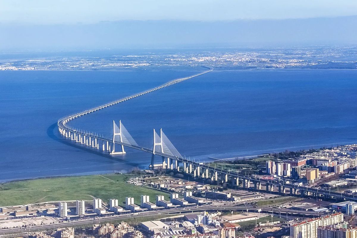


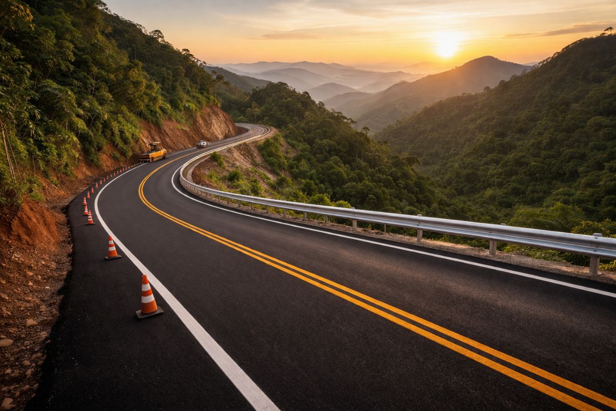
Inaugurated in 1998, the largest bridge in Europe connects Lisbon to the South Bank over 17 kilometers across the Tagus, redistributing road traffic, reducing congestion, strengthening regional logistics, attracting tourism, and consolidating new urban and industrial investments on both banks, altering historical routes and daily patterns
In March 1998, Lisbon inaugurated the Vasco da Gama Bridge and gained, all at once, a new connection over the Tagus and the largest bridge in Europe, with approximately 17 kilometers connecting the capital to the South Bank and creating an alternative route to the congested April 25 Bridge.
More than two decades later, in 2025, the structure has established itself as an essential corridor for daily commutes, freight circulation, and access to new urban and industrial areas, transforming an engineering project into a central piece of the redesign of mobility and the economy in Greater Lisbon.
How the Largest Bridge in Europe Reshaped Mobility in Lisbon

Since the start of operations, the Vasco da Gama Bridge has been designed to alleviate the heavy traffic on the other road crossing over the Tagus.
-
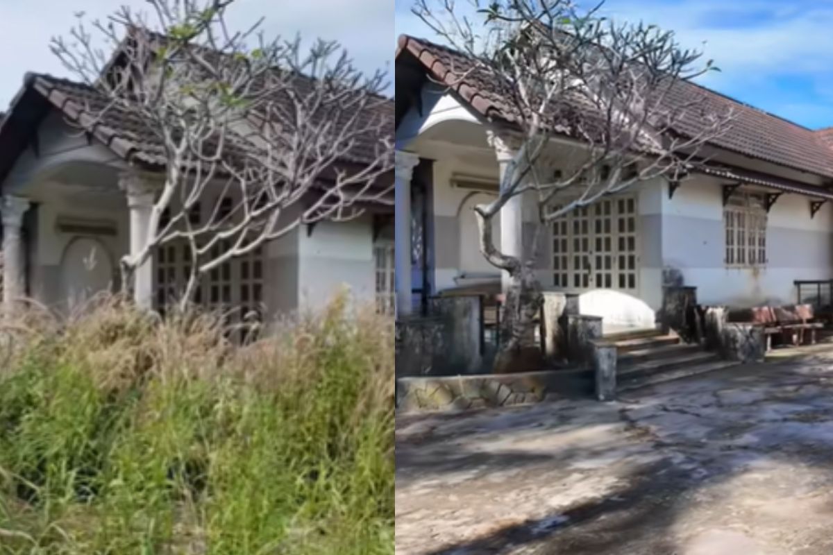
Abandoned house for 15 years disappears in the woods, shocks owner with unrecognizable scenery and is reborn in an intense transformation after almost 90 hours of work in just 10 days.
-
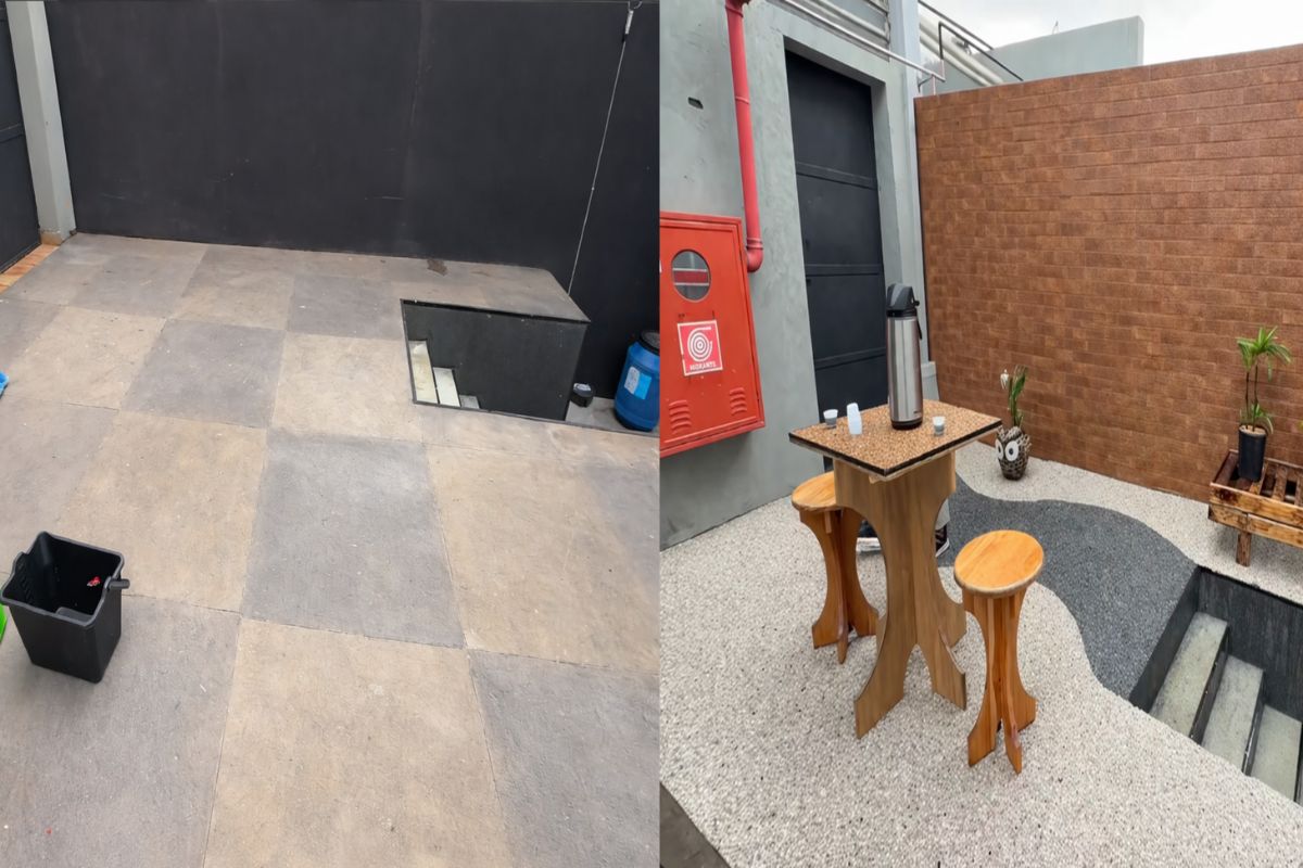
In just three hours, a natural stone floor transforms the entrance of the house with an organic effect, immediate drainage, and a sophisticated non-slip finish that doesn’t puddle water, dries quickly, and impresses with the final result.
-
‘Interlocking brick’ made of earth arrives in the construction industry with cost reductions of up to 40% on the project.

-
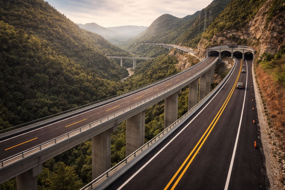
Espírito Santo will receive the largest engineering project in its history with the duplication of BR 262, which will have 50 viaducts, 28 bridges, and 2-kilometer tunnels cutting through the most challenging mountainous region of the entire state.

By offering a more direct route between the north and east of the country and the South Bank, the largest bridge in Europe has been absorbing a significant portion of long-distance traffic and metropolitan commutes.
This redistribution of vehicles has reduced pressure on traditional access points, decreased travel times, and allowed for greater predictability in car and truck journeys.
In practice, the bridge has reorganized routes, shifted circulation axes, and expanded the range of alternatives for those crossing the Tagus estuary daily.
The integration with other national highways has turned the crossing into a logistics hub, bringing Lisbon closer to industrial hubs and distribution centers located on the South Bank and in inland regions, without relying exclusively on older corridors.
Structural Features Supporting the Structure
With approximately 17 kilometers of total length, the Vasco da Gama Bridge is a combination of viaduct sections and cable-stayed segments over the estuary, designed to ensure safety in navigation, heavy road traffic, and severe weather events.
The deck, with about 30 meters in width, accommodates multiple lanes in each direction and specific signage for dynamic lane management.
The foundations were sized for complex estuarine soils and to withstand strong winds and potential earthquakes, combining large volumes of concrete and metal structures.
Permanent monitoring systems track traffic, structural conditions, and unexpected events, allowing for quick interventions and fine management of vehicle flow.
This set of solutions positions the largest bridge in Europe as an example of a structure designed to operate continuously with high loads, reducing operational risks and ensuring near-total availability throughout the year.
Logistical, Economic, and Tourist Impacts in the Tagus Area
The entry into service of the Vasco da Gama Bridge profoundly changed the economic geography of the region.
By shortening distances between Lisbon, Montijo, Alcochete, and other municipalities on the South Bank, the largest bridge in Europe made areas previously considered peripheral more competitive for the installation of industrial parks, logistics centers, and new real estate developments.
Distribution companies, construction, wholesale trade, and services began to use the crossing as a preferred route to reduce delivery times and operational costs.
The improved access has favored more efficient supply chains and stimulated investments in areas previously underutilized from a production standpoint.
In tourism, the bridge has also become an indirect attraction.
The quick connection between Lisbon and cities on the opposite bank facilitated the movement of visitors, diversified itineraries, and expanded the reach of hotels, restaurants, and tour operators that now explore both the capital and the Tagus estuary area.
Environmental Protection in the Tagus Estuary Natural Park
Because it crosses an area classified as a Natural Park, the construction and operation of the Vasco da Gama Bridge required specific environmental mitigation measures.
The estuary is an area of high ecological sensitivity, hosting migratory birds and aquatic ecosystems that depend on continuous care.
Impact studies, fauna and flora monitoring programs, and the definition of protection zones were incorporated into the project.
Foundation techniques and sediment containment were chosen to limit changes in water quality and underwater habitats.
The bridge’s lighting was designed with attention to light pollution, reducing interference with species that utilize the estuary at different stages of their life cycle.
This set of measures seeks to align the role of the largest bridge in Europe in mobility with the need to preserve one of Portugal’s most important natural environments, in a coexistence that requires ongoing adjustments and constant oversight.
Symbol of Progress and Luso-Brazilian Connection
Over more than 25 years, the Vasco da Gama Bridge has come to be seen not only as infrastructure but as a symbol of a phase of modernization of Portuguese transport networks.
The impact on mobility, logistics, and tourism has turned the structure into a landmark of long-term planning and territorial integration around Lisbon.
The chosen name reinforces this symbolic dimension.
By honoring the navigator Vasco da Gama, the bridge evokes the history of great navigations and resonates with the Brazilian club that bears the same name, affectionately linking Portugal and Brazil.
In practice, the largest bridge in Europe has become a physical emblem of connection between maritime past, road present, and shared cultural ties between the two countries.
If you had the opportunity to cross the largest bridge in Europe today, what would catch your attention the most: the engineering, the landscape over the Tagus, or the impact it has had on the lives of those who travel through Lisbon every day?


O texto está correto; já a interpretação do texto da maioria dos comentaristas precisa melhorar; e muito! É só ler até o final antes de comentarem, equivocadamente, que o jornalista/redator não fez faculdade e outras besteiras do tipo: “Ao homenagear o navegador Vasco da Gama, a ponte evoca a história das grandes navegações e encontra ‘eco no clube brasileiro’ que leva a mesma designação, aproximando afetivamente Portugal e Brasil.” ENCONTRA ECO!!!
Não é o nome de um time brasileiro não… Vasco da Gama foi um importante e renomado navegador Português no final dos anos 1400 início dos anos 1500… por isso esse nome nessa ponte é não por causa do time Vasco da Gama… o time Vaco da Gama que também tem o mone desse navegador Português.
****, a reportagem diz que leva o mesmo nome,de um grande time, não que é por em homenagem a um grande time brasileiro. Saber Interpretar um texto é tudo…
Não é o nome de um time brasileiro não… Vasco da Gama foi um importante e renomado navegador Português em início dos anos 1500… por isso esse nome nessa ponte é não por causa do time Vasco da Gama… o time Vaco da Gama que também tem o mone desse navegador Português.
O nome da ponte é o nome de um grande navegador do seculo XV, o time carioca também leva o nome do navegador.