 Portuguese
  English
  Spanish
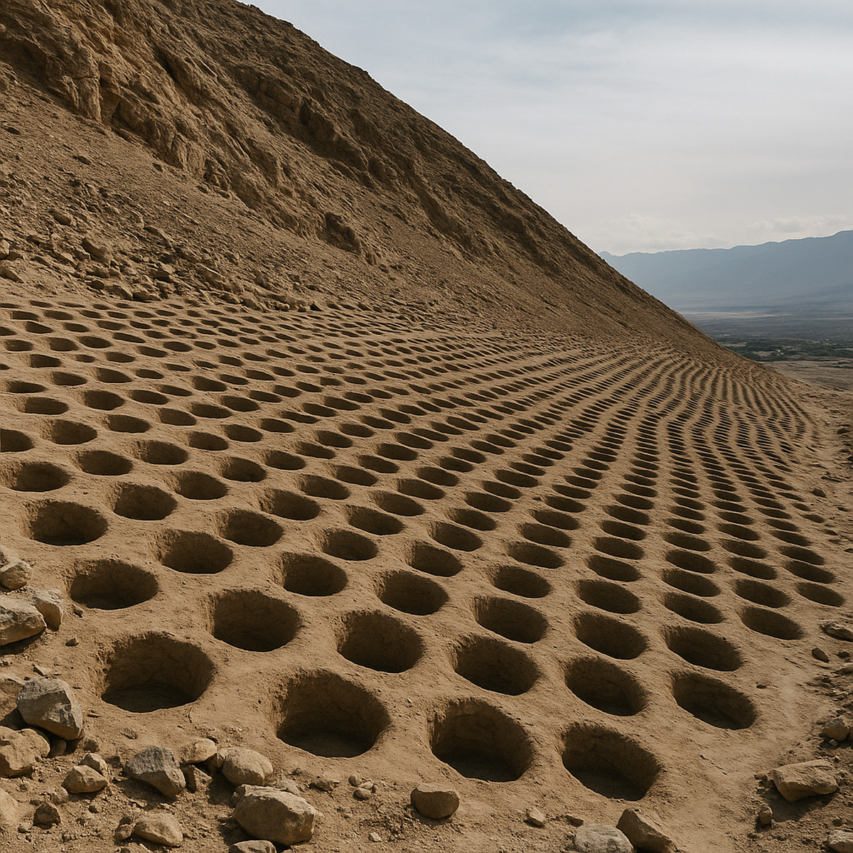
New Study Reveals How Thousands of Cavities Formed a Pre-Inca Market That Evolved Into an Administrative Record
Mount Sierpe, in the Pisco Valley, in southern Peru, gained new interpretation after a study published in 2024 in the journal Antiquity, which analyzed more than 5,000 aligned cavities. The site, studied since the early 20th century, has returned to debate because new drone mappings revealed previously ignored patterns. The researchers, led by Jacob Bongers, also used microscopic analyses of sediments to identify the function of the structures.
The study thus showed that the site may have functioned as a marketplace around the year 1000, when the region was part of the Kingdom of Chincha. The cavities, measuring between 1 and 2 meters wide, occupy 1.5 km of the slope and form separate blocks. The researchers identified repetitive series of seven or eight holes, indicating social planning and community organization.
Numerical Patterns and Indications of Record Inspired by Quipu
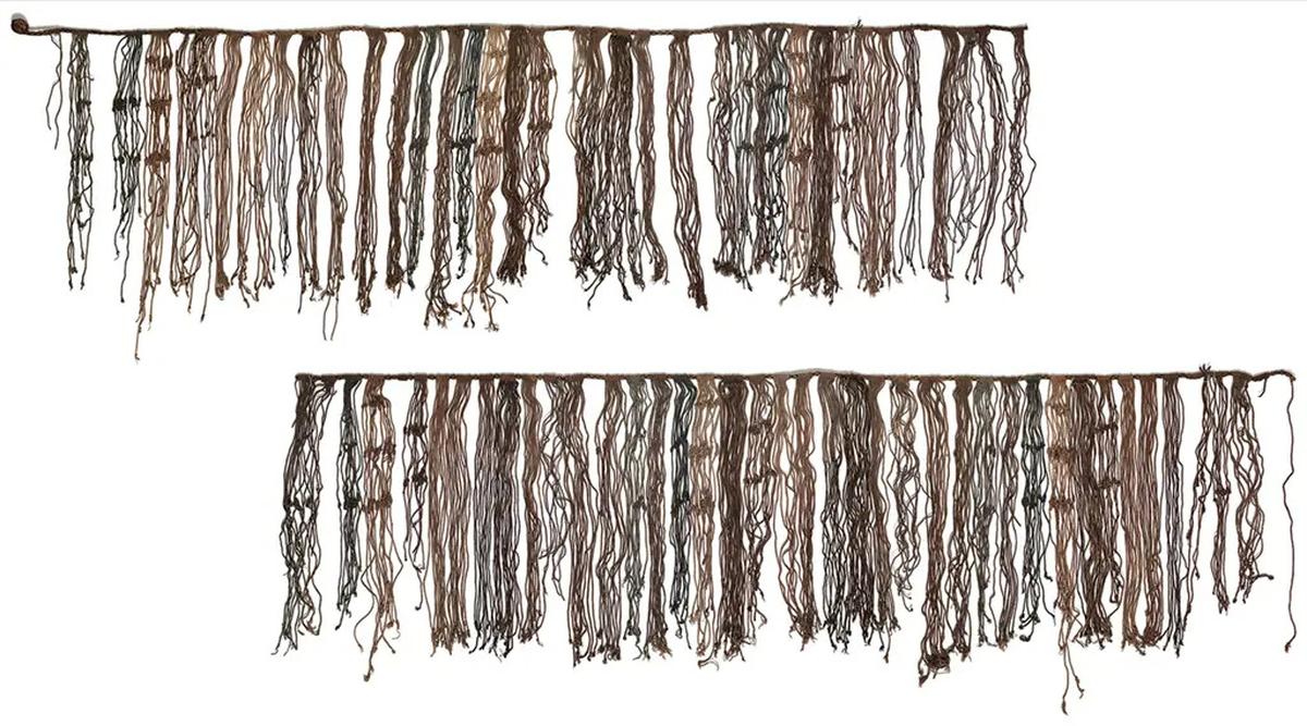
The analyses revealed corn pollen and reeds fibers, plants used to produce traditional baskets. These traces, according to Bongers, suggest the transport of goods in organized bundles. The geometry of the set, on the other hand, resembles the quipu, the Inca system that used cords and knots to record administrative data.
-
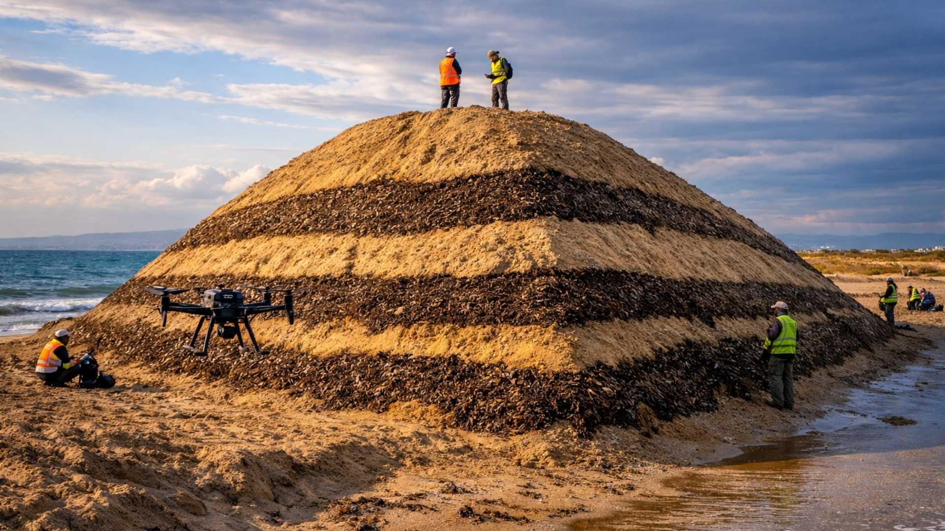
Spain surprises the world by erecting 62 artificial dunes, mixing sand with natural remains of posidonia, and causing the structure to lose only 1.4% of its volume in 1 year.
-
With 16 Bulava missiles, improvements in acoustic stealth, and a design focused on silent patrols, Russia’s nuclear submarine was born to ensure Moscow’s invisible retaliation and has become one of the pillars of its maritime strength.

-
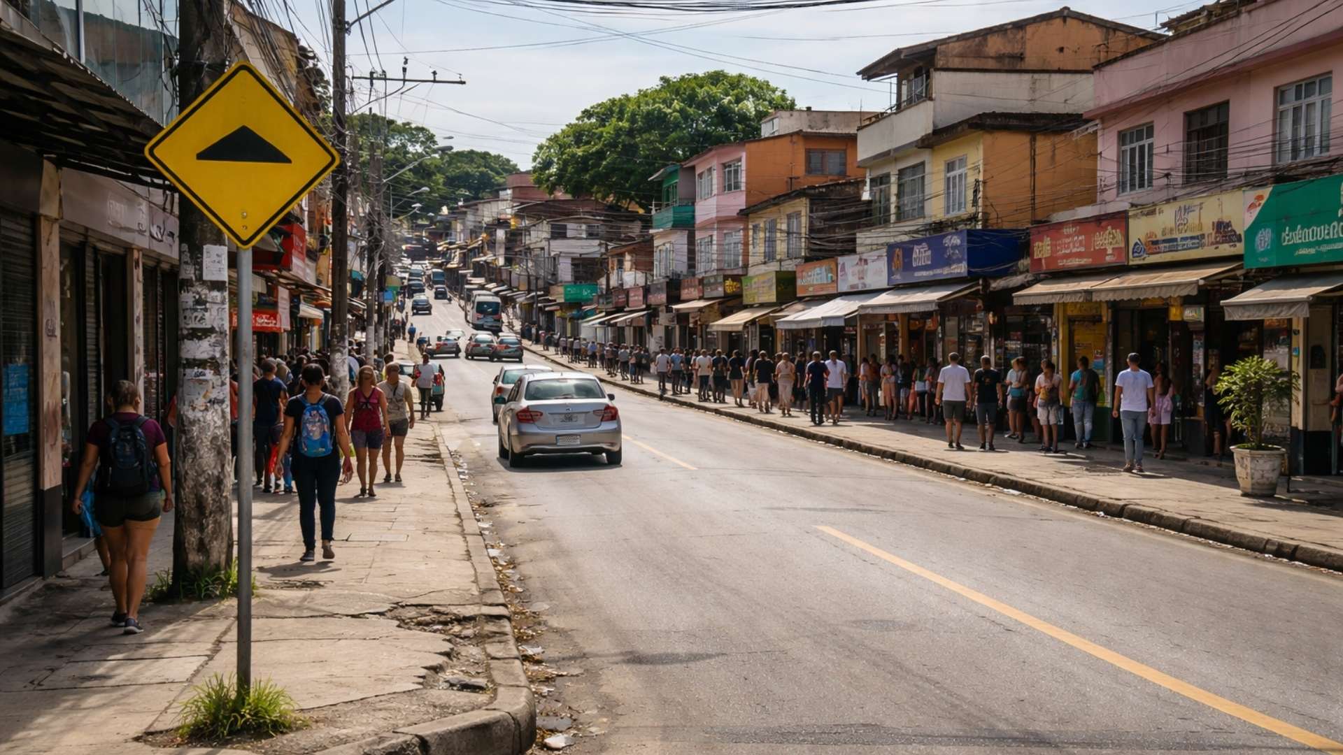
‘Populous’ city in Rio among the worst in Brazil in national ranking and exposes silent development crisis.
-
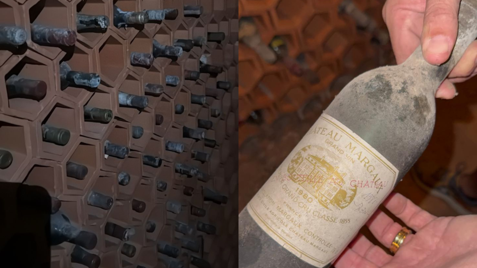
Couple buys house in the South Zone of São Paulo, opens a hidden door in the garage, and finds a secret wine cellar with dozens of old wines forgotten since the 1970s.

This similarity, as reported by the team, strengthens when compared to a quipu found in the region, now preserved in the Ethnological Museum of Berlin. The hypothesis, therefore, suggests that Mount Sierpe functioned as a “landscape quipu”, used to control deliveries and organize tributes during the Inca Empire, especially after the 15th century.
Location in Trading Zone and Ancient Commercial Connections
Mount Sierpe, located in the ecological zone called chaupiyunga, lies between mountain and coast, an area historically used by various peoples. The region thus served as a meeting point for farmers, fishermen, and llama caravans that traveled between different trade routes.
The strategic position, according to the study, favors the idea that the site centralized the exchange of goods. The blocks may have represented groups responsible for delivering specific products, following administrative models known in Andean societies. This reading thus reinforces the commercial and distributive function of the structure.
Rejection of Ancient Hypotheses and New Steps in Research
The researchers, in reviewing previous studies, rejected hypotheses related to military functions, mining, or funerary rituals, as no traces of such types were identified. The arid climate, in turn, makes any agricultural use unfeasible, eliminating this possibility.
The team, coordinated by Bongers, will continue with new excavations and radiocarbon dating to determine the functional evolution of the site more accurately. The archaeologist even highlighted that Mount Sierpe represents a unique case of the use of the landscape as an administrative tool, a common practice among various Andean peoples.
Relevant Highlights of the Archaeological Site
• More than 5,000 organized cavities along the slope.
• Repetitive numerical patterns suggesting administrative use.
• Traces of corn and reeds associated with the transport of goods.
• Direct similarity with Inca quipus.
• Strategic location in the chaupiyunga zone.
• Confirmed administrative use after the 15th century.
• Rejection of fanciful theories based on solid evidence.
The study thus broadens the understanding of Andean organizational forms and shows how ancient societies structured sophisticated tools to manage territories.
Given this, how many other structures hide equally impressive social technologies?


-

2 pessoas reagiram a isso.