 Portuguese
  English
  Spanish
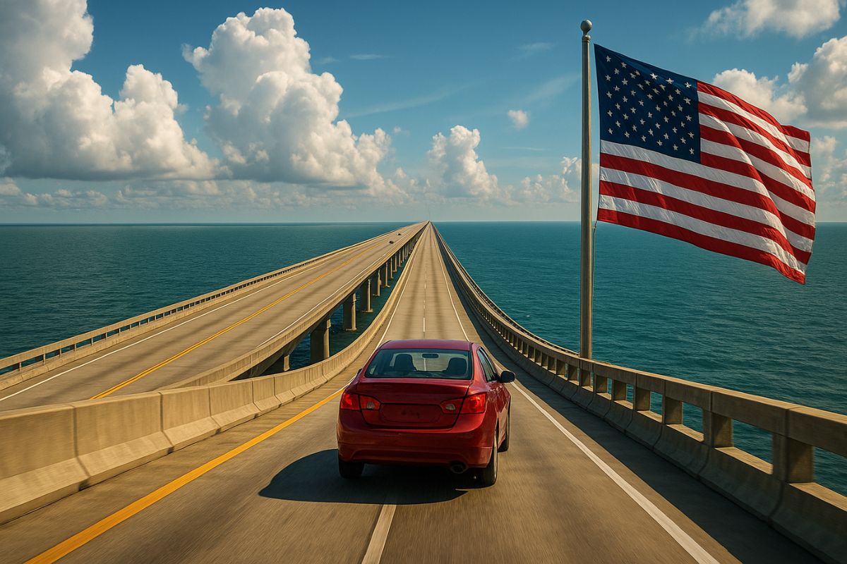


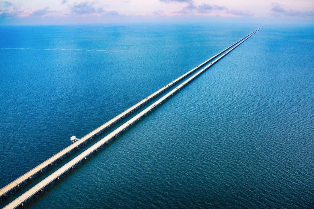
The American Bridge Lake Pontchartrain Causeway, in Louisiana, spans 38.4 km in two parallel structures and gives the sensation of an “endless highway” over the water.
The American bridge connecting the New Orleans area (Metairie) to Mandeville crosses the entire Lake Pontchartrain and offers a unique experience: for almost 13 km, no solid ground is visible. On foggy days, sky and water blend, and the driver seems to float on an infinite straightaway.
Constructed to support the growth around the lake, the Causeway consists of two parallel bridges (1956 and 1969), supported by over 9,500 concrete pillars. Designed for hurricanes and intense swells, the structure withstood Katrina and quickly resumed operations after repairs.
Where It Is and Why It Impresses
Located in Louisiana, the Lake Pontchartrain Causeway connects Metairie, to the south, to Mandeville, in the so-called “Northshore”.
-
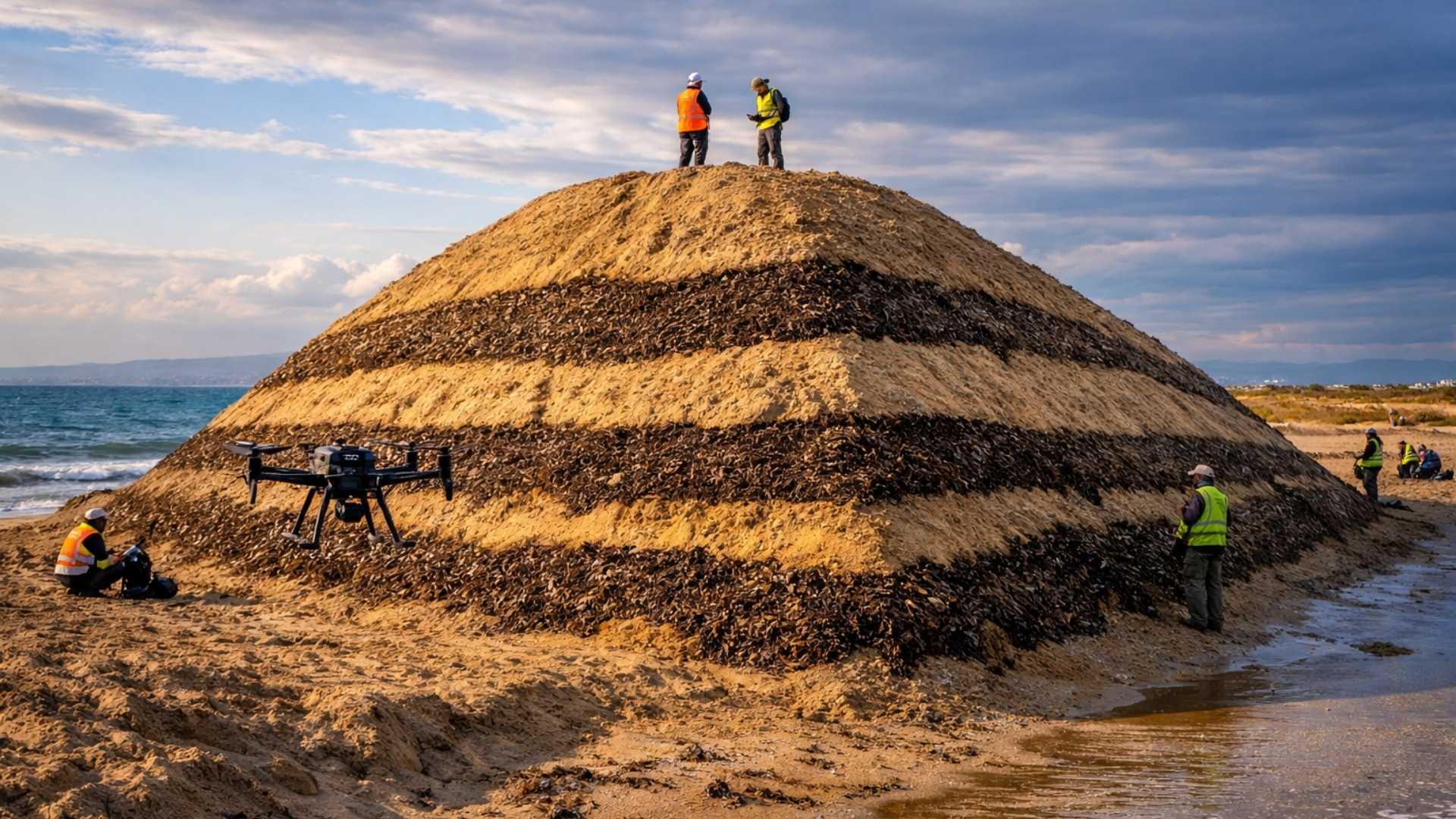
Spain surprises the world by erecting 62 artificial dunes, mixing sand with natural remains of posidonia, and causing the structure to lose only 1.4% of its volume in 1 year.
-
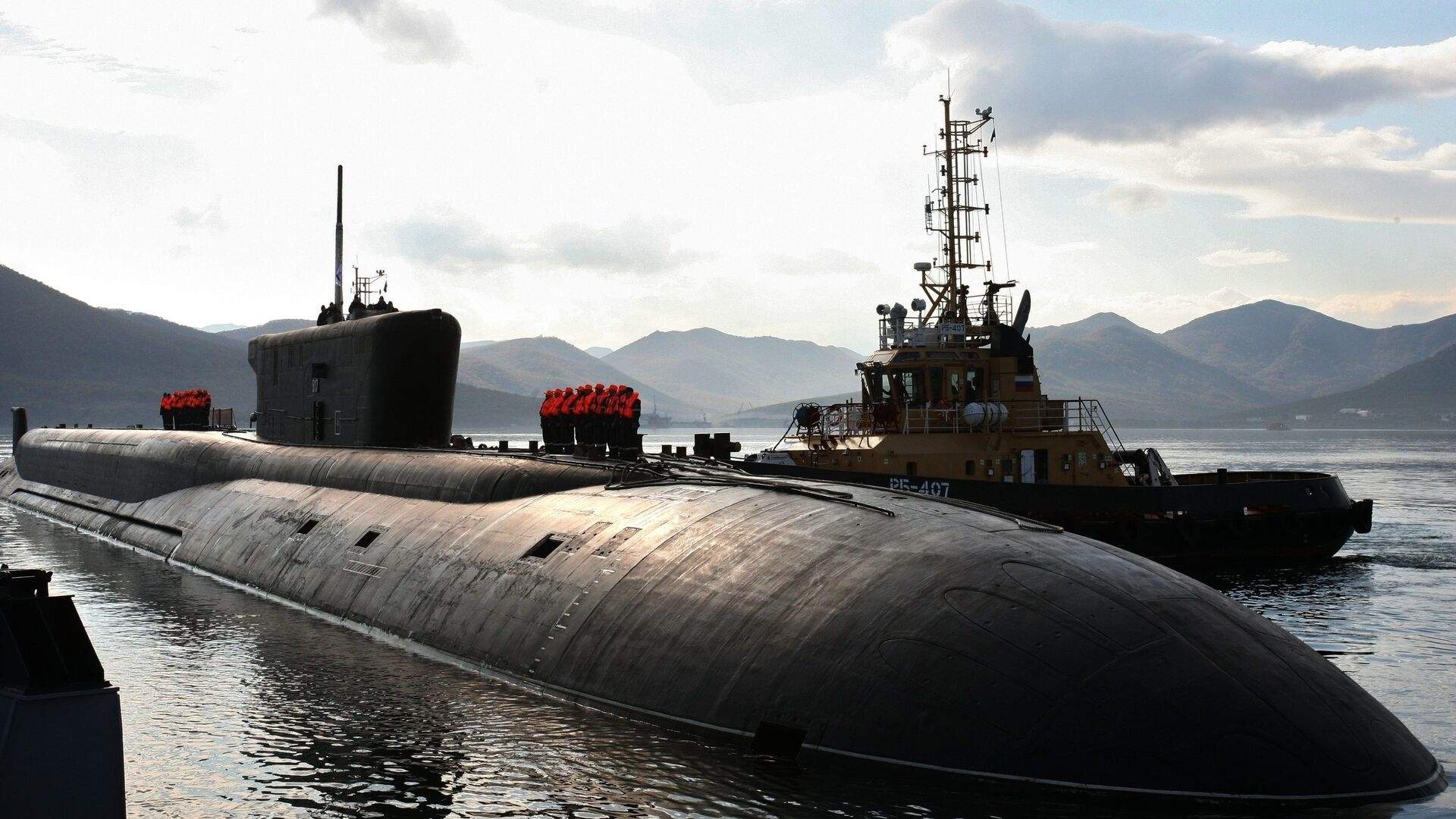
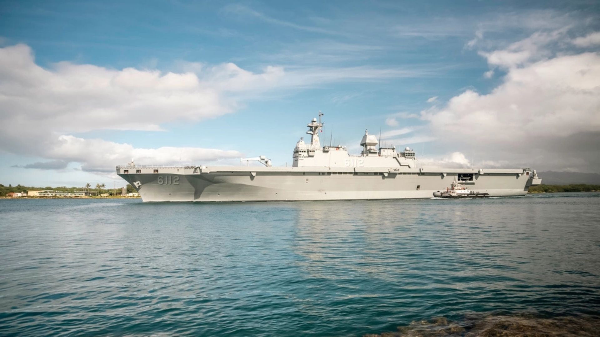
With 16 Bulava missiles, improvements in acoustic stealth, and a design focused on silent patrols, Russia’s nuclear submarine was born to ensure Moscow’s invisible retaliation and has become one of the pillars of its maritime strength.
-
‘Populous’ city in Rio among the worst in Brazil in national ranking and exposes silent development crisis.
-
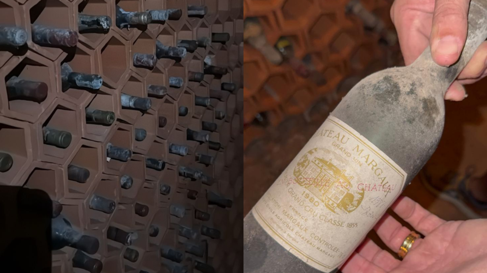
Couple buys house in the South Zone of São Paulo, opens a hidden door in the garage, and finds a secret wine cellar with dozens of old wines forgotten since the 1970s.

Under normal conditions, the crossing takes about 30 to 40 minutes, during which the driver drives over the lake without any terrestrial reference points.
It’s a minimalist landscape: water on the left, water on the right, and a flat horizon.
This sensation is not just aesthetic: the absence of visual references can cause disorientation in some drivers.
For this reason, management maintains patrol support along the route, including vehicles positioned in the central section to assist those who feel panic, dizziness, or need an emergency stop.
Dimensions and Engineering
The Causeway totals 38.4 km and maintains approximately 4.9 m of height over the water surface for most of the route.
The twin lanes run parallel, separated by about 24 meters, with turnaround points and technical crossings at strategic sections.
The first bridge, inaugurated in 1956, was followed by a second, opened in 1969, to handle the increasing flow in opposite directions.
The modular design with precast piles simplified assembly, distributed loads, and increased resilience against wave impacts and vessels.
Operation, Toll, and Safety Rules
In the direction Metairie → Mandeville, the passage is free. On the return, Mandeville → Metairie, there is a toll, with a discount for those using an electronic tag.
The revenue funds maintenance and improvements, from signage to barriers and technical shoulders.
The speed limit is 45 mph (about 72 km/h), reduced at the toll plaza to 25 mph. There are no scenic viewpoints or leisure areas: the stopping bays are for emergencies only, which helps maintain continuous flow and reduce risks on days with poor visibility.
Resistance to Extreme Events and Incident History
The structure withstood Hurricane Katrina (2005). Sections were torn off, but the foundations remained intact; restoration occurred in a short period, evidencing the correctness of the structural design and response plan.
In 2019–2020, a package of improvements worth tens of millions of dollars added shoulders and reinforcements to enhance safety.
The history records a notable accident in 1964, when barges struck the bridge and a bus fell into the lake, with fatalities.
Since then, monitoring protocols, pillar protection, and emergency response have been strengthened, as well as traffic and weather surveillance.
Driving Psychology and Driver Support
Driving so many kilometers over water can provoke anxiety in those afraid of bridges or “roads without edges”.
The administration maintains patrols and assistance to accompany vehicles that report nervousness, discomfort, or difficulty staying in their lane, a resource that effectively saves lives and prevents collisions.
Foggy days require extra caution. The phenomenon “erases” the horizon and intensifies the feeling of an aquatic tunnel.
In these scenarios, signage, lane marking, and electronic monitoring guide the driver and deter risky maneuvers.
Regional Impact and Environment
The American bridge has driven the expansion of the Northshore: Mandeville and other cities have grown by becoming the “backyard” of New Orleans for living and working.
Thousands of daily commutes cross the lake, shortening routes and integrating the metropolitan economy, from commerce to services.
From an environmental perspective, it’s a sensitive estuary. Pillars, traffic, and construction require constant monitoring to mitigate effects on water quality and fish and bird habitats.
Maintenance and oversight programs seek to balance economic vitality with the protection of the lake.
Practical Tips for Crossing
Before entering the American bridge, check fuel, lights, and weather conditions. In case of fog, increase the distance from the vehicle ahead and maintain a constant speed.
Remember: there are no tourist stopping points, and the bays are for emergencies only.
If you are apprehensive about long crossings over water, plan your timing (avoid storms), use the right lane, and if necessary, request escort from the patrol.
It’s better to slow down than risk a sudden maneuver in an environment with distant edges.
The Lake Pontchartrain Causeway is the American bridge that transforms an ordinary commute into a hypnotic crossing over the lake a feat of engineering, logistics, and safety. Now we want to hear from you: would you dare to drive for 40 minutes without seeing solid ground?
On foggy days, would you prefer to postpone the trip or cross with patrol support? And the toll that funds maintenance, do you think it’s fair for this type of structure? Leave your opinion in the comments real accounts help those planning their first crossing.


Great article, thank you for sharing these insights! I’ve tested many methods for building backlinks, and what really worked for me was using AI-powered automation. With us, we can scale link building in a safe and efficient way. It’s amazing to see how much time this saves compared to manual outreach.