 Portuguese
  English
  Spanish
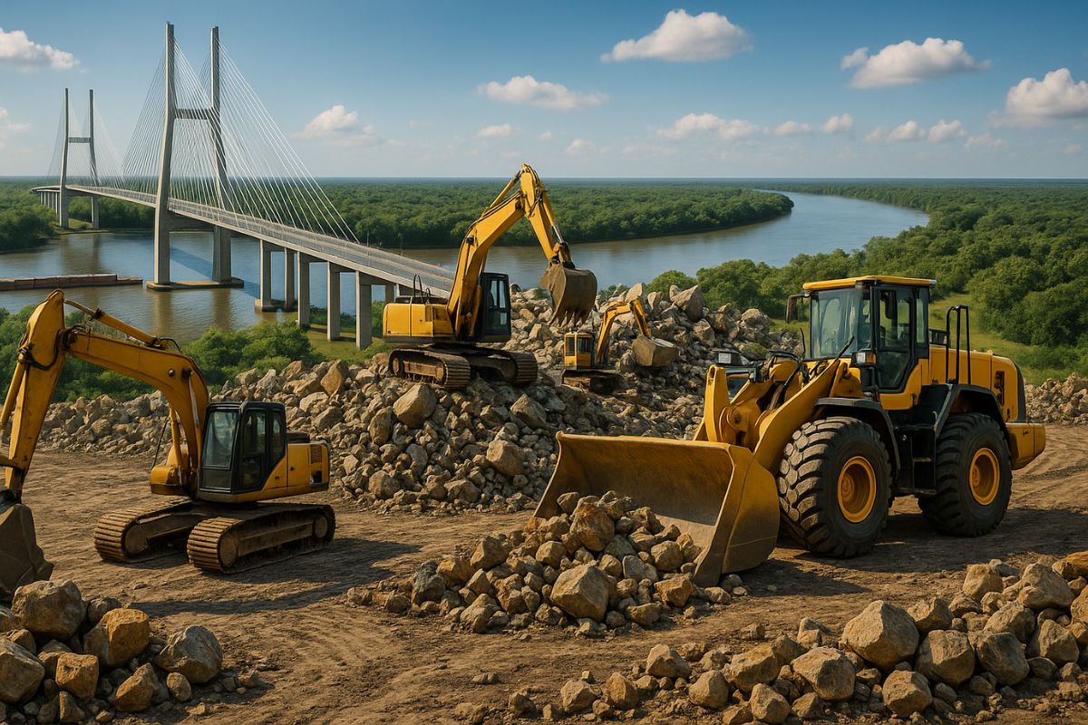
The Structure Linking Porto Murtinho (MS) to Carmelo Peralta (PY) is in the Final Construction Phase and Promises to Reduce the Distance to Asian Markets by Over 9,000 km, Strengthening the Export of the Brazilian Harvest.
One of the most important infrastructure projects in South America is in its final phase. The bridge that will connect Brazil to the Pacific is the key piece for a road corridor that promises to transform the export logistics of Brazilian agribusiness, shortening distances and reducing transportation costs to the massive Asian markets.
Located over the Paraguay River, the structure is the missing link to enable the so-called Bioceanic Route. With an inauguration scheduled for the first half of 2026, the bridge is not just an engineering project; it is a strategic initiative that will reshape trade routes on the continent and strengthen Brazil’s position in the global arena.
What Is the Bridge That Will Connect Brazil to the Pacific and Where Is It Located?
The Bioceanic Bridge is an imposing cable-stayed structure being built over the Paraguay River, connecting the cities of Porto Murtinho in Mato Grosso do Sul and Carmelo Peralta in Paraguay. The project is the fundamental piece for enabling the bioceanic road corridor.
-
He buried 1,200 old tires in the walls to build his own self-sufficient house in the mountains with glass bottles, rainwater, and an integrated greenhouse.

-
The aircraft carrier HMS Prince of Wales is heading to the Arctic with F-35 fighters, helicopters, and warships in an operation that repositions the United Kingdom at the forefront of NATO in 2026.
-
He found the largest gold shipwreck in the United States with tons of the precious metal at a depth of 2,400 meters in the Atlantic and recovered a treasure that no one thought possible to reach, but 500 gold coins disappeared without explanation.
-
The United States has a serious problem with its F-35s: China is already producing fighters at a pace that exceeds American capacity and could manufacture up to 300 aircraft per year before the end of the decade, shifting the global military balance.

With a total length of 1,294 meters and a main navigation span of 350 meters, the bridge has two main pillars reaching 130 meters in height, equivalent to a building over 40 stories tall.
The investment in the structure is R$ 472.4 million, fully financed by the Brazilian federal government.
Although the initial expectation was for completion in 2025, the schedule has been updated, and the inauguration is expected to occur between February and May of 2026.
The Path to the Pacific: The Route That Crosses 4 Countries in South America

The bridge is the starting point of a transcontinental corridor that crosses four countries. The route starts in the Brazilian Midwest, crosses the Paraguayan Chaco, goes through northwest Argentina, and finally reaches the northern ports of Chile, providing direct access to the Pacific Ocean.
Within this new logistical artery, cities like Campo Grande (MS) are set to become important logistical centers and commercial hubs, consolidating agribusiness cargo for export.
The route is designed to connect territories that have historically been sidelined from major development axes, promoting greater economic integration among South American countries.
12 Days Less to Asia: How the Bridge That Will Connect Brazil to the Pacific Will Lower Freight Costs for the MS Harvest
The greatest impact of the bridge that will connect Brazil to the Pacific will be felt in agribusiness. The new route will provide significant savings in time and money for exporting production from the Midwest to the Asian markets.
Time Reduction: a ship journey from a Chilean port to Shanghai, China, takes about 42 days. By traditional routes through the Panama Canal, the same journey takes around 54 days. The savings amount to approximately 12 days.
Distance Reduction: the route to Asia will be shortened by over 9,700 kilometers compared to the path via the Atlantic Ocean.
Cost Reduction: the freight cost for a container to Shanghai, for example, could see a reduction of up to 35%. For meat exports, savings could exceed 20%.
This logistical efficiency will make products such as soybeans, corn, and meats from Mato Grosso do Sul much more competitive in the international market.
The Challenges of the Project: Environmental Impacts in the Pantanal and the Chaco

A project of this magnitude presents significant challenges. The construction and operation of the road corridor generate concerns about environmental impacts on sensitive ecosystems, such as the Brazilian Pantanal and the Paraguayan Chaco.
Studies indicate risks of deforestation, increased heavy vehicle traffic, pollution, and wildlife accidents.
The increased value of lands along the route may also intensify the pressure of monoculture on areas of native vegetation.
To mitigate these issues, it is crucial to implement robust environmental governance and Strategic Environmental Assessments (SEA) that consider the cumulative impacts of the entire corridor.
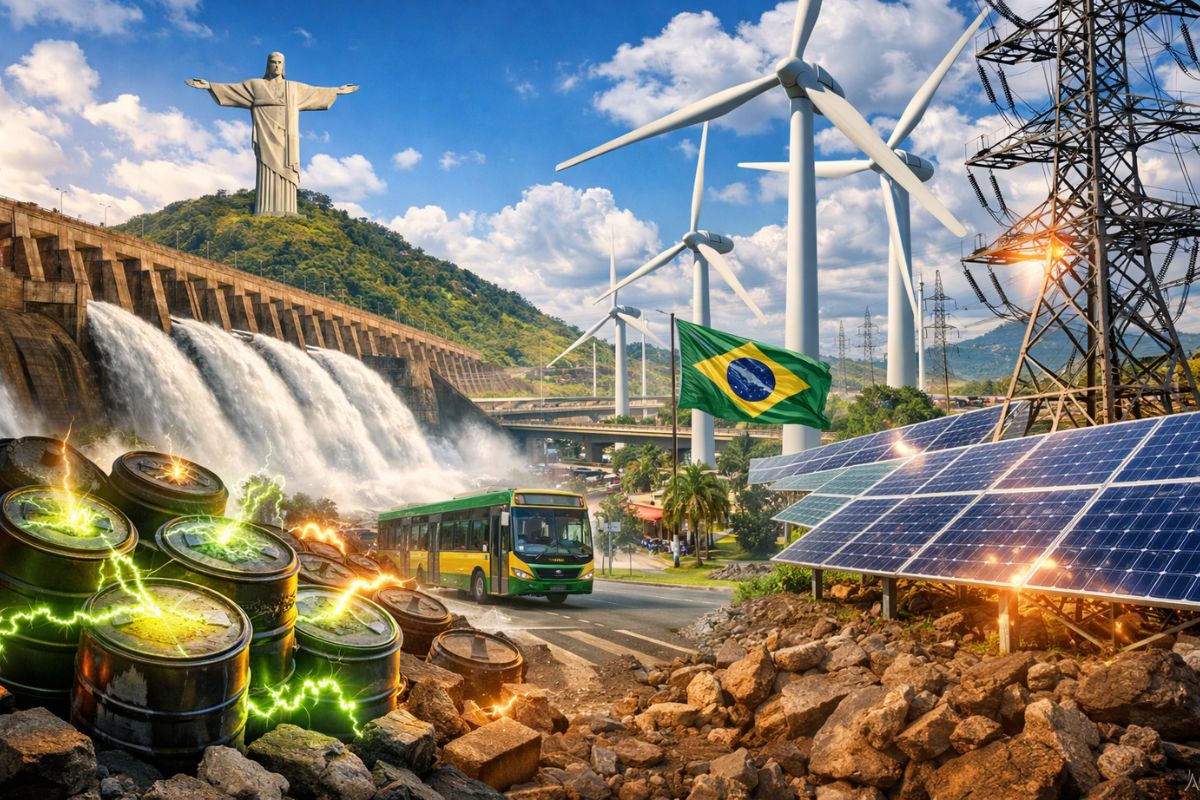
The New Connection of Brazil with Asian Markets
Besides the economy, the bridge that will connect Brazil to the Pacific has a profound geopolitical significance. By creating a new and efficient exit to the Pacific Ocean, the route increases Brazil’s strategic autonomy, reducing reliance on the Panama Canal and southern and southeastern ports.
This direct connection to the Pacific Basin strengthens Brazil’s positioning in trade with the dynamic economies of Asia, which are the largest consumers of agricultural commodities in the world.
The bridge, therefore, is not just a physical link, but a strategic piece that will deepen South American integration and project Brazil more assertively onto the global stage.


Seja o primeiro a reagir!