 Portuguese
  English
  Spanish
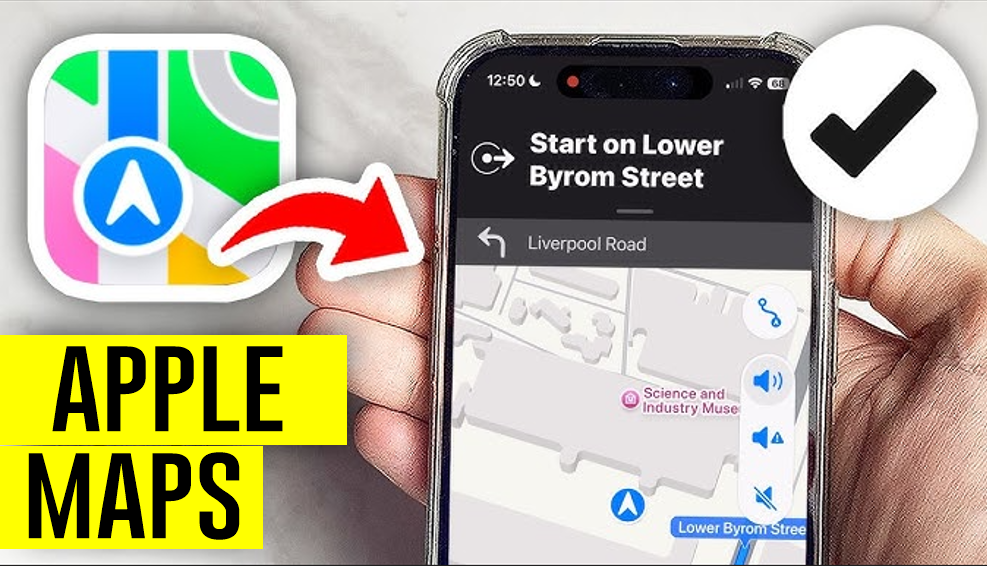

Will It Be The End Of Google Maps? Apple Maps’ Innovative Feature Promises To Revolutionize Navigation By Using Detailed Traffic Light Information
Have you ever stopped to think about how navigation apps like Google Maps can accurately predict your route, estimate your arrival time, and even suggest alternative paths? One of the most interesting technologies in this area involves the use of stop signs and traffic lights. Yes, those elements found at nearly every corner are helping to transform the way we move.
Apple Maps, in particular, is leading this advancement. With a new generation of features that incorporates this data into the map, the promise is to offer even more efficient, precise, and safe navigation. Let’s explore how this works and what to expect for the future.
Better Than Google Maps? — Stop Signs And Traffic Lights On The Apple Maps Map
If you’ve used Apple Maps recently, you may have noticed icons representing stop signs and traffic lights. These visual elements are more than decoration: they help drivers anticipate what lies ahead.
-
China has launched the world’s first floating artificial island, a scientific structure designed to face open seas, test equipment weighing hundreds of tons, and reach depths of 10,000 meters.
-
China accelerates global science and may surpass the United States in 2 years with increased public investment, continuous growth, and direct impact on the global technological competition.

-
Scientific studies indicate that drought may be strengthening a much greater silent threat: more resistant superbugs.

-
Man builds functional 5-meter submarine in his garage using gas cylinders, PVC pipes, and a refrigerator motor, and navigates with the vessel on a lake in Colombia.


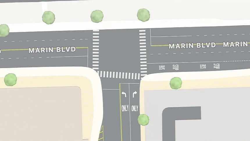
By viewing a stop sign or a traffic light on the map, it is possible to slow down in advance and avoid abrupt stops. Although the feature does not yet include audio notifications, it already offers a special advantage for those who pay attention to the screen.
For now, these icons do not emit sound alerts to prevent distractions while driving. However, Apple is exploring ways to improve this. One future possibility could be integrating audio notifications that inform about the presence of nearby stop signs or traffic lights. This type of enhancement could make navigation even more practical and safe.
The Technology Behind Apple Maps
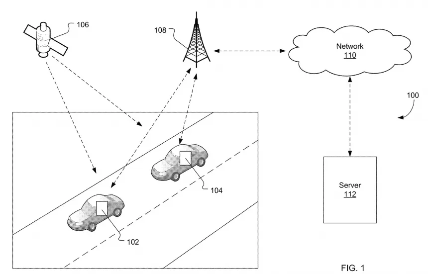
The big idea from Apple is how it collects and utilizes traffic data. When vehicles repeatedly stop at a specific point, the system can identify specific movement patterns. These patterns help Apple Maps differentiate stop signs from traffic lights.
For example:
- Stop Signs: Characterized by a “stop and go” pattern, where each vehicle waits its turn to proceed.
- Traffic Lights: Vehicles move together when the green light turns on, creating a higher flow pattern.
With this information, Apple Maps not only identifies the location of stop signs and traffic lights but also assesses their impact on your route.
Impact On Travel Time
One of the main benefits of this technology is the accuracy in calculating the estimated time of arrival (ETA). By incorporating data such as average stop durations at stop signs and traffic lights, real-time traffic conditions, and even weather factors, Apple Maps can offer more specific details.
Have you ever found yourself in a situation where the ETA showed you would arrive in 10 minutes, but a long traffic light or a traffic jam delayed you? With this new data, Apple Maps can avoid such surprises. It calculates the average waiting time at each point and adjusts the ETA as needed.
Furthermore, the tool can suggest faster alternative routes. If a road has many stop signs or traffic lights with long waiting times, the system may divert to a more efficient route.
Real-Time Problem Detection
Another interesting use of this technology is the ability to detect traffic light malfunctions. When a traffic light fails, movement patterns change. Vehicles start to behave as if there were a stop sign, adopting the “stop and go” pattern. Apple Maps can identify this change almost in real-time and alert local authorities, as well as adjust users’ routes.
Imagine the convenience of being notified about a faulty traffic light before even reaching the location. This not only saves time but also helps avoid frustrations in traffic.
Personalized And Smart Notifications
If you’ve used Waze, you’re probably familiar with notifications about traffic jams. Apple Maps could adopt a similar approach, but with an additional touch of intelligence. By informing about the estimated duration of stops at traffic lights or stop signs, drivers gain a clearer view of the impact on their routes.
For example, upon entering a street with traffic lights, Apple Maps could display an intermediate notification that you will spend, on average, three minutes at each traffic light. This helps plan travel time better.
The Time Of Day Makes A Difference
Another interesting detail is how waiting times vary depending on the time of day. In the morning, traffic can be heavier, while in the evening it tends to be smoother. Apple Maps is developing delay patterns that take these variations into account. Thus, the system can adjust routing and notifications even more accurately.
The Future Of Apple Maps
Although the idea is still in concept stages, the potential is enormous. Apple has already filed a patent called “routing based on blocked stops,” detailing how these features can be integrated into the navigation system. However, it may take years before we see all of this in practice.
Meanwhile, it is fascinating to watch how technology is evolving to make our lives more convenient. Imagine a future where navigation apps not only guide you but also deeply understand what is happening on the road, offering quick and smart solutions.
If you want to stay updated on these developments, it’s worth keeping an eye on the advancements of Apple Maps. Who knows, the next time you hit the road, your navigation app may already be smarter and more efficient than ever.


O Google ainda tem o Waze