 Portuguese
  English
  Spanish
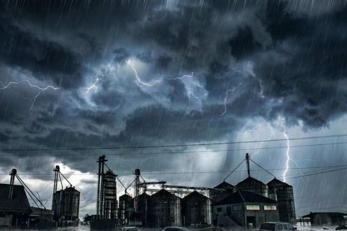
Extreme Rain Volumes Maintained for Several Days Increase Risk of Urban Collapse, River Overflows, and Severe Landslides in Minas Gerais, Rio de Janeiro, Espírito Santo, and Goiás.
The intense and persistent rains have put Brazil on red alert, the highest level of meteorological risk, with a concrete possibility of large-scale flooding, landslides, and severe damage to urban infrastructure in four states in the coming days.
The High Danger warning was issued by the National Institute of Meteorology and remains valid until Wednesday (21), covering Minas Gerais, Rio de Janeiro, Espírito Santo, and Goiás, regions that already have a recent history of disturbances caused by extreme events associated with excessive rain.
Extreme Rains Increase Immediate Risk of Floods and Landslides

The combination of heavy and persistent rains significantly increases the risk of river overflows, urban flooding, and mass movements in hillside areas, especially in densely populated regions.
-
The coldest seawater ever recorded in Earth’s history was hidden under extreme ice 717 million years ago and reached an impressive -15°C.

-
China has launched the world’s first floating artificial island, a scientific structure designed to face open seas, test equipment weighing hundreds of tons, and reach depths of 10,000 meters.

-
China accelerates global science and may surpass the United States in 2 years with increased public investment, continuous growth, and direct impact on the global technological competition.

-
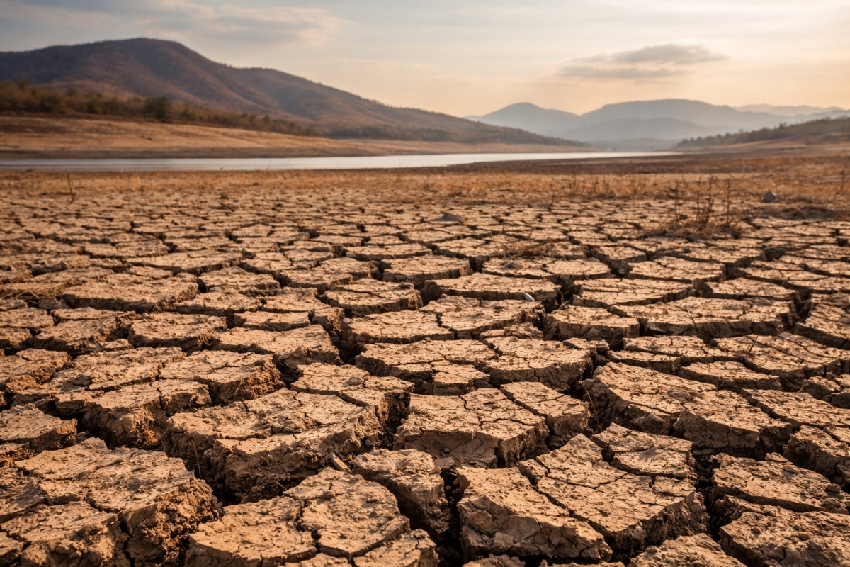
Scientific studies indicate that drought may be strengthening a much greater silent threat: more resistant superbugs.

According to weather alerts, accumulations can exceed high marks in a short period, creating a saturation scenario that favors devastating landslides.
In urban areas, compromised drainage increases the risk of road collapses, interruption of essential services, and isolation of entire neighborhoods.
States on Red Alert Concentrate Extreme Rain Volumes
In Rio de Janeiro, concern is primarily focused on the Northern Fluminense region, where rain volumes may exceed 100 millimeters in just one day, drastically raising the risk of flooding and landslides.
In Minas Gerais, the Eastern and central regions are under critical monitoring, with the possibility of high accumulations that may affect both urban and rural areas, increasing the chance of river overflow and hillside instability.
In Espírito Santo, much of the state is in the path of the most intense rains, with the potential for severe flooding events and direct impacts on highways, housing, and risk areas.
In Goiás, the alert involves severe storms associated with significant rain volumes, capable of causing rapid flooding and structural damage, especially in urban areas with a history of flooding.
ZCAS Maintains Continuous Rains and Prolongs the Danger Scenario
The main factor responsible for the extreme episode of rains is the action of the South Atlantic Convergence Zone, known as ZCAS.
This meteorological system acts as a persistent moisture corridor connecting the Amazon region to the Southeast of the country, maintaining atmospheric instability over the same areas for several consecutive days.
The persistence of ZCAS prevents the displacement of the rains, causing the volumes to gradually accumulate, increasing the risk of extreme events.
Meteorological models indicate that accumulations may reach historic levels by the end of the week, worsening the vulnerability scenario.
Extreme Forecast Index Indicates Rare and Dangerous Events
The meteorological risk maps point to high values of the Extreme Forecast Index, the EFI, which signals when a weather event is far above the historical average for a given region.
Values close to the maximum limit indicate statistically rare rains, with a high potential for causing severe damage to the population, urban infrastructure, and the environment.
Under these conditions, the risk to physical integrity and human life is considered extremely high.
Rains Also Put Other States at Risk Level
Besides the areas under red alert, nine other states remain under orange alert for rains, considered to be a danger level.
States in the North, Northeast, and Midwest face atmospheric instability, with the possibility of flooding, falling trees, and isolated disturbances.
Even outside the maximum alert, regions such as São Paulo remain on alert after recent reports of disturbances caused by the rains, especially in urban areas and on the coast.
Prevention is Decisive Amid the Rain Alert
Given the critical scenario, authorities emphasize that prevention is essential to reduce risks and avoid tragedies.
The recommendation is to maintain constant attention to weather updates and official communications, especially in areas close to rivers, hills, and historically vulnerable regions.
In evacuation situations, the recommendation is to act quickly and follow Civil Defense guidelines, avoiding unnecessary movements during periods of intense rains while respecting alerts issued by local authorities.
With the persistence of the rains and the maintenance of ZCAS, the coming days require maximum attention from the population and emergency agencies. Is your city prepared to face extreme rain volumes or still ignores clear signs of risk?


Seja o primeiro a reagir!