 Portuguese
  English
  Spanish
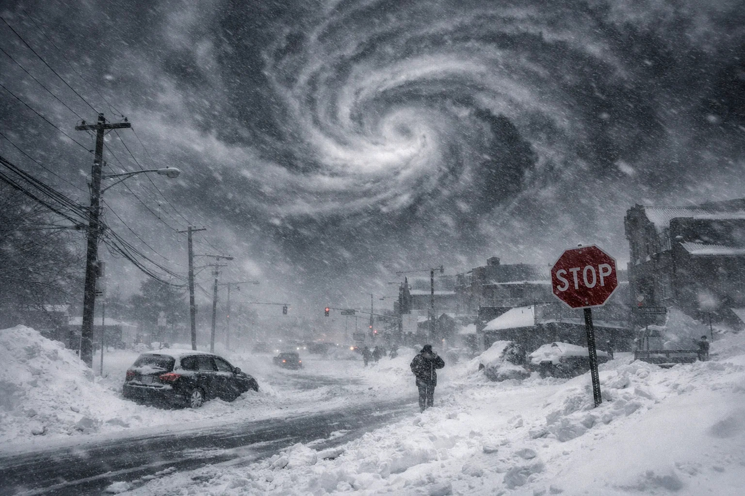
The Forecast Indicates a Potentially Explosive Winter Storm, with Bombogenesis Risk, Snow Over 15 Centimeters, Strong Gusts, and Extreme Temperatures That Could Paralyze Major Cities on the East Coast
Winter continues to show its full strength in the eastern United States, and it seems that it has no intention of letting up in the coming days. A dangerous combination of intense Arctic air, warmer ocean waters, and atmospheric instability puts the region on alert for the formation of a so-called bomb cyclone, a rare and highly destructive phenomenon during winter.
The information was disclosed by Associated Press, according to a report published this week, based on data from the National Oceanic and Atmospheric Administration (NOAA), as well as analyses from meteorologists at the Weather Channel and independent experts.
Extreme Cold Advances and Creates Perfect Conditions for a Bomb Cyclone
First of all, it’s important to understand the current meteorological context. The eastern U.S. is undergoing a prolonged period of intense cold, with sub-zero temperatures persisting at least until the first week of February. This scenario creates ideal conditions for the emergence of a large-scale winter storm.
-
Tourists were poisoned on Everest in a million-dollar fraud scheme involving helicopters that diverted over $19 million and shocked international authorities.

-
Hidden beneath the dense forest of the Sierra Nevada, Betoma emerges in a neighbor of Brazil as the greatest archaeological discovery of the century, revealing a colossal ancestral city covering over 18 km², with 8,334 stone structures and the potential to rewrite the history of South American civilizations.

-
Goodbye iron: new technology from Xiaomi promises to revolutionize the way we iron clothes with 500 kPa steam, continuous flow of 120 g/min, heating in 65 seconds, and six smart modes for different fabrics.

-
Rio Pardo, the most mysterious city in Rio Grande do Sul: untouched Pampas castle, the missing treasure of the Devil Boy, bride’s saint, invisible tunnels, and a 200-year curse today.


According to meteorologist Peter Mullinax from the NOAA Weather Prediction Center, a strong storm is starting to form between Friday night and Saturday, with the most significant initial impact in the Carolinas. If the atmospheric pressure drops rapidly, the system could turn into a bomb cyclone, also known as bombogenesis.
This type of storm occurs when the system’s pressure drops sharply — by at least 24 millibars in 24 hours — resulting in a phenomenon comparable, in intensity, to a moderately strong hurricane, but in mid-winter.
As a direct consequence, meteorologists are warning of severe blizzards, violent winds, and extremely low wind chills.
Intense Blizzards, Strong Winds, and Risk of Blackouts
Next, the projected impacts draw attention due to their severity. In the Carolinas, northern Georgia, and southern Virginia, the storm could drop at least 6 inches of snow, equivalent to about 15 centimeters, with conditions prompting total blackout due to low visibility.
Furthermore, there is uncertainty regarding the exact path of the system. If the cyclone follows the Interstate 95 corridor, it could directly impact major urban centers, including Washington, Philadelphia, New York, and even Boston, causing significant disruption.
James Belanger, vice president of meteorology at the Weather Channel, highlighted that there is high confidence in the occurrence of significant snowfall in the coastal areas of the Carolinas and Virginia. However, he noted that a variation of just 50 miles (80 kilometers) in the storm’s center will be decisive in determining the extent of impacts further north.
Even if snow does not reach certain areas, the winds will be a critical factor. Gusts could reach 40 miles per hour, around 65 km/h, knocking down trees, damaging electrical grids, and increasing the risk of widespread power outages.
More Explosive Storm Than the Previous One and Persistent Cold
Unlike the last major storm recorded, which had little wind intensity, this new system is expected to be much more aggressive. Meteorologists explain that the current storm will have a greater influx of energy, driven by the contrast between the extremely cold Arctic air and the warmer waters of the Gulf of Mexico and the Gulf Stream in the Atlantic.
According to Bernadette Woods Placky, chief meteorologist of the Climate Central organization, warmer waters — partly influenced by human-caused climate change — provide more moisture and energy to the system, intensifying its strength.
If the bomb cyclone consolidates as it approaches the Carolinas, its pressure will drop drastically, generating winds comparable to those of a moderate hurricane, as well as extreme snowfall accumulation, capable of creating snowbanks so high that they can bury vehicles, according to meteorologist Ryan Maue.
Meanwhile, the Arctic cold is not expected to retreat anytime soon. Experts indicate that the atmospheric pattern will keep the eastern U.S. locked in a cycle of intense cold and snowstorms, with only brief warming periods that will still remain below historical averages.
“We are entering a brutally cold period,” Maue said, emphasizing that new systems may form as early as the end of the first week of February.
Source: Science Alert


-

-

-

10 pessoas reagiram a isso.