 Portuguese
  English
  Spanish
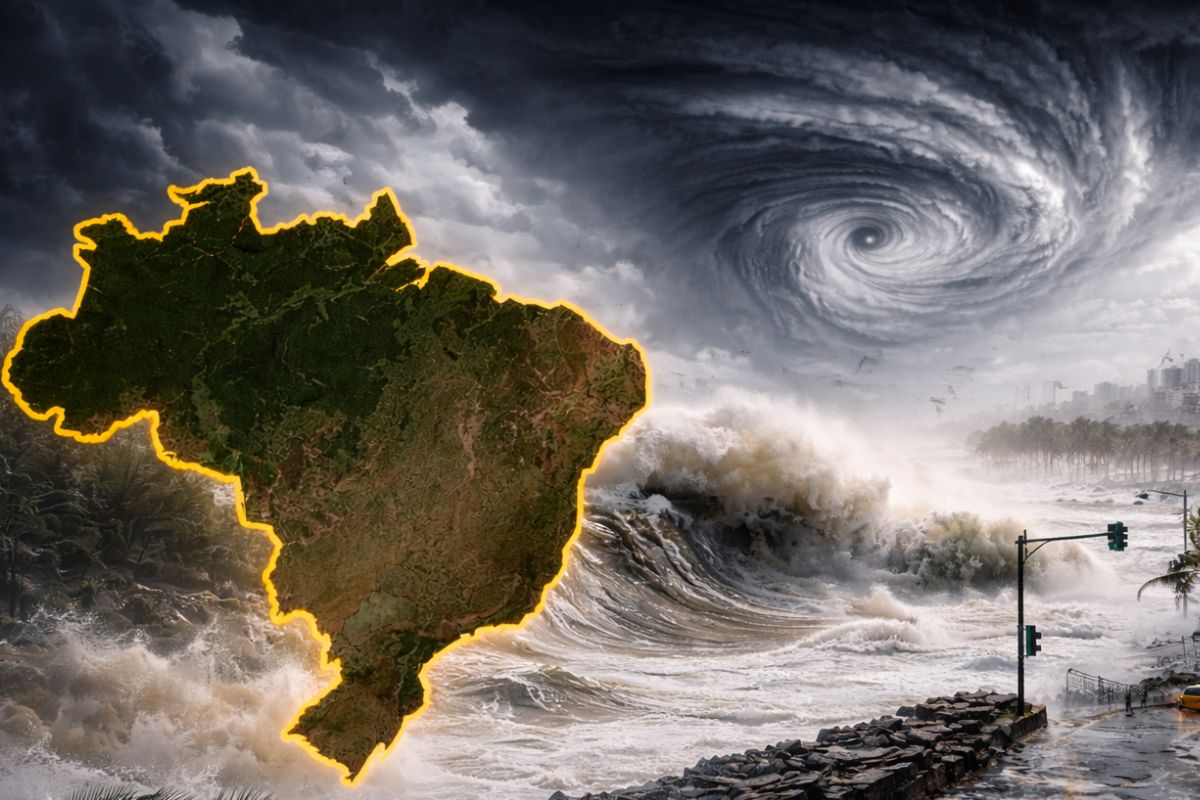
With Activity Close to the Coast and Influence Over Instability Areas, the Subtropical Cyclone Helps Organize Heavy Rain, Strong Gusts, and Storms in Different Regions of the Country, While Monitoring Agencies Reinforce Warnings for Floods, Landslides, River Overflows, Power Outages, and Structural Damage in an Alert Scenario.
The Subtropical Cyclone monitored in the ocean, close to the Brazilian coast, has taken on an important role in maintaining atmospheric instability and helps spread storms in various areas of the country. Amid this situation, more than 700 municipalities have entered alert, mainly in the North and Northeast regions, with forecasts of rain exceeding 100 mm in a single day and winds of up to 100 km/h.
The combination between the system at sea and instability areas on land has raised the level of concern for monitoring agencies, which point out the risk of flooding, landslides, river overflows, and interruptions in the power supply. The scenario also requires attention in other parts of Brazil, including the South, where storms and the possibility of hail are forecasted.
How the Subtropical Cyclone Reinforces Instability
The subtropical cyclone in operation in the ocean, close to the coast of Rio de Janeiro, does not only appear in the news as an isolated phenomenon at sea. It influences the organization of the atmosphere and promotes the formation of more structured rain areas, helping to explain why different regions have begun to register or expect intense precipitation in the same period.
-
How the terraforming of Mars can transform the planet: artificial aerosols can increase the temperature by up to 35°C in 15 years, creating conditions for liquid water.

-
Scientists drilled nearly 8,000 meters into the ocean floor above the fault that caused the 2011 tsunami in Japan and discovered that a layer of clay 130 million years old was responsible for making the wave much worse than any model had predicted.

-
Thousands of years after causing the largest eruption of the Holocene, one of the world’s largest supervolcanoes is rebuilding itself beneath the sea south of Japan, receiving new magma and alarming scientists with its transformation.

-
China has activated a magnet 700,000 times more powerful than the Earth’s magnetic field that operates for over 200 consecutive hours while consuming little energy, and now the world wants to know what Beijing plans to do with this technology in 2026.


This type of system can amplify the reach and persistence of bad weather, especially when it encounters an environment already laden with moisture and instability.
In practice, the most noticeable effect for the population is the increase in weather irregularity, with moments of heavy rain, gusty winds, and the risk of concentrated storms. This is not just about passing showers.
The picture described by weather warnings indicates conditions for more severe episodes, with the capacity to cause urban disruptions, affect rural areas, and require rapid responses from emergency services.
More Than 700 Municipalities Enter the Attention Area
The alerts began to take effect on Wednesday morning (4) and will last at least until Thursday night (5), covering an extensive area of the national territory. The areas under the most attention are concentrated in states such as Pará, Maranhão, Bahia, Ceará, Piauí, Tocantins, and part of Amazonas, indicating that the risk is not restricted to a single rain corridor.
The scope of the warnings is one of the most striking elements in this episode, as it involves hundreds of municipalities at the same time.
Among the areas highlighted in the monitoring are northeastern Pará, the Marajó region, western Maranhão, the sertões of the Northeast, the São Francisco Valley, and northern Minas Gerais.
The continuous monitoring of dozens of meteorological microrregions reinforces that the issue is not only the intensity of rain in isolated points, but the possibility of successive instability events in areas already vulnerable to flooding, soil saturation, and drainage difficulties.
Extreme Rain and Winds of Up to 100 km/h Increase Risks
In part of the North and Northeast, the forecast indicates rain exceeding 60 mm per hour or more than 100 mm in a single day, a volume that completely alters the level of risk for cities and communities exposed.
When precipitation concentrates in a short time, water struggles to drain, rainwater galleries may become overloaded, and rivers tend to respond more quickly. It is this accelerated accumulation that transforms a rain alert into a concrete threat for urban and hillside areas.
Additionally, another weather warning points to precipitation between 30 mm and 60 mm per hour in various regions, accompanied by winds that can reach 100 km/h.
This combination amplifies the potential for damage, as it does not only affect streets and houses subject to flooding. It also endangers trees, more fragile structures, electrical networks, signs, roofs, and even crops. In such scenarios, the impact does not come from a single factor, but from the combination of intense water, strong wind, and electrical discharges.
Flooding, Landslides, and Structural Damage Come Into Focus
The risk of severe flooding emerges as one of the main concerns because heavy rain can fall on densely populated areas and also on regions with limited drainage. In places near rivers and channels, the danger increases with overflow, while in neighborhoods with irregular occupancy or a history of flooding, the situation tends to deteriorate quickly.
When water rises quickly, the population’s capacity to react diminishes, and small delays in adopting safety measures can increase losses.
In areas with more sensitive terrain, especially hillsides, the fear shifts to landslides. Saturated soil loses stability, and any alteration in the terrain becomes a warning sign.
At the same time, strong winds increase the chance of tree falls and damage to structures, while electrical discharges pose additional risks to people, properties, and energy systems. The result is a weather scenario that simultaneously affects mobility, housing, supply, and public safety.
Southern Brazil Also Enters the Path of Storms
Although the concentration of broader alerts is in the North and Northeast, the advance of instability does not leave the South completely off the concern map.
In areas of Rio Grande do Sul and western Santa Catarina, the forecast also points to storms, with a possibility of hail. This indicates that the atmospheric environment remains favorable for severe events in different parts of the country, albeit with distinct regional characteristics.
In the South, the attention often turns to localized damage caused by more intense storms, especially when hail is in the forecast.
This type of occurrence can cause rapid losses to homes, vehicles, crops, and service networks, even when the episode does not have the same territorial reach as the alerts issued for other regions.
Therefore, monitoring cannot be limited to the areas with the highest number of municipalities under warning, but must consider the overall behavior of instability.
What the Population Should Do in the Face of Advancing Severe Weather
Safety guidelines gain importance precisely because the risk involves heavy rain, wind, lightning, and the possibility of structural collapses.
In case of gusts, the recommendation is to avoid seeking shelter under trees, as there is danger both of toppling and electrical discharges. It is also not advisable to park vehicles near transmission towers or billboards, which are more vulnerable when winds intensify.
During storms, turning off electrical devices and, when possible, the main power switch is an important measure to reduce risks.
In hillside areas, any cracks, soil movement, or alterations in the terrain should be carefully observed immediately.
The safest response is always to anticipate the risk, rather than wait for the situation to worsen. In emergencies, the population should contact Civil Defense at phone number 199 or the Fire Department at number 193.
One System at Sea, Multiple Impacts on Land
The advance of this episode shows how an atmospheric system positioned in the ocean can have direct impacts on the daily routine of cities far from the coast.
The subtropical cyclone helps maintain atmospheric instability and promotes the organization of storms, while weather warnings make it clear that the issue is not limited to the rain itself, but to the chain of effects it provokes.
From urban mobility to risk on hillsides, covering energy, agriculture, and safety, the impact spreads along with instability.
In this scenario, attention to warnings and the adoption of preventive measures become not just generic recommendations but hold immediate practical value.
When hundreds of municipalities enter alert at the same time, the difference between disturbance and tragedy may lie in the speed with which each person interprets the risk and acts. In your area, has heavy rain already changed the routine or caused some kind of loss?


-

-

-

-

-

-

89 pessoas reagiram a isso.