 Portuguese
  English
  Spanish
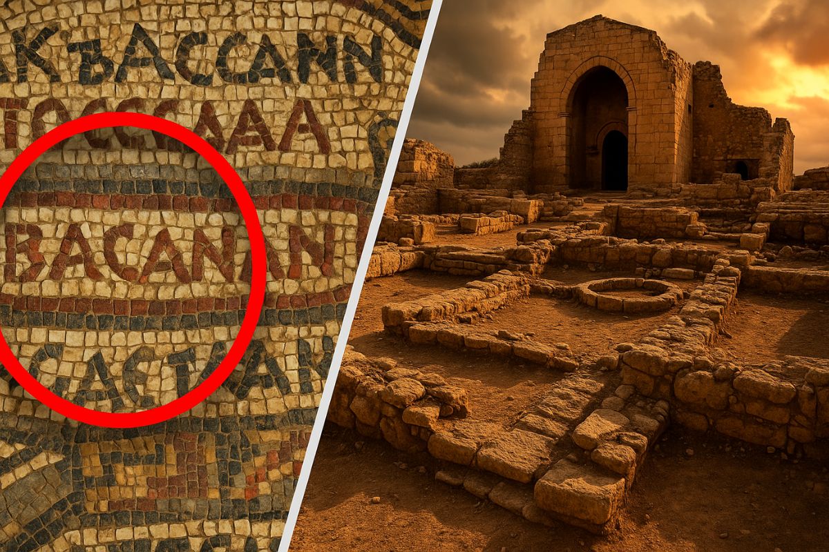
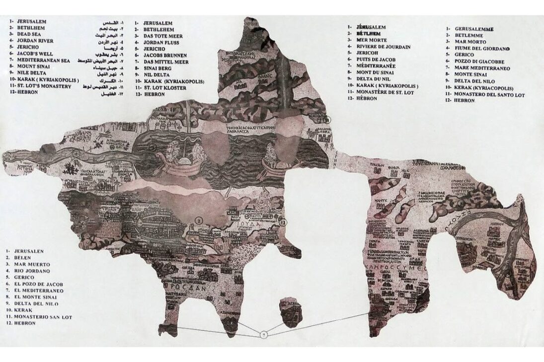
Archeologists Located Vestiges of Tharais, An Ancient Byzantine Center, Based on the Map of Madaba, 6th Century Mosaic
After decades of searches and frustrating hypotheses, researchers from Mutah University in Jordan claim to have found the lost Christian city known as Tharais. The decisive clue was in the Map of Madaba, considered the oldest cartographic record of the Holy Land still preserved.
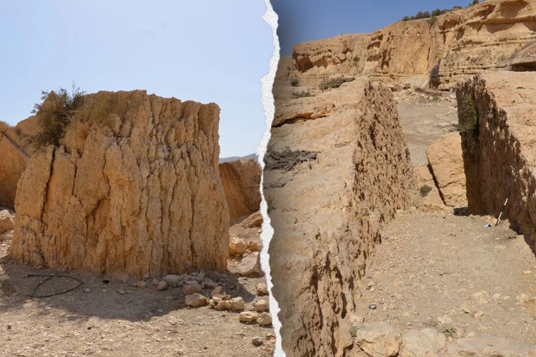
The discovery occurred near El-Iraq, west of Karak, where fragments of ceramics, mosaics, and Byzantine structures indicated the presence of an ancient religious and commercial center. The findings conclude a long archaeological debate about the exact location of the city, mentioned in the 6th-century mosaic that adorns the floor of St. George’s Basilica.
Indications of a Forgotten City
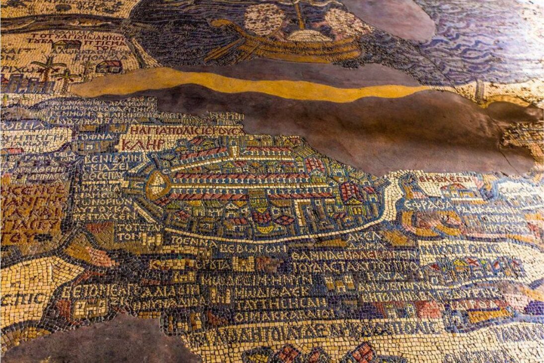
The Map of Madaba, located in an Orthodox basilica in Jordan, is a stone mosaic depicting Palestine and nearby regions. Produced around the year 560 AD, the artifact shows historical cities like Jerusalem, Jericho, and Bethlehem — and also Tharais, whose position has puzzled researchers for decades.
-
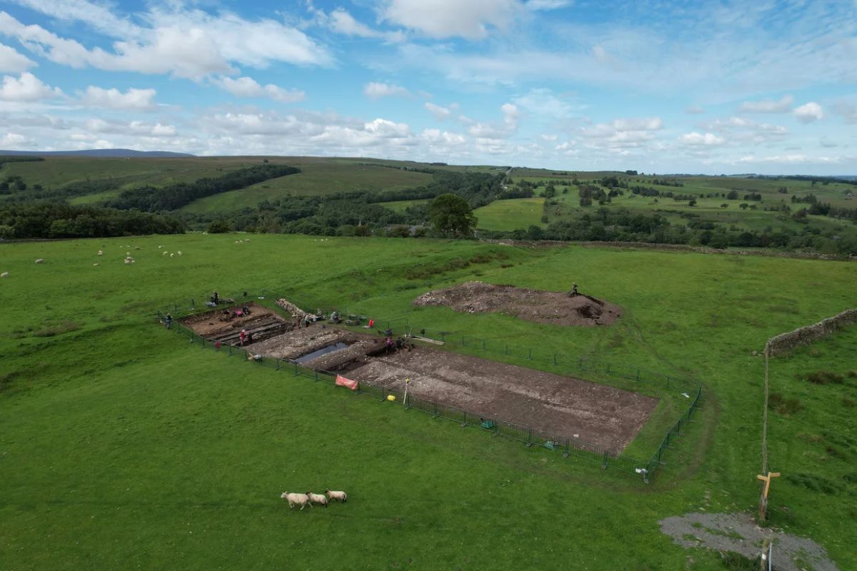
Archaeologists found giant shoes over 30 centimeters near Hadrian’s Wall that survived nearly two thousand years buried and now raise a mystery: who were these Roman soldiers so different from the others?
-
Meta’s new smart glasses are not just for seeing; they use artificial intelligence, analyze your food, summarize messages, and can even change the way you work in professions like engineering.

-
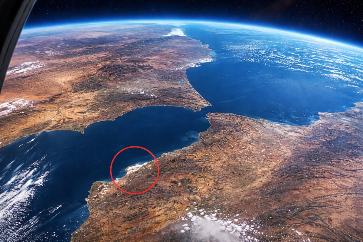
According to an analysis by NASA, only one human-made structure is visible from space, and it is not the Great Wall of China or the Pyramids of Egypt.
-
After 377 years of history, the Brazilian Army will have its first female general: Colonel Claudia Cacho has been promoted to brigadier general by Lula and will receive the sword and command baton this Wednesday in Brasília.


Using new technologies and cross-referencing topographic data with the information from the map, the team led by Musallam Al-Rawahneh identified material signs typical of Byzantine occupation. Between 2021 and 2024, fragments of columns, funerary inscriptions in Greek and Latin, glassware, agricultural tools, and remnants of a church in the basilica style were found.
Religious and Commercial Center
According to statements by Al-Rawahneh to the portal La Brújula Verde, the architectural structure and findings suggest that Tharais was not just an agricultural village, but also a strategic commercial post and sacred Christian center in the south of the ancient province of Palestine.
The archaeologists also located a circular olive oil press and watermills — which reinforces the hypothesis that the settlement was self-sustaining and integrated into the regional economy of the Byzantine Empire.
Why This Discovery Matters?
In addition to solving a historical mystery, the location of Tharais helps to reconstruct the Christian and Byzantine presence in the Middle East between the 5th and 7th centuries. It also confirms that ancient religious maps, like that of Madaba, are valid archaeological tools for guiding actual excavations.
The research was published in the scientific journal Gephyra and may pave the way for new studies on Christian occupation in the region. The researchers warn, however, that the work is just beginning — and that the preservation of the site will be essential for future investigations.
Have you heard of the Map of Madaba or the city of Tharais? What do you think of this archaeological discovery? Leave your comments!


Seja o primeiro a reagir!