 Portuguese
  English
  Spanish
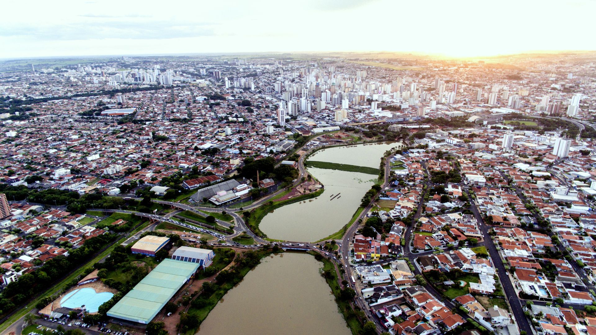
Municipality in the Interior of São Paulo Combines High Development, Exemplary Sanitation, and Urban Quality Recognized Nationally, with Half a Million Inhabitants and Indicators That Place It Among the Best in Brazil in Recent Rankings.
São José do Rio Preto, in the northwest of São Paulo, ranks among the best municipalities in the country in terms of development and sanitation indicators, according to national rankings, and has an estimated population of 504,166 residents in 2025, according to IBGE.
The municipality is ranked as the 8th most developed city in Brazil in the Firjan Municipal Development Index (IFDM) 2025, according to disclosures from Firjan and the city hall, with performance based on employment and income, health, and education.
In terms of human development, the most cited indicator for the city is the HDI 0.797, calculated based on the 2010 Census, as referenced in the Atlas of Human Development in Brazil and also reproduced on the IBGE page.
-
Italian researchers have detected what appears to be a second Sphinx buried under the sands of Egypt, and satellite scans reveal a gigantic underground megastructure hidden beneath the Giza Plateau for over 3,000 years.

-
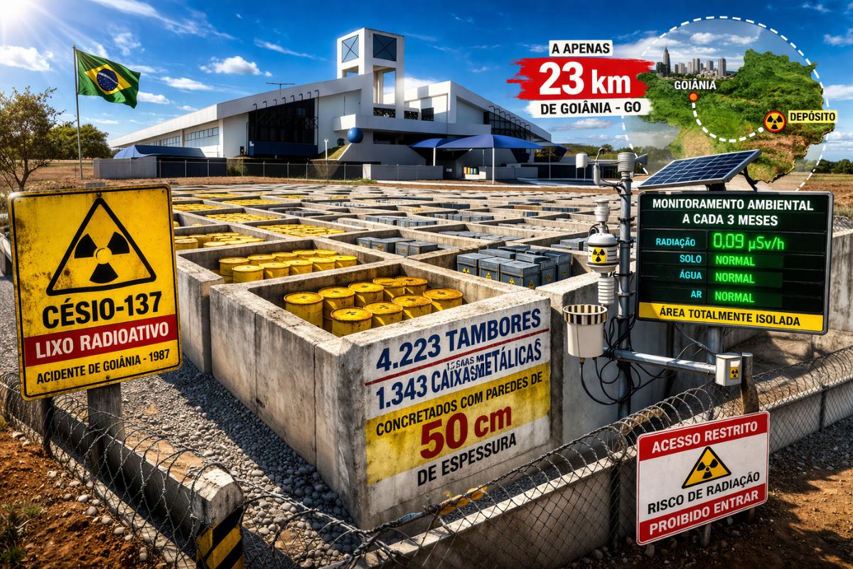
There are 4,223 drums and 1,343 metal boxes concreted with 50-centimeter walls that store the radioactive waste from Cesium-137 in the worst radiological accident in Brazil, just 23 kilometers from Goiânia, with environmental monitoring every three months.
-
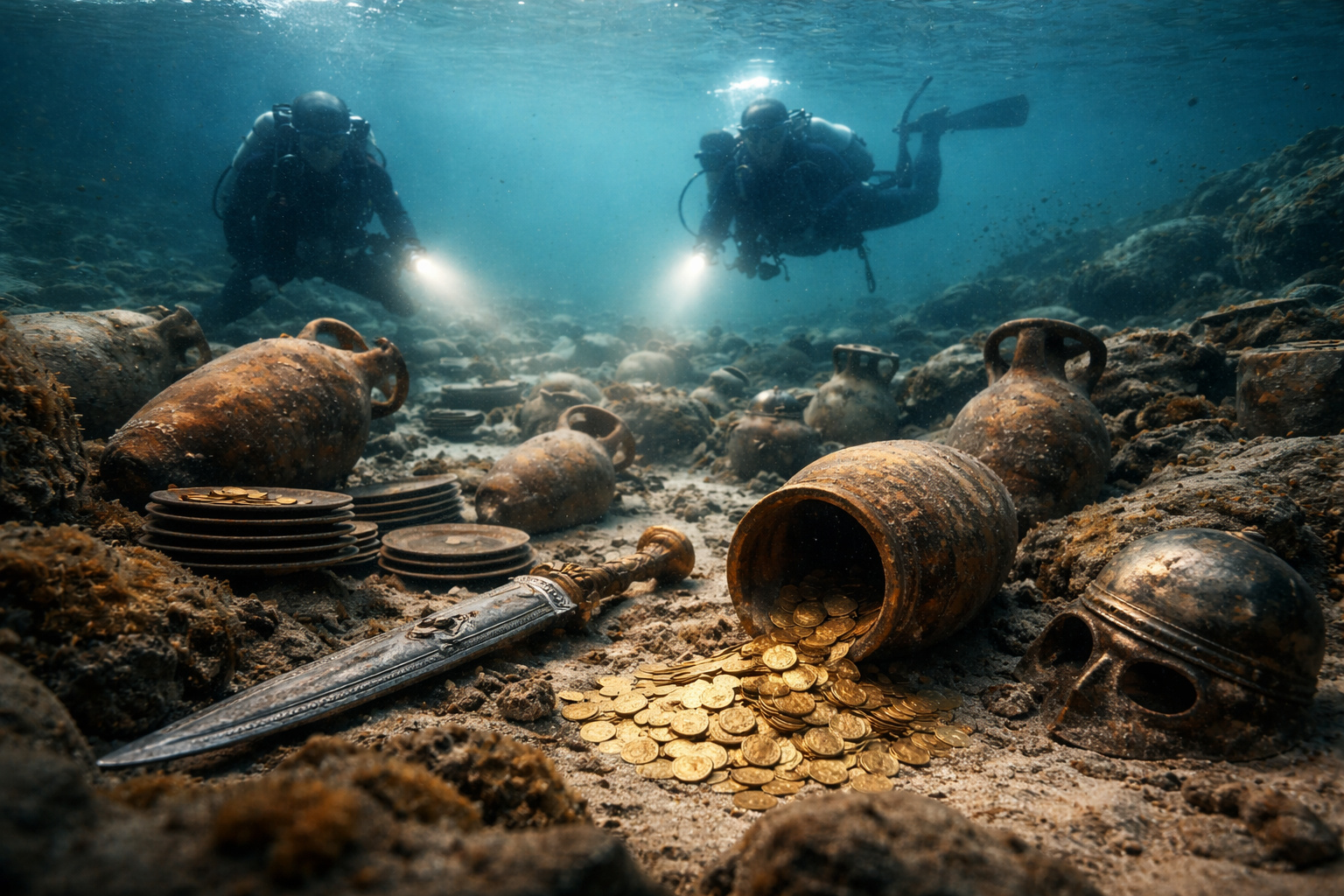
Giant Roman treasure found at the bottom of Lake Neuchâtel in Switzerland reveals an advanced trade system, circulation of goods, and armed escort in the Roman Empire about two thousand years ago.
-
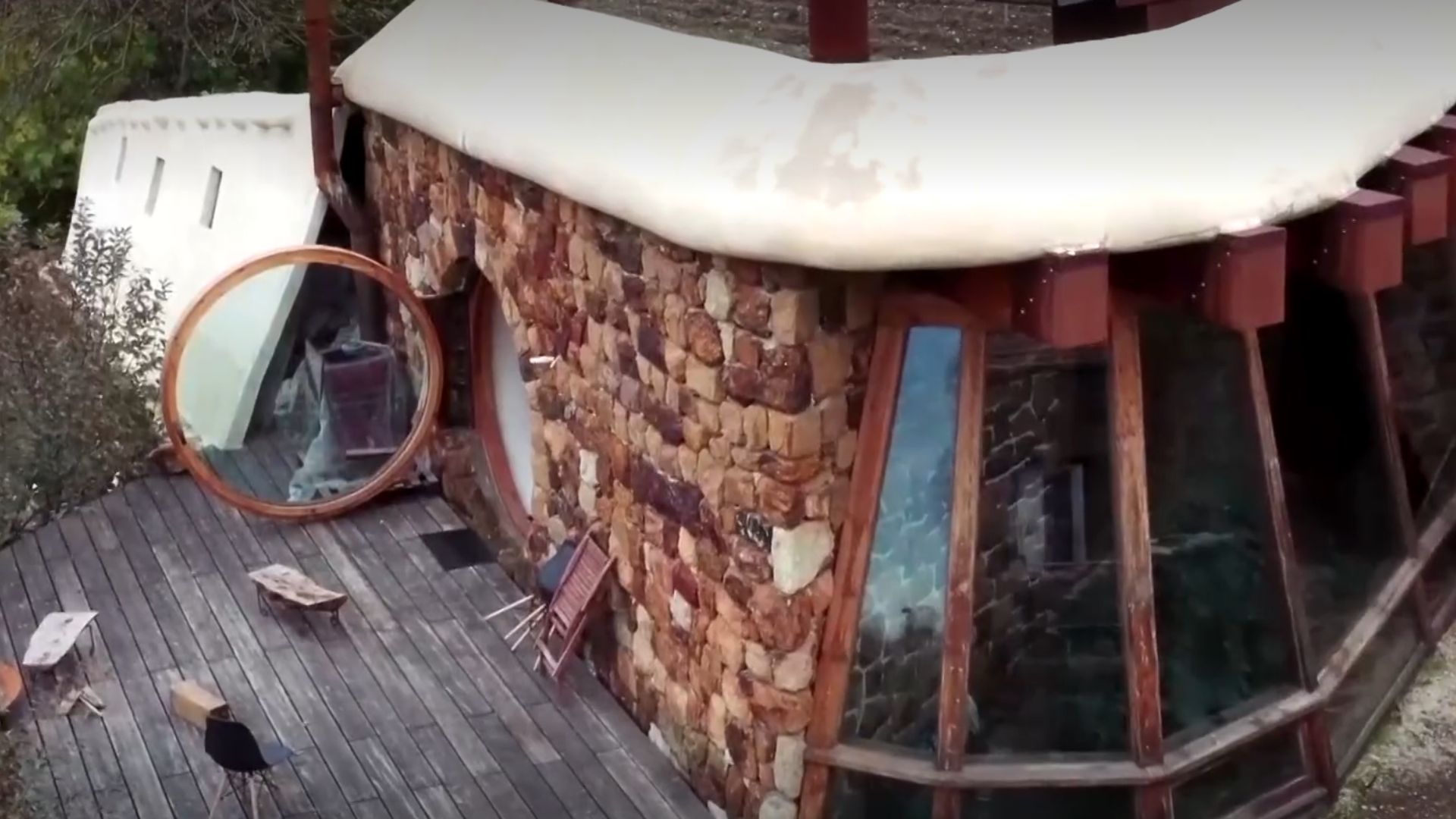
He buried 1,200 old tires in the walls to build his own self-sufficient house in the mountains with glass bottles, rainwater, and an integrated greenhouse.

However, the standout feature is sanitation: in 2023, São José do Rio Preto ranked 1st place in the Sanitation Ranking by Instituto Trata Brasil among the 100 largest cities.
In that survey, the institute reported 100% water coverage, 93.9% sewage collection, and 91.6% treatment of sewage generated, numbers that placed the city at the top of the ranking and became a reference in national comparison.
In the following ranking, released in 2024, the municipality maintained a prominent position, appearing in 2nd place, behind Maringá (PR), according to consolidated data from Trata Brasil.

The technical data from 2024 reports 100% water coverage and shows the sewage treatment indicator at 91.36%, in addition to the average per capita investment recorded in the table as R$ 135.14 during the considered study period.
Why São José do Rio Preto is Called the Capital of the Great Lakes
The nickname circulates in local reports and content that associate Rio Preto with a network of urban reservoirs and the fact that the municipality is located in the area of the Guarani Aquifer, one of the largest underground water reserves in the world.
Among the most well-known points, the Municipal Reservoir Park concentrates part of the outdoor leisure activities, with a walking path of 2,700 meters and community areas that serve as a postcard for the city.
Around the water, the illuminated fountain, cited as one of the largest in the country, is described with over 30 jets and a reach of nearly 15 meters, in local tourism records and promotional materials about the space.
In popular votes that listed wonders of the city, the Municipal Reservoir appears among the winners, alongside other urban landmarks, according to records published by the local press about the tally of that result.
From the Chapel of 1852 to the Regional Hub of the Interior of São Paulo
The formation of the urban nucleus is associated with 1852 when residents led by João Bernardino de Seixas Ribeiro built a chapel and marked the beginning of the settlement, according to historical accounts gathered in local publications.
Decades later, the city had its name simplified to Rio Preto by state law in 1906, and the full toponym was restored by state decree on November 30, 1944, according to historical records on the official denomination.

The arrival of the railroad in 1912 is cited as one of the factors that boosted the regional economy and reinforced the municipality’s role as a hub for commerce and services in the interior of São Paulo.
What to Visit in São José do Rio Preto
Without relying on classic tourist routes, the city brings together cultural facilities and public areas that connect to everyday life, highlighting the architectural ensemble of the Swift Complex, along the banks of the Reservoir Park.
The space, which originated as an industrial unit in 1944 and now houses educational and cultural activities, includes the Municipal Theatre Paulo Moura, with a capacity of 954 seats, often described as the second-largest theater in the interior of São Paulo.
In the city center, the Municipal Market, known as Mercadão, was inaugurated on July 19, 1944, features art deco elements, and was registered as a municipal heritage in 2004, functioning as a hub and traditional point for food and commerce.
The Cathedral of São José appears in local narratives as a historical reference of the initial landmark of the settlement, alongside squares and central streets that preserve the urban memory linked to the municipality’s origin.
FIT Rio Preto Moves the City in July

In July, the International Theatre Festival expands the cultural occupation of the city and, in 2025, announced a program featuring 47 works and 111 free performances distributed across 10 regions.
The festival’s proposal includes performances in theaters, squares, streets, and alternative spaces, with part of the nighttime activities concentrated in the Swift Complex, where cultural events tend to extend during the festival period.
Climate in Northwest São Paulo Throughout the Year
Climatological data indicate a pattern of a wetter summer and a drier winter, with historical averages showing July as the month with the least precipitation and January as one of the wettest.
In the presented series, the monthly averages suggest higher maximums between September and November and milder temperatures between May and July, which influences the planning of outdoor activities, such as walking by the reservoir and visiting parks.
How to Get to São José do Rio Preto
By road, the connection with the city of São Paulo is typically described at about 445 km in routes via highways, with variations depending on the chosen path.
Additionally, Professor Eribelto Manoel Reino State Airport receives regular flights operated by airlines such as Azul, GOL, and LATAM, according to institutional information about the terminal.


-

-

-

-

-

12 pessoas reagiram a isso.