 Português
  Inglês
  Espanhol
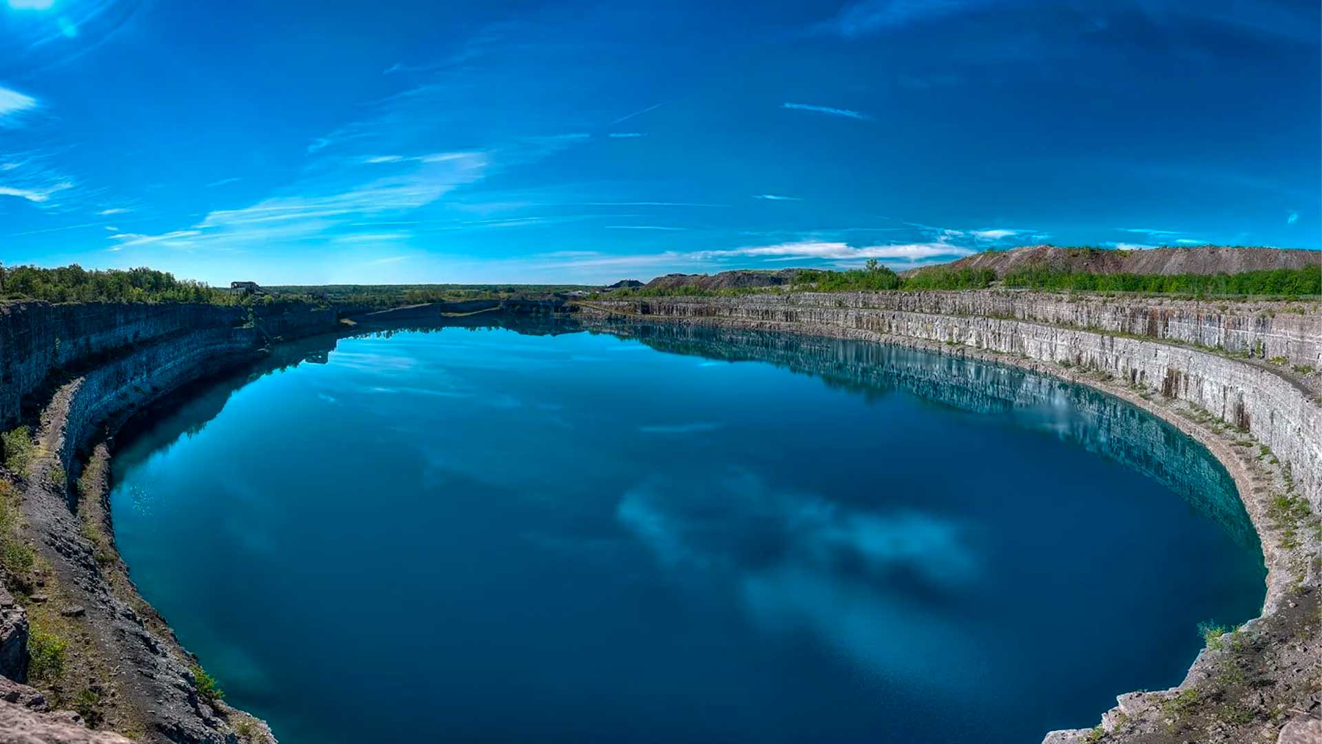


The Old Marmora Mine Filled with Water After Iron Mining Stopped and Turned into a Blue-Green Postcard. Now, a Project Aims to Repurpose the Pit for Energy Storage and Reopen the Debate on Tourism and Safety.
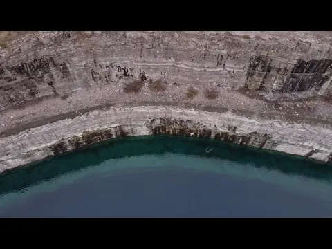
A few minutes from downtown Marmora, in eastern Ontario, an industrial crater created by iron mining turned into a turquoise lake that catches the eye of passersby in the area. The site is known as Marmora Mine, or Marmoraton Mine, and is now seen as a rare example of how a mined area can gain new meaning.
The size helps explain the curiosity. Project documents describe the pit as being about 740 meters long, 450 meters wide, and nearly 220 meters deep.
What was once a difficult liability to ignore has also caught the attention of energy companies and the public sector. The proposal under review aims to turn the pit into a lower reservoir of a pumped storage system, combined with a solar park, creating a clean energy hub in the old mining complex.
-
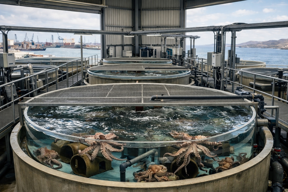
The world’s first octopus farm wants to open in the Canary Islands and is already provoking an international reaction: the plan aims to produce 3,000 tons per year.
-
Drought may be creating stronger superbugs in the soil and helping antibiotic resistance reach hospitals, warns a study highlighting a problem that could grow alongside extreme weather.

-
The biggest scam in history: Napoleon’s France deceived the United States by selling them a territory that was Spanish.

-
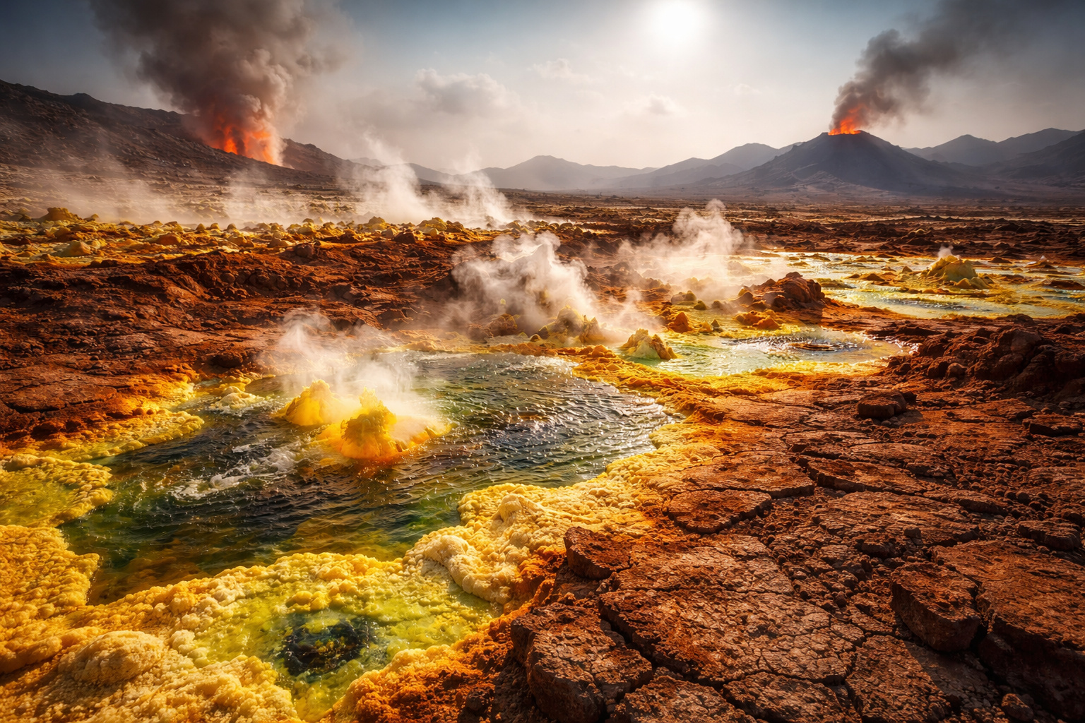
Why is the Danakil Desert so dangerous? It has unstable terrain and how extreme temperatures and toxic gases turn the region into one of the most hostile environments on Earth.
The story, however, is not just about the future. It’s also about the impact mining had on the territory and how an extreme landscape can divide opinions between those who see tourism potential and those who fear risks and invasions.
The Artificial Lake That Was Born from a Magnetite Pit in Marmora
The origin of the hole begins with the local geology. According to the tourism site Marmora and Lake, an intrusion of igneous rock and a chemical reaction with marbles in the region formed a large deposit of magnetite, an iron ore that was hidden under hundreds of feet of limestone.
The discovery and opening of the mine changed the landscape irreversibly. The local tourism material reports that, after the land was purchased by Bethlehem Steel and the removal of more than 120 feet of limestone, the area was mined for over 20 years, leaving a pit over half a mile long and about 700 feet deep.
With the end of constant groundwater pumping and the gradual abandonment of operations, the pit began to fill with water over time. The result is the lake that now stands out for its color and contrast with the rock walls and piles of waste surrounding it.
How Iron Mining Marked the Town and Ended Before Modern Rehabilitation Rules
The Marmora Historical Foundation records that the magnetite body was identified in 1948 in a government aeromagnetic survey, and that the process of removing the overburden began in 1953.
In local historical accounts, the mine gained economic relevance and employed workers for decades, with production reaching hundreds of thousands of tons per year at its peak. The foundation’s text also describes how legal limits and the cost of deepening the pit weighed on decisions when the steel market slowed down in the late 1970s.
Moreover, the project description document submitted to the Canadian government states that the Marmoraton Mine ceased production and closed in 1978, before modern environmental rehabilitation legislative requirements, which helps explain why the area remained structurally unchanged for decades.
Scenic Overlook Tourism and the Debate on Safety in an Extreme Landscape
The image of the turquoise lake spread and became a common photo stop, but direct access is a sensitive point. The official tourism website for Marmora and Lake states that swimming or accessing the pit area is not allowed for safety reasons, although there is a viewing point for the public.
This contrast often generates frustration among some visitors, who see an obvious recreational potential, but it also reinforces a practical warning. The pit has high walls, unstable ground in some sections, and an uncommon depth for a lake formed by mining, which increases the risk of accidents and complex rescue operations.
To try to organize interest without encouraging invasions, the local tourism strategy itself prefers guided or self-guided tours in the surrounding area, such as the Miner’s Loop, which connects points of geological and historical interest in the Marmora region.
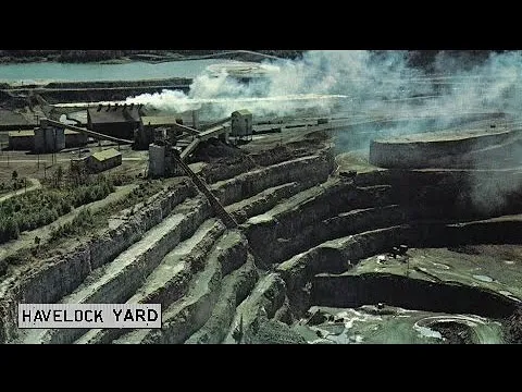
Repurposing with Energy and the Proposal to Transform the Pit into Hydroelectric Storage
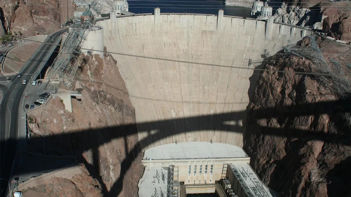
The most concrete change under discussion is the Marmora Clean Energy Hub Project. In the document filed with the Canadian federal agency responsible for impact assessment, the plan proposes a closed-loop pumped storage facility of about 400 megawatts, using the pit as a lower reservoir and building an upper reservoir on the rock piles in the area, as well as approximately 30 megawatts of solar generation on land.
The logic is to operate like a large battery. During periods of lower demand, the system would use energy from the grid to pump water to the upper reservoir, and during periods of higher demand, it would return that energy to the system by allowing the water to flow down and trigger turbines.
The document also notes that the pit is isolated from other surface water bodies and that recent measurements indicated water quality generally compatible with provincial objectives, with variations that may reflect regional natural conditions.
The timeline mentioned in the same material refers to a target for operational start in 2029, in a context where Ontario is seeking more flexibility to integrate renewables and meet growing demand.
If realized, the project could give Marmora Mine a new economic role, but it also tends to reopen local discussions about what the community wants for the area. For you, should the lake remain just a safe overlook, or does it make sense to push for more access and recreation even with the risks and a megaproject on the horizon? Share your opinion in the comments.


Interesting article. There is another hole in the ground in Ontario that was created under the same circumstances. It was also an open pit iron ore mine that closed in the mid 1980’s. The Griffith mine about 60 km south of Red Lake left a similar hole in the ground. I still visit the area every 5 years or so and everytime I do I would visit the old mine site and the pit there is also now full and also a beautiful turquoise colour. As somebody who loves to fish I have always wondered if the old pit would make a great place to stock some lake trout. Seems like such a waste of a beautiful body of water to do nothing but there is no shortage of lakes in that section of Ontario as lakes outnumber the residents. Anyways thanks for rek8ndling some memories of my childhood.
Excelente artigo. Esse é o aproveitamento para as cavas exauridas tomadas por água, produção de energia hidráulica a partir da solar, inclusive abastecimento d’água para cidades, mas esse não é caso, por causa de metais contaminantes.
Interesting, I know if similar open pit operations in Northern Ontario. The old Adams mine was an iron ore mine that was allowed to fill with water and is now used to farm trout. Adding a massive hydro electric storage facility could enhance the fish farming project creating electricity and adding vital oxygen to the water at the same time.
Excelente idéia de captar água com energia solar e transformar em hídrica, aqui no Brasil poderiam usar a idéia e fazer o mesmo.