 Portuguese
  English
  Spanish
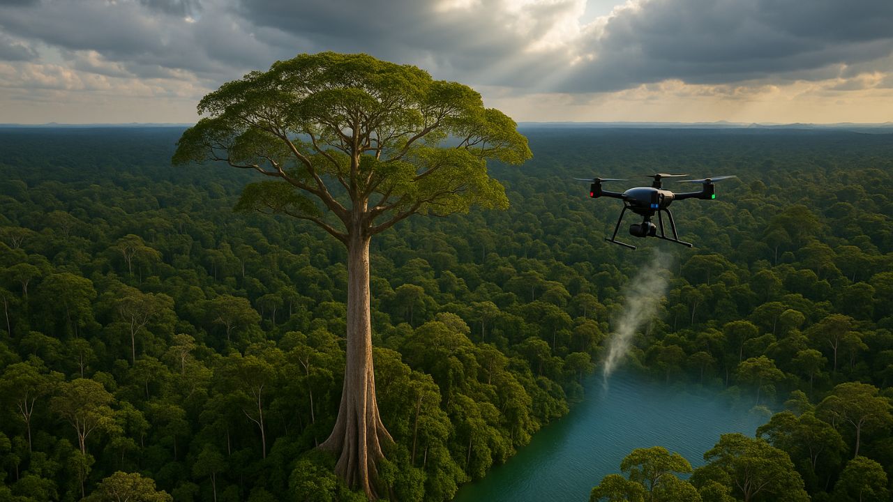
Brazilian Researchers Combine Drones, Sensors and Traditional Knowledge to Study and Protect in Real Time an Angelim-vermelho of 88.5 Meters.
The discovery of the tallest tree in the Amazon marked a new era of research. Brazilian scientists are now using innovative technology to monitor this giant. Drones and sensors create a “Jungle Internet”. The goal is to understand and protect this unique ecosystem in real time.
How a Ray of Light Revealed the Giant of the Forest
The tallest tree in the Amazon was not found by explorers on land. Its first identification came from beams of light. Between 2016 and 2018, the National Institute for Space Research (INPE) used LiDAR technology. The initial goal was to measure the forest’s carbon.
Laser pulses created an accurate 3D map of the vegetation. During analysis, researchers noticed an anomaly. They found trees that exceeded 80 meters in height. The most prominent individual, an Angelim-vermelho, was measured at an impressive 88.5 meters tall.
-
With a cost per shot close to zero, the DragonFire laser could change naval warfare in 2027 and provide British ships with nearly unlimited defense against drones.

-
A British startup creates tires that generate electricity in electric vehicles when passing over potholes, speed bumps, and cracks.

-
Scientists have created robots made with living cells that have their own nervous system, swim on their own, explore the environment, and self-organize without any genetic engineering, and now they want to do the same with human cells.

-
Students create a solar-powered ambulance that operates without a plug, without fuel, and still keeps medical equipment running in remote areas.


The Challenging Journey to the Tallest Tree
The LiDAR data provided the exact coordinates. But confirming the height of the tallest tree required an epic journey. Five expeditions over three years were necessary to reach the site. The research team traveled about 250 kilometers by river and then walked up to 30 kilometers through dense forest. The success of the mission critically depended on the knowledge of local community guides. At the site, scientists confirmed the height and collected leaf and soil samples for detailed studies.
High-Precision Eyes in the Amazon Sky
Traditional forest monitoring is slow, costly, and dangerous. Unmanned aerial vehicles (UAVs), or drones, have changed this scenario. They are faster, safer, and more economical than field teams or manned aircraft. Flying below the clouds, drones provide ultra-high-resolution images on a centimeter scale.
This technology allows for detailed monitoring of the canopy’s health. Drones can be equipped with special sensors, such as LiDAR and multispectral, creating a “digital twin” of the forest to track the health and growth of the tallest tree and its surroundings.
Sensors That Connect the Forest in Real Time
The real technological revolution in the project is the so-called “Jungle Internet”. This concept describes the fusion of drone monitoring with the Internet of Things (IoT). Small sensors, developed by Brazilian companies like Treevia, are attached directly to the trees. These devices measure crucial variables such as trunk diameter growth, temperature, and humidity.
The data is transmitted in near real-time via satellite. This data fusion is powerful. A drone can show stress in the leaves (the “where”). The sensor can reveal that the tree’s growth slowed weeks earlier, during a drought (the “when”). This allows scientists to connect cause to effect.
Technology in the Fight for the Survival of the Tallest Tree
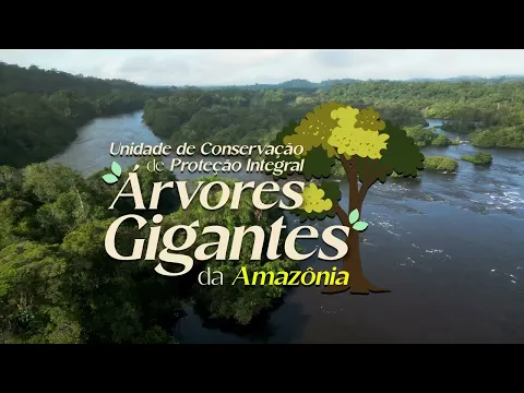
This advanced monitoring is not only for science. The area of the tallest tree, located in the Paru State Forest, faces severe threats. Illegal mining and deforestation are the main dangers. The same technology used for research is a powerful tool for conservation.
Drones can quickly detect the opening of illegal roads or clearings, allowing for a more agile response from environmental agencies. The attention generated by the discovery has been a catalyst for political action, resulting in the creation of the State Park of Giant Trees in 2024 to protect this sanctuary more rigorously.


Seja o primeiro a reagir!