 Portuguese
  English
  Spanish
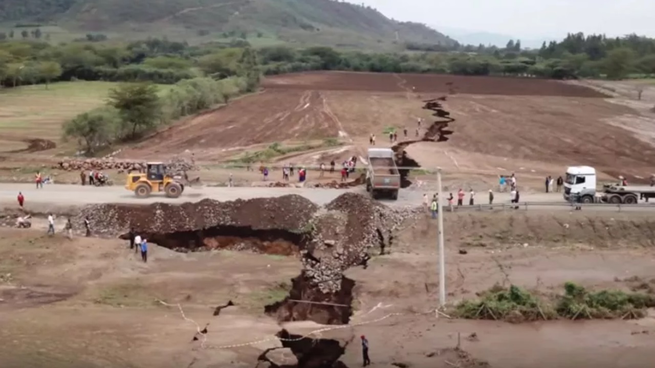
 60 Km Rift Opened in 2005 in the Afar Desert, Ethiopia, Revealed Tectonic Plates Separating and the Birth of a New Ocean in the African Rift Valley.
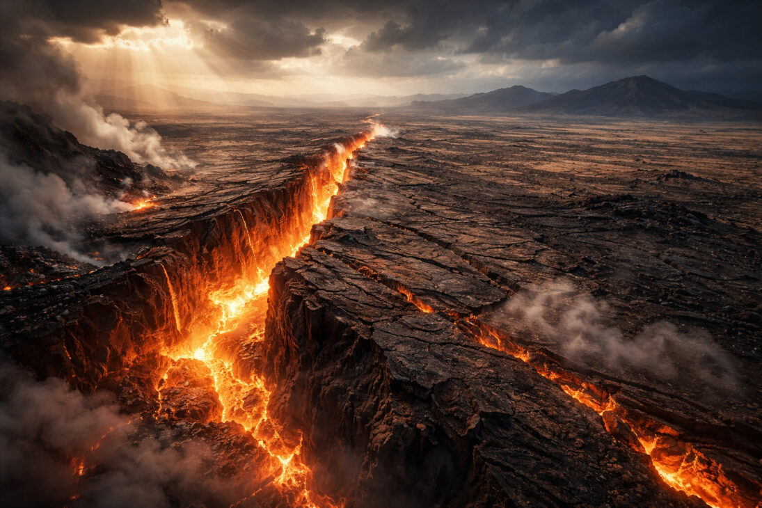
In September 2005, residents of the Afar Desert in northeastern Ethiopia woke up to shaking ground, air darkened by volcanic ash, and the sound of cracks opening in the earth. In just ten days, a fissure about 60 kilometers long tore through the region’s surface. The ground even separated by up to 8 meters in less than two weeks. Under normal tectonic drift conditions, a shift of this magnitude would take several centuries to occur.
When geologists arrived at the site, they found the largest evidence ever recorded on solid ground of a geological process that normally happens on the ocean floor: a tectonic plate splitting in half. What happened in the Afar Desert was not an isolated event but part of a much larger process that began about 30 million years ago and, when completed, could create a new ocean and redraw the map of Africa.
Afar: The Region Where Three Tectonic Plates Diverge Simultaneously
The Afar region, located in northeastern Ethiopia, occupies an extremely rare position on the Earth’s surface. It is situated exactly above the junction of three major tectonic plates: the Nubian Plate, which corresponds to the western part of Africa; the Somali Plate, which corresponds to the eastern part of the continent; and the Arabian Plate, which is moving away from Africa toward the Middle East.
-
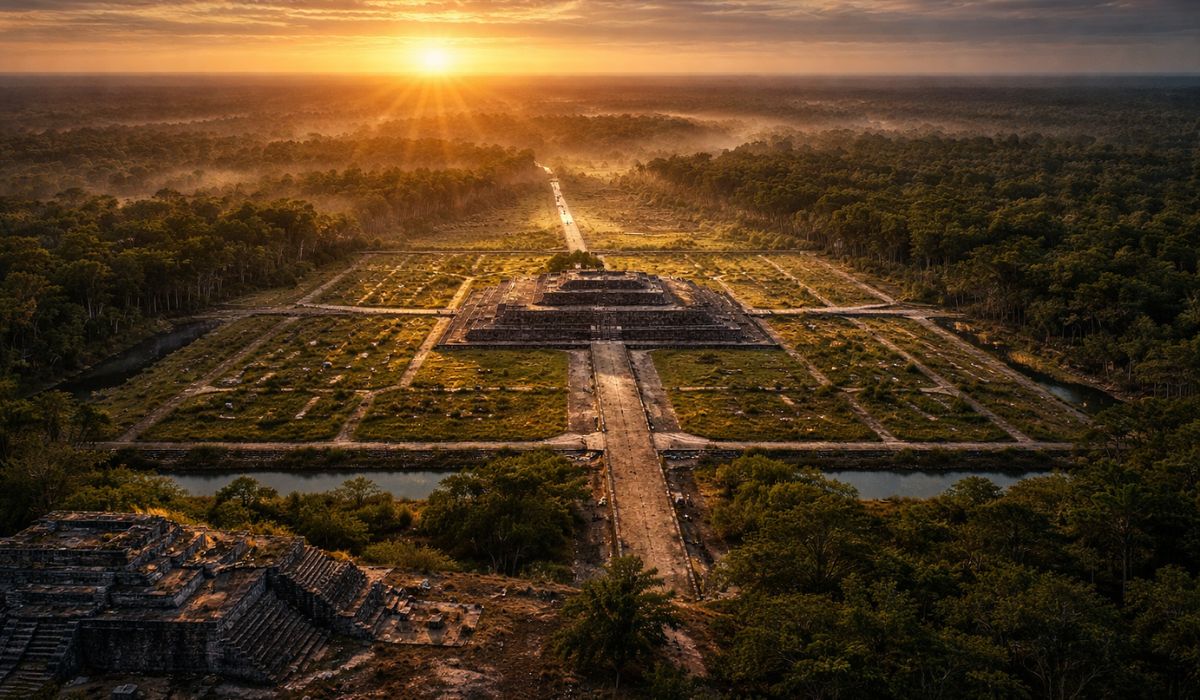
In Mexico, a 3,000-year-old Maya site with the dimensions of an entire city may have been built as a colossal map of the cosmos, created to represent the order of the universe and reveal how this people organized space, time, and rituals.
-
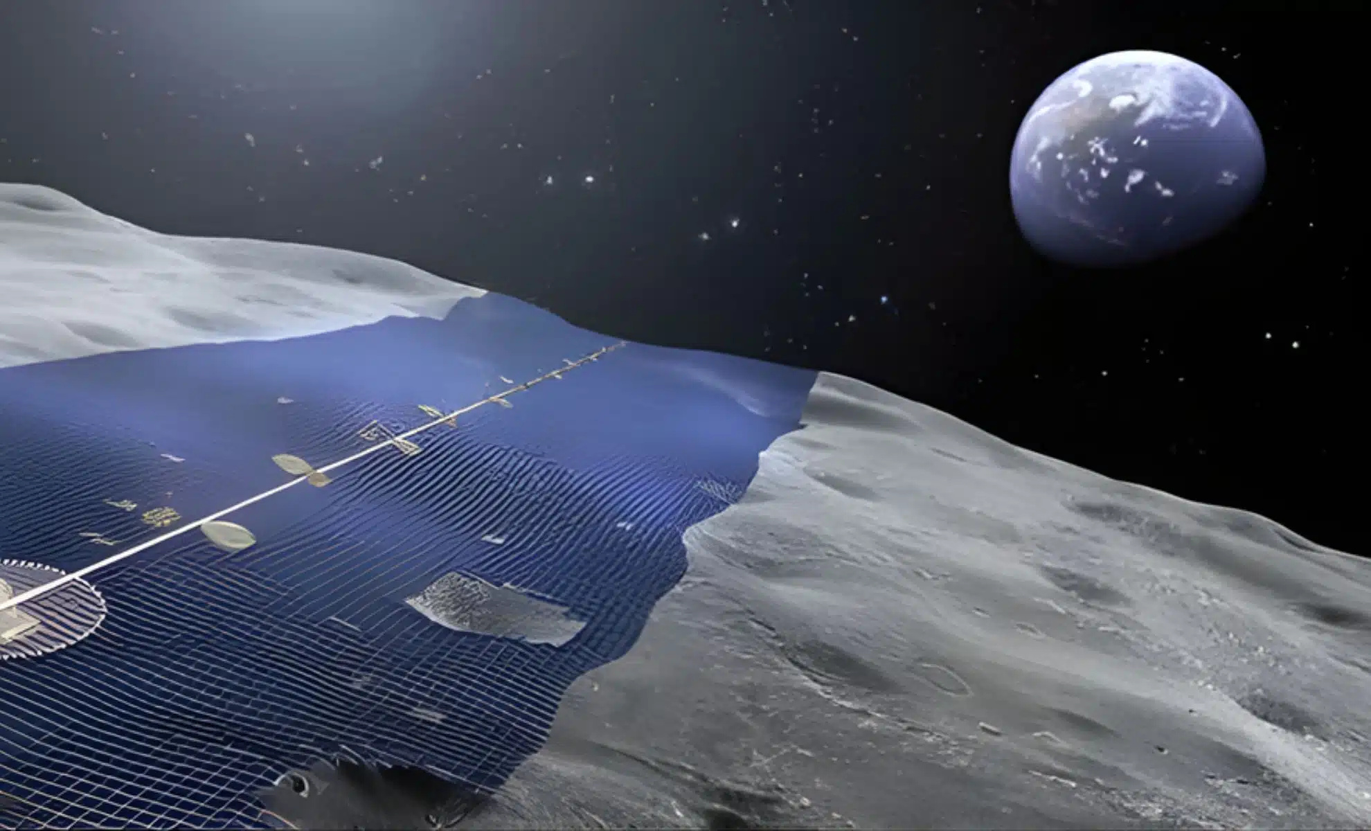
Japan wants to build a solar ring of 10,900 kilometers on the Moon to continuously send energy to Earth.
-
Weighing almost 1 ton, with temperatures of up to 3,000°C, the ability to launch 10,000 fragments within a radius of 1 km, capable of penetrating concrete and melting steel, Turkey’s terrifying bomb emerges as one of the most destructive non-nuclear weapons ever presented.

-
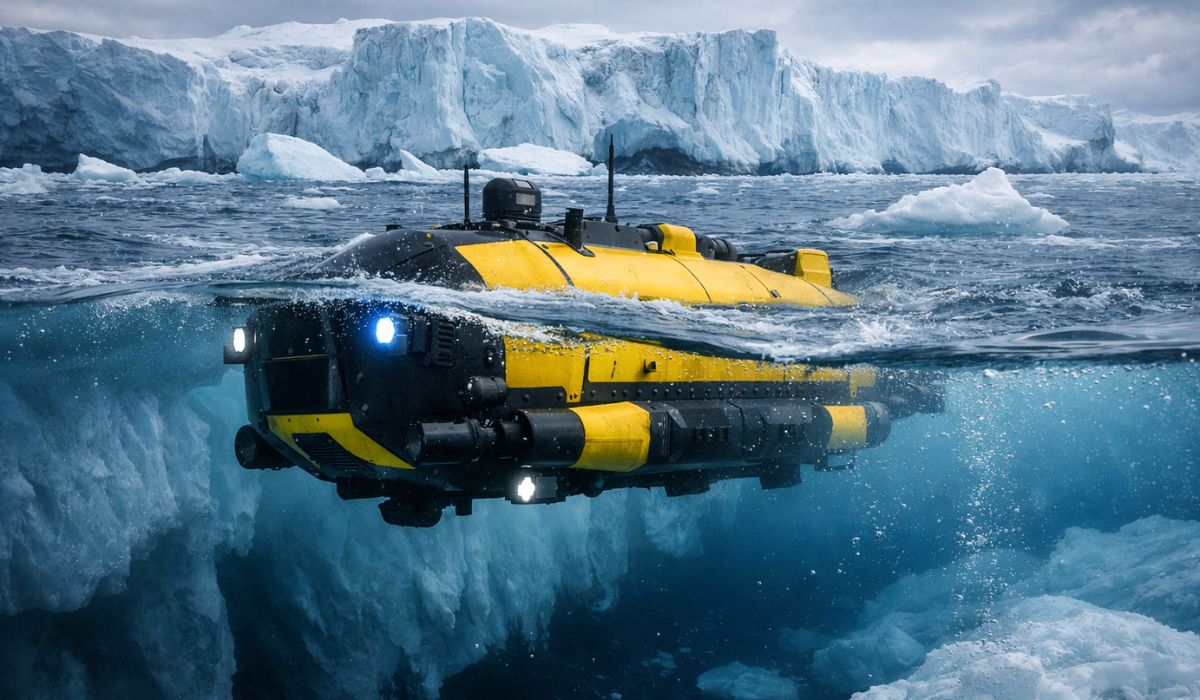
After a submarine disappeared beneath the “Doomsday Glacier,” scientists announce a new monstrous machine capable of operating at 3,000 meters depth to return to the heart of the ice and investigate a threat that could raise sea levels worldwide.

Geologists refer to this configuration as a tectonic triple junction, an unusual phenomenon when observed on solid ground. For the most part of the planet, similar processes occur on the ocean floor, where new oceanic crust forms along mid-ocean ridges.
In Afar, however, this process occurs exposed on the surface, allowing researchers to track plate separation directly on the ground using instruments such as high-precision GPS, seismic sensors, and volcanic rock analysis.
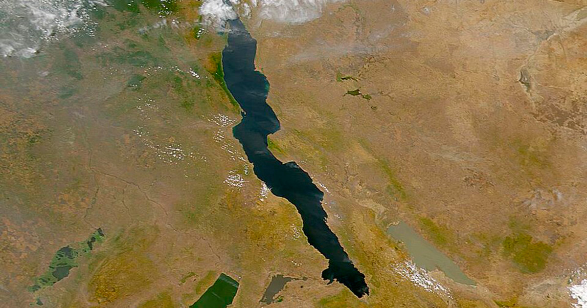
The Arabian Plate moves away from Africa at approximately 2.5 centimeters per year, a movement that over millions of years has already opened the Red Sea and the Gulf of Aden. Meanwhile, the Nubian and Somali Plates separate more slowly, at rates between 5 and 13 millimeters per year, along the East African Rift Valley, a geological structure that runs through Ethiopia, Kenya, and Tanzania and extends to Mozambique for more than 3,000 kilometers.
The Danakil Depression: One of the Most Extreme Environments on Earth
The most advanced point of this continental separation process is in the Danakil Depression, in the northernmost part of the Afar region. This is one of the planet’s most hostile natural environments. Daytime temperatures can exceed 50 °C, while nighttime lows rarely drop below 35 °C. Rain is virtually nonexistent, and the landscape is dominated by salt flats, volcanic fields, and extremely acidic geothermal areas.
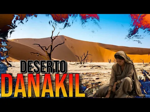
Geophysicist Cynthia Ebinger from Tulane University, who has studied the region for decades, often describes the place as a landscape worthy of Dante’s hell.
In addition to the extreme conditions, the region is also one of the lowest areas on the Earth’s surface. The floor of the Danakil Depression lies about 125 meters below sea level, and in some points near the geothermal area of Dallol, the depth reaches approximately 120 meters below sea level.
Dallol is famous for its multicolored acidic pools, some with a pH lower than 1, comparable to the acidity of industrial batteries.
Extremely Thin Continental Crust Reveals Transition to Oceanic Crust
The Earth’s crust beneath the Afar region has undergone an intense process of tectonic thinning. In stable continents, the crust is typically between 35 and 40 kilometers thick. However, in the Danakil Depression, the stretching caused by the rift has drastically reduced this thickness. In some areas near the Erta Ale volcano, typical continental crust no longer exists.
What remains is a transitional crust, resembling the oceanic crust that forms at mid-ocean ridges. The Erta Ale, a volcano about 613 meters high above the surface, houses one of the few permanent lava lakes on the planet, continuously active since at least 1906.
Currently, only a topographical barrier of about 20 meters high in Eritrea separates the Danakil Depression from the Red Sea.
The Mantle Plume Under Afar and the “Pulse” of the Earth’s Mantle
For decades, geologists have known there is a mantle plume beneath the Afar region — a column of extremely hot material that rises from the deep interior of the Earth and contributes to weakening the continental crust. However, the behavior of this plume has remained poorly understood.
In July 2025, a study published in the journal Nature Geoscience provided new details about this process. The research was conducted by scientists from ten international institutions, including the universities of Southampton, Swansea, Addis Ababa, and the Ethiopian Institute of Geophysics.
The researchers analyzed 130 samples of volcanic rock collected over more than a decade and combined the data with advanced geophysical models. The result revealed something unexpected: the mantle under Afar pulses in rhythmic cycles.
Waves of partially melted rock rise from the planet’s interior with distinct chemical signatures, functioning as true “geological barcodes.” Each pulse carries material from the mantle with slightly different composition, recording the deep layers it has passed through.
Geologist Emma Watts from Swansea University described the phenomenon as a geological heartbeat.
The 2005 Rift Changed the Understanding of Ocean Formation
The tectonic event of 2005 in Afar was pivotal for modern geoscience. Before it, the dominant model described the opening of continental rifts as a slow and continuous process, occurring millimeter by millimeter over thousands of years.
What happened in Ethiopia showed that this process can also occur in abrupt jumps, with long periods of relative stability followed by rapid episodes in which centuries of tectonic movement happen in just a few days.
The rift was accompanied by a series of magma dike intrusions that propagated for dozens of kilometers below the surface. This mechanism is exactly the same as what occurs at mid-ocean ridges, where new oceans form on the ocean floor.
Subsequent seismic studies confirmed that the active volcanic processes in the Ethiopian rift are practically identical to those occurring at submarine ridges. In other words, Afar represents an observable ocean in formation directly on solid ground.
How the East African Rift Valley Can Create a New Ocean
The East African Rift Valley already appears on the map as a geological scar cutting through the continent from north to south. This structure is characterized by a sequence of large deep lakes—such as Turkana, Victoria, Tanganyika, and Malawi—formed by the sinking of the crust as the continent is slowly stretched. The formation of a new ocean follows a relatively well-known geological process.
First, the continental rift deepens. Next, the crust becomes increasingly thin. The mantle rises closer to the surface, and basaltic magma begins to fill the space created by the separation of the plates. Over time, the bottom of the rift may fall below sea level, allowing ocean water to invade the region.
In the Danakil Depression, two of these stages have already occurred. The crust has been thinned to the point of becoming partially oceanic, and the floor of the depression is already below sea level. What remains now is the collapse of the geographical barrier separating the Red Sea from the depression.
When this happens, the water from the Gulf of Aden and the Red Sea may invade the rift, forming a new inland sea, which over millions of years may evolve into a new ocean separating the Horn of Africa from the rest of the continent.
Afar: The Rarest Natural Laboratory of Modern Geology
For geologists, Afar represents a virtually unique phenomenon. Researcher Christopher Moore, who studies the Ethiopian rift, describes the region as the only place on Earth where it is possible to directly observe the transition between a continental rift and an oceanic rift.
On the ocean floor, this process occurs under extreme pressure and depth conditions that make direct observations difficult. In Afar, it occurs in the open air.
The landscape mixes lava lakes, extremely acidic geothermal fields, salt flats that were once ocean floors, and active volcanoes. At the same time, local communities of the Afar people have been manually extracting salt blocks for centuries and transporting them in camel caravans across the desert.
Meanwhile, scientific instruments installed in the region continuously measure the movement of tectonic plates with millimeter precision per year. Seismographs record nearly imperceptible micro-quakes and feed models that help scientists understand how all the oceans on the planet were formed, from the Atlantic to the Pacific.
Underneath this extreme landscape, the pulse of the Earth’s mantle continues to slowly push the plates, stretching the crust that will one day definitively separate two parts of a continent that were once one.


-

Uma pessoa reagiu a isso.