 Portuguese
  English
  Spanish
 Solar Energy Overcomes Relief Limitations in Brazil with Adapted Trackers, Reducing Civil Work Costs and Increasing the Economic Viability of Photovoltaic Projects.
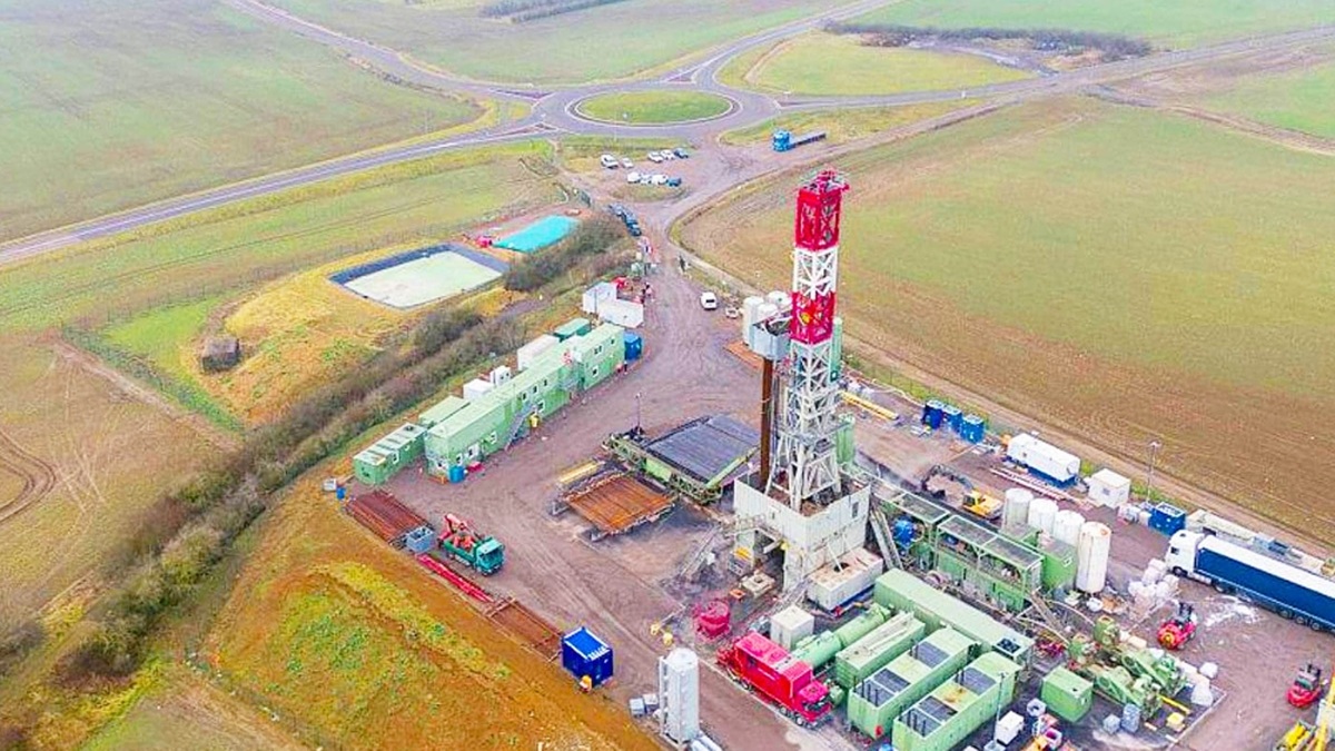
The expansion of solar energy in Brazil enters a new phase marked by overcoming technical challenges that, until a few years ago, limited the advancement of photovoltaic projects.
With the accelerated growth of installed capacity and increased competition for flat areas, topography has begun to play a central role in the planning of solar plants.
Land with steep slopes, undulations, and irregularities, previously considered economically unviable, now integrates the map of opportunities in the sector.
-
While Brazil wants to end the 6×1 work shift, the president of Argentina wants 12 hours for his workers, increasing political tension in the country.

-
The village where two rivers run side by side without mixing in Santarém and Alter do Chão reveals some of the most beautiful freshwater beaches on the planet.
-
Mars is accelerating, and scientists have discovered that the planet’s day is getting shorter, revealing surprising signs of internal activity.

-
Artemis 2 is set to launch on April 1 at 7:24 PM to orbit the Moon with four astronauts, but a class X solar flare and coronal mass ejection could interfere with communications and threaten the launch.

This movement occurs at a moment when the country is consolidating itself as one of the most dynamic markets in the world for photovoltaic generation.
As projects move away from major load centers and advance into new regions, technological solutions capable of reconciling energy performance, cost control, and reduced environmental impact gain prominence.
Topography Ceases to Be an Obstacle and Becomes a Strategic Variable
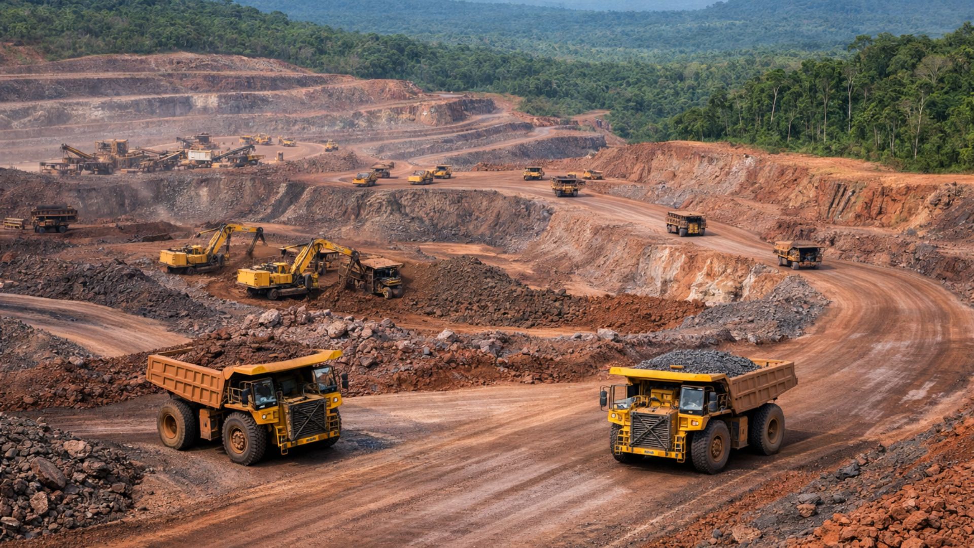
Historically, the solar energy sector prioritized flat areas due to construction ease and budget predictability. However, with the maturation of the Brazilian market and the relative scarcity of these areas, developments on more complex terrain have begun to be considered. The challenge has always been the additional costs associated with earthworks, foundations, and earth movement.
Experts point out that in large-scale photovoltaic projects, civil works can represent a significant portion of total CAPEX. In irregular areas, the use of conventional trackers usually requires extensive earth cuts, fillings, and strict alignments, increasing timelines, costs, and environmental risks.
In this scenario, topography has ceased to be merely a technical datum and now directly influences the economic viability of projects. Thus, the choice of solar tracking system has become a strategic decision.
Trackers Gain a Central Role in Economic Viability
Solar tracking systems, known as trackers, follow the sun’s movement throughout the day, increasing the generation of solar energy compared to fixed structures. However, more than productivity gains, these devices have become crucial in adapting projects to the actual conditions of the terrain.
By allowing greater flexibility in installation, modern trackers reduce the need for major interventions on the ground. As a result, costs associated with earthworks and foundations can be significantly reduced, while indicators such as LCOE (Levelized Cost of Energy) are preserved or even improved.
It is at this intersection of engineering, energy efficiency, and financial viability that specialized companies have been expanding their operations in Brazil, offering solutions designed for different geographical realities.
Technology Expands the Universe of Areas Suitable for Solar Energy
The geographical diversity of Brazil requires specific solutions for each type of terrain. With this in mind, Axial, the national arm of a globally recognized Spanish company in the development of solar trackers, has been investing in technologies adaptable to various relief conditions.
According to Ronald Carias Esteban, general director of Axial in Brazil, the sector can no longer work with one-size-fits-all solutions. “With the diversity of topographies in the country, we can no longer have a single solution. Our models are designed to act as project catalysts, ensuring the best LCOE in terrains that were previously discarded,” he explains.
This approach has allowed areas previously overlooked to be considered economically viable for the deployment of solar energy plants, expanding the sector’s growth potential.
Energy Efficiency in Flat and Undulating Terrain
In flat or slightly undulating regions, developers’ focus remains on maximizing generation. For this type of terrain, solutions like the Axial Tracker Twin stand out for their efficiency and construction simplicity.
The bifilar model uses kinetic technology in its single-axis structure, ensuring greater precision in the movement of photovoltaic modules throughout the day. Additionally, the system facilitates assembly and reduces installation time.
According to Esteban, the energy gain is significant. “Designed to maximize performance, this model can result in an increase of up to 30% in energy production compared to fixed structures,” he claims.
This increase in generation is especially relevant in an increasingly competitive market where projects compete for space in auctions, power purchase agreements (PPAs), and merchant models.
Specific Solutions for Terrain with Steep Slopes
While in regular areas the priority is efficiency, in more complex terrains, the challenge is structural. For this context, trackers capable of operating under adverse topographic conditions have been developed, without the need for major interventions on the ground.
An example is the SlopeSync system, designed to handle steep slopes and significant morphological variations. The main differentiator of the technology lies in eliminating the requirement for perfect alignment of the pillars, one of the biggest barriers in solar projects on inclined areas.
The system supports deviations of up to 30° in the North-South direction and height variations of up to 15% or 400 millimeters, offering greater freedom to the executive project and reducing engineering restrictions.
According to Esteban, this flexibility generates direct impacts on the schedule and budget. “This adaptability significantly reduces costs and the project’s execution time, while minimizing environmental intervention on the ground,” he notes.
Less Environmental Impact and Gains in Licensing
The reduction of earth movement brings not only financial benefits. In solar energy projects, less intervention in the ground helps facilitate environmental licensing processes, which are becoming increasingly stringent in the country.
Moreover, the decrease in cuts and fillings reduces risks associated with erosion, siltation, and surface water runoff, critical factors in regions with rugged terrain. Thus, the adapted trackers also align with environmental demands and the ESG agenda of the electricity sector.
Innovation Drives Competitiveness in the Solar Sector
To keep pace with the maturity of the Brazilian market, continuous investment in Research & Development has become an essential part of the strategy for companies in the sector. In the case of Axial, innovation is seen as a pillar to sustain the growth of solar energy in the long term.
“With a focus on innovation and investments in Research & Development, Axial positions itself as a strategic partner for the next phase of solar expansion in the country, making photovoltaic plants viable and highly efficient, regardless of the geographical challenge,” Esteban highlights.
This vision reinforces the trend that applied engineering will increasingly be decisive for the competitiveness of projects.


Seja o primeiro a reagir!