 Portuguese
  English
  Spanish
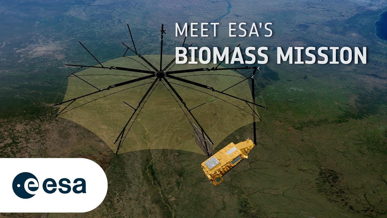
ESA Launches The BIOMASS Satellite With The World’s First P-Band Radar To Map With Unique Accuracy The Carbon Stored In Forests And Understand Its Role In Global Warming.
Imagine looking at a dense forest covered by clouds in the middle of the Amazon or Congo, and still being able to see what is beneath the tree canopy — measuring the trunks, branches, and calculating exactly how much wood, and therefore, how much carbon, exists there. What seems like a science fiction scene has just become reality with the launch of the BIOMASS satellite by the European Space Agency (ESA).
This is the first time in history that a P-band radar — the deepest and most penetrating ever sent to space — will be used to map terrestrial biomass with unprecedented accuracy, revealing the true role of forests in the global carbon cycle. What is at stake is understanding how much CO₂ they actually absorb, where the largest carbon stocks on the planet are located, and how all of this is changing with the advance of climate change.
The Mission That Looks Down — To Understand The Whole
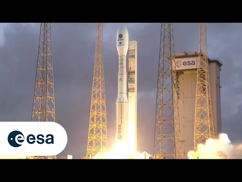
Successfully launched on April 29, 2025, aboard a Vega-C rocket from the Kourou space center in French Guiana, the BIOMASS satellite now orbits the Earth as part of the ESA’s Earth Explorers program.
-
China has created a mass-produced hypersonic missile that costs the same as a Tesla, and this is changing everything in modern warfare because the United States cannot defend itself without spending millions.

-
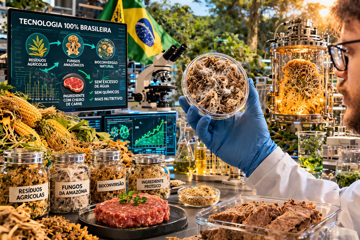
100% Brazilian technology transforms agricultural waste into a meat-scented ingredient using fungi from the Amazon rainforest. The process does not use excessive water or chemicals, and it also increases the nutritional value of the final product.
-
Psychology reveals that adults who avoid conflicts at all costs are not balanced individuals, but rather children who learned in the worst way that expressing emotions brought punishment and now live paralyzed by the fear of expressing themselves.

-
Goodbye pet hair on clothes: a washer with an internal filter promises to remove up to 5 times more hair than regular machines and uses an XL trap dryer system to capture what remains.


Less than an hour after separating from the rocket, the satellite had already sent its first signal, confirming that it was operational.
The mission was designed with a clear purpose: to quantify forest biomass and, consequently, the amount of carbon stored in the world’s forests — something that has never been done globally with precision before.
This includes remote areas, covered by tropical clouds or by tree canopies so dense that no other satellite has been able to penetrate.
According to ESA, more than 70% of terrestrial biomass is concentrated in tropical forests, such as the Amazon, the Congo Basin, and Southeast Asia. However, most global attention is limited to visible vegetation cover from satellites, which is not enough to estimate what is actually stored in the trunks, stems, and branches — the woody part of the forest, which stores up to 50% of a tree’s weight in carbon.
The P-Band Radar: The Secret of BIOMASS
The central innovation of the mission lies in the first synthetic aperture radar in P-band to be sent to space. While satellites like Sentinel-1 (C-band) or NASA’s NISAR (L-band) use shorter wavelengths, the P-band radar operates with much longer waves, capable of penetrating the tree canopy, cloud cover, and even heavy rain.
This allows BIOMASS to interact directly with the most valuable components of the carbon cycle: the wood, the trunk, the branches, and the forest soil. The radar emits pulses and captures the returning echo, processing the signal to measure the three-dimensional structure of the vegetation.
And we’re not talking about simple images: the radar is capable of estimating tree height, forest density, and the distribution of woody organic matter, creating a global map of forest biomass with a precision that no terrestrial or orbital instrument has achieved before.
Implementation: An Engineering Challenge
To make this measurement possible, the satellite will need to deploy a 12-meter-diameter reflector antenna, mounted on a 7.5-meter articulated arm. This extremely delicate maneuver will be carried out in the initial days of the mission. Once fully deployed, the antenna will be able to scan vast regions of the Earth’s surface with high resolution, even in hard-to-access areas.
The BIOMASS satellite also incorporates fine navigation and control systems, which will allow repeated passes over the same areas at slightly different angles. This enables it to apply radar tomography techniques, a type of layer scanning, which will allow 3D reconstructions of forest structure.
Mission in Two Phases: 3D Map and Monitoring
The mission is divided into two main phases. The first, called the tomography phase, will last 18 months and will be dedicated to building three-dimensional models of forests by crossing signals collected from different angles. The second phase, lasting 4 years, will be the interferometric phase, during which the satellite will observe changes in height, density, and structure of forests over time.
With this, it will be possible to estimate with great precision how much carbon is being absorbed or emitted, by region and type of forest. And this information has direct implications for climate policies, carbon markets, REDD+, and environmental planning.
Why Does This Matter?
We know that forests absorb, on average, about 8 billion metric tons of net CO₂ per year — but that is just an estimate. Deforestation and forest degradation return some of that carbon to the atmosphere. The problem is that, until now, we did not have reliable global tools to quantify exactly this balance.
BIOMASS changes the game. With it, it will be possible to:
- Calculate forest carbon stock above ground with high precision
- Detect areas of biomass loss or gain year after year
- Model the impact of climate and human activity on forests
- Support international emissions reduction agreements
In other words: BIOMASS not only observes the Earth — it helps redefine how we understand the role of forests in the global climate balance.
A Leap for Science — And For Environmental Protection
With years of investment and cutting-edge technologies like the P-band radar, ESA launches with BIOMASS one of the most ambitious scientific projects of the decade in the fields of climatology, ecology, and remote sensing.
The mission also has symbolic value: it shows that the space race is not just for Mars, but also to save our planet, providing critical data to combat global warming and protect what remains of tropical forests.
If BIOMASS achieves its goal — and all indications are that it will — we will begin to see forests not just as green landscapes, but as vital carbon reservoirs, now visible with unprecedented scientific clarity.


Seja o primeiro a reagir!