 English
  Francês
  Alemão
  Italiano
  Japonês
  Norueguês
  Portuguese
  Spanish
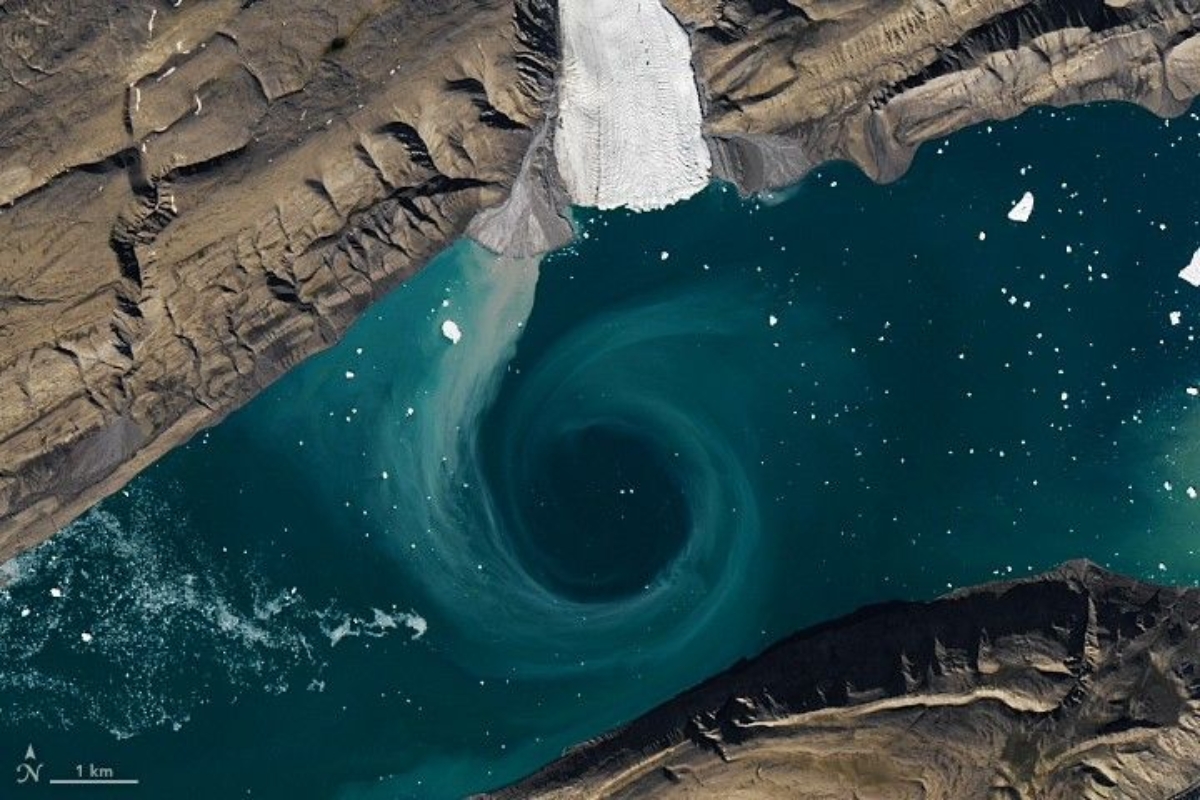
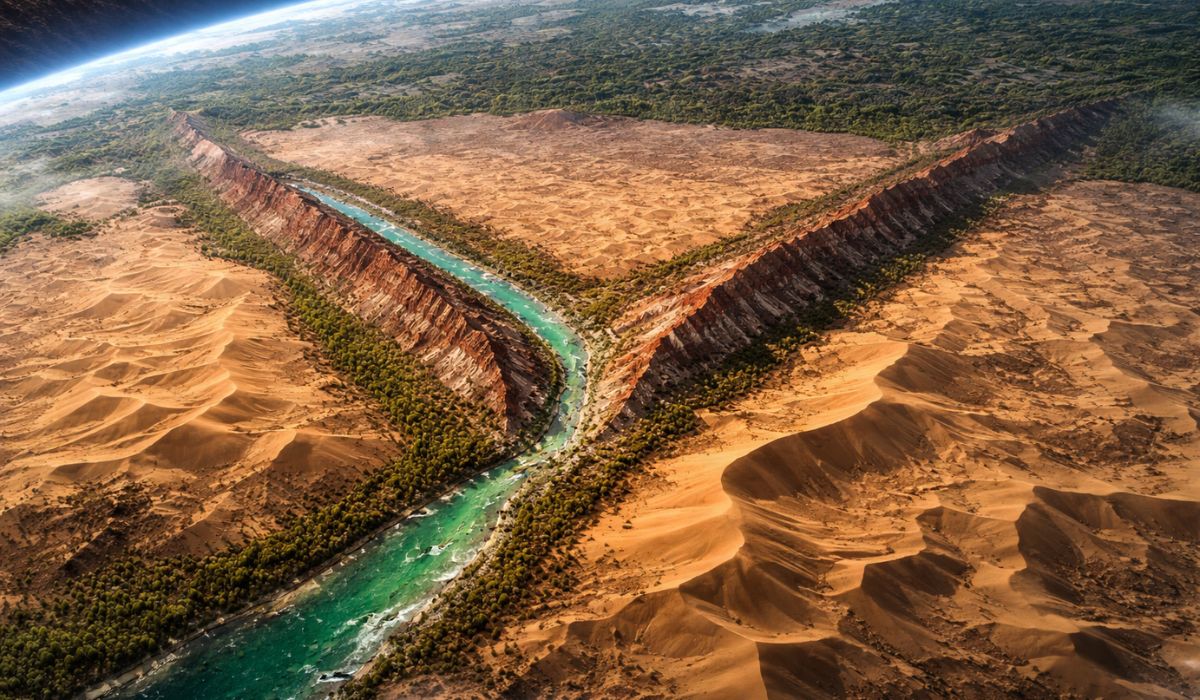
Registered phenomenon in the Canadian Arctic shows a visible whirlpool from space, fed by melting and sediments, with direct impact on marine life and ice in the region
An image taken over a remote fjord in the Canadian Arctic turned a dark circle in the water into a global topic. At first glance, the scene appears to show an open hole on the surface.
What appears there, however, is a natural movement of the ocean. The visible pattern in the sea reveals how summer in the region reorganizes the ice, spreads sediments, and alters the functioning of the ecosystem.
This type of record also helps to understand something larger. Melting not only changes the landscape. It interferes with water circulation, carries nutrients, and amplifies signs of transformation in one of the planet’s most sensitive areas.
-
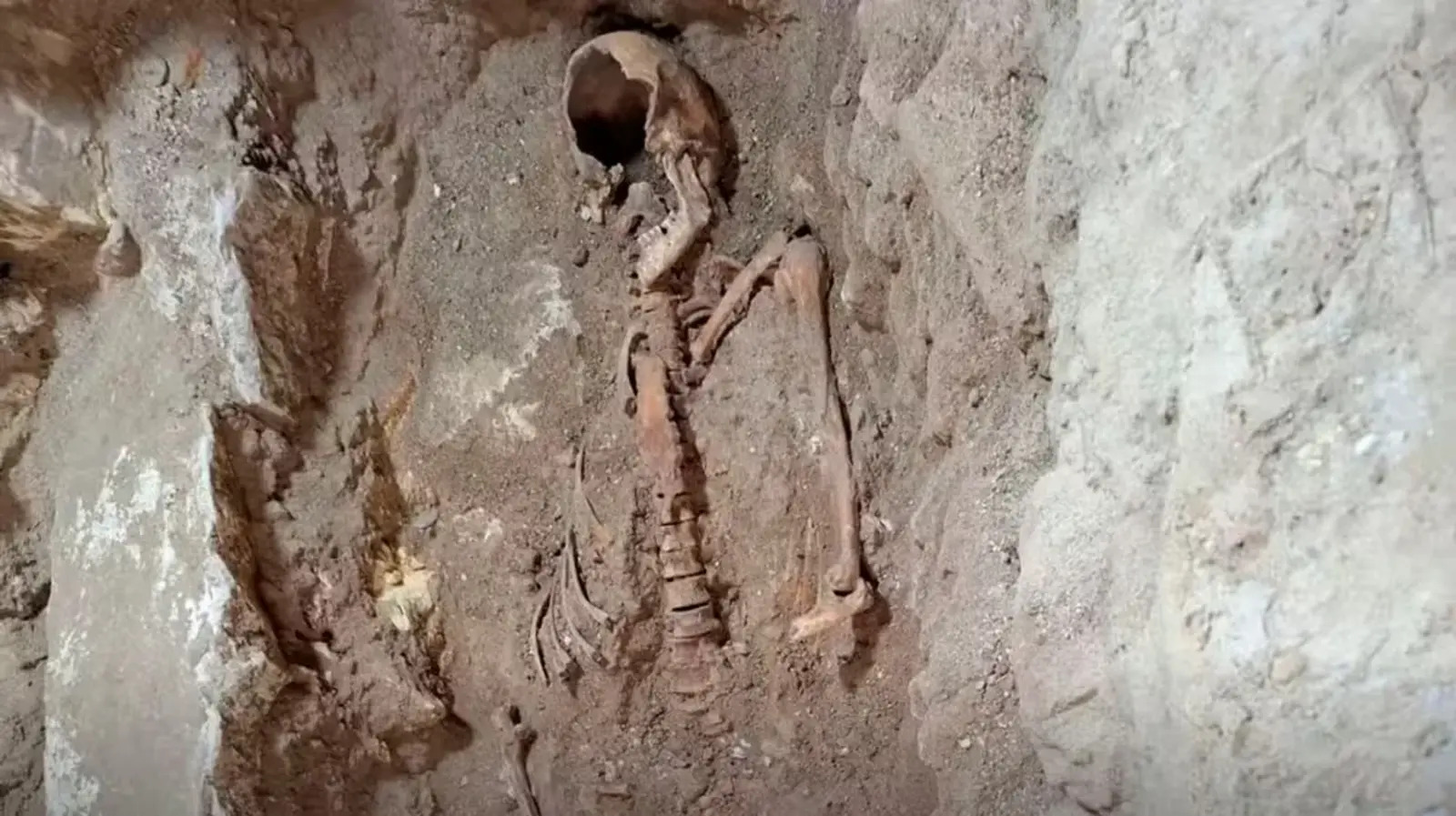
350-year mystery may have been solved: remains of a soldier who inspired the hero of The Three Musketeers found beneath a church in the Netherlands.
-
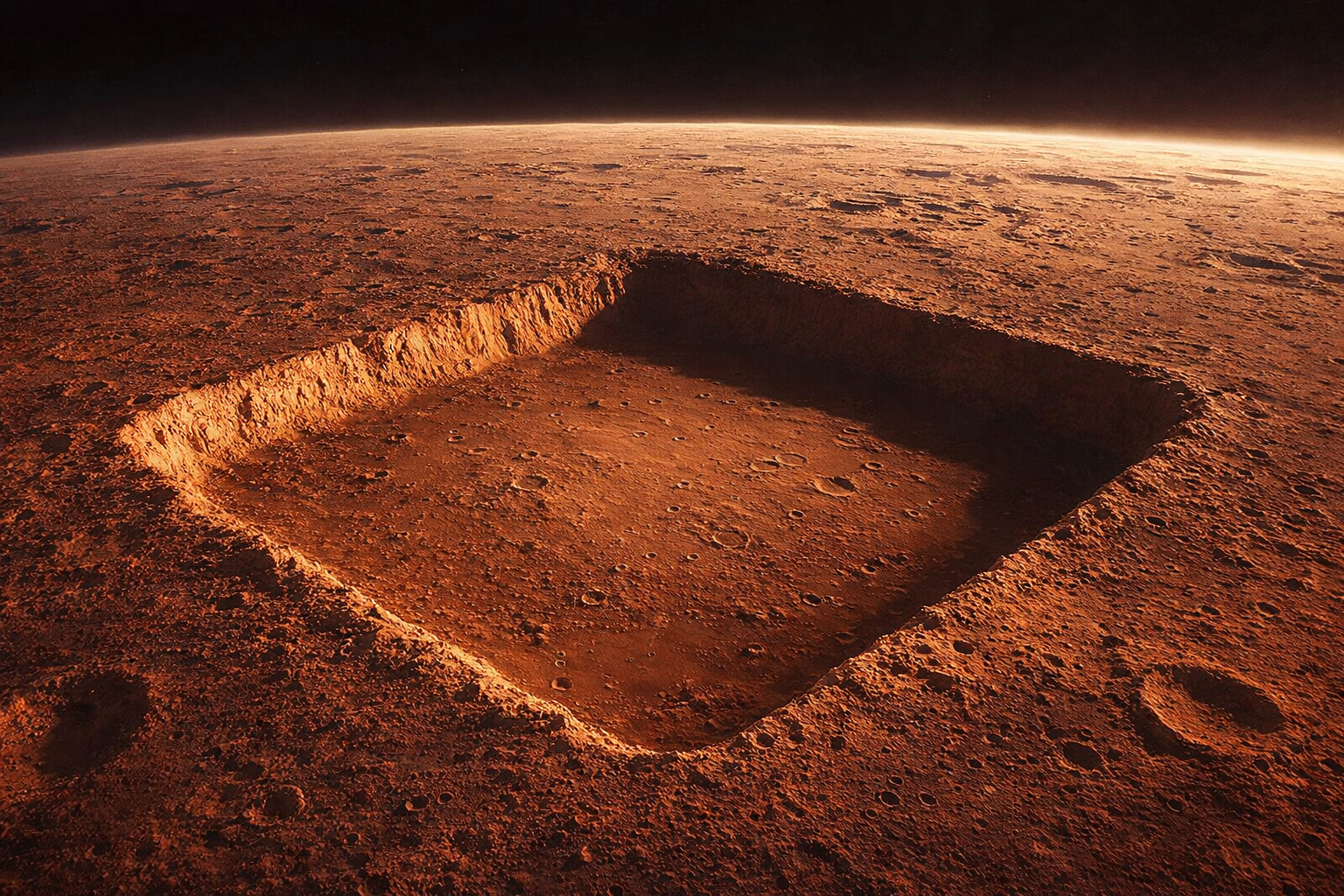
NASA photographed a nearly perfect square with 3 km sides on Mars, 13 times larger than the Great Pyramid of Giza, but the official explanation is natural erosion; still, no one has explained why the four sides have almost identical lengths.
-
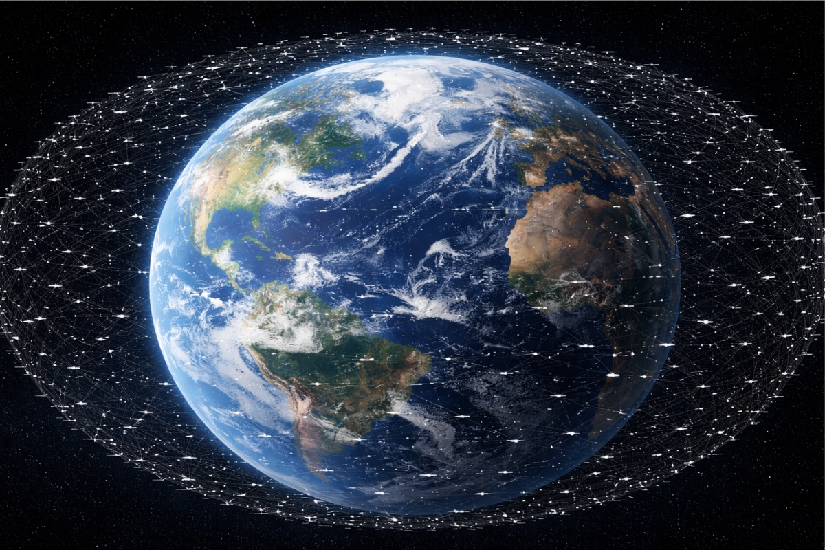
Starlink breaks the barrier of 10,000 satellites in orbit and takes its expansion to an unprecedented level, with a direct impact on global internet, technological competition, and the race for space.
-
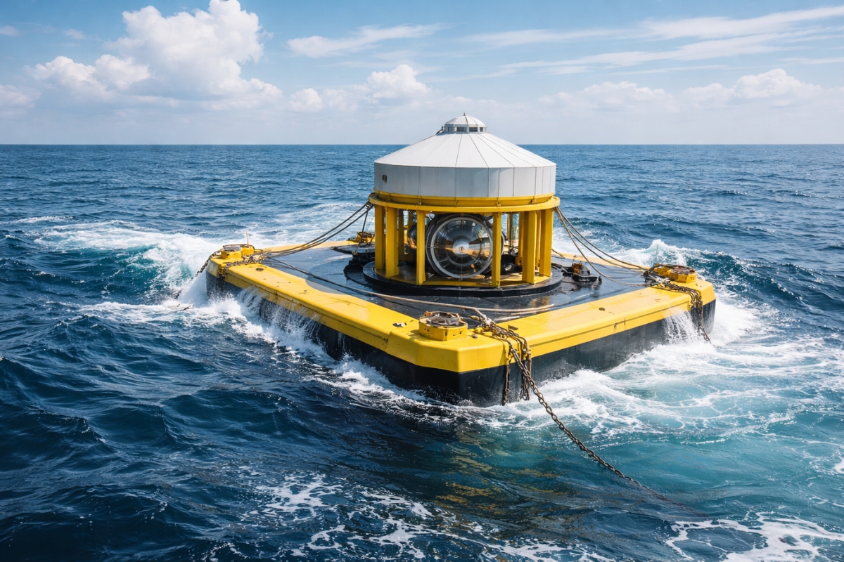
Japan finds an alternative to oil amid rising prices by transforming ocean balance into electricity with a new technology that maintains efficiency even when the sea changes.

Cañon Fiord connects isolated waters to the Arctic Ocean
The scene was recorded in Cañon Fiord, on Ellesmere Island, within the Canadian Arctic archipelago. This section is about 115 kilometers southeast of the Eureka research station.
The waters of the fjord flow towards Nansen Sound and then to the Arctic Ocean. This makes the area important for observing how ice, sediments, and currents mix on a large scale.
Image from August 9, 2022 revealed the dark circle

The record was made on August 9, 2022 with the OLI sensor, installed on the Landsat 8 satellite. The equipment observes bands of visible and near-infrared light, allowing for high-definition environmental details.
In practice, this means clearly seeing changes in water, ice, and materials carried by melting. In remote regions, this monitoring becomes an important piece for understanding the pace of transformations.
The so-called hole is a whirlpool of water marked by ice and particles
The dark circle is not a real opening in the sea. It is an ocean whirlpool, formed when water changes direction, encounters natural barriers, or begins to swirl due to differences in density and current.
For much of the year, sea ice covers these waters and can reach 2 meters in thickness. This reduces the mixing caused by the wind and keeps the water less turbid.
In summer, everything changes rapidly. The ice breaks, shifts, and begins to outline the swirl of water, along with suspended particles. The result is a circular pattern that is visible even from space.
Glacial flour colors the water and brings nutrients to the fjord

The turquoise band that appears around the whirlpool does not indicate contamination. It is primarily formed by glacial flour, a very fine rock powder generated by the friction of the glacier with the ground and carried by melting water.
According to NASA Earth Observatory, the Earth observation platform of the space agency, this material can serve as a critical source of nutrients, particularly soluble iron.
This detail has enormous weight in the sea. Phytoplankton, the base of marine food chains, depends on this nutrient to grow. When there is more food available at the surface, the effects can reach fish, birds, and marine mammals.
Ice from the Agassiz Ice Cap amplifies the climatic signal
The images also show ice coming from the Agassiz Ice Cap, one of the large ice fields of Ellesmere. This reinforces the link between the visible whirlpool, the volume of melting, and the amount of sediments released into the water during summer.
The dynamics are not isolated. They accompany a system that has been losing mass significantly and help explain why water circulation in the region may become increasingly marked by this process.
Loss of 61 ± 7 gigatons per year exposes the scale of change
Scientific measurements indicated that the Canadian Arctic archipelago lost 61 ± 7 gigatons of ice per year between 2004 and 2009. During this period, the contribution to sea level rise was estimated at 0.17 ± 0.02 millimeters per year.
The data also pointed to a significant increase in the rate of loss between 2004 and 2006 and 2007 and 2009, associated with warmer summers. On a global scale, glaciers outside Greenland and Antarctica lost an average of 199 ± 32 gigatons per year between 2002 and 2016.
This snapshot shows that the image is not only impressive due to its curious shape. It helps visualize a process that connects melting, nutrients, ocean circulation, and rising sea levels.
The final effect goes beyond the aesthetics of the scene. What appears to be just a dark circle in the fjord reveals a rapidly changing environment, impacting marine life and the balance of ice in the region.
By making this movement visible, the record enhances the understanding of the Arctic and shows that each sign of melting carries consequences far greater than it seems. It is a picture that pressures the region.


Seja o primeiro a reagir!