 Portuguese
  English
  Spanish
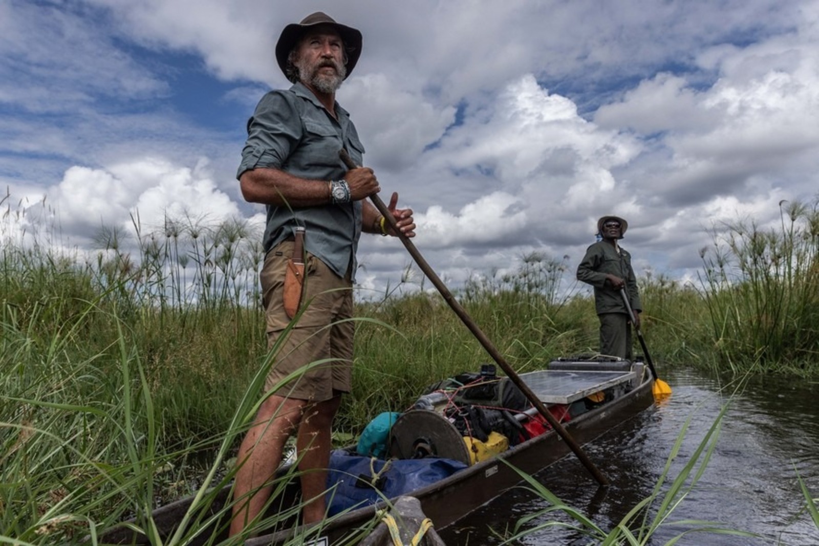
After Six Months Through Minefields, Boyes Describes Lisima Lya Mwono As An Isolated Region Vital To Large African Basins Mapped Since 2015 By An International Scientific Project With Lasting Environmental Impact
South African explorer Steve Boyes, 46, reports a 6-month expedition through minefields, mapping 15 rivers since 2015 and revealing a wetland of 420 cubic kilometers of water in western Angola.
Steve Boyes, 46, describes arriving at Lisima Lya Mwono in western Angola a decade ago, after six months of expedition, as access to the most remote known place, now central to a scientific project with continental impact.
In times of GPS, satellite imagery, and instant messaging apps, Boyes states that the region seemed unreachable, despite being located in a wet plateau in western Angola.
-
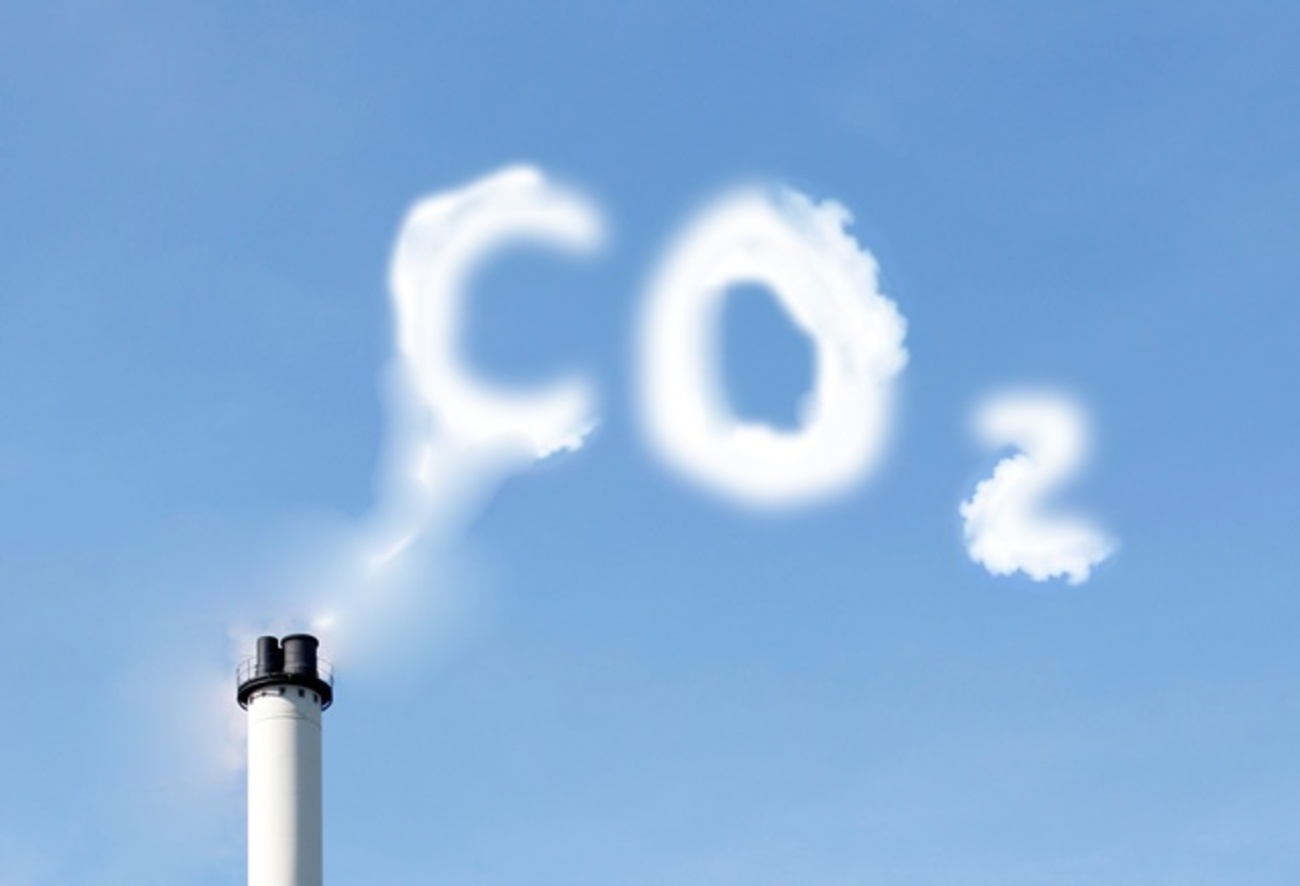
While the world looks at oil, the war with Iran is already disrupting helium supply from Qatar, affecting car and iPhone chips, threatening AI expansion, and putting pressure on aluminum packaging at the highest value in four years.

-
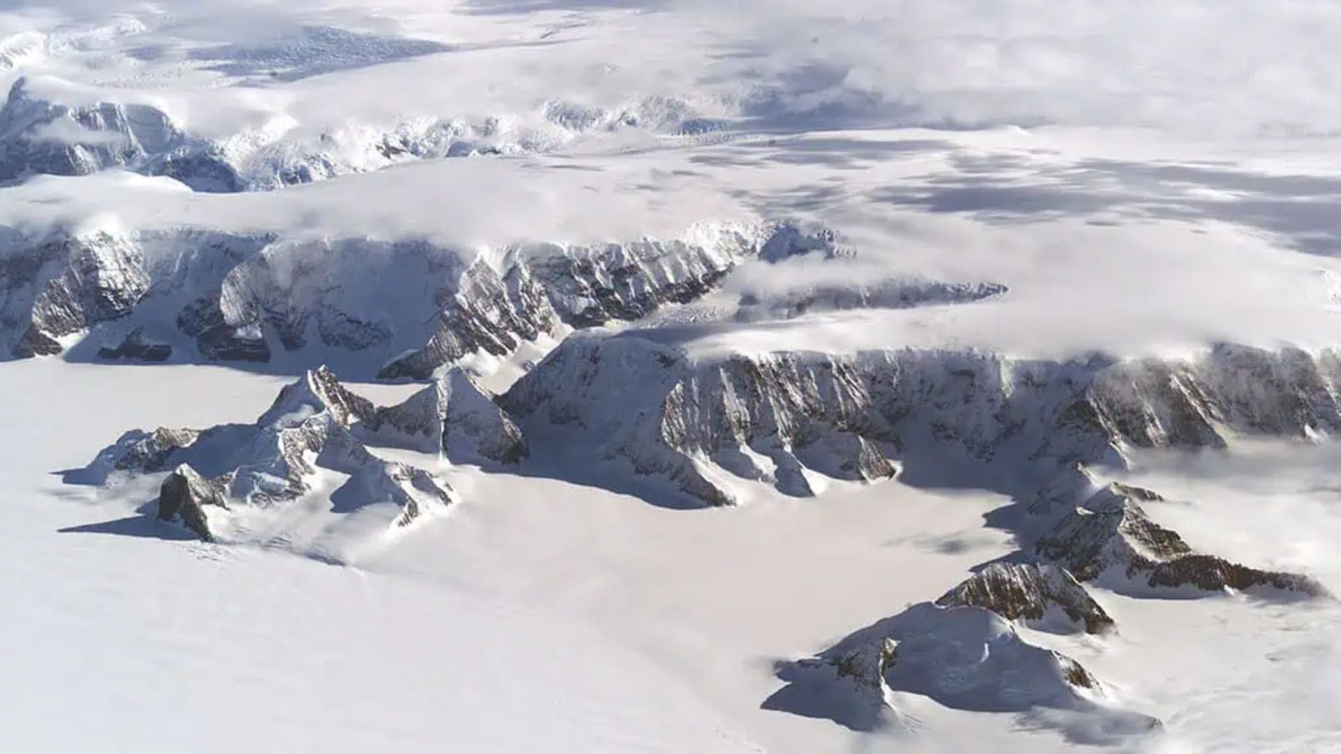
Global warming will expose a treasure hidden under the ice of Antarctica and may spark an international dispute over gold and valuable minerals.
-
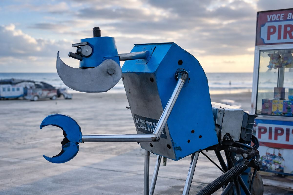
A street vendor from Praia Grande built a robot made of scrap from scooters and washing machines that pulls his popcorn cart on the beach, emits sounds, and interacts with customers, becoming an attraction on the coast of São Paulo.
-
The specifications of the Xiaomi 18 Pro Max have been leaked, and the highlight is a dual 200 MP camera with a new 22-nanometer technology that promises to consume less energy and capture details in shadows and bright areas using LOFIC HDR.


The perception stems from the extreme logistical difficulty faced during the first incursion, carried out a decade ago, when the team crossed remote areas without basic infrastructure.
According to Boyes, access required six months in armored vehicles, traversing routes that included two minefields still active in the territory.
The account was given during a meeting with journalists hosted by the Swiss manufacturer Rolex, the project’s sponsor since 2022.
The fieldwork became the subject of a film directed by Werner Herzog, a veteran filmmaker known for documentaries on human and environmental exploration.
Lisima Lya Mwono occupies an area equivalent to the territory of Germany, concentrating waterways and extensive peatlands in the Angolan plateau.
These water systems discharge around 420 cubic kilometers of water into large African river basins, according to measurements gathered by the team.
Among the rivers fed are Cubango, Zambezi, and Congo, as well as Cuando, Cuanza, and Cunene, which spread across different regions of the continent.
The Zambezi, for example, crosses Southern Africa until it reaches the Indian Ocean, connecting the region to distant coastal ecosystems.
Local Communities And Historical Barriers To Access
Despite its isolated appearance, Boyes emphasizes the historical presence of human communities in the region, essential for the preservation of local waters.
British explorers, such as Ian Livingstone, and Portuguese traders traversed nearby areas since the 19th century, but avoided Lisima Lya Mwono.
Old accounts spoke of treacherous waters and impassable terrain for vessels or land carriages.
These narratives, according to Boyes, were deliberately spread by local populations to protect sacred areas and traditional hunting zones.
The region was referred to as the land of a thousand rivers, described as impossible to cross by those unfamiliar with its paths.
The explorer claims he was never met with hostility but with cooperation from experienced hunters and fishermen.
According to him, the generosity of these communities was constant during the expeditions carried out over the years.
Today, besides the natural isolation, access is hindered by a direct legacy of the Angolan civil war.
The conflict lasted 27 years, with intermittent episodes until 2002, leaving active minefields in remote rural areas.
According to the Africa Defense Forum newspaper, about 975 minefields in the country still await proper clearance.
Technological Mapping And Geographic Discoveries
The Great Spine of Africa project seeks to map large wetland areas of the African continent in detail, without hiding its routes.
Equipment installed on canoes captures 360° images, triggered automatically every 13 seconds of navigation.
The images are gathered by a computer program, forming interactive 3D maps of the rivers traveled.
Since 2015, the team has crossed 15 rivers, fully documenting the environments encountered along the routes.
After 45 days of navigation, a significant geographic discovery regarding the Lungo-Bungo river emerged.
Located in Lisima Lya Mwono, it was confirmed as the farthest tributary of the Zambezi.
This finding added 342 km to the river’s total length, which now measures 3,421 km from end to end.
The value remains lower than the Nile, cited with 6.6 km in length, but reinforces the continental scale of the Zambezi.
Environmental Recognition And Human Impact
In July of this year, the region was the subject of discussion during the Ramsar Convention on wetlands.
The meeting took place near the border between Zambia and Zimbabwe and formalized a request for international recognition.
Lisima Lya Mwono faces droughts and the encroachment of economic activities, factors considered in the evaluation process.
If it receives the title, the area will come to integrate cross-border regulatory regimes aimed at sustainable protection.
As it concentrates springs, the decision directly impacts the lives of 400 million people dependent on these basins.
The region also influences two-thirds of the remaining African elephant population, according to estimates cited by the team.
Rare species, some observed only once in the past, depend on the integrity of these aquatic ecosystems.
The current team includes over 100 people and 30 institutional partners involved in the expeditions.
There is support from a laboratory in Botswana, responsible for the biological analysis of the collected water samples.
Through these samples, it is possible to identify species that passed through the location up to two weeks before collection.
Rare Species And Ongoing Investigations
Among the findings is the freshwater fish Paramormyrops jacksoni, known as the Ghost stonebasher.
The species was recorded during an expedition in western Angola three years ago, according to Boyes.
Prior to that, it had only been seen once, 55 years ago, in an aquifer system north of the highlands.
Another focus of the team is the so-called ghost elephants, descendants of the African elephant Fénykövi.
Fénykövi is described as the largest of its kind, weighing 11 tons and standing 4 meters tall.
The search became the subject of a documentary directed by Werner Herzog, released at the Venice Film Festival in August.
Boyes states that it took 7 years to obtain the first photographic records of these elephants.
In the last two years, the team has also been collecting animal DNA for comparison with Fénykövi’s remains.
According to the explorer, these examples represent just the beginning of possible discoveries.
He projects the identification of hundreds of new species, especially in the most remote basins of the Congo.
The next stage of the work is scheduled for next year, with an expanded focus on continental fish fauna.
With information from GQ.Globo.


Seja o primeiro a reagir!