 Portuguese
  English
  Spanish
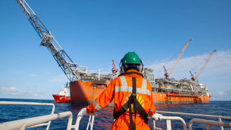
Data Acquisition Campaigns Have Been Authorized for Shell in Gato do Mato to Be Launched in 2019
Shell acquired blocks in Gato do Mato and Gato do Mato Sul in the second round of oil auctions in October 2017, but only now has it been authorized to license these assets, as the saying goes, “better late than never.” It’s worth noting that these acquisitions by the Anglo-Dutch company are in the form of a consortium with the oil company Total, in the pre-salt layer of the Santos Basin. In a clever way, Shell and other multinationals have been gaining ground in national exploration.
According to Shell, the seismic data acquisitions are scheduled to begin in July 2019. The territorial area that will be covered for data acquisition is within a perimeter of 9,400 km², which ultimately will also encompass the Maromba area, potentially providing an indirect benefit for the oil company.
-
Government unlocks R$ 554 million for a highway that has been requested for decades and accelerates the duplication of BR.

-
Without bricks, without cement, and without endless construction: the cardboard house that is assembled in modules and can be moved.

-
Billions of barrels on the equatorial margin could lead Amapá to double its oil production in Brazil — the state aims to enter the route of companies in the Campos Basin, attract investments, and boost jobs and businesses in the oil and gas sector.

-
Without bricks, without cement, and without endless construction: the cardboard house that is assembled in modules and can be moved.

To carry out this type of operation, a multilateral logistical planning among the involved companies will be necessary, but the good news is that the port bases of Rio de Janeiro, Niterói, and Jacarepaguá will be used in the operations of Shell and the company acquiring the data, which will certainly provide more future opportunities across all levels of this sector.
Understand How Seismic Ships Operate
These are vessels that use cables and sensors with several meters of length that are dragged across the sea. These systems emit “sound bursts” toward the ocean floor, which reflect back into 3D images, similar to sonar. There are more advanced equipment that can now emit signals that can be visualized in 4D, providing more complete profiling information and more accurate data.
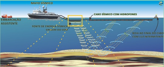
How the Offshore Seismic Data Acquisition System Works


Seja o primeiro a reagir!