 Portuguese
  English
  Spanish
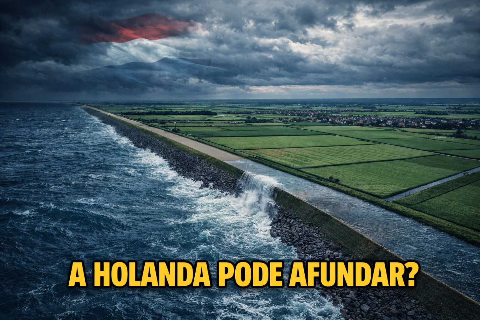
The Netherlands Created Agricultural Land by Draining the Sea with Polders and Dikes, But Today Faces Subsidence, Climate Change, and the Risk of Losing Areas Below Sea Level.
Between the XIII and XX centuries, in the region that today corresponds mainly to the provinces of Flevoland, North Holland, and South Holland, the Netherlands carried out one of the largest continuous hydraulic engineering projects in human history: draining parts of the North Sea to create agricultural land below sea level.
These areas, known as polders, only exist thanks to an integrated system of dikes, sluices, canals, pumping stations, and barriers, currently managed by official bodies such as Rijkswaterstaat and research centers like Deltares.
However, official data released between 2018 and 2024, combined with studies from Dutch universities and government reports, show that the same territory reclaimed from the sea is now slowly sinking, suffering from saline intrusion, facing more intense rainfall, prolonged droughts, and the constant rise of sea levels, putting agriculture, entire cities, and the very logic of the Dutch hydraulic model at risk.
-
Friends have been building a small “town” for 30 years to grow old together, with compact houses, a common area, nature surrounding it, and a collective life project designed for friendship, coexistence, and simplicity.

-
This small town in Germany created its own currency 24 years ago, today it circulates millions per year, is accepted in over 300 stores, and the German government allowed all of this to happen under one condition.

-
Curitiba is shrinking and is expected to lose 97,000 residents by 2050, while inland cities in Paraná such as Sarandi, Araucária, and Toledo are experiencing accelerated growth that is changing the entire state’s map.

-
Tourists were poisoned on Everest in a million-dollar fraud scheme involving helicopters that diverted over $19 million and shocked international authorities.


What Are Polders and How Did the Netherlands Create Lands Where There Once Was Sea
Polders are areas surrounded by dikes, where water is artificially removed and controlled to allow human settlement. Unlike common landfills, polders depend on constant pumping to avoid flooding.
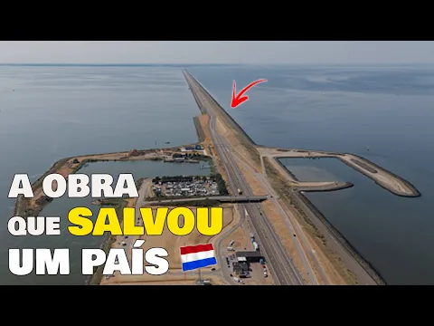
The most emblematic case is the province of Flevoland, created in the 20th century after the closure of the Zuiderzee with the construction of the Afsluitdijk, a dam approximately 32 km long, completed in 1932. Following this closure, enormous areas of the old sea were drained, giving rise to planned cities, high-productivity agricultural centers, road and rail infrastructure, and even fertile land below sea level.
Today, about 26% of Dutch territory is below sea level, and more than 60% of the population lives in flood-prone areas, according to official data from the Dutch government.
The Engineering That Kept the Sea Outside for Centuries
The Dutch success did not come from a single project but from an integrated system, which includes:
- More than 3,500 km of dikes
- Electric and diesel pumping stations
- Agricultural drainage canals
- Tide control sluices
- Temporary water retention reservoirs
These structures are monitored in real-time by sensors, computational models, and technical teams from Rijkswaterstaat, responsible for keeping the country literally dry.
For decades, this model functioned exemplary, allowing the Netherlands to become a global agricultural power, even with limited territory.
The Invisible Problem: Subsidence That Makes the Land Sink
The current greatest enemy of the polders is not just the sea, but also what happens beneath the soil. Much of the drained land consists of peat — an organic carbon-rich material formed by the partial decomposition of plants — along with organic clay and recent marine sediments.
When these areas are drained for agriculture, the soil dries, oxidizes, and compacts, causing subsidence — a gradual and continuous sinking of the ground. Studies from Deltares indicate that some agricultural regions sink between 1 and 2 centimeters per year, which increases the risk of flooding, requires increasingly taller dikes, raises pumping costs, and weakens the foundations of houses and roads.
In urban areas, this already causes structural cracks, issues in plumbing, and billion-dollar maintenance costs.
Climate Change and Sea Level Rise Aggravate the Scenario
Besides subsidence, the Netherlands faces an external factor that escapes local control: the global sea level rise. Official reports indicate that the North Sea could rise between 0.6 and 1.2 meters by 2100, depending on the climate scenario. This means that:
- Dikes designed for the 20th century may become insufficient
- Storms generate extreme hydraulic pressure
- Rare events are occurring more frequently
In 2021 and 2023, heavy rains led authorities to temporarily shut off agricultural systems, redirecting water to sacrifice areas — something unthinkable decades ago.
Saline Intrusion Threatens Agriculture Created Over the Sea
Another direct effect of the hydraulic model is the intrusion of saltwater into aquifers and agricultural soil. With less freshwater available during dry periods and increased pressure from the sea, salt advances underground, reducing agricultural productivity, killing sensitive crops, contaminating underground reservoirs, and requiring changes in the type of cultivation.
Regions previously dedicated to producing potatoes, onions, and flowers are being forced to test more salt-tolerant crops, which significantly alters the entire productive logic of the country.
The Dutch Paradox: Keep Polders or Return Areas to the Sea
In light of this scenario, the Dutch government has started discussing something previously considered taboo: allowing some areas to be flooded again. The strategy, known as “Room for the River,” proposes:
- Removing dikes in selected areas
- Creating controlled flooding zones
- Protecting priority cities
- Reducing pressure on the system as a whole
In other words, the Netherlands is beginning to accept that it will not be able to save everything.

The Real Cost of Keeping the Country Dry and Why the Dutch Case Has Become a Global Warning
Maintaining the polders requires billions of euros per year in energy for pumping, dike reinforcement, digital monitoring, and constant climate adaptation works. According to official estimates, these costs could double by 2050, calling into question the financial sustainability of the model in the long term.
What is happening in the Netherlands is not just a local problem. International experts are using the polders as an extreme example of the limits of engineering against nature, especially for countries planning coastal landfills, encroaching on mangroves, draining wetlands, or ignoring long-term subsidence. The lesson is clear: the system can work for decades, but it comes at an increasing cost over time.
The Land Stolen from the Sea Now Collects Its Debt
The Netherlands has achieved something that seemed impossible: turning sea into fertile land, sustaining millions of people, and building one of the most productive agricultures on the planet. But now, centuries later, the country faces the inevitable side effect of this achievement.
And the question that once seemed absurd becomes increasingly concrete: how long will it be possible to keep the sea outside?


-

-

-

3 pessoas reagiram a isso.