 Portuguese
  English
  Spanish
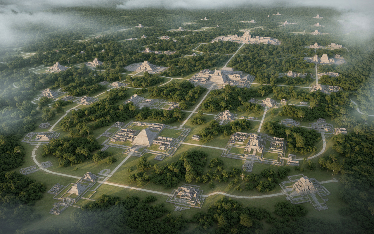
Revolutionary discovery reveals complex pre-classical Maya urban network in Guatemala, with hundreds of settlements interconnected by extensive elevated ways, demonstrating high levels of social organization, advanced engineering, and regional integration.
In 2023, a study conducted by international researchers and published in the Cambridge University Press journal Ancient Mesoamerica, brought one of the most impressive revelations about the Maya civilization during the Pre-Classical period. Using airborne laser scanning technology known as LiDAR, scientists mapped a vast area in northern Guatemala, within the region known as the Mirador-Calakmul Karst Basin.
The survey identified 964 archaeological settlements, later organized into at least 417 residential centers, including cities, towns, and villages interconnected by a monumental infrastructure that includes about 177 kilometers of elevated walkways, known as causeways.
This set of data redefines the understanding of the Maya urban scale during the Pre-Classical period, suggesting a population density and level of organization much higher than previously believed.
-
Much more than a conventional boss: meet the story of the CEO of BYD who spends the day teaching his own engineers so they never stop creating.

-
Understand how the factory that is the second largest in the world manages to produce at a surreal pace and dominate the streets with technology and sustainability.

-
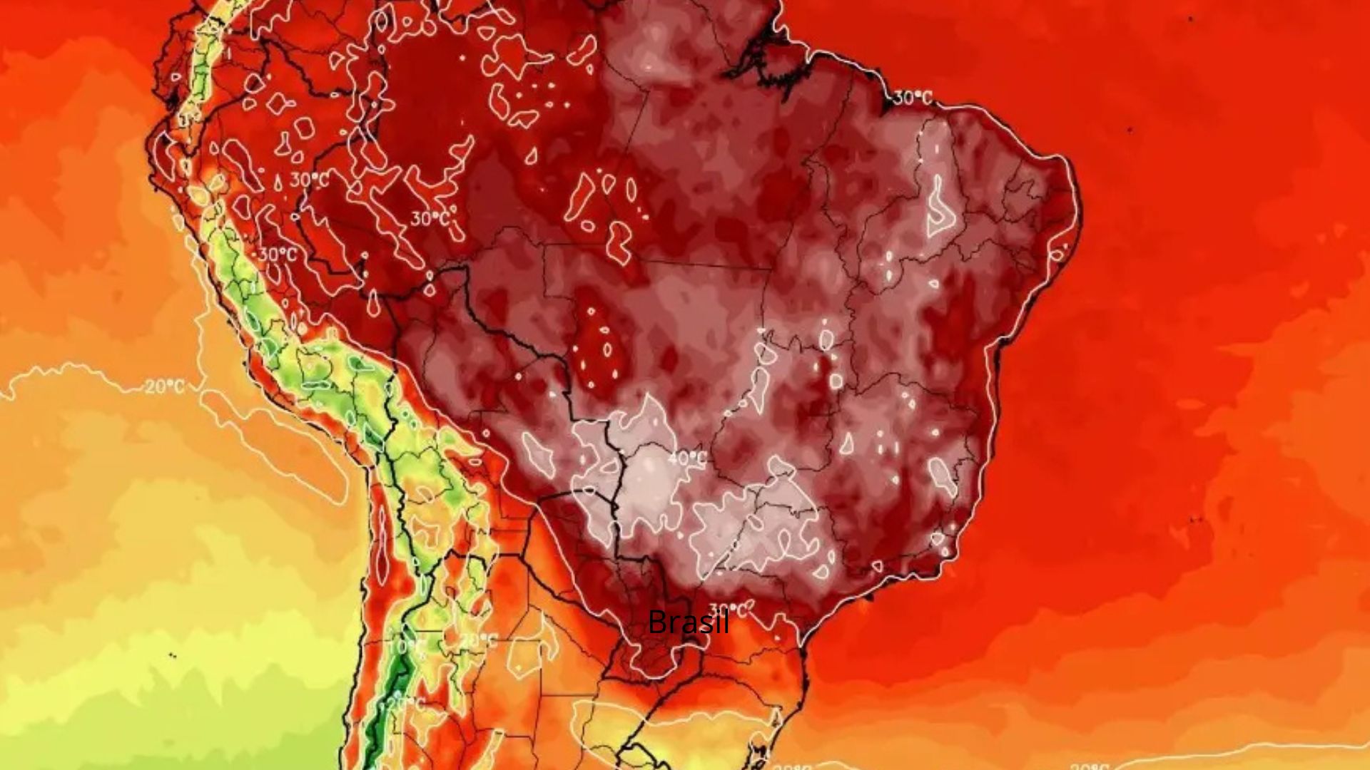
Natural phenomenon expected to cause a ‘thermal disaster’ in Brazil, with extreme heat, drought, and financial impact, now has a date set to occur.
-
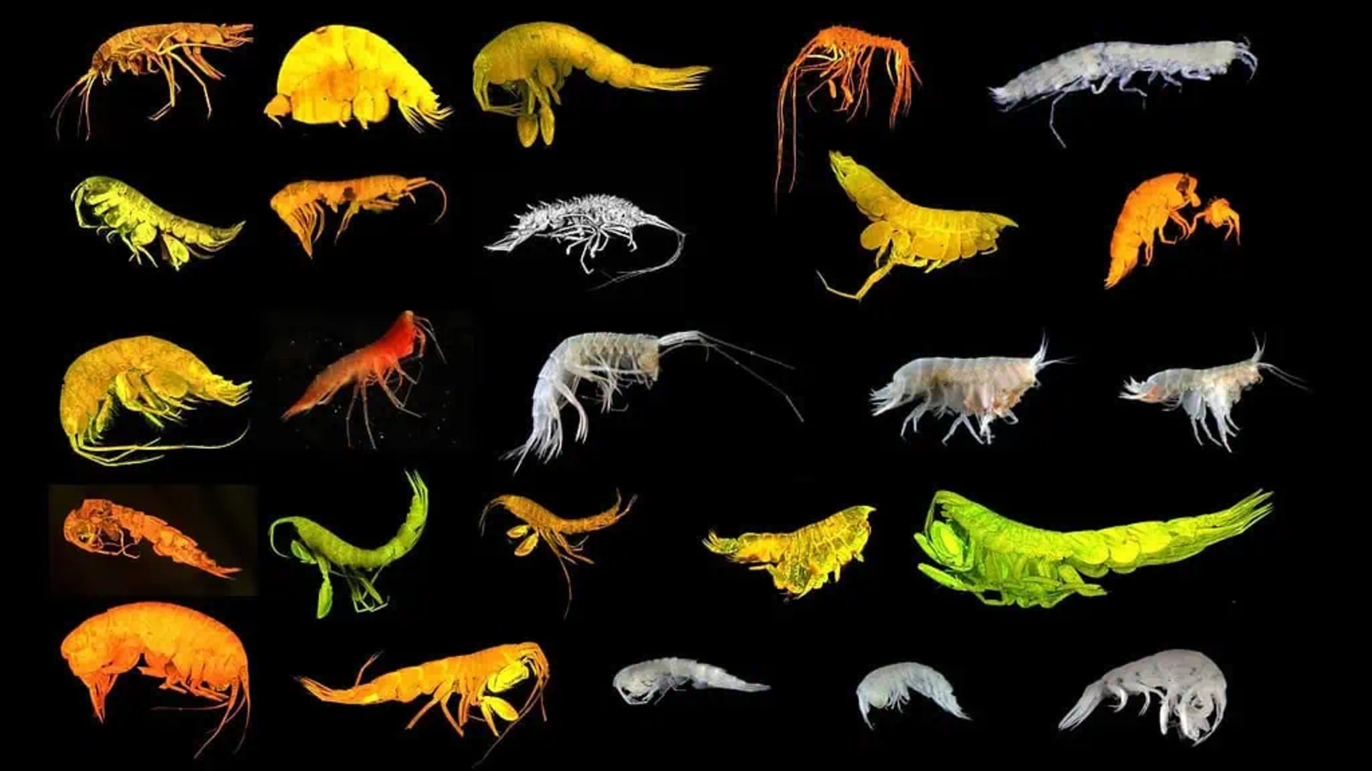
Scientists have just discovered a completely new and hidden branch of life on the ocean floor, exactly in the area that the United States plans to destroy to mine battery metals.
LiDAR technology revealed hidden structures beneath the forest without the need for excavation
The discovery was only possible thanks to the use of LiDAR, a technology that allows mapping the terrain even under dense vegetation. From aircraft, laser pulses are emitted towards the ground, penetrating the tree canopy and returning with precise information about the land surface.
With this method, researchers were able to digitally remove vegetation and reveal artificial platforms, pyramids, elevated roads, and residential areas. This approach revolutionized Mesoamerican archaeology, allowing the identification of structures invisible to the naked eye and significantly expanding the archaeological map of the region.
964 settlements indicate massive and highly organized occupation during the Pre-Classical period
The identification of 964 settlements in a single region demonstrates that northern Guatemala housed intense human occupation during the Pre-Classical period, which spans approximately from 1000 BC to 250 AD.
These settlements vary in scale and complexity, including large urban centers, intermediate communities, and small housing units. The reorganization of this data into 417 main centers reveals a hierarchical structure of occupation, suggesting the existence of complex political and administrative systems.
177 kilometers of elevated roads connected cities and reinforced regional integration
One of the most impressive elements of the study is the identification of about 177 kilometers of elevated walkways that connected different settlements. These structures, built with stone and compacted earth, had strategic functions, such as facilitating movement in flooded areas, connecting urban centers, and economically integrating the region. The existence of this road network indicates that the cities were not isolated but rather part of an interconnected regional system.
In addition to the roads, the survey revealed a large number of monumental structures, including:
- Large pyramids;
- Elevated platforms;
- Ceremonial plazas;
- Architectural complexes.
These constructions required significant mobilization of human resources and planning, reinforcing the idea that pre-classical Maya society possessed advanced levels of social organization.
Scale of the discovery suggests a population much greater than previous estimates
The data obtained with LiDAR indicates that the studied region could support a significantly larger population than previously thought. The density of settlements and the complexity of the infrastructure suggest continuous and intensive occupation.
This evidence contradicts old models that viewed the Pre-Classical period as a phase of early development, with small populations and simple structures.
Regional integration points to sophisticated political and economic systems
The interconnection between the settlements, evidenced by the elevated roads and the spatial distribution of the structures, suggests the existence of coordinated political systems. These systems may have included:
- Trade networks;
- Territorial organization;
- Regional power centers.
The observed complexity indicates that these societies were already operating on a scale comparable to more well-known urban civilizations.
Discovery reinforces the role of the Pre-Classical period as a phase of high Maya complexity
Traditionally, the Pre-Classical period was considered an early stage in the development of Maya civilization. However, recent evidence points to a much more advanced scenario.
The presence of monumental infrastructure, transport networks, and high population density indicates that many of the elements associated with the Maya peak were already present centuries earlier.
Mirador-Calakmul region consolidates as one of the largest archaeological complexes in America
The data set obtained positions the Mirador-Calakmul Karst Basin region as one of the most important archaeological areas in the Americas. The combination of large territorial extent, high density of structures, and regional integration transforms this area into one of the main focal points of study for understanding the evolution of Mesoamerican civilizations.
Even with the advancement of LiDAR, much of the region has yet to be fully analyzed. This means that new discoveries may further expand knowledge about the Maya civilization. Modern archaeology, combined with technology, continues to push the boundaries of what is known about ancient societies.
What else may be hidden beneath the uncharted Mesoamerican forest?
The discoveries in northern Guatemala show that the history of the Maya civilization is still far from being fully understood. Monumental structures and complex urban networks remained hidden for centuries and are only now beginning to be revealed.
In light of this, an inevitable question arises: how many other cities and urban systems remain hidden beneath the vegetation, waiting to be discovered? Leave your analysis in the comments.


Seja o primeiro a reagir!