 English
  Francês
  Alemão
  Italiano
  Japonês
  Norueguês
  Portuguese
  Spanish
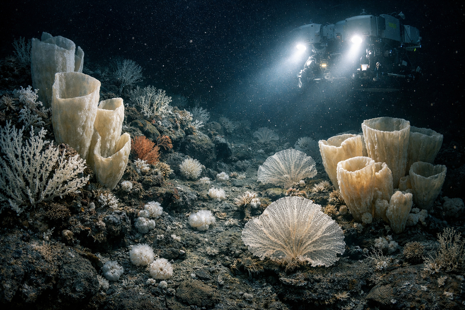
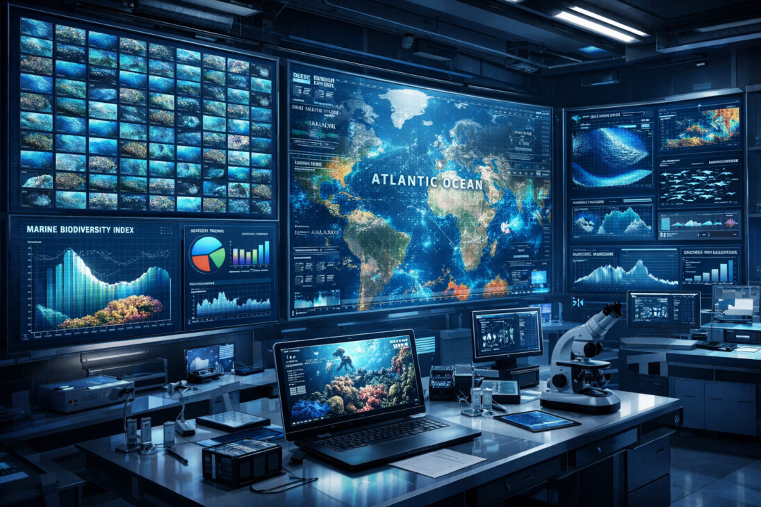
Deep Vision Project Uses Advanced Algorithms to Transform Thousands of Hours of Underwater Images into Detailed Maps of Vulnerable Marine Ecosystems in the Atlantic and Beyond
The vast majority of the deep ocean remains largely unknown to science. Thousands of meters below the surface, where sunlight does not reach and the pressure is extreme, complex ecosystems thrive in silence, far from human observation. However, thanks to recent advances in artificial intelligence (AI), this scenario is beginning to change.
The information was released by “R7.com”, which presented details of the Deep Vision scientific project, an initiative that aims to use advanced algorithms to analyze vast collections of underwater images and videos accumulated over the past decades. According to the report, the goal is clear: to transform underexplored files into detailed maps of vulnerable marine ecosystems throughout the Atlantic.
In the last 20 years, scientific missions with underwater robots and autonomous vehicles have recorded a massive amount of visual data from the depths of the ocean. However, despite this ongoing effort, much of this material remains unanalyzed. And this is precisely where AI comes into play.
-
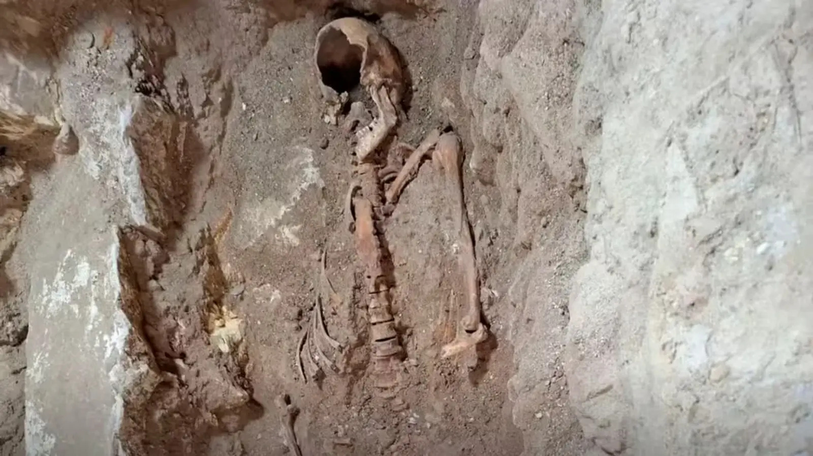
350-year mystery may have been solved: remains of a soldier who inspired the hero of The Three Musketeers found beneath a church in the Netherlands.
-
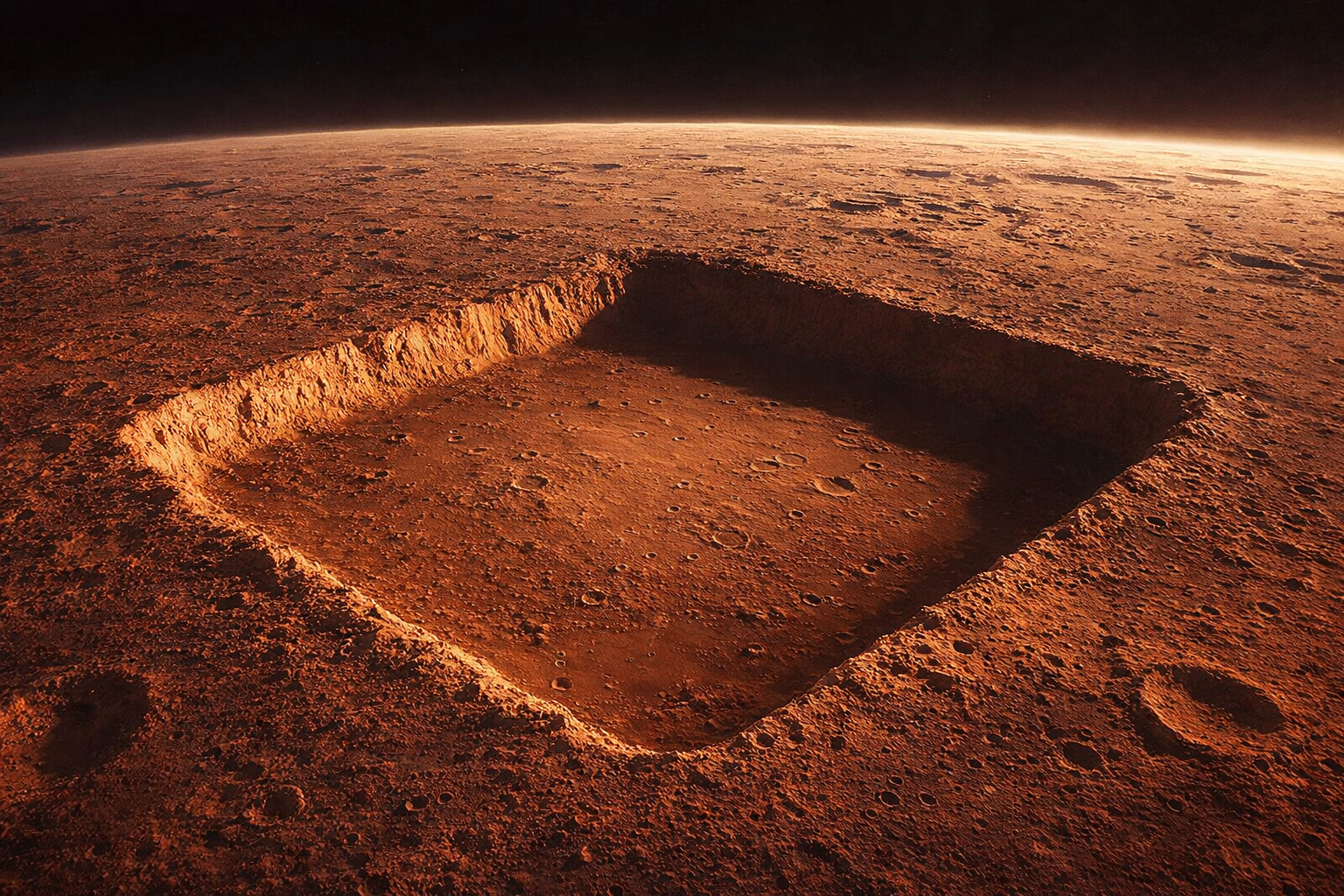
NASA photographed a nearly perfect square with 3 km sides on Mars, 13 times larger than the Great Pyramid of Giza, but the official explanation is natural erosion; still, no one has explained why the four sides have almost identical lengths.
-
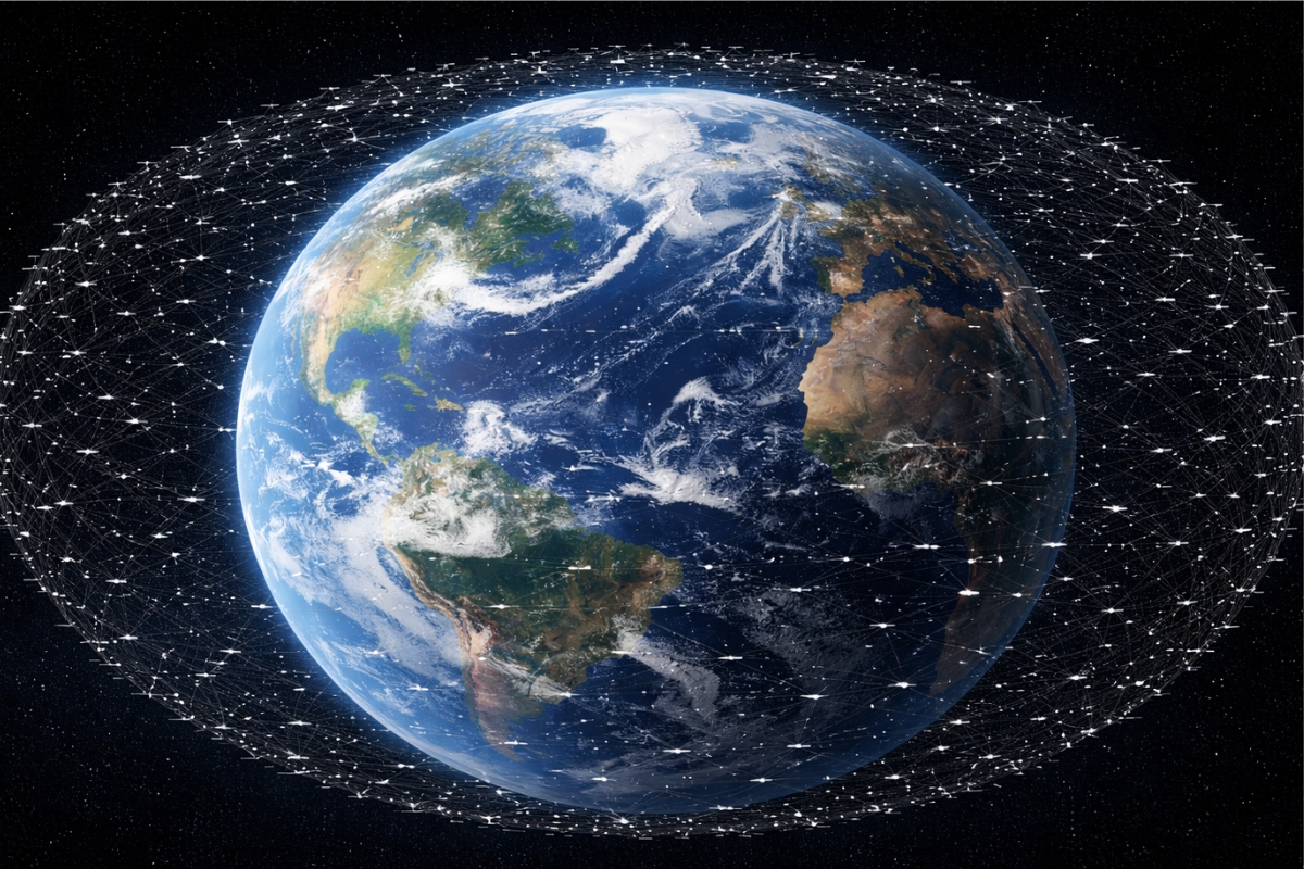
Starlink breaks the barrier of 10,000 satellites in orbit and takes its expansion to an unprecedented level, with a direct impact on global internet, technological competition, and the race for space.
-
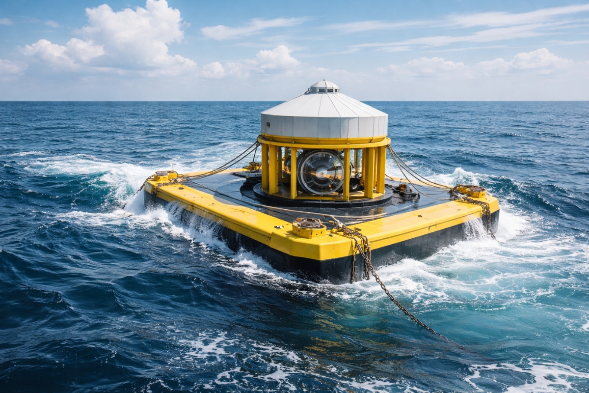
Japan finds an alternative to oil amid rising prices by transforming ocean balance into electricity with a new technology that maintains efficiency even when the sea changes.

Among the main challenges faced by researchers are thousands of hours of unexamined recordings, extremely time-consuming analysis processes for human experts, difficulties in quickly identifying rare species and habitats, and, moreover, a lack of sufficient data to guide marine conservation policies. Therefore, in this context, artificial intelligence emerges as a strategic solution capable of drastically accelerating the interpretation of this information.
Algorithms Analyze Tens of Thousands of Images in a Few Days
Traditionally, the manual analysis of underwater images requires highly specialized training and can take months to process a single scientific dive. However, in contrast to this traditional method, AI-based systems can examine tens of thousands of images in just a few days.
Recent research has already demonstrated that algorithms trained with marine biodiversity data can recognize specific organisms and ecological patterns in large volumes of images. Among the most relevant examples are xenophyophores, giant unicellular organisms that live on the ocean floor and serve as indicators of sensitive marine ecosystems.
In addition to speed, AI offers another crucial advantage: consistency. While human experts may interpret images differently, leading to variations in results, algorithms apply standardized criteria. Consequently, analyses become more comparable over time, increasing the reliability of scientific studies.
Thus, by automating the identification of species and habitats, researchers can spend more time interpreting the ecological data and less time on the repetitive process of image screening.
Corals and Sponges Function as “Forests” on the Ocean Floor
A significant portion of the research conducted by the Deep Vision project focuses on organisms that serve as essential structures for deep marine life, especially corals and cold-water sponges.
These organisms play a role similar to trees in a terrestrial forest. In environments where there are no plants due to the absence of sunlight, they provide shelter, food, and structural support for various species. Therefore, when scientists identify these structures, they can infer the presence of complex ecosystems around.
For this reason, researchers classify these organisms as indicators of vulnerable marine ecosystems. If these structures disappear, the entire surrounding ecosystem can collapse. Thus, mapping their distribution becomes essential for conservation strategies.
After identifying the species in the images, researchers use the collected data to create habitat suitability models. These models, in turn, allow predicting where certain organisms are likely to occur, even in areas that have not yet been directly explored.
This predictive capability is crucial as it guides decisions about marine protected areas, industrial fishing, and even potential deep-sea mining activities. Furthermore, organisms on the ocean floor play an essential role in nutrient recycling and the global carbon cycle – crucial processes for the environmental balance of the planet.
If the Deep Vision project achieves its goals in the Atlantic, the same approach could be replicated in other regions of the world. The Pacific, Indian, and Antarctic Oceans face similar challenges, with vast areas still unexplored and limited data.
Thus, with the support of artificial intelligence, scientists are finally beginning to unravel the true complexity of life in the depths of the ocean – one of the Earth’s most mysterious environments and, at the same time, one of the most important for the environmental future of the planet.
Do you believe that artificial intelligence will be decisive in protecting the oceans before human activities advance over still unknown areas?


Seja o primeiro a reagir!