 Português
  Inglês
  Espanhol
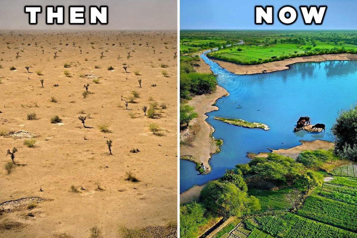
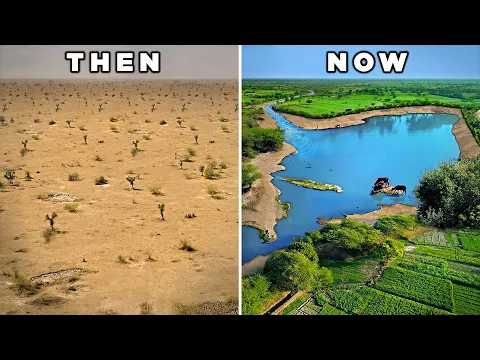
In The Arid Land Of A State In India, The Village Of Laporiya Transformed Drought-Stricken Soil Into Fertile Land, Recharged Aquifers Capable Of Sustaining Three Years Of Drought And Inspired Dozens Of Villages To Reclaim The Whole Region.
For decades, Rajasthan was synonymous with water scarcity: short monsoons, nine months of drought and fields that barely produced during the rainy season. In Laporiya, a small community decided that the arid land of a state in India would not be a destination, but a starting point for a water revolution. Over 45 years of community work, they redesigned the landscape, created water harvesting systems on flat land, and brought back a groundwater table so robust that it could now feed wells for three consecutive years without rain.
From The Arid Land Of A State In India To The Village That Stores Water For Three Years Of Drought
Laporiya is located in Rajasthan, a region where monsoon rains are fast and irregular. For a long time, surviving just one year of drought was already difficult for the village: few trees, planting restricted to the rainy season, and permanent scarcity.
Laxman Singh, son of the former local leaders, witnessed this reality from a young age. Instead of accepting that the arid land of a state in India would condemn his people to dependence and migration, he initiated a process of social mobilization: organized neighbors, discussed solutions, reclaimed traditional knowledge, and gradually built a culture of collective care for water and territory.
-
Hidden giants at the bottom of the North Sea reveal how 18,000-year-old icebergs help predict glacier collapse and rising oceans.

-
For more than 10 years, scientists have observed the ice of Greenland deforming into giant spirals without explanation; they have now discovered that solid ice can “boil” from within like magma, an invisible phenomenon that could alter climate predictions and involves a mass capable of raising sea levels by up to 7 meters.

-
A gigantic freshwater reservoir appears beneath the Great Salt Lake, between 3 and 4 kilometers deep, surprising scientists with an unexpected flow towards the interior of the lake.
-
At over 8,800 meters above sea level, the summit of Mount Everest is made up of rocks that originated at the bottom of an ocean about 500 million years ago and were pushed to the highest point on Earth by the collision of tectonic plates.

Today, the results are visible: the residents claim to have enough groundwater to face three consecutive years of drought, something unthinkable before the interventions.
This security did not come from large externally imposed projects but from decades of excavation, planting, and planning carried out by the community itself.
Water Design In Flat Lands: Interlinking Villages And Basins

One of the greatest doubts in landscape restoration is how to work when the land is flat, without significant slopes. Laporiya is proof that this is possible.
Instead of relying solely on their own area, the village connected hydrologically with neighboring villages, forming a community water management network.
In the village of Gagardu, for example, a large catchment lake receives runoff from a vast area. When this lake overflows, the water is directed through a channel about 4 kilometers long to Laporiya.
Thus, every rain is maximized, passing from reservoir to reservoir, instead of simply being lost to surface runoff.
This integrated system of harvesting, diversion and infiltration has a clear goal: to maximize the percolation of water into the soil, recharging the aquifer, feeding wells and ensuring water for both irrigation and wildlife and livestock.
The arid land of a state in India has been redesigned as a large sponge, capable of storing every millimeter of rain that falls.
The Chauca System: Holes, Mounds And Full Aquifers
The great innovation of Laporiya for working on flat terrain is the so-called Chauca system. Instead of deep large reservoirs, the community digs a series of shallow holes, distributed across the landscape, and uses the soil removed to form mounds that delineate small compartments.
When it rains, the water runoff fills these compartments. The mounds temporarily hold the water, allowing it to slowly infiltrate into the soil, instead of quickly running off.
As this water infiltrates, the surface soil remains moist longer, creating ideal conditions for the growth of grasses and vegetation used for animal grazing.
Each compartment of the Chauca system overflows into the next, until the excess reaches a larger body of water.
Before this intervention, certain drainage channels only received water during the monsoons. Today, even months after the last significant rain, it is still possible to see retained water, a direct result of infiltration and percolation built over 20 years of continuous work.
Recharging The Groundwater Table: From 70 Feet Deep To Nearly Full Wells

The effects of aquifer recharge in the arid land of a state in India are literally measured in meters. Before the excavation of water bodies like the Dev Sagar lake, the groundwater level had dropped to about 60 to 70 feet deep, requiring enormous efforts to reach drinking water.
Over the years, the work of infiltration and percolation changed this picture. Today, there are reports of wells where the water table is between 1.5 and 3 meters below the surface.
During the monsoons, some of these wells nearly overflow, to the point that a person can kneel down, extend their hands and scoop up water directly.
This return of water to the surface is not by chance: it is the accumulation of 45 years of careful rain management in arid land of a state in India.
Even with pumps drawing water from lakes and wells to irrigate wheat fields, the visible level does not drop easily because the invisible stock underground is constantly replenished. This is not a “miracle,” but rather hydrological mathematics favored by good landscape design.
Agricultural Prosperity In The Middle Of A Semi-Arid Region
When water loss is stopped, the rest of the transformation comes in chain. In the surroundings of Laporiya and neighboring villages, a much more stable agriculture can now be seen.
In the dry season, fields of mustard, chickpeas, and wheat dominate the landscape. The current production is sufficient to sustain the families of the village, without the permanent sense of scarcity that marked the past.
Not all areas are irrigated by groundwater; part of the fields depends exclusively on rain. Even so, the farmers built mounds with trees that separate the plots, forming lines that also function as catchment structures.
When the monsoons arrive, these mounds favor the temporary flooding of the fields, soaking the soil in a controlled way and nourishing the crops.
The result is an intelligent use of the rain: a portion of the water is transformed into aquifer recharge, another into soil moisture, and another into agricultural production. All of this in the arid land of a state in India that for decades was seen as incapable of providing food security.
Community Forests And Milder Climate
About 40 years ago, it was possible to see the neighboring villages from Laporiya, so scarce were the trees. Today, that view has disappeared: the tree cover has grown so much that the villages are hidden behind green bands of vegetation.
Most of these trees have been planted in the past four decades, as a joint effort of the community.
According to the residents, the change is noticeable: the local temperature no longer reaches the extreme heat of the past, and the village is considered one of the greenest in the entire region.
This community forest is not just a scenery; it helps reduce evaporation, protect the soil, and create milder microclimates, closing the cycle between water, vegetation, and quality of life.
With about 3,000 inhabitants and an area of approximately 1,500 hectares, Laporiya has become a living example of how ecological regeneration can go hand in hand with rural prosperity. New houses have sprung up, concrete signs that the local economy has strengthened as water returned.
A Water Revolution That Has Already Reached More Than 60 Villages
The work initiated in Laporiya has not been restricted to the village’s borders. Over time, water harvesting practices, the Chauca system, and tree planting have been taken to neighboring communities. Today, there is action in almost 60 surrounding villages, all within this same arid land of a state in India.
This advancement was not led by a top-down plan, but built as a participatory process.
The “physical work” seen in the channels, lakes, and mounds is, above all, the result of nearly half a century of social organization, trust, and a sense of shared responsibility.
The community has come to see the health of the village and the region as a common good, not an individual problem.
This story also inspires professionals and students who visit Laporiya to learn, document, and multiply the model in other parts of the world.
The message is simple and powerful: if a community can build water security in an arid land of a state in India, how many other places considered “impossible” could also be transformed?
And you, looking at the dry areas of Brazil and other countries, do you believe that experiences like Laporiya’s could be adapted to recover water and life in regions currently treated as unviable?


-

-

-

6 pessoas reagiram a isso.