 Portuguese
  English
  Spanish
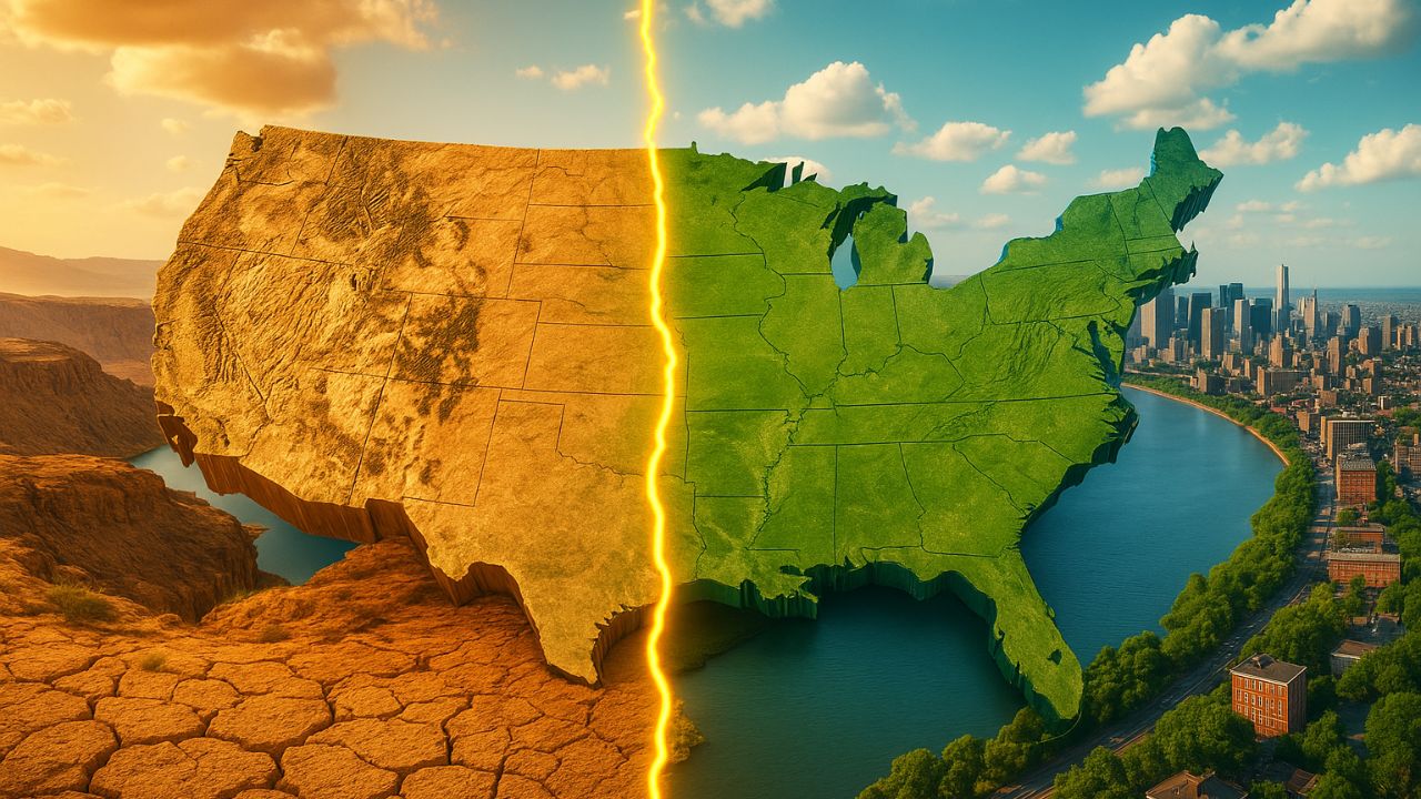


Understand Why 80% of Americans Live in the East, How the Population Distribution of the United States Was Shaped by Water, the Invisible Line That Divides the United States, the Colorado River, and the Water Crisis in the Western United States
When crossing the United States on a map, a nearly perfect boundary appears between the wet side and the arid side of the country. It is this invisible line, near the 98th meridian, that helps explain why most Americans live in dense and prosperous cities in the East and why much of the West exists only thanks to aqueducts and reservoirs. More than just a geographical detail, this division shows how water defines where Americans live, work, and build their future.
Over more than a century, this line has determined which areas would have abundant agriculture, rushing rivers, large metropolitan areas, and robust infrastructure. While 80% of Americans live on the eastern side, only 20% are spread across the continental West, a region that today heavily depends on the Colorado River and faces an unprecedented water crisis, exacerbated by climate change and political decisions made over 100 years ago.
The Line That Divides Rain, Cities, and Where Americans Live
In 1878, geologist John Wesley Powell traveled through the interior of the country and noticed a sharp change in the landscape as he walked from East to West. Plants became scarce, the soil grew drier, and rainfall diminished. To mark this transition, he drew an approximate line on the map, linked to the 100th meridian.
-
The Argentine government celebrates the lowest poverty rate in 7 years, but experts warn that the methodology has changed, real wages have fallen, unemployment has risen, and the number of people on the streets of Buenos Aires has increased by 57% since Milei took office.

-
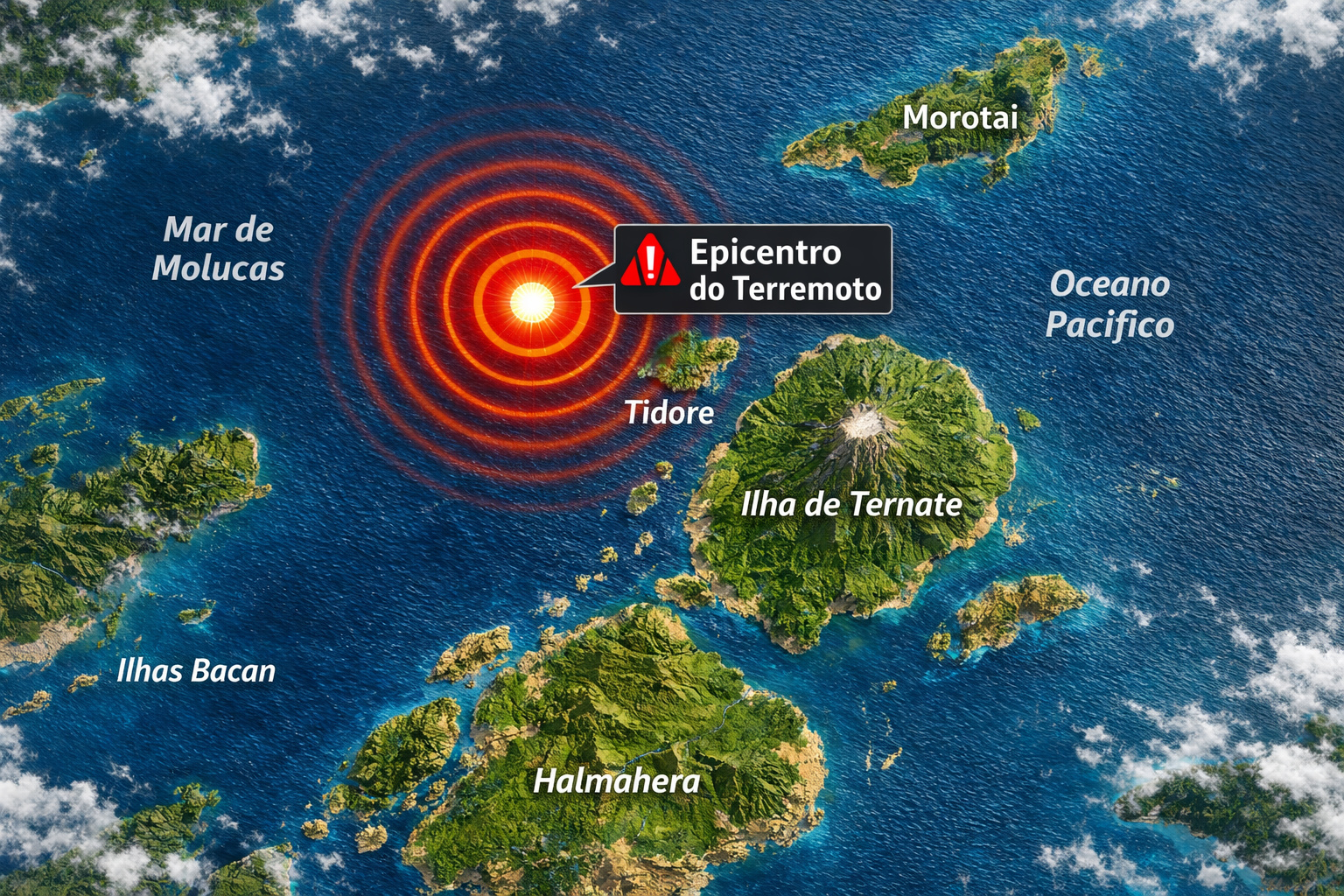
7.8 magnitude earthquake in Indonesia frightens the population, triggers tsunami alert, and hits an island with over 200,000 inhabitants this Thursday.
-
Google will finally let you change that embarrassing Gmail address you created in your teenage years without losing any accounts, logins, or old emails: the feature is already available in the United States.

-
Heading to Brazil in a Bonanza F33 single-engine aircraft: a couple departs from Florida on a visual flight, makes technical stops in the Caribbean to refuel and organize paperwork, and begins the staged crossing until they reach the country.


Today, climatologists identify this boundary closer to the 98th meridian, but the logic remains the same: on one side, a wet East; on the other, a much drier West. And this division is directly reflected in where Americans live. About 80% of the population is located to the east of this line, while the rest is distributed across the vast, mountainous, and dry West.
At night, satellite images make this even more evident. The eastern side of the map appears filled with continuous lights, revealing connected cities and intense economic activity, while the West shows only patches of brightness surrounded by large dark areas. The imaginary line runs through cities like San Antonio, Austin, Dallas, Fort Worth, Oklahoma City, Wichita, Lincoln, Omaha, Fargo, and continues up to Winnipeg, Canada.
Within this great relative void of the West, the main exception is California. With nearly 40 million inhabitants, the state alone accounts for more than half of all people living west of the 98th meridian. Yet the rule still holds: Americans predominantly live where water is most abundant.
Wet East: Giant Rivers, Fertile Soil, and Resilient Cities
The main reason for this population concentration lies in the most basic element of life: water. In the American East, the climate is wetter, rainfall is more regular, and the rivers are larger.
The city of Dallas, for instance, receives about 960 millimeters of rain per year. Just a few kilometers west of this invisible line, Abilene drops to 660 millimeters and Midland to just 380 millimeters. In just a few hundred kilometers, the water that sustains crops, rivers, and cities becomes much scarcer.
Additionally, the East benefits from one of the largest water networks on the planet: the Mississippi River basin. Together with its tributaries, the Mississippi traverses the agricultural heart of the United States, in a region of extremely fertile soil and flat topography.
It is here that what many consider the largest contiguous stretch of arable land in the world emerges, where Midwestern states produce grains on a gigantic scale, feeding not only Americans but also many other countries. And all of this comes with a decisive advantage: in most of these areas, there is no need to resort to complex irrigation systems, because rainfall and the natural river network take care of it.
This combination of factors caused the East to industrialize earlier, attract more people, and build a much more robust urban infrastructure. It is no coincidence that most of the major metropolises, industrial hubs, and historical transportation routes are located on the side where most Americans live.
Dry West: Mountains, Rain Shadow, and Dependence on Colorado
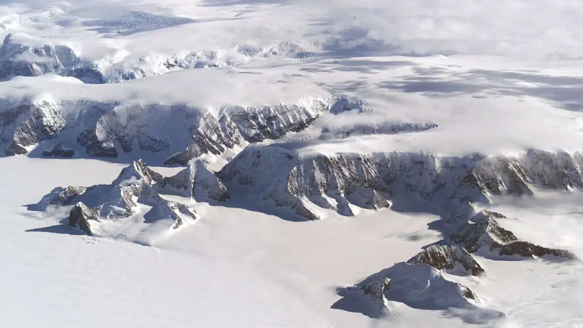
If the East was shaped by the abundance of water, the West was molded by scarcity. In his expeditions, Powell noticed that as he approached the Rocky Mountains, the climate changed rapidly.
With peaks exceeding 4,400 meters, this mountain range blocks moisture coming from the Pacific Ocean. The phenomenon, known as rain shadow, works as follows: moist air hits the mountain barrier, rises, cools, condenses, and causes rain on the coast and slopes. When it passes to the other side, the air is already dry.
The result is a vast interior arid and prone to desertification, with few natural sources of freshwater. The same pattern repeats with other mountain ranges, such as the Sierra Nevada and the Cascade Range, further reinforcing the moisture blockade.
While the East has the Mississippi, the West primarily depends on the Colorado River basin, whose flow capacity can be up to 20 times lower than that of the great river of the Midwest. Therefore, Western cities have only been able to grow thanks to a complex network of aqueducts, dams, and irrigation systems.
Even Los Angeles, located on the Pacific coast, cannot sustain itself solely with water from its surroundings. The city relies on large engineering projects that capture water from rivers and reservoirs hundreds of kilometers away. Without these works, much of the western metropolises simply would not exist, and even fewer Americans would live there.
When the Climate Changes, the Line Moves
With the advance of climate change, the situation becomes even more delicate. Dry air is advancing over areas that once received regular rainfall, especially in the agricultural regions near the 98th meridian.
Corn producers in these transition zones have been forced to switch crops, migrating to grains like wheat, which require less water and tolerate drought better. At the same time, the Colorado River is facing its worst historical moment.
The river, which supplies about 40 million people, is so over-exploited for irrigation and urban consumption that it often can no longer reach the Gulf of California. What was once a powerful watercourse flowing to the ocean now ends up in dry, fragmented stretches.
With less snow in the mountains, higher temperatures, and more people consuming water, the American West is undergoing an unprecedented water crisis. By 2025, the situation reached a point where the government had to adopt water reduction and cutoff policies in several states.
The most affected are California, Nevada, Arizona, and New Mexico, which were already at the limit of using the Colorado River and now need to renegotiate, reduce consumption, and rethink their urban and agricultural growth models.
Powell Predicted the Problem Before Americans Experienced This Collapse
Interestingly, John Wesley Powell had already envisioned this future about 150 years ago. For him, the invisible line separating the wet East from the arid West required a completely different logic of land occupation.
Powell argued that the boundaries of Western states should not be drawn by arbitrary straight lines on the map, but by watersheds. The idea was simple and powerful: each region would manage the water from its own river sustainably, respecting the real capacity of the environment.
If his proposal had been adopted, it is likely that fewer Americans would live in such vulnerable areas today, and that water disputes would be smaller. However, Congress ignored the warning.
At the time, interests were focused on the rapid colonization model of the Homestead Act, which facilitated land access and favored large speculators. The priority was to expand to the West as quickly as possible, not to draw a country around the water.
Decades later, the Colorado River Compact of 1922 worsened the situation by dividing the river’s flow based on overestimated measurements. The agreement assumed that there would always be more water available than the river could practically provide.
Today, with lower reservoir levels, more people consuming, and less rainfall, the states that once grew thanks to the apparent abundance of water are now competing for every liter more intensely.
Arizona, California, and the Pressure on the Colorado
One of the best examples of this conflict is the state of Arizona. Even though it is located in a naturally dry region, it manages to produce food on a national scale thanks to a large irrigation network fed by the Colorado River.
This structure allows the desert to transform into productive fields, but it also pressures the entire water system, especially when we add the demands from California, Nevada, and other states that depend on the same basin.
With reservoirs at historically low levels and a warmer climate, the math does not add up. If nothing changes, the West risks having to choose between sustaining cities, maintaining crops, or preserving ecosystems.
Meanwhile, on the other side of the invisible line, the East continues to be the place where most Americans live, with larger rivers, more rainfall, and infrastructure built over centuries on this relative abundance of water.
The Future of the Invisible Line and Where Americans Live
The big question now is whether technology and management will be able to overcome geography. Desalination of seawater, large-scale reuse, changes in agricultural practices, and strict consumption restrictions are some of the solutions being discussed.
But none of them erase the fact that the invisible line near the 98th meridian continues to determine where Americans live with greater water security and where life depends on massive works and difficult political decisions.
What is already clear is that the water crisis in the West is not an isolated accident, but rather the result of a century of accelerated growth in a region that has always had too little water. The question left by Powell continues to echo: can a territory ignore its own geography without paying the price later?
And what do you think will happen if this crisis continues to worsen: will we see more Americans living migrating from the dry West to regions with more water, or will technology manage to hold this invisible line where it is today?


Na minha opinião acho q oq moram no oeste não vão para o leste,pq eles são resilientes e muito fiéis ao seu Estado.O governo vai ter q continuar a procurar alternativas para para q o oeste continue vivo.Assisto vídeos de caminhoneiros q passam próximo ao rio Colorado,e atualmente o rio tá num nível tão baixo q tem lugar q a água some literalmente e detergente aparece em outro lugar.Realmente a situação não está pra peixe.
Creio que sendo o Rio Colorado a única bacia hidrográfica importante mas muito explorada o resultado é um aumento considerável da falta de água. Muitos americanos se mudarão para o Leste.